"Pearl" in Winter Garden, Florida
|
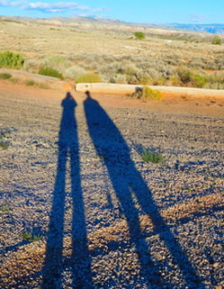
Long shadows in Wyoming
|
|
We were so lucky to be in Prairie Village (part of the greater Kansas City Metro area) this autumn. According to long-time residents and this article on a local news site, though it's always pretty here in the fall, this year served up exceptional foliage. There is such a large variety of deciduous trees here that foliage comes in all shades, from the impossibly bright gold of ginkgos to the fiery oranges and reds of maples. We enjoyed many a walk and bike ride while the trees were at their peak. Hope you enjoy our photos as much as we enjoyed taking them! Note: These photos were all taken in Prairie Village or Overland Park, Kansas. Doesn't look a bit like what we imagined of Kansas before we arrived! 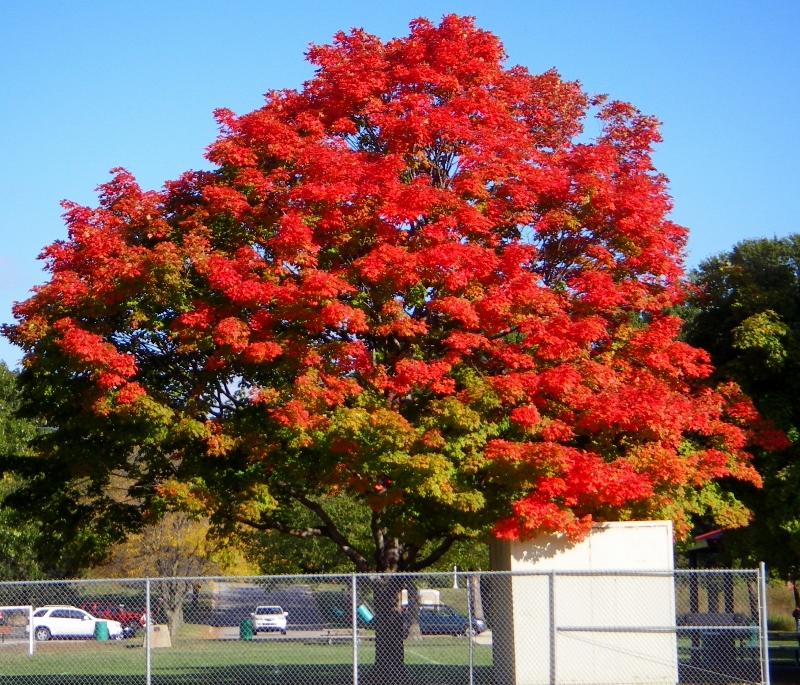 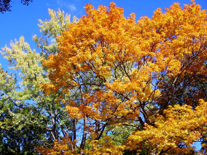 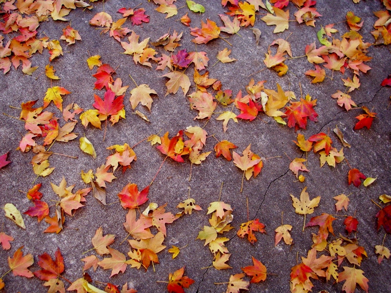 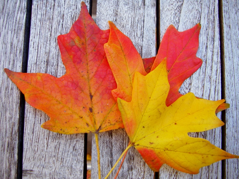 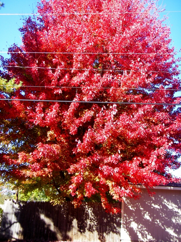 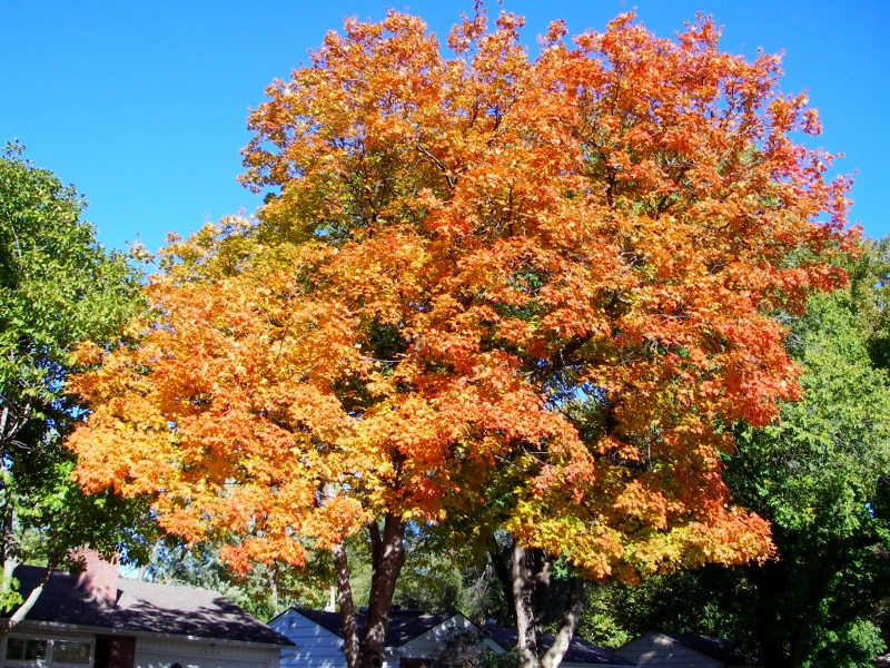 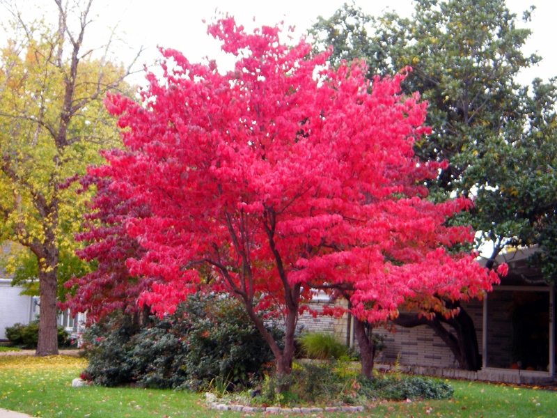 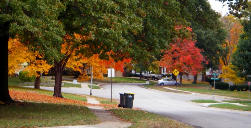 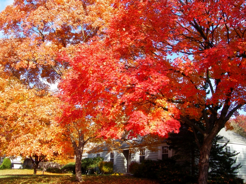 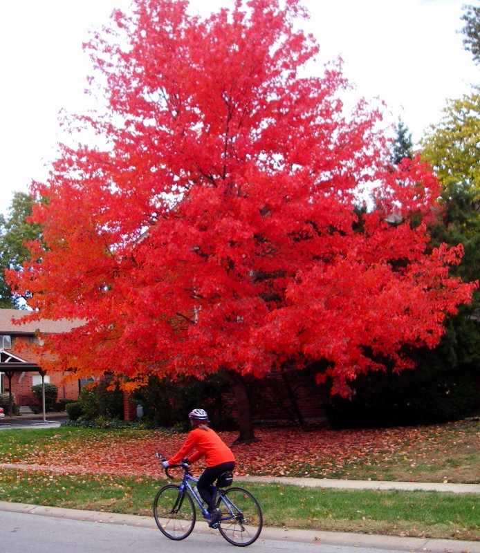 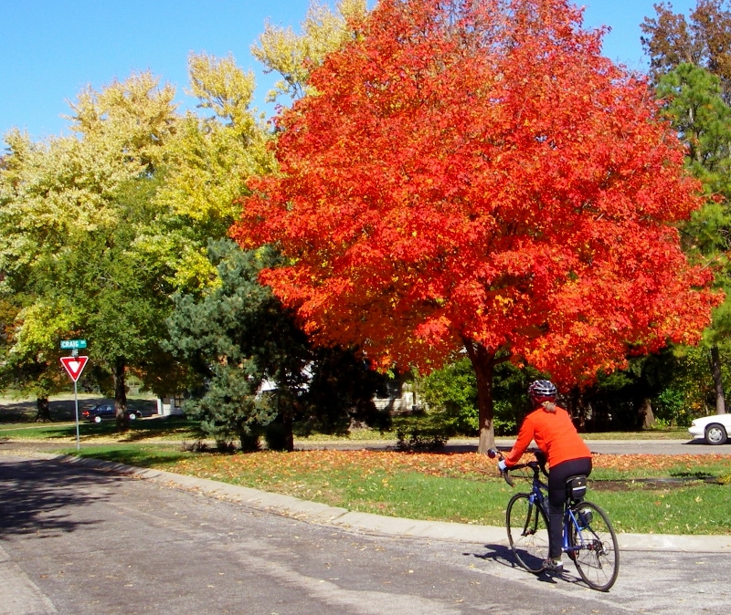 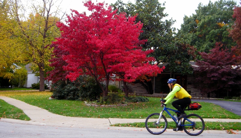 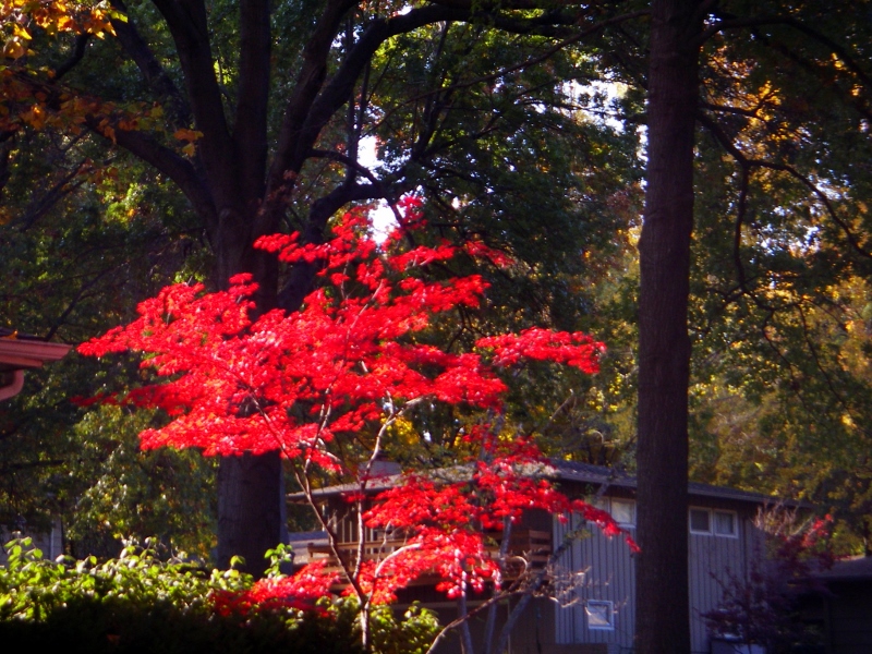 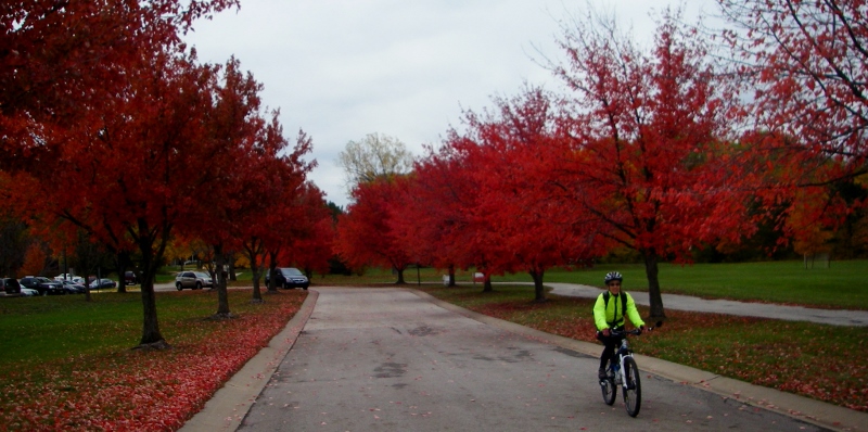 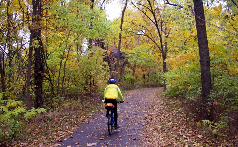 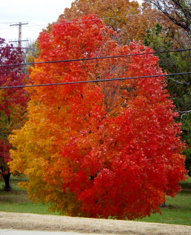 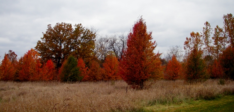
4 Comments
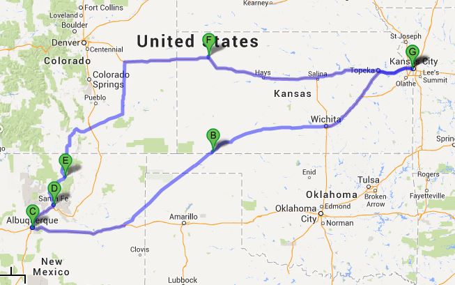 Our July 2013 Southwest Trip route Here's a handy-dandy little list of links to all our posts about our summer trip to New Mexico. We sure had a great time and saw so much beauty. This trip solidified our love of the southwest US even more.
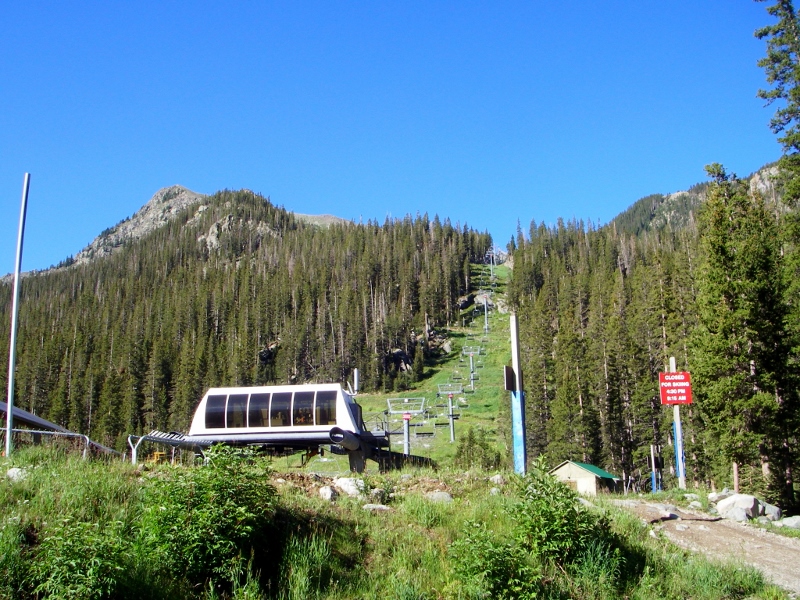
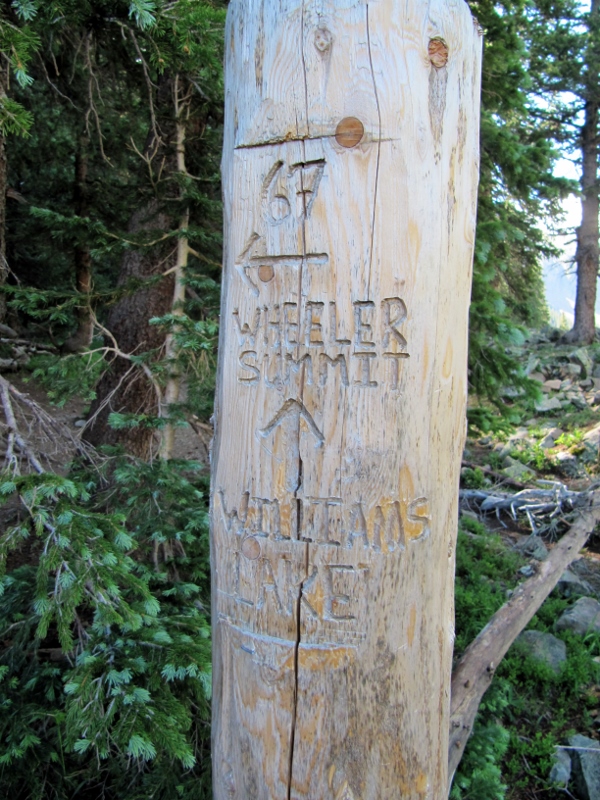
We never came to New Mexico with the intent to hike to the summit of the highest peak in the state, Mount Wheeler (elevation 13,167'). We're not really what you'd call "peak baggers"; in fact, we didn't even know what the highest peak in the state was until we got here and read a brief blurb about it in a travel brochure. Once we learned of it, though, we thought "Wouldn't that be a fun thing to do while we're here?" Well, why the heck not? Perhaps because we really hadn't been training for a hike of this intensity? Nah...that wouldn't stop us. We'd been hiking and biking quite a bit, and since we'd been in New Mexico for ten days at this point, we'd become pretty acclimated to the higher elevation. So, we decided to give it a go -- nothing like a little adventure to keep things fresh, right? So on the morning of July 19, we got going and made the drive up to Taos Ski Valley to start our hike. The weather was perfectly clear at the start, but storms were in the forecast later in the day, and one place you don't want to be is above the treeline when lightning is striking, so we knew we couldn't dawdle. 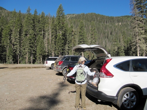 We hiked through the ski area and over to the official starting trail, Williams Lake. We'd already climbed some just getting to this trailhead, and this two-mile trail would give us plenty more climbing before we got to the really strenuous part of the hike.
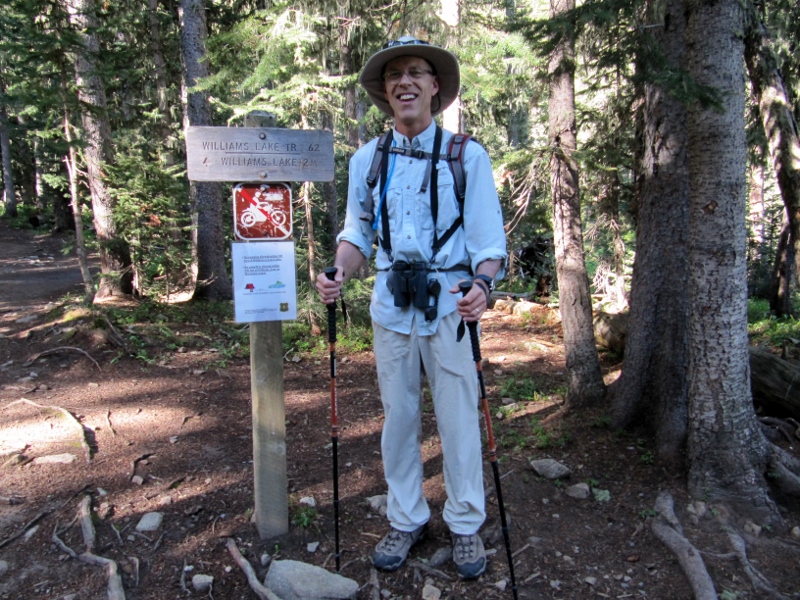 Williams Lake Trailhead
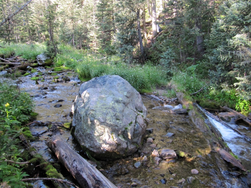
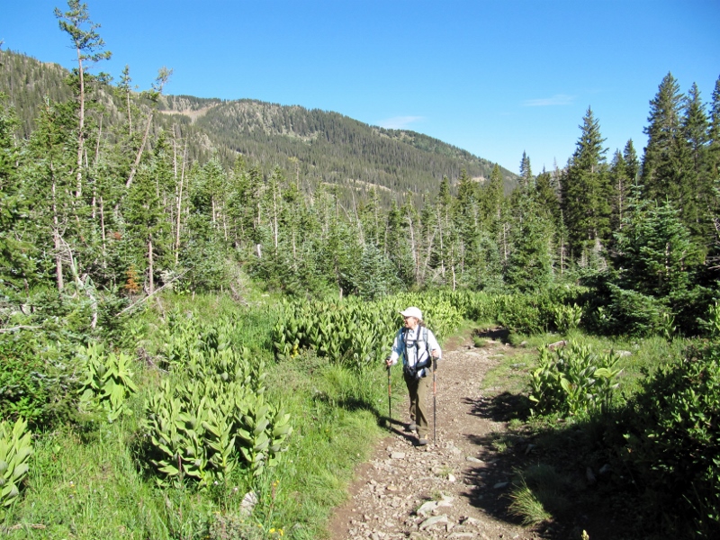
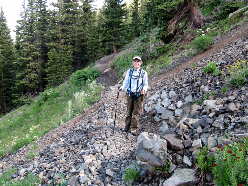 We thought this was rocky, but it was nothing compared to the talus we'd have to cross numerous times on the last 1/2 mile of the trail 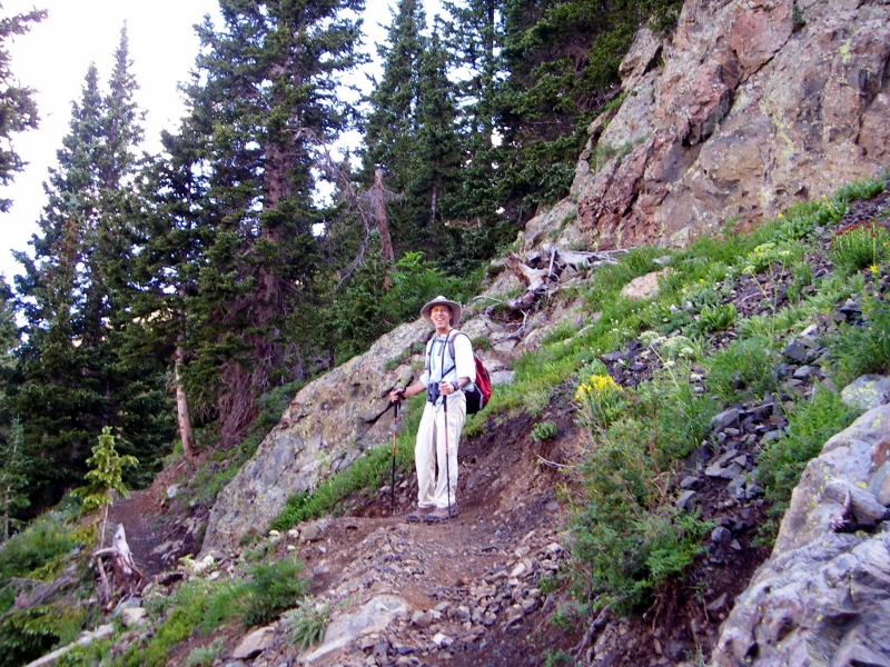 There were some pretty wildflowers, and even more beautiful views, along this part of the trail. I felt like we were in the Alps (though I've never been there!) 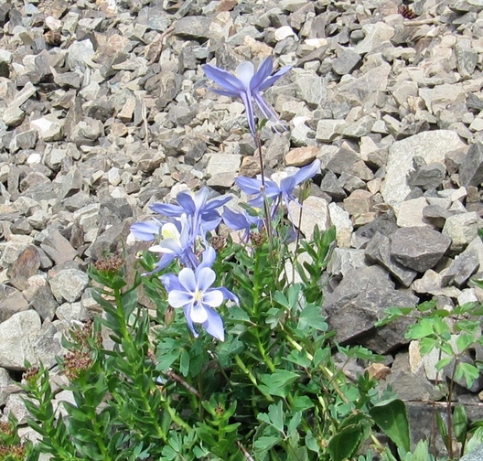 Wild Columbine Continuing upward, we caught of a view of Williams Lake below us. If you look closely, you can see small patches of remaining snow on the peaks across the way (left side of photo). 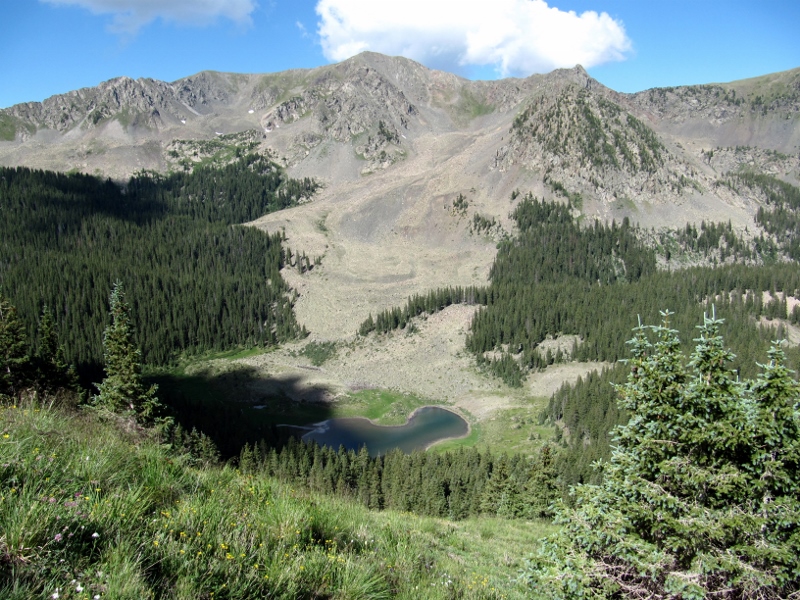 Williams Lake As we emerged from the treeline, we could see the trail before us going up, up, up. Kind of daunting! 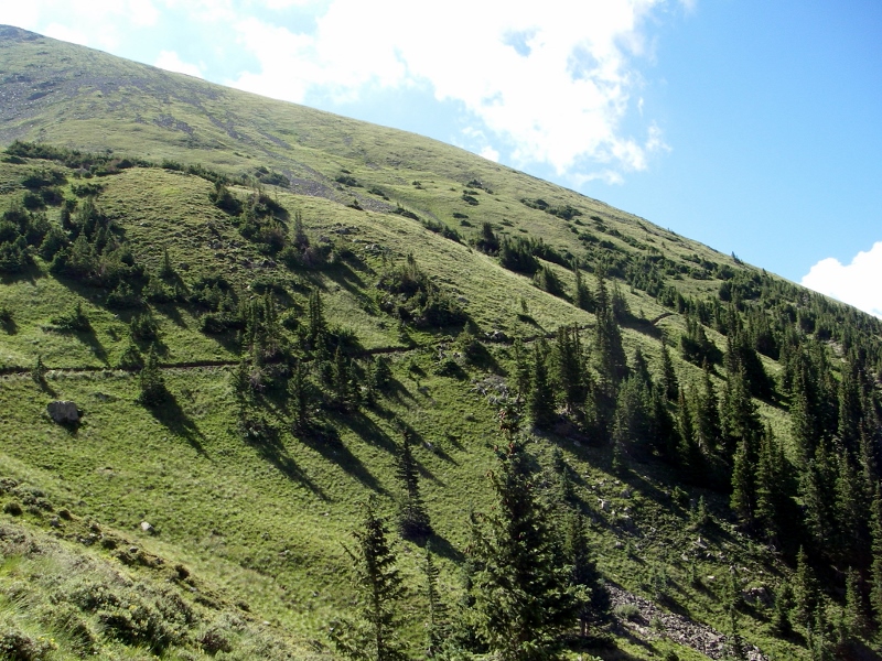 I love the photo below. I call it the "Sound of Music" shot as Barry looks like he is singing "Climb Every Mountain". What do you think?! He was definitely loving this hike. 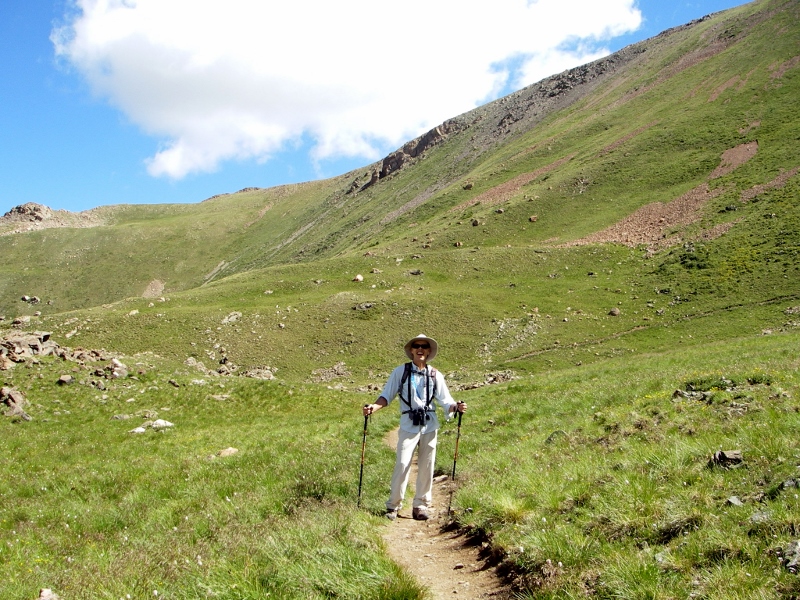 Next up, we started hitting the talus/scree areas. Basically these are parts of the trail where the terrain is comprised of loose stone. Smaller stones are called scree, and larger are called talus. These areas can be slippery and difficult to traverse, and we were glad for our hiking poles to help us keep our balance. We saw other folks doing the hike who were not wearing appropriate hiking boots or using poles, and I wondered how they did it. Of course, it helped that they were mostly a lot younger than us! 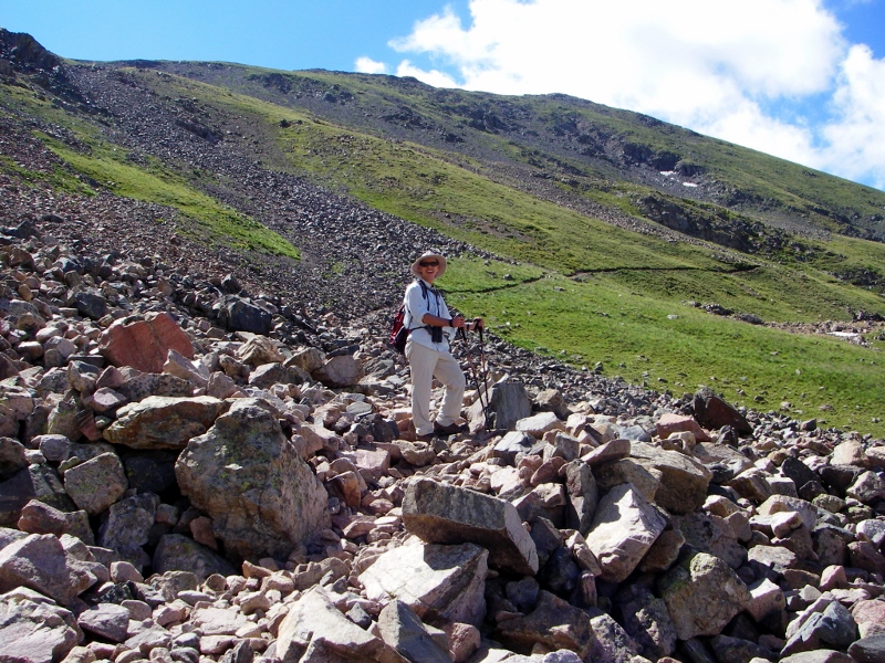 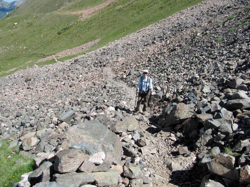 If you think I wasn't huffing and puffing like crazy, you would be mistaken. This talus/scree was not only slippery, it was steeper than the photos can show. I had to stop several times just to let my heart rate get back to something resembling normal. The air is very thin up here, as the elevation went from just over 10,000' up to over 13,000', and we are used to living at sea level or just a bit above. Fortunately we weren't plagued with any altitude sickness, but it was hard to catch your breath. 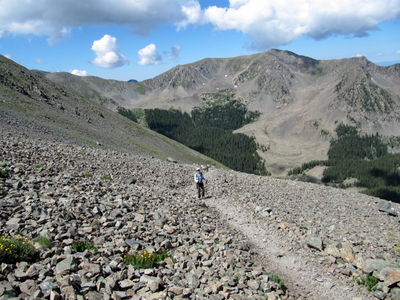 Scree, scree as far as the eye can see! The views were just getting better all the time, though, making all the pain worth it.
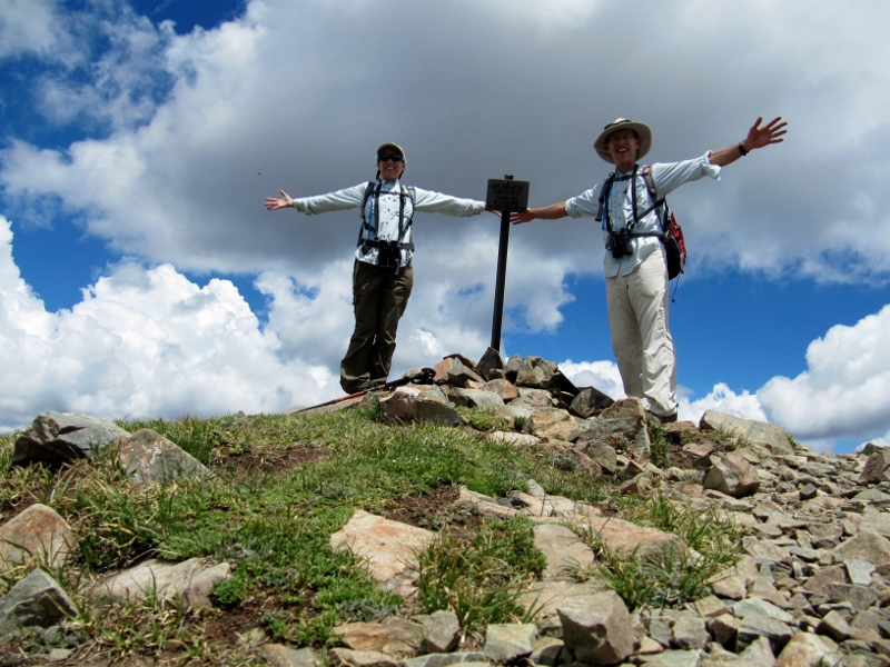
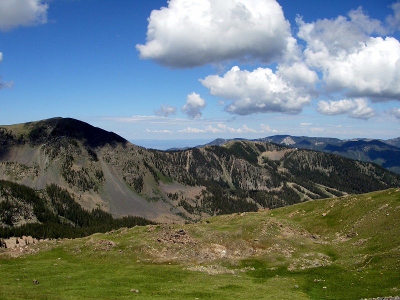
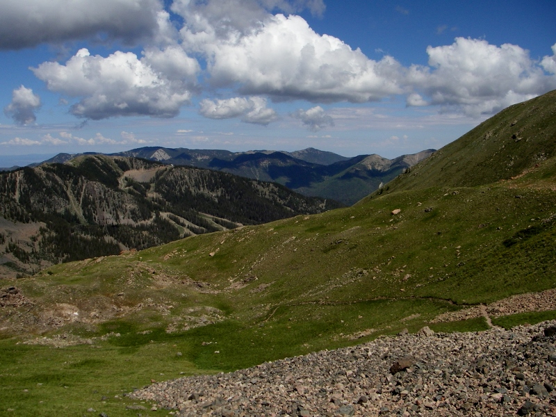
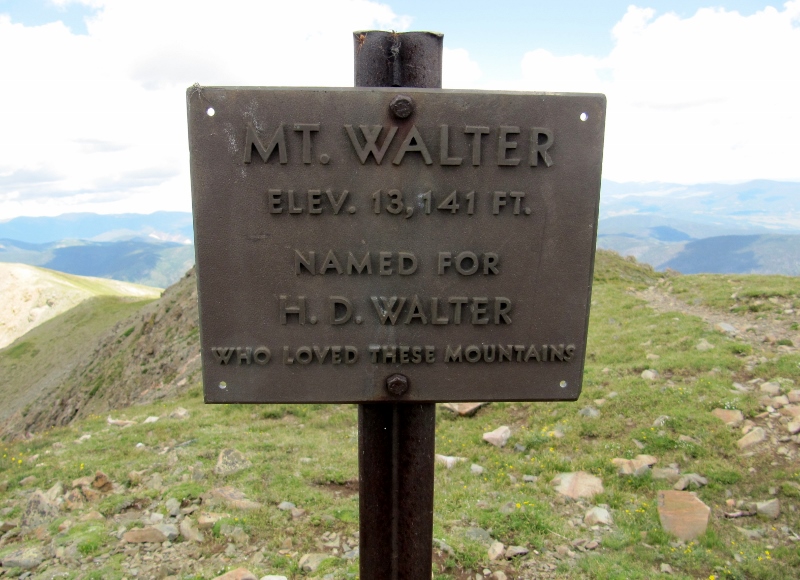
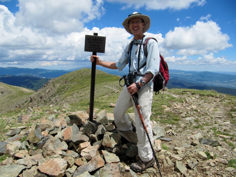
Once we finally got up high enough, we had to hike along the ridgeline to get to the Wheeler Peak summit. 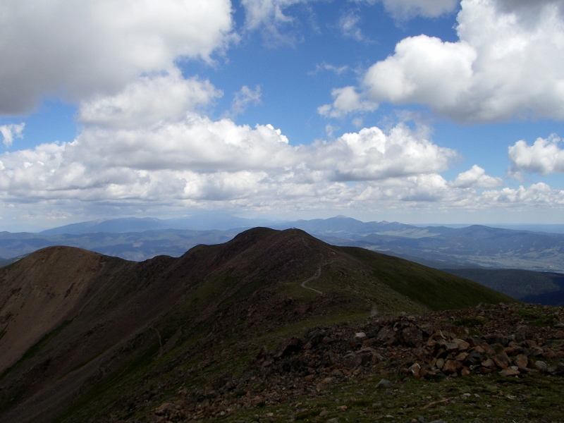 After what seemed like forever, we could finally see the light at the end of the tunnel. And it appeared we had a guide to help us the now-short distance to the summit! This female mountain goat was so tame we practically had to chase her off the trail so we could continue. 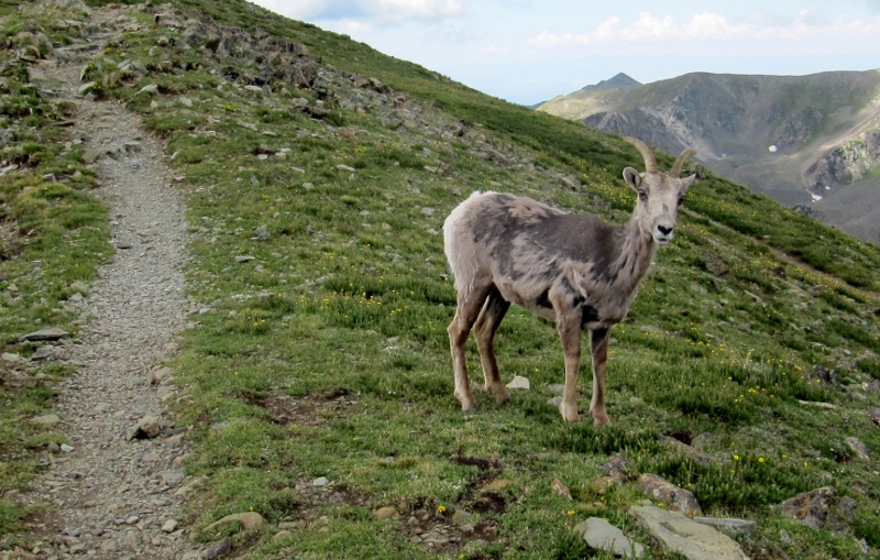 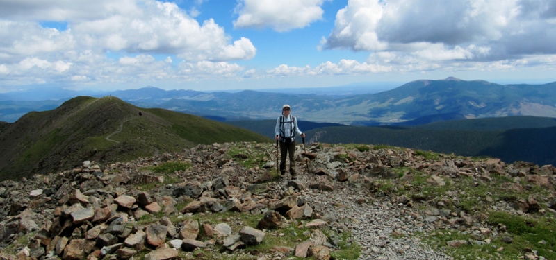 We did it!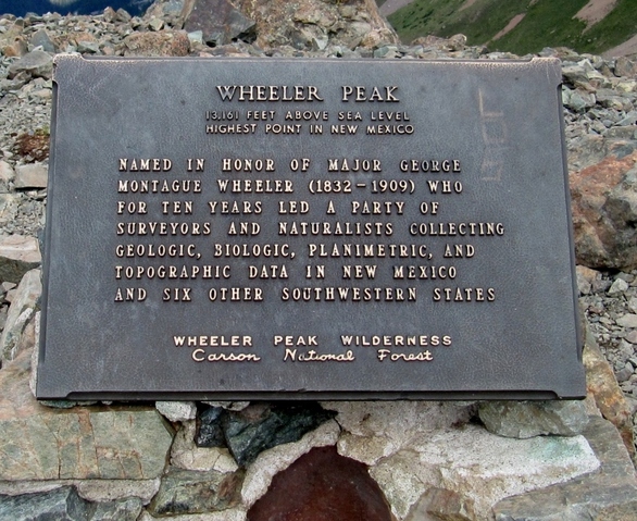 We met another friendly couple at the summit, and we took photos of each other. They were taking the longer way, around the back side of the mountain, both ways. Then again, they were a lot younger than us. 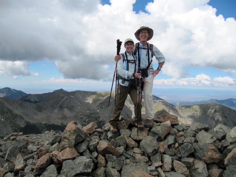 I think our "guide" was a bit of a ham too -- she surely didn't mind posing for photos. It was very cool being so close to this wild, but very tame, creature. 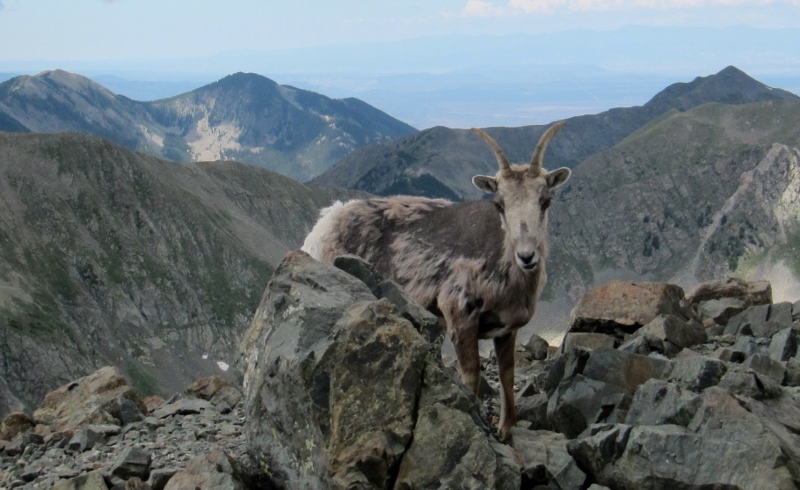 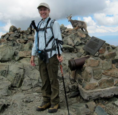 Of course we signed the logbook showing that we made it to the summit, for posterity. 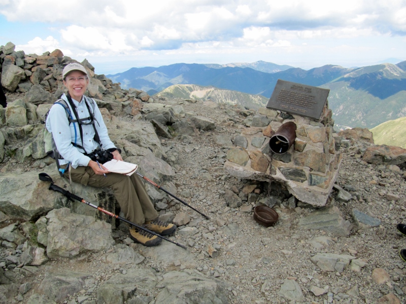 We then hiked over to Mt. Walter nearby, the second highest point in New Mexico (elevation 13, 141'). While we were in the neighborhood and all... 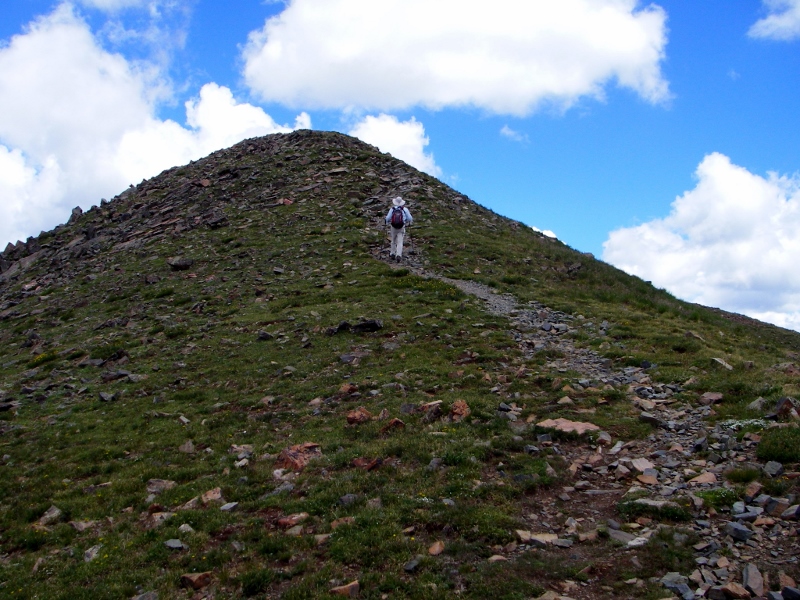
 Mount Walter summit (taken with self-timer as no one else was around) There were quite a few marmots near the peaks. This one seems to be wondering what the fuss was all about. 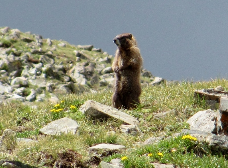 As we turned and started making our way down from the summit, we could see storm clouds off in the distance, and we were very glad we were heading down. We actually had to hustle quite a bit to get below the treeline as storms move in quickly in the mountains here. 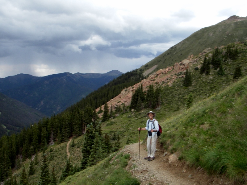 Storms not too far away now -- we were starting to hear thunder Fortunately, by the time we started hearing thunder, we were almost down to the treeline. We were going pretty fast now that we'd made it through the most challenging, rocky terrain. 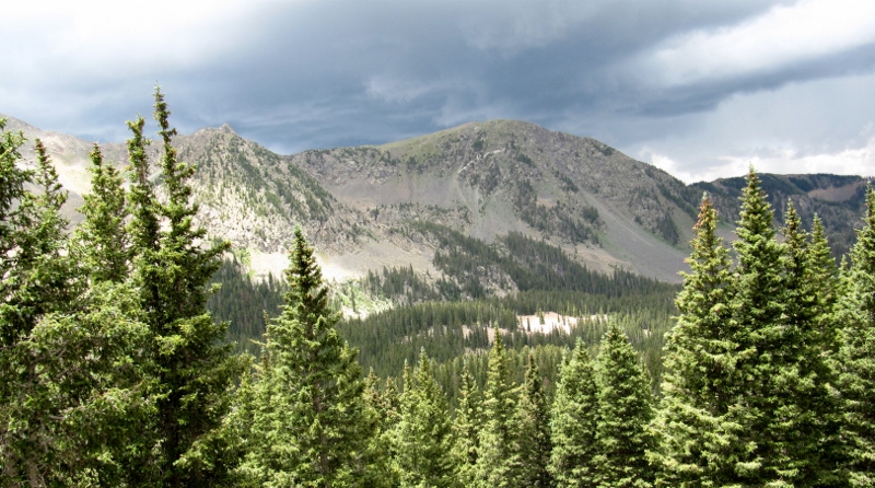 Gorgeous views with the storms in sight We made it safely below the treeline as thunder rumbled. Would we make it down before the rain began? We had to skip our planned picnic on the way down in the interest of staying safe and dry, so I was starving by this point and practically jogging down the trail. Glad it was downhill! 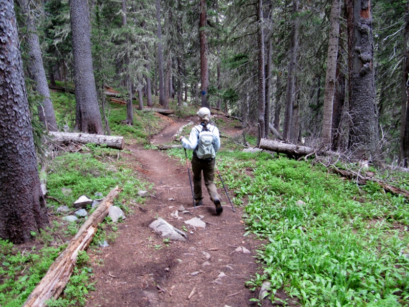 We did take a slight detour to see Williams Lake, and managed to eat a quick snack there before continuing. 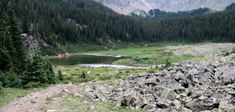 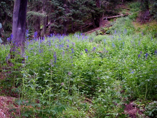 Pretty wildflowers near the lake Amazingly, even with the storms approaching, we still passed other hikers heading the other way. Not sure what they were thinking! We didn't quite beat the rain -- it started just as we were a bit past the lake, though the thunder and lightning had moved a safe distance away by this time. Barry had not brought his rain jacket on this trip, but we did have this great garbage bag, which worked well to cover him and his pack with our valuables. 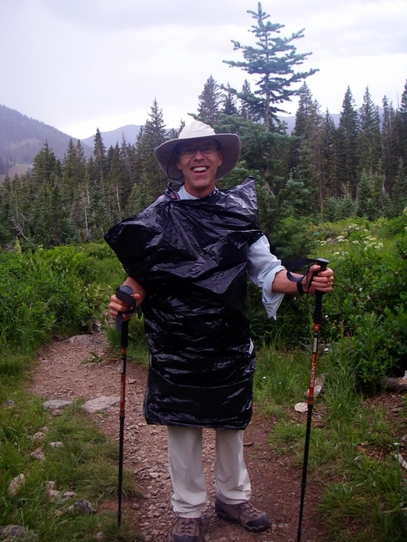 By the time we got back to the car, it was raining pretty hard and it even hailed tiny pellets for just a couple of minutes. We were so glad to be finished with the hike!  And this is what we saw as we headed back into Taos -- what a change from the morning's bright blue skies and sunshine.  All in all, despite the rain at the end, this hike was truly a "peak" experience. We were tired but felt very proud that we'd accomplished it, especially since we hadn't really planned for or specifically trained for it, as we had for other difficult hikes in the past, like the Grand Canyon. Our total mileage including the walk to and from the Williams Lake Trailhead was 9.4 miles.
|
Emily & BarryWe're a long-married, early-retired couple who are currently traveling as nomads with no fixed home base. After years of living in North Carolina (Emily's home state), we spent 18 months living oceanfront on Ambergris Caye, Belize, a year road-tripping the US in a Honda CR-V, a year in Playa del Carmen, Mexico, and are now roaming North America in our 32' motorhome, Pearl, following warm weather whenever possible. 
Paisley, May 2016

States visited (pre-RV)
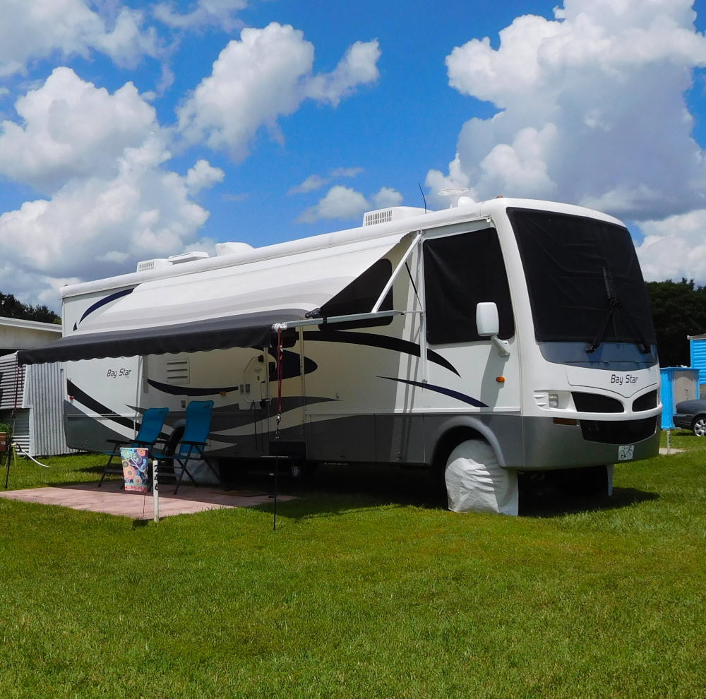
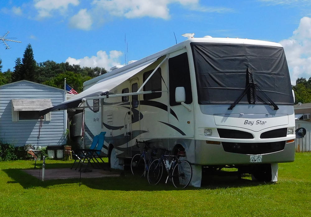
Pearl, a 2007 Newmar Bay Star
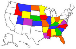
States visited in "Pearl"
Archives
July 2019
Favorite Travel Blogs |
 RSS Feed
