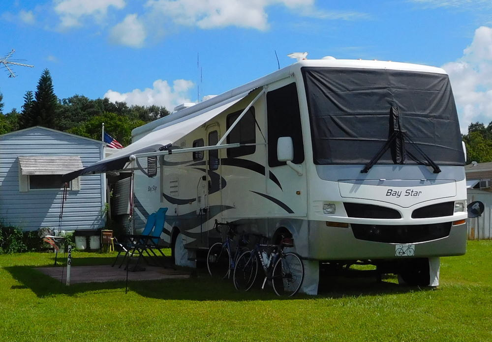
"Pearl" in Winter Garden, Florida
|
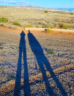
Long shadows in Wyoming
|
|
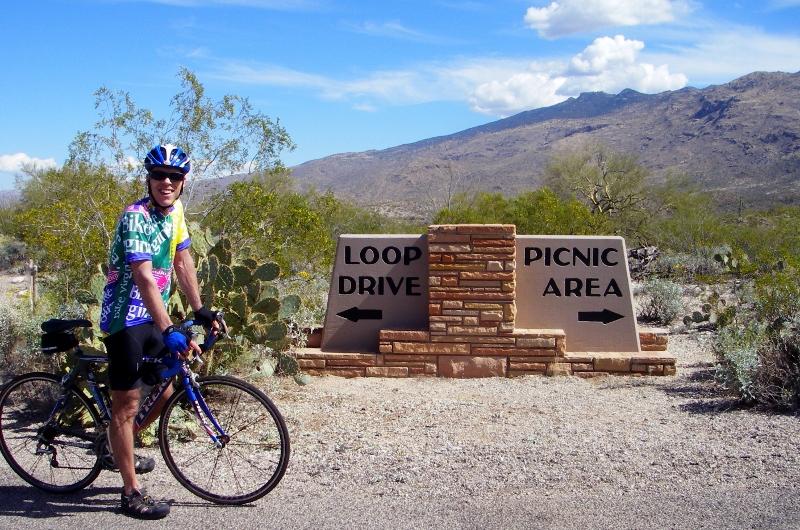
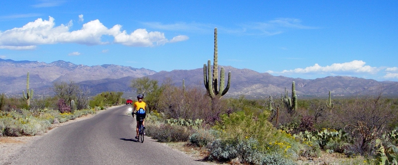
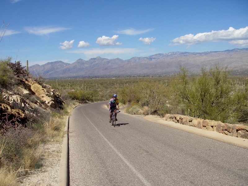
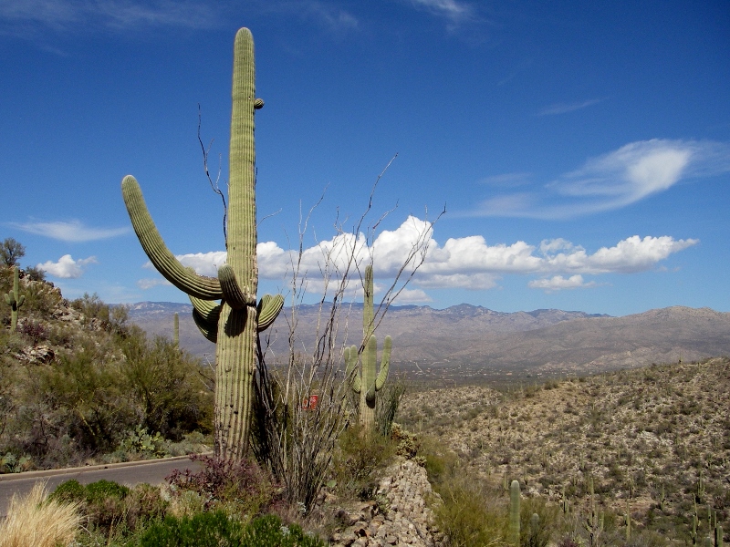
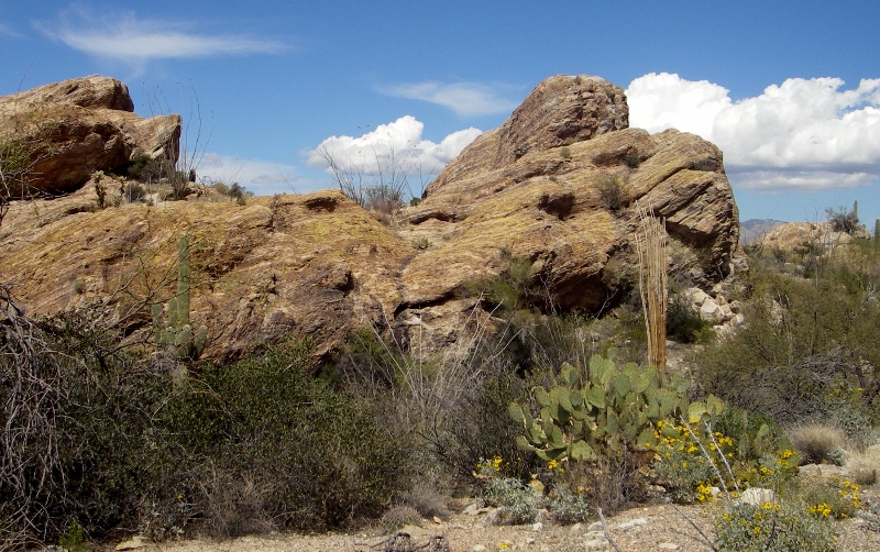
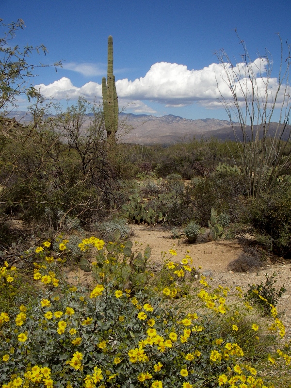
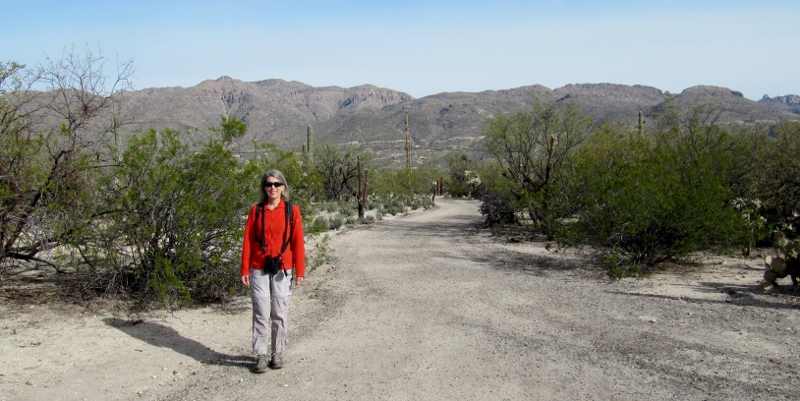
For the past two Wednesdays, we have ridden over to Saguaro National Park, about nine miles from the condo where we're staying in Tucson. Last week we went ahead and bought an annual national park pass, since we hope/plan to go to quite a few National Parks and monuments in the coming year. For $80, it's a great deal if you plan on going to several sites over the course of a year: one pass admits everyone in your vehicle, or up to four on bikes or on foot. If you're over 62, you can get a lifetime pass for only $10, but we have to wait a couple more years for Barry to qualify for that. There are actually two "districts" to this park. On the east side of the city is the Rincon Mountain District; and on the west side is the Tucson Mountain District. The districts are close to an hour's drive apart. Since we are staying on the east side of the city, that's the district we visited twice. We were right outside the Tucson Mountain District when we visited the Arizona-Sonora Desert Museum, but didn't actually enter the park. Inside the Rincon Mountain District of the park is a scenic one-way driving loop, the Cactus Forest Loop, that's a favorite of cyclists. This one-way road is like a roller coaster with swooping descents, a few short, steep climbs, and one long, challenging climb in the middle. Although it's listed at eight miles, if you add in a ride over to the picnic area and back, plus getting to and from the loop, you'll end up with around nine miles of very, very fun riding that will get your heart pounding. The views of the desert, Santa Catalina mountains, and oh yes, all those saguaros, are breathtaking! Here's the elevation profile for the loop. The climb includes grades of up to 19.4%, so it is not for the faint of heart, quads, or those with single-speed bikes. I was in my easiest gear for much of the climb and could have used one or two more! 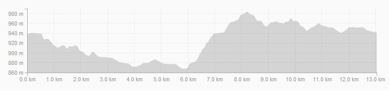
Cactus Forest Loop elevation profile
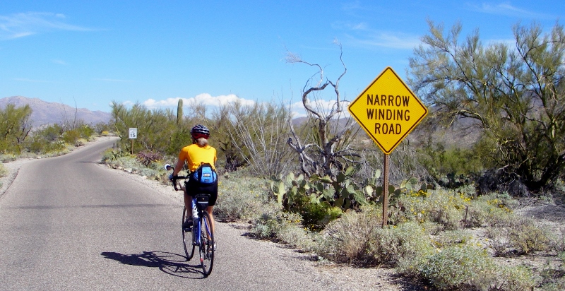
Since we visited the park mid-week, we encountered more cyclists than cars on the loop both times. Many of the cyclists appeared to be pro teams in training with their matching kits and super high-end bicycles. On the first visit, it was overcast, so our photos weren't as good. Fortunately, when we went back yesterday, we had brilliant sunshine. In just a week of warm weather, lots more flowers were blooming too, so it was much prettier in that way as well. Check it out! 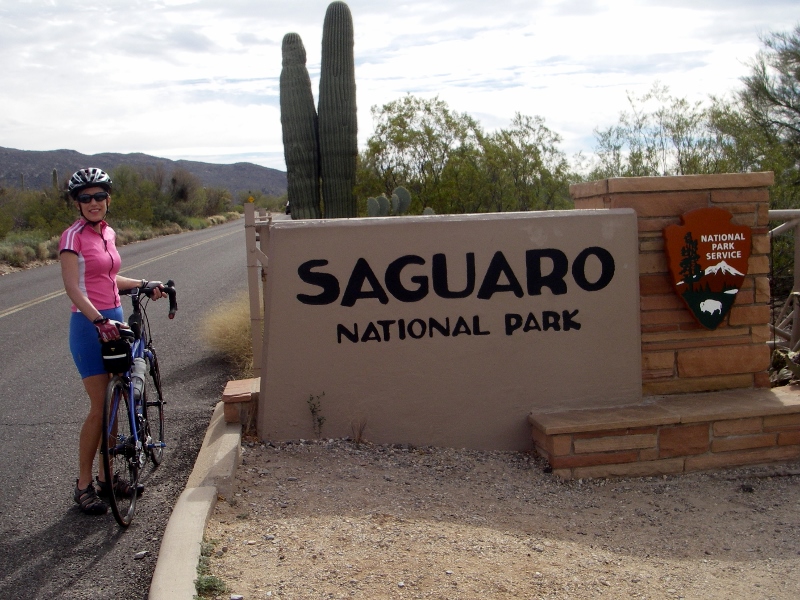
Our first visit was a bit overcast...
...but the second was a much prettier day.
Starting the loop
The park ranger warned us sternly about this steep descent with sharp curve both times we came through, but as long as your bike has good brakes and you exercise common sense, it's no problem. The sign is pretty humorous, though! 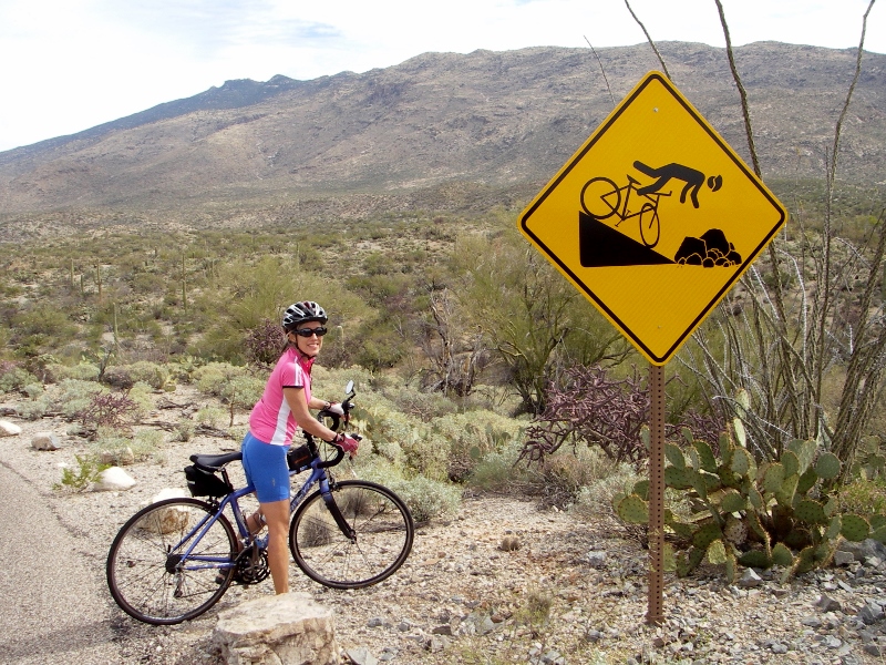
Eeeeek!
Here I am descending it on our second visit to the park. Keep in mind that cameras always flatten out hills -- it was definitely a steep one. 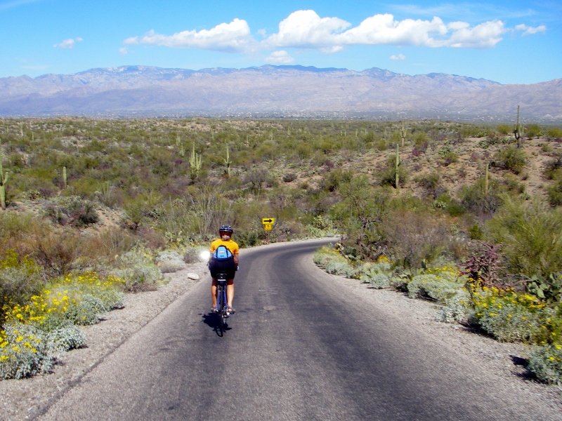
And here's one of the short, steep climbs. Loved the "Share the Road" sign including a desert tortoise! Wish we'd seen one. 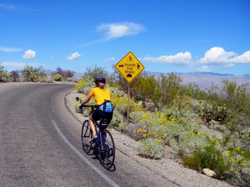
Speaking of wildlife, on our second park visit we were warned by the ranger that gila monsters had been sighted in the park recently. We didn't see one of those, but on our first visit, we did come across this guy right in the road. Our first-ever rattlesnake sighting! Fortunately, he was just sunning himself and didn't even move. 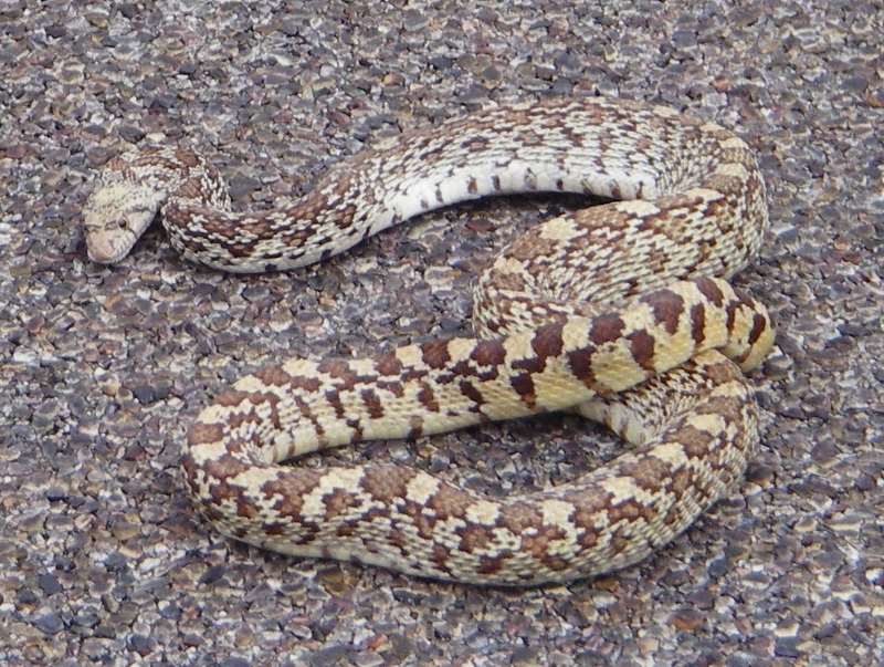
Pretty nicely camoflaged with the road surface, no?
But on our second visit, no wildlife other than birds were in evidence. 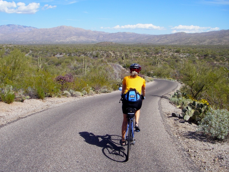
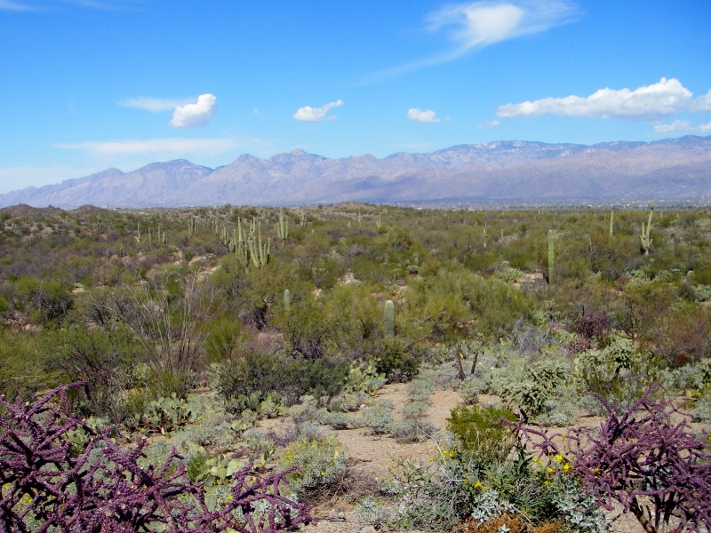
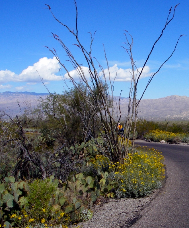
Desert cacti and flowers
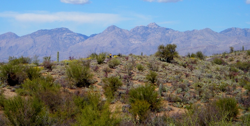
If you look closely you might be able to make out a tiny dot of orange -- that's me riding along!
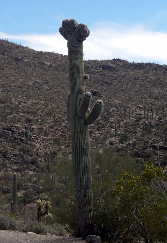
An especially nice Saguaro
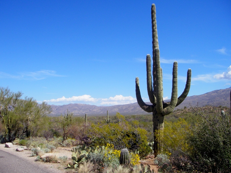
In close-up
Barry starting the climb up the long hill
Nice view from part-way up...still some more climbing ahead, though.
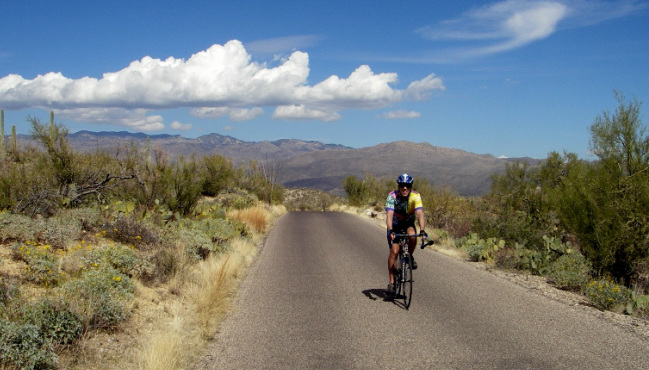
Barry finishing up the big climb
At the high point of the loop is "Javelina Rocks". Alas, no javelinas to be found, though. 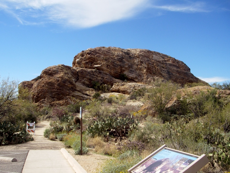
Another view of Javelina Rocks
Another view from high up -- loved the wildflowers in bloom as well
Rare Crested Saguaro on the way to the picnic area
On our second visit to the park, Barry decided to ride the loop a second time without the burden of stopping to take photos numerous times. I didn't want to climb the hill again as we'd had a long climb just to get to the park as well, so I hung out outside of the Visitor Center while I waited. This Feather Tree right outside was interesting to me. 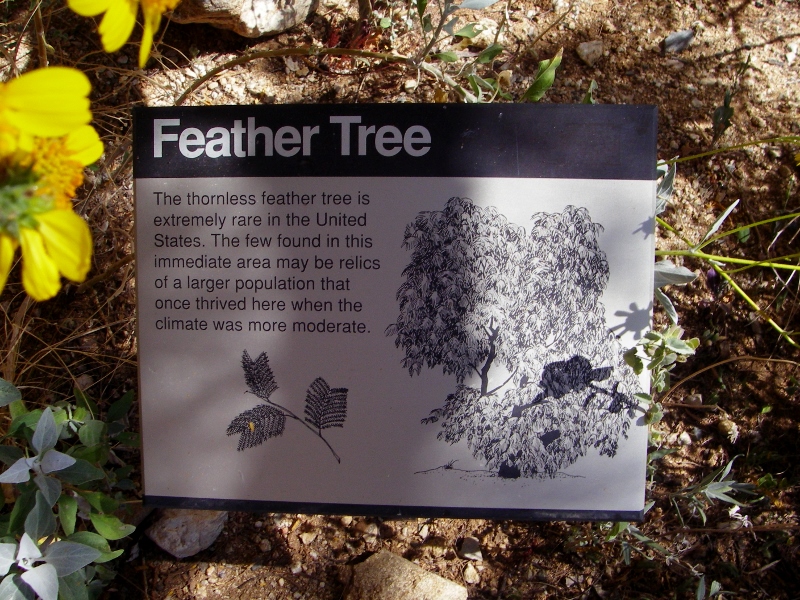
Climate change anyone?
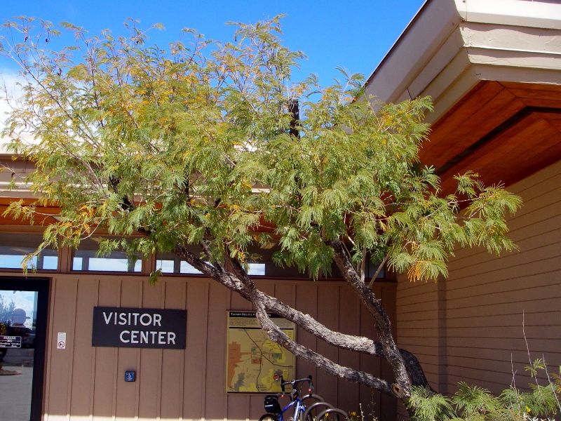
Feather Tree
We're looking forward to coming back to the park sometime in the future to hike, as the Desert Forest Loop is but a small piece of the entire park. There are numerous trails to explore on foot as well. Here's a map of the park, and you can see what a small piece of it the loop we rode covers. 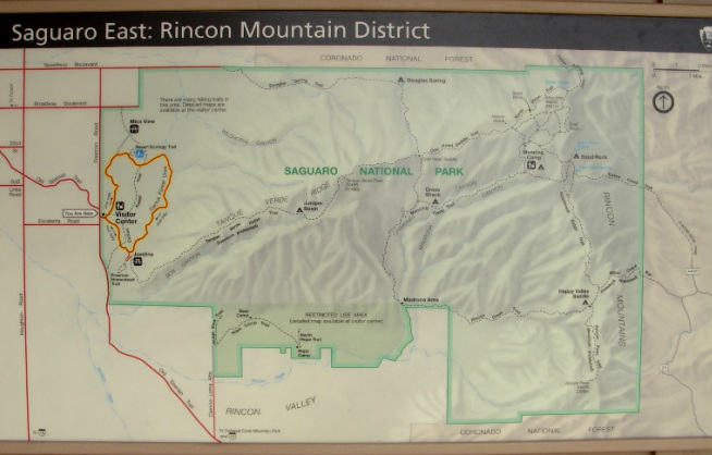
The Desert Forest Loop we rode is highlighted in yellow, but the Saguaro National Park East District is much, much larger!
This plaque in the garden by the Visitor Center really summed up this park -- and indeed the entire region -- to me. 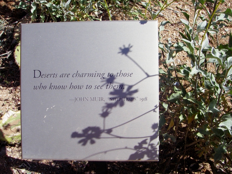
"Deserts are charming to those who know how to see them." -- John Muir, "Steep Trails", 1918.
0 Comments
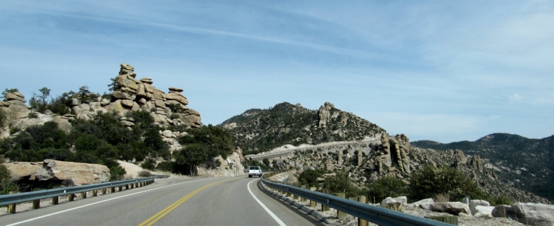
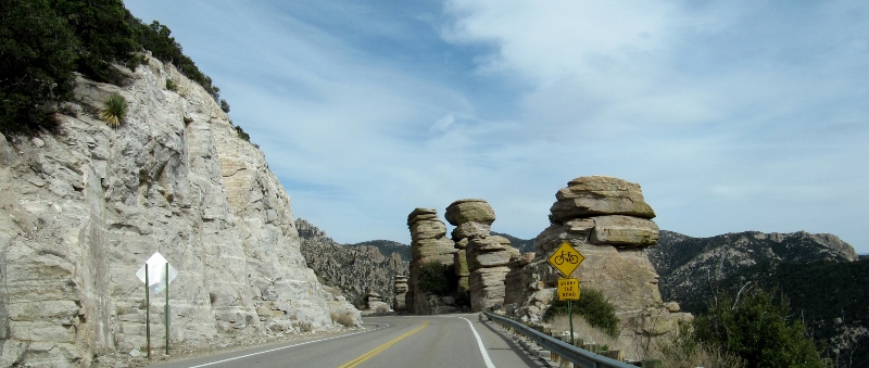
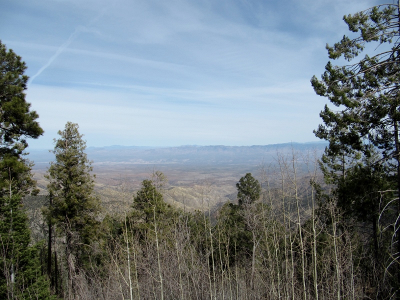
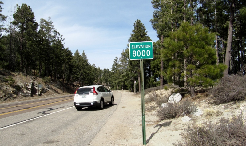
In Part 1, we'd just decided at the spur of the moment to ride up to Mt. Lemmon after spending the morning birding at Agua Caliente Park. We usually plan things out in advance, but a little spontaneity can be fun, right? From reading articles like this one on Tucson cycling routes, we knew that the 26-mile ride up the Catalina Highway to the mountaintop was a very popular (and challenging!) training ride for both professional and amateur cyclists in the area. Lance Armstrong used to ride it, for instance -- 'nuff said. But today we'd be taking the easy way out and driving this scenic byway. We could immediately see why so many flock up this way. In the winter, it can be a place to ski if the weather is right; and in the summer, the over 8000' elevation provides a respite from Tucson's brutal heat. Plus the views are breathtaking! It was a bit hazy and semi-overcast on this day, so we didn't take as many photos as we might have on a crystal-clear day. Still, it was undeniably beautiful. 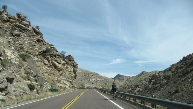
We saw lots of cyclists in both directions. I'm not sure I'd want to ride up the 26 miles, but Barry would!
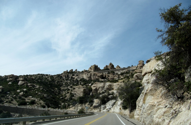
Beautiful rock formations along the way
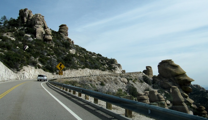
"Share the Road"
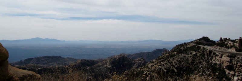
View from up high
In case you're wondering, when we got up to the highest point, we did get to see just a bit of snow left over from the last cold snap. 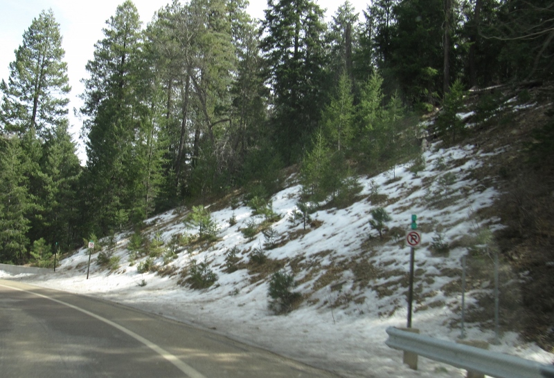
It was interesting to see the different foliage up at this level -- lots of pine trees, as you can see
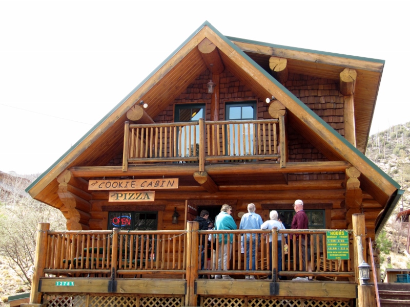
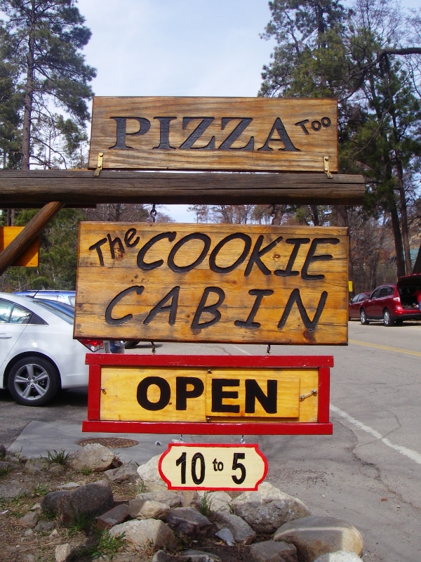
When we got up to the small tourist town of Summerhaven near the summit, we stopped to grab a bite to eat. This cute "Cookie Cabin" looked promising...
It was interesting to watch the temperature as we ascended and descended the mountain. Here's the difference.
On the way back down, we (along with others) got stopped by the sheriff for a bit to wait for a commercial being filmed along the road -- probably one of those car ads with sweeping mountain vistas. We saw many parking areas with marked hiking trails along the way as most of the drive is in the Coronado National Forest. We will definitely have to come back here for some hiking another time. 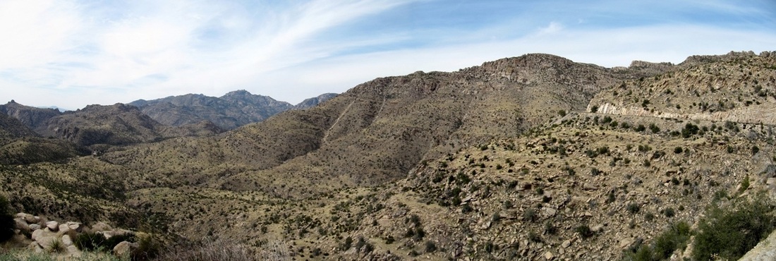
I can see why they'd want to film a commercial here!
Last Friday we gave the bikes a well-earned day off and made plans to do some birding instead. I had read about Agua Caliente Park at the far northeast side of Tucson, and it sounded like the perfect spot. "An oasis of green in the desert" was a common thread. Unfortunately, due to the severe drought in this part of the country, most of the water that used to be there in multiple spring-fed pools has dried up, said the latest reviews on Tripadvisor. Still, it seemed worth a visit, particularly since it's not that far from the condo where we're staying. The reviews were right. It is an oasis even now, with huge palm trees, lots of green everywhere, and plenty of birds. But the reviewers also got it right when they said that the pools have dried up -- all but the main pool were completely dry, and the water level in the remaining pool was low. Apparently the spring that used to feed these pond has stopped flowing and the current pond is fed by a well. I hope it doesn't dry up completely before the rains come again, but the climate, she is a-changing, and it may never be what it used to be. What a shame. The site of the park was originally a ranch, now listed in the National Register of Historic Places. The restored ranch house on site is now part of the park. It houses a art gallery and nature shop. 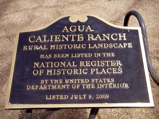
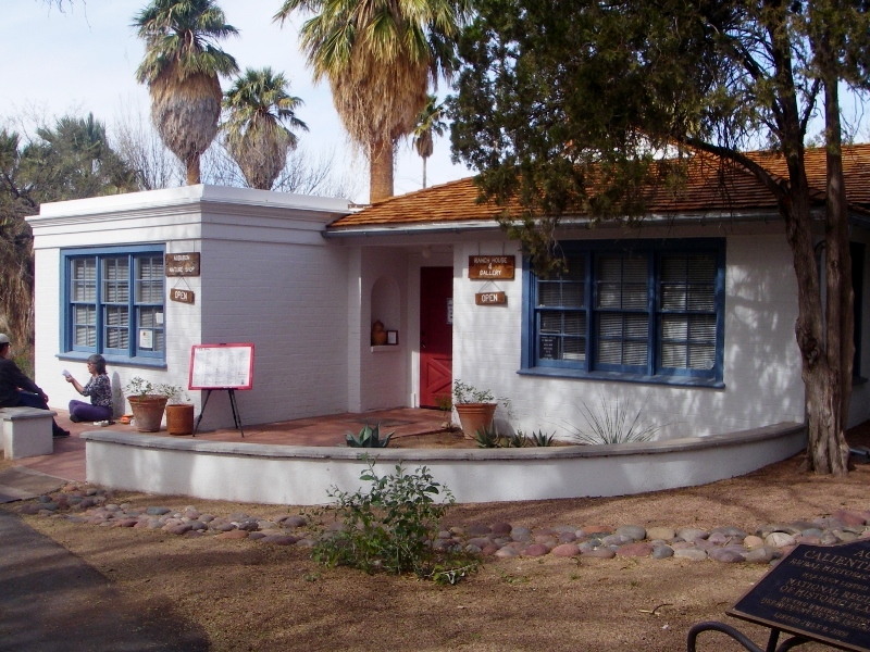
Restored ranch house
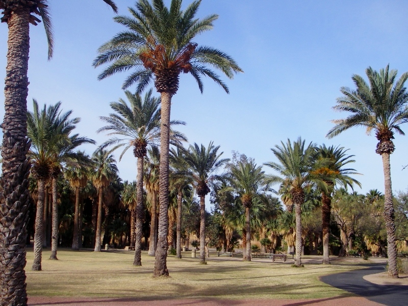
Gorgeous palm trees
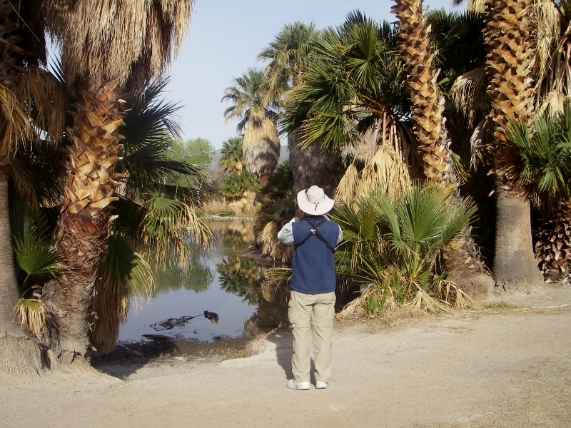
Barry checking out the remaining pond
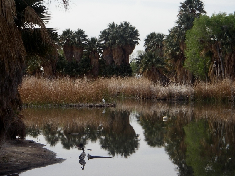
Low water but still beautiful

The "Giant Mesquite Tree" was just starting to leaf out.
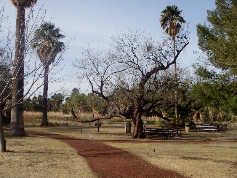
There are paths, paved and unpaved, throughout the park boundaries. This one is going to be gorgeous once all these trees have leafed out. It would be a nice shady place to retreat to in Tucson's hot summer. 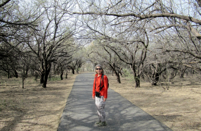
Here's one of the ponds that has completely dried up. Sad to see. 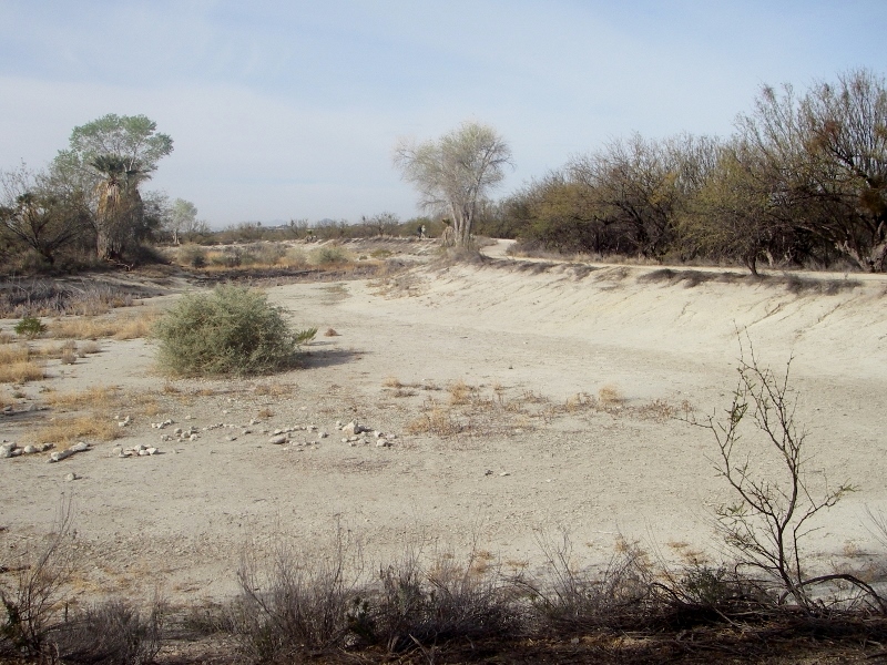
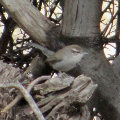
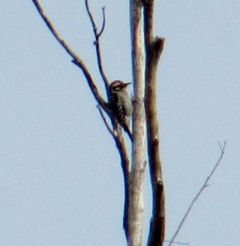
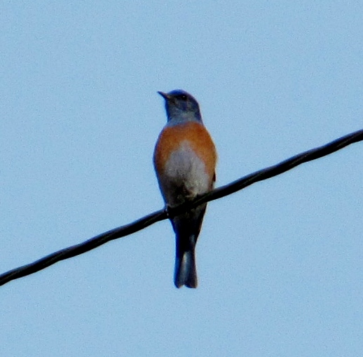
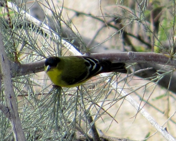
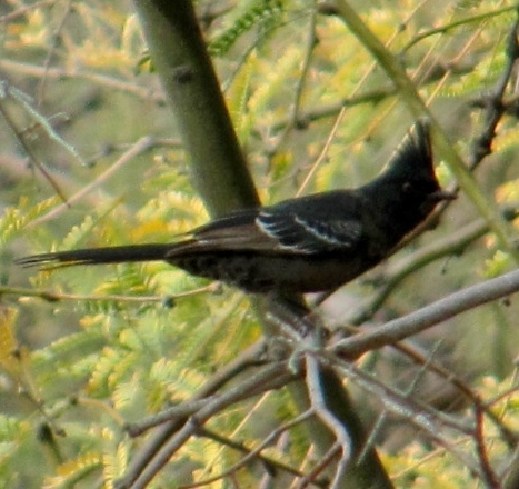
Here are some of the birds we saw in the park. We both nabbed a few new ones for our life lists, including the Western Bluebird. They were especially plentiful in the park on this day and were a delight to see!
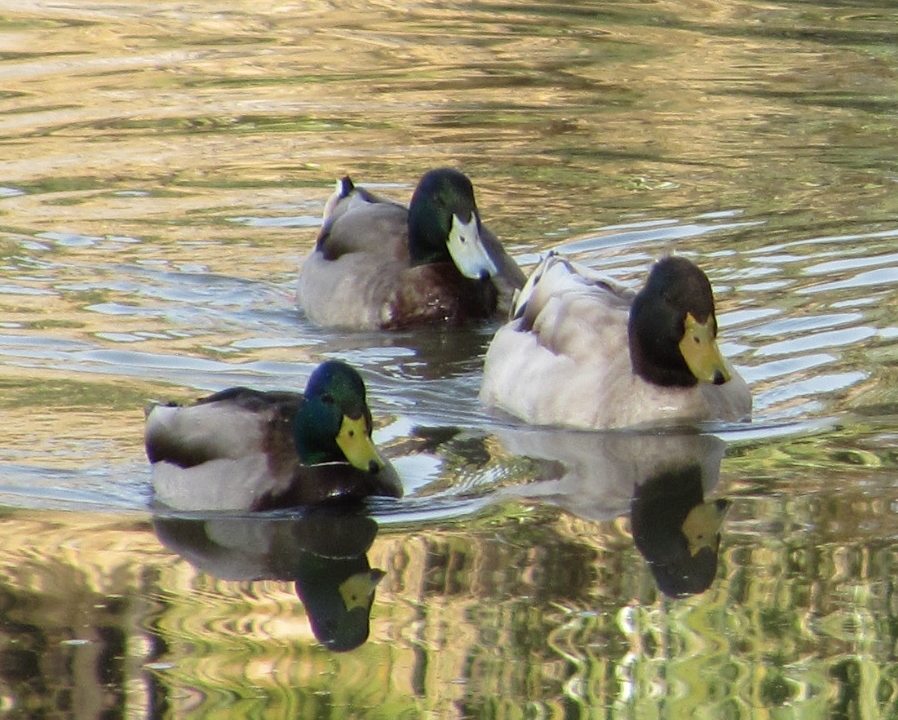
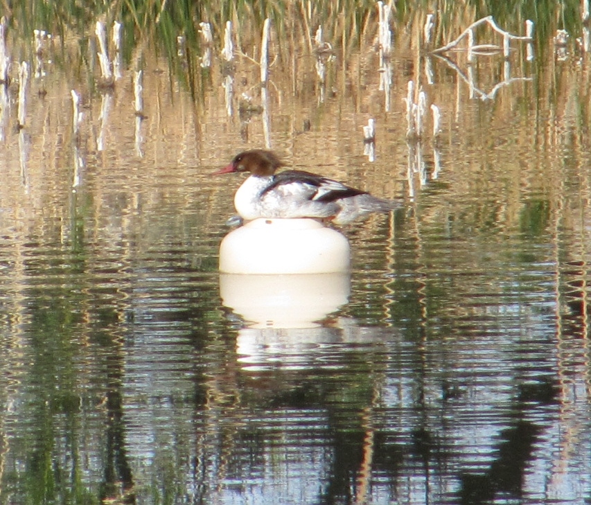
Mallard to left (male), Lesser Scaups (pair)
While we were walking around the park, we realized we could see part of the Catalina Highway going up-up-up to Mount Lemmon. Although we hadn't planned it, we thought, "Hey, why don't we drive up there?!" So, leaving the park, that's exactly what we did. Stay tuned for Part 2 of our fun-tastic Friday!
|
Emily & BarryWe're a long-married, early-retired couple who are currently traveling as nomads with no fixed home base. After years of living in North Carolina (Emily's home state), we spent 18 months living oceanfront on Ambergris Caye, Belize, a year road-tripping the US in a Honda CR-V, a year in Playa del Carmen, Mexico, and are now roaming North America in our 32' motorhome, Pearl, following warm weather whenever possible. 
Paisley, May 2016

States visited (pre-RV)
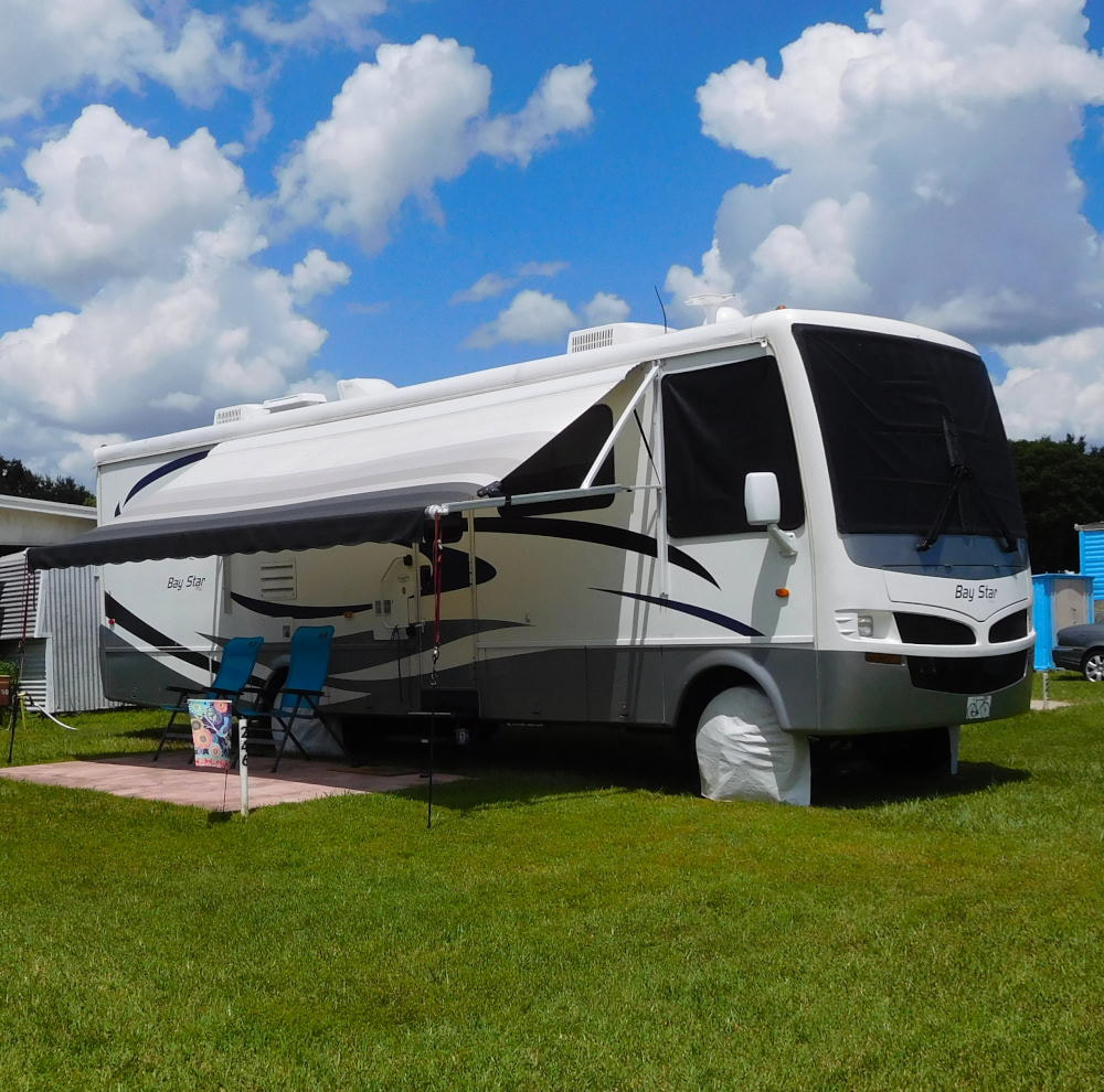
Pearl, a 2007 Newmar Bay Star

States visited in "Pearl"
Archives
July 2019
Favorite Travel Blogs |
 RSS Feed
