"Pearl" in Winter Garden, Florida
|
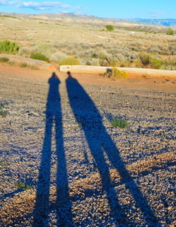
Long shadows in Wyoming
|
|
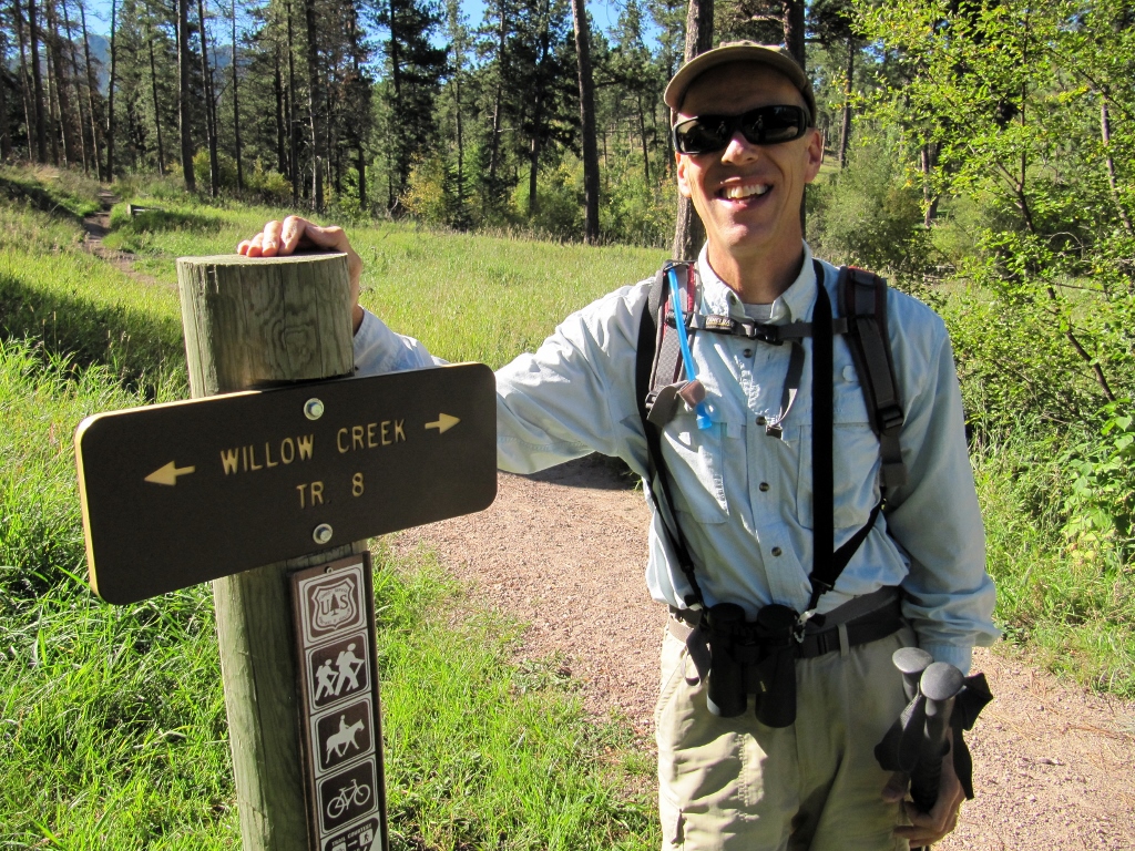
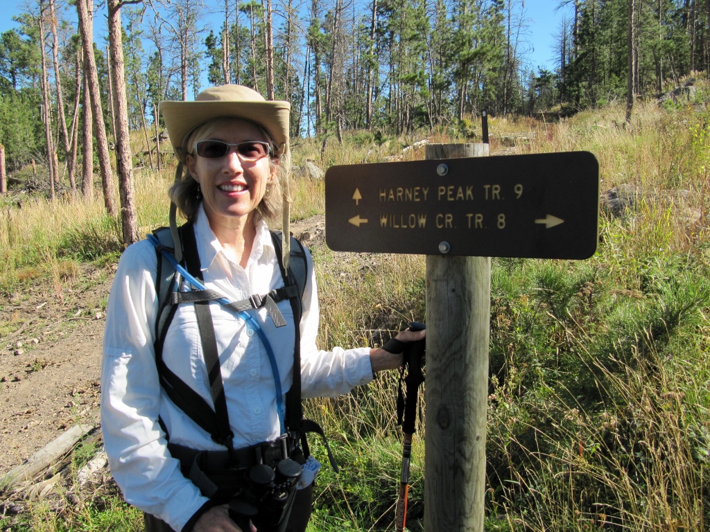
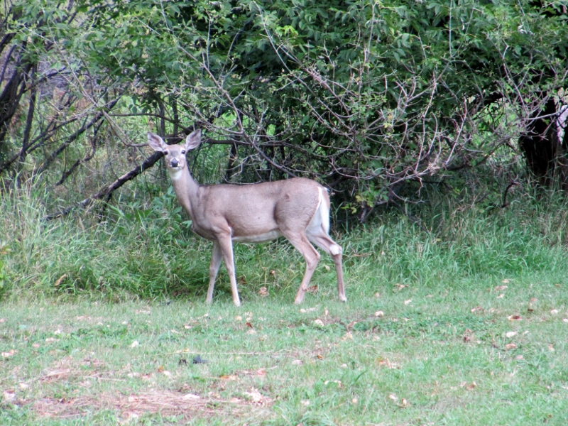
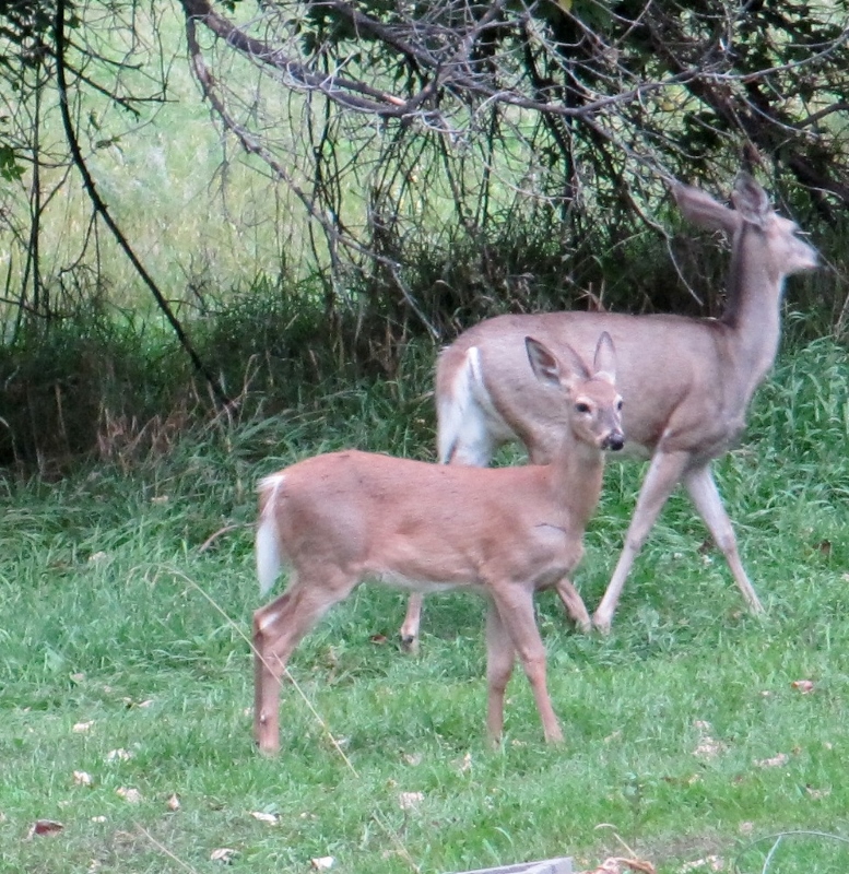
Back in July we had an amazing "peak experience" when we hiked to the summit of the highest mountain in New Mexico, Wheeler Peak (photos here). So in South Dakota, we decided to do the same. The highest peak in the state at 7242', Harney Peak is also the highest point in the US east of the Rocky Mountains. Although it's quite a bit shorter than Wheeler, which towers at 13167' in altitude, the hike to the summit of Harney was challenging nonetheless. Here's a blurb Barry found online: There are multiple routes to the summit, the easiest being the southern approach from Sylvan Lake. This route follows the Harney Peak-Sylvan Lake Trail for 3.5 miles one way, and 1,100 feet of elevation gain. I would rate this hike as easy to moderate. This trail receives heavy use. So naturally, we did the northern approach! As promised, it was lightly traveled; in fact, we saw no other hikers on this route in either direction. There were quite a few folks at the peak who had done the well-traveled and easier hike from Sylvan Lake, which made us very happy that we'd taken "the road less traveled." We appreciate our solitude when hiking, and the views were indeed scenic. 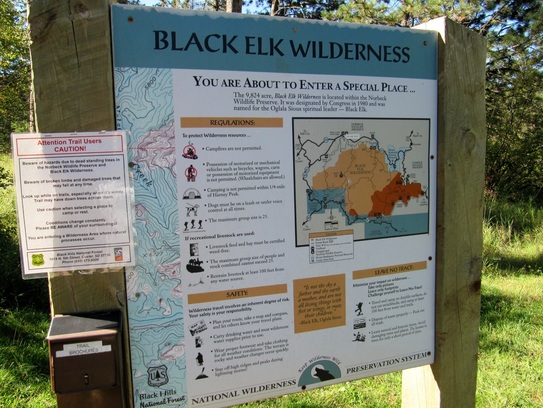 It really is special, though we didn't see any elk, unfortunately 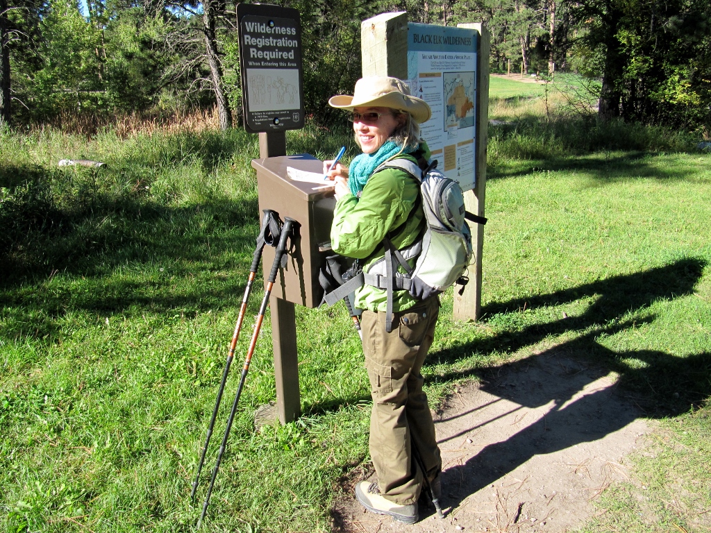 The sign-in...and yes, it was a bit chilly starting out!
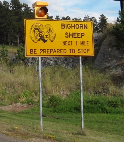
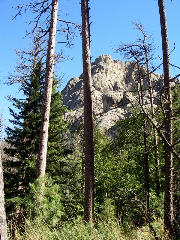 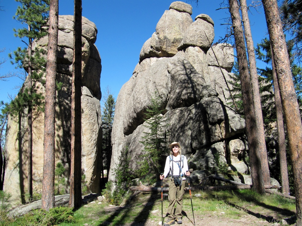 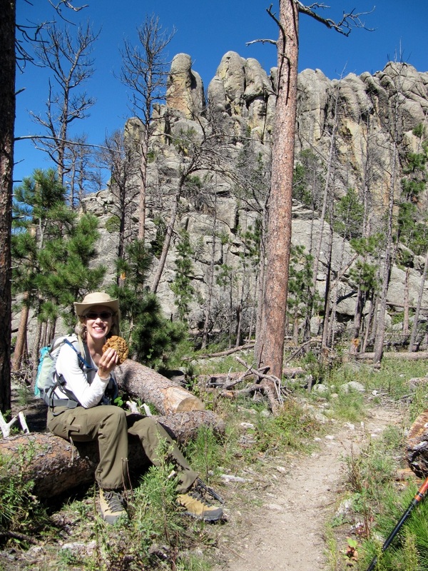 Cookie break in an amazingly beautiful setting...and not a soul around! 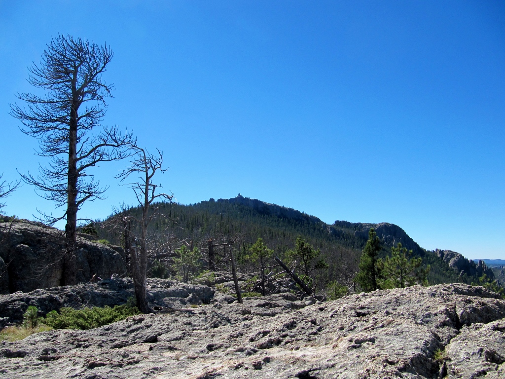 See that tiny little peak in the middle of the photo? That's where we're heading. 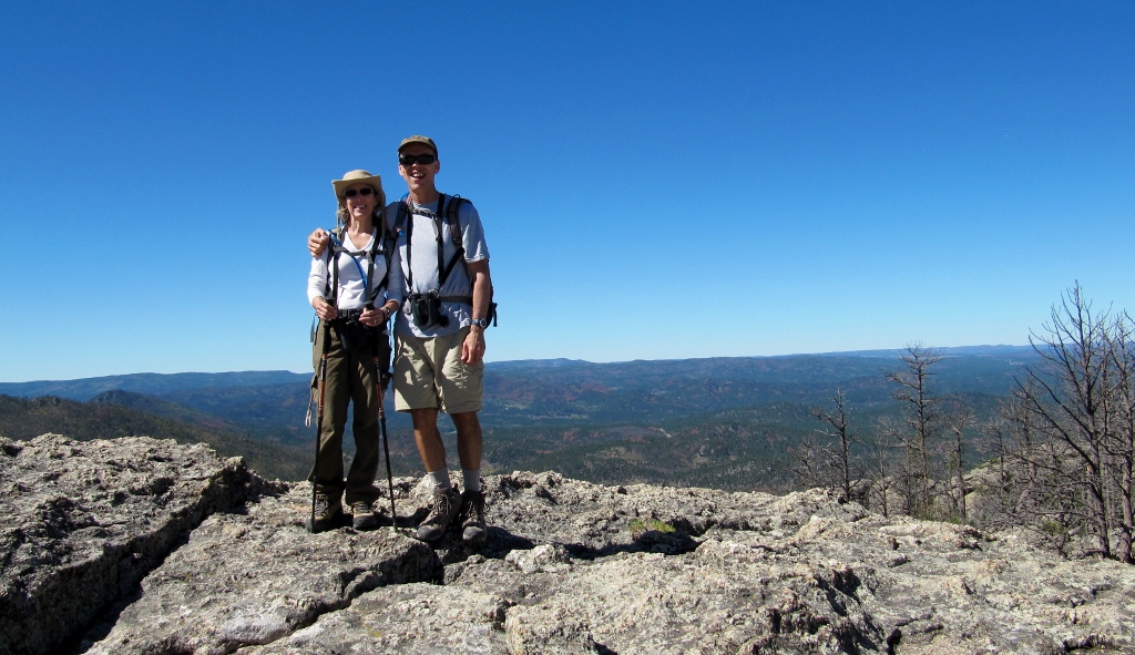 Already feels like we're on top of the world, but we still have a couple miles to go! 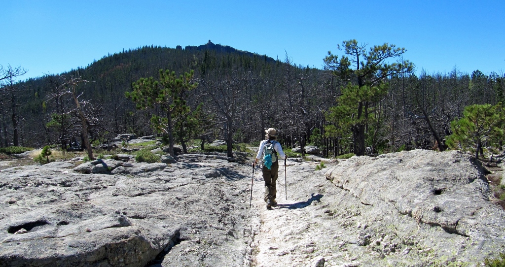 The goal in sight! 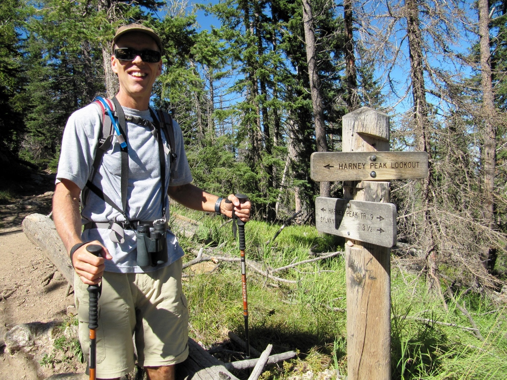 Just a short bit to go to the summit now! 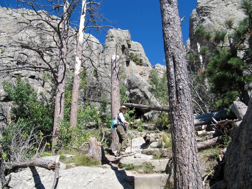 Almost there... 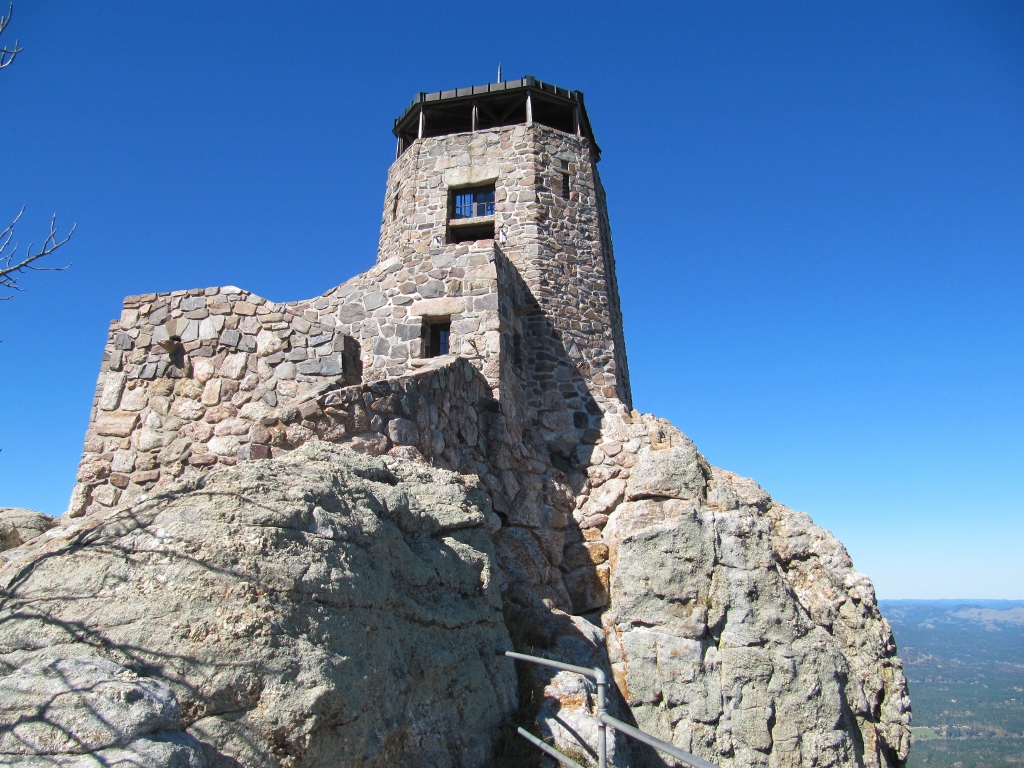 This cool structure is at the peak. I can't imagine how they built this way up here! 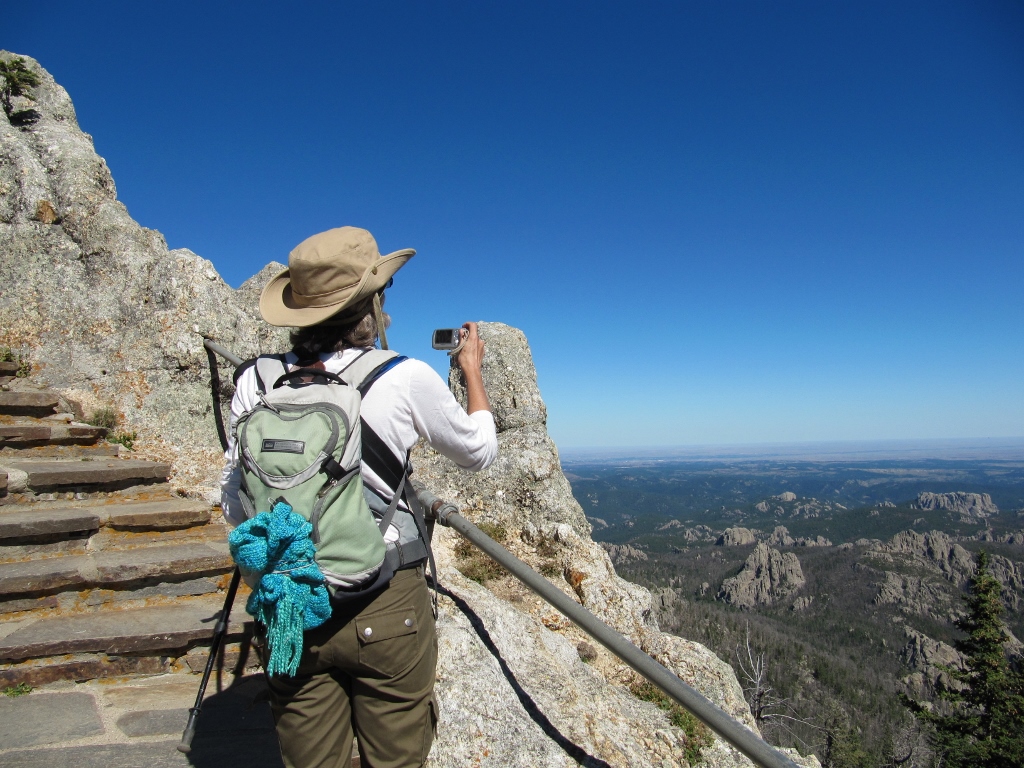 The views! 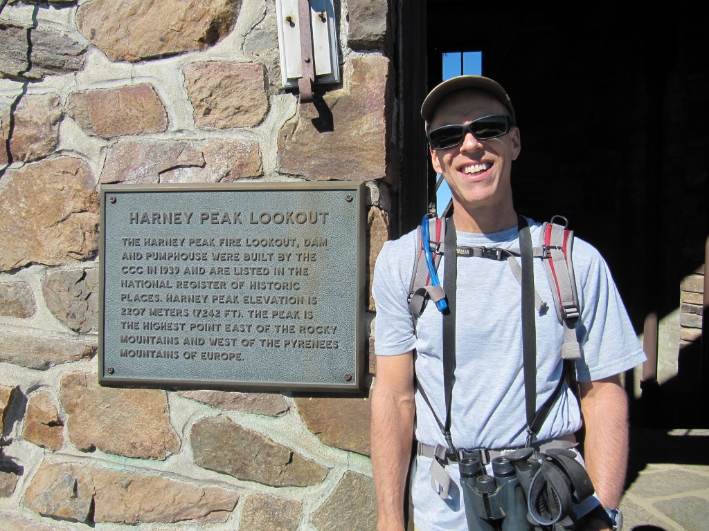 We did it! Another summit conquered... 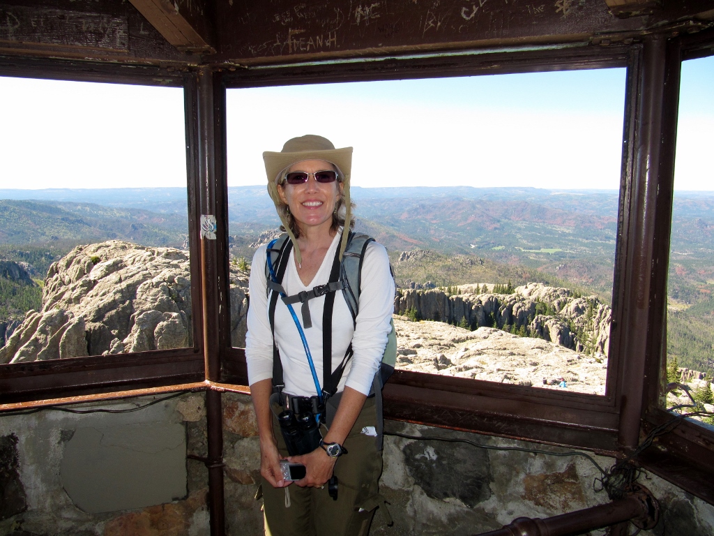 At the top of the tower at the summit it was windy and chilly, but I was quite warm from the climbing Though we carefully avoided showing other people in our photos, there was a surprising number of other hikers (and a couple of dogs!) at the summit. We heard some German being spoken and realized that at least some of our fellow hikers were Europeans. This makes sense as they do tend to be in better physical condition than folks in the US (sadly). And with it being a fall weekday, younger, more fit Americans were likely to be at work or school. But as I mentioned earlier, all the other hikers came up from Sylvan Lake, so we had the north #9 trail to ourselves in both directions -- perfect. The views from the summit were amazing, though photos never seem to do these kinds of views justice. You miss so much when it's not in 3-D nor 360-degrees worth! But here are a few shots anyway. 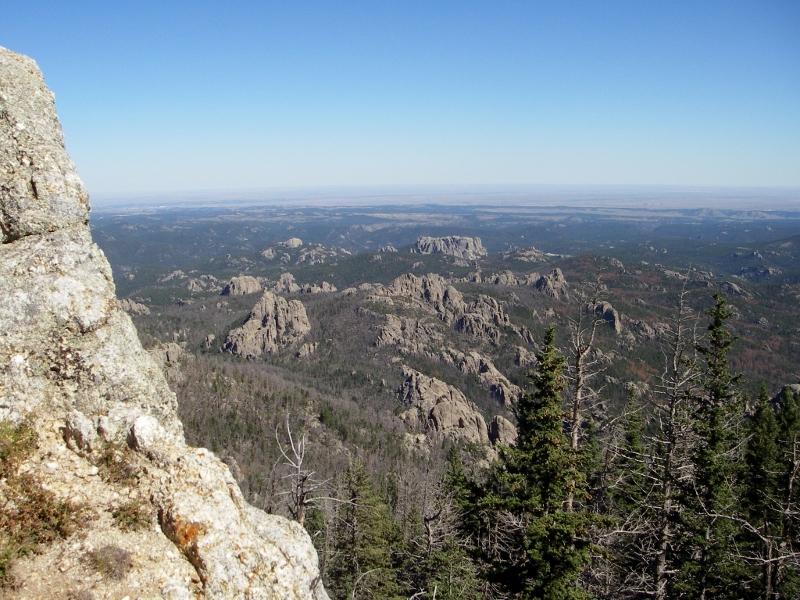 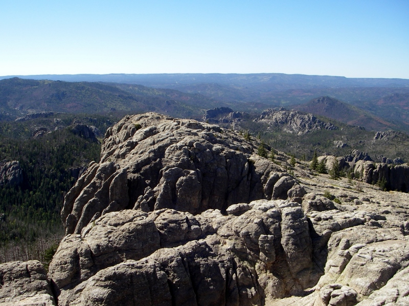 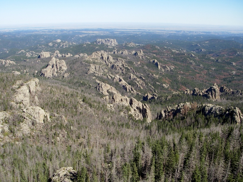 Notice in the photos above all the defoliated trees. These are not deciduous trees that have shed their leaves but pines that have died due to the incredible scourge of the mountain pine beetle. Signs of their destructiveness were all around us during our time in the South Dakota Black Hills. It was so sad and sickening. According to this website from a South Dakota congresswoman, one third of National Forest System land in the Black Hills has been lost to these insects, and the Black Elk Wilderness is the hardest hit. I plan on writing some letters after this trip. 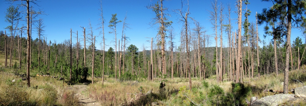 Seeing so many dead pines makes my heart heavy.... But back to our hike. The five-mile return trip was quite a bit faster than the trip up, but still provided challenges with rocks and steep areas. We are always glad to have our hiking poles along; they are especially helpful when descending and enable us to go quite a bit faster than we could otherwise, while taking weight off of and protecting our knees. 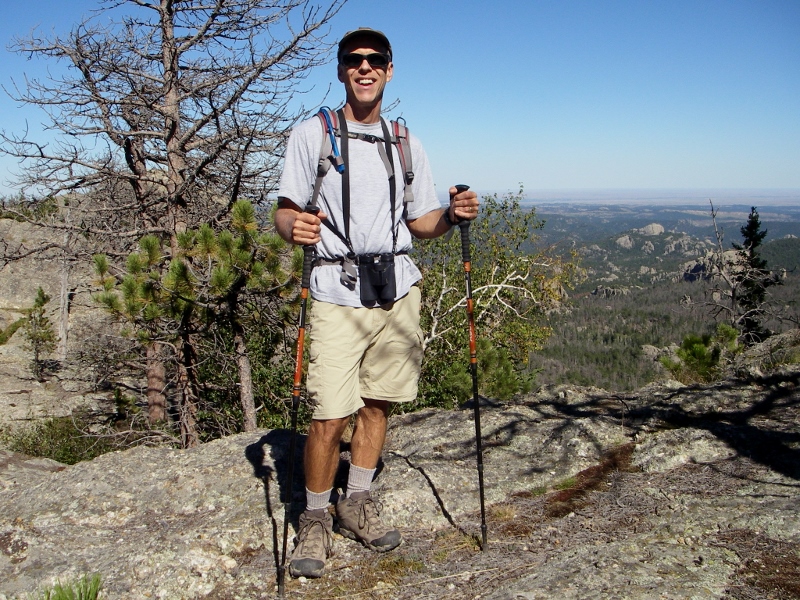 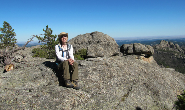 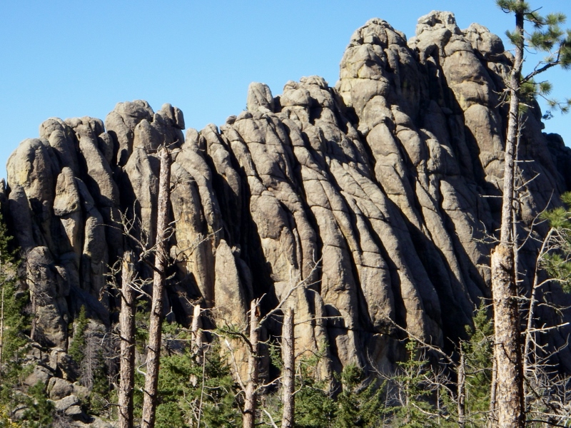 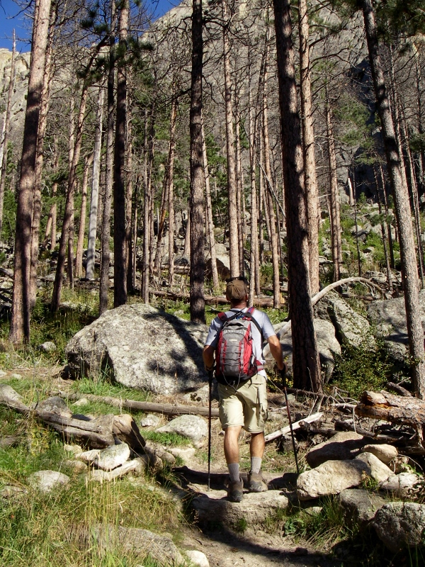 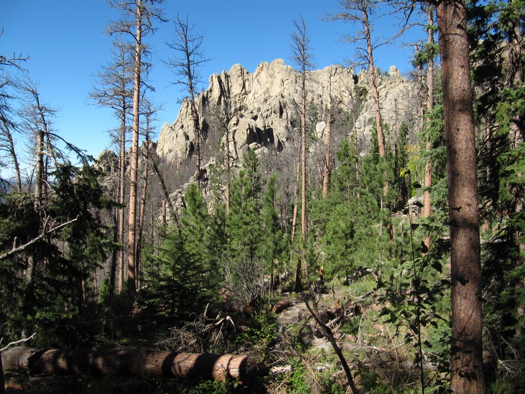 Please stay tuned...there will be from South Dakota in the days to come....
3 Comments
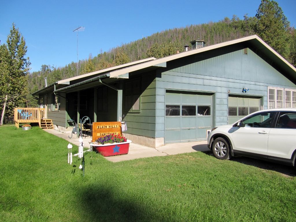
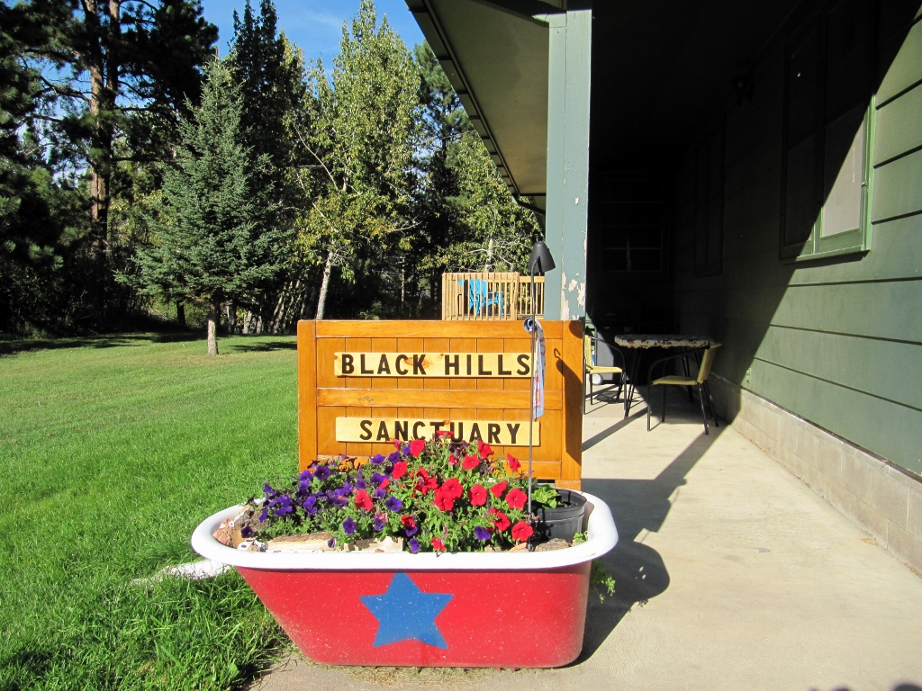
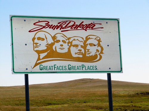 On September 17th we hit the road and headed from North Dakota to South Dakota. We would be spending eight days and nine nights in the Black Hills area. Barry had been here with his folks many decades ago, but it was my first time, so I was excited. And South Dakota didn't disappoint. On the way to our rental in Hill City, we passed Bear Butte, which was impressive. Wished we had time to stop in the state park there, but we'll have to save that for another trip. 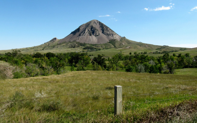 We found our cute rental (through VRBO) just outside of Hill City and got settled in. It's just the right size for us, and Paisley, of course. We're always happy when we can find decent, reasonably priced lodging that is actually pet-friendly. And unlike a hotel, there is a grassy, safe (well off the road) yard here where we can throw her ball for a rousing game of fetch!
 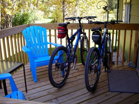 Bike parking! 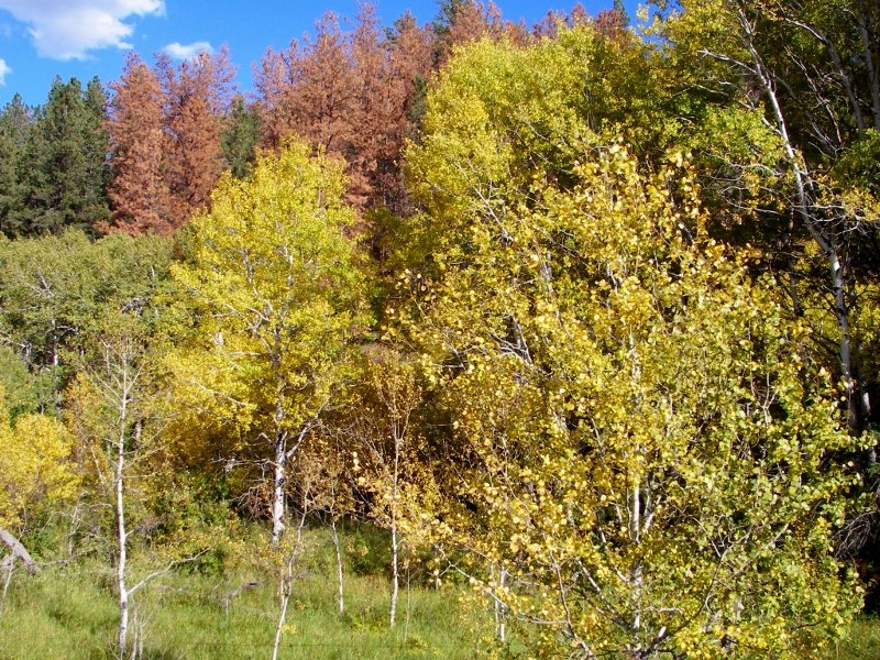 Beautiful yard and trees out back
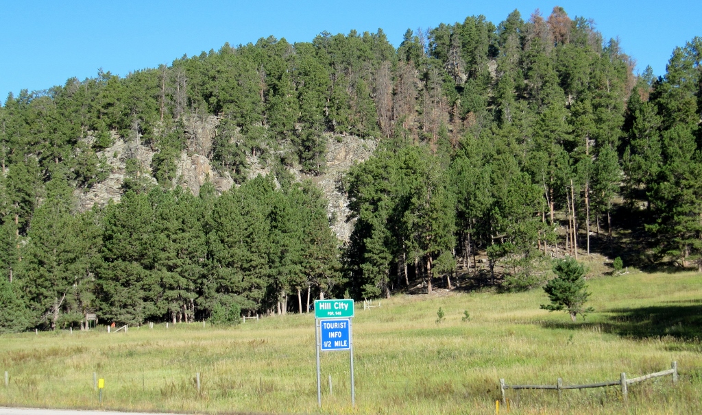
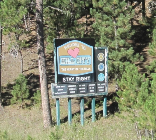
Hill CityHill City itself is just a mile or so to the west. It's a cute little town nestled into beautiful piney hills; thus the name. According to the sign, the permanent population is just 948. However, this town swells with tourists even in September, and I can only imagine how busy it is during the summer months. There are several hotels and the town is skirted by multiple campgrounds since it's so close to area attractions like Mount Rushmore and the Michelson Trail. There is only one (non-chain) grocery store in town, Krull's, and they must be making a killing. We ended up there every couple of days as we ate a lot of meals in our rental to keep expenses to a reasonable level.
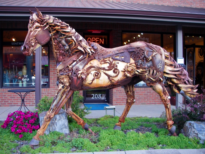
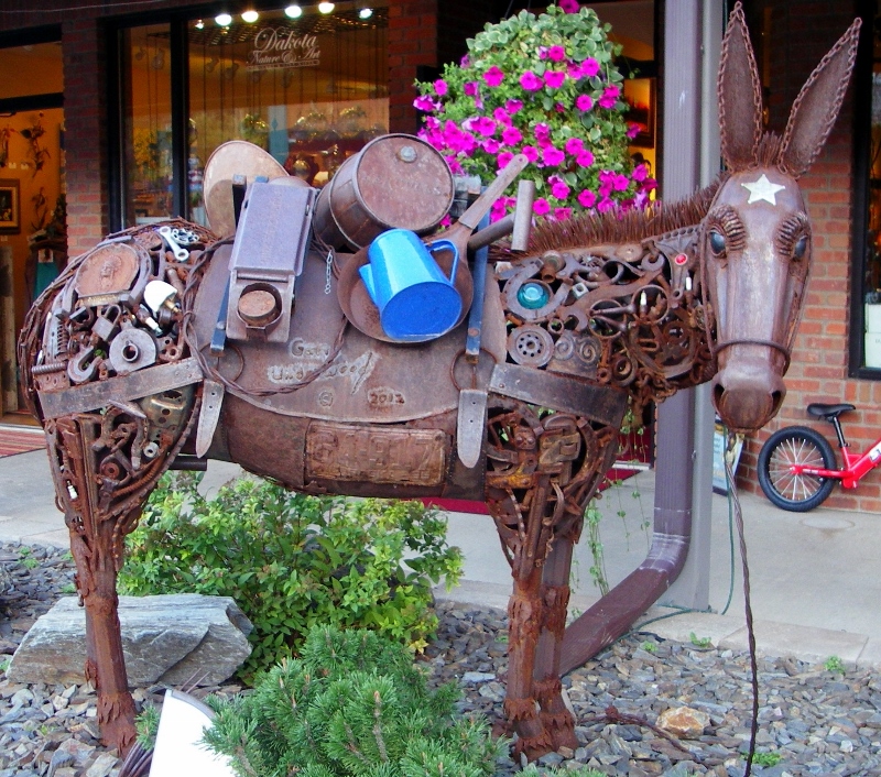
 One of the many hills in Hill City Here are some photos we snapped while walking around the cute main street in town. 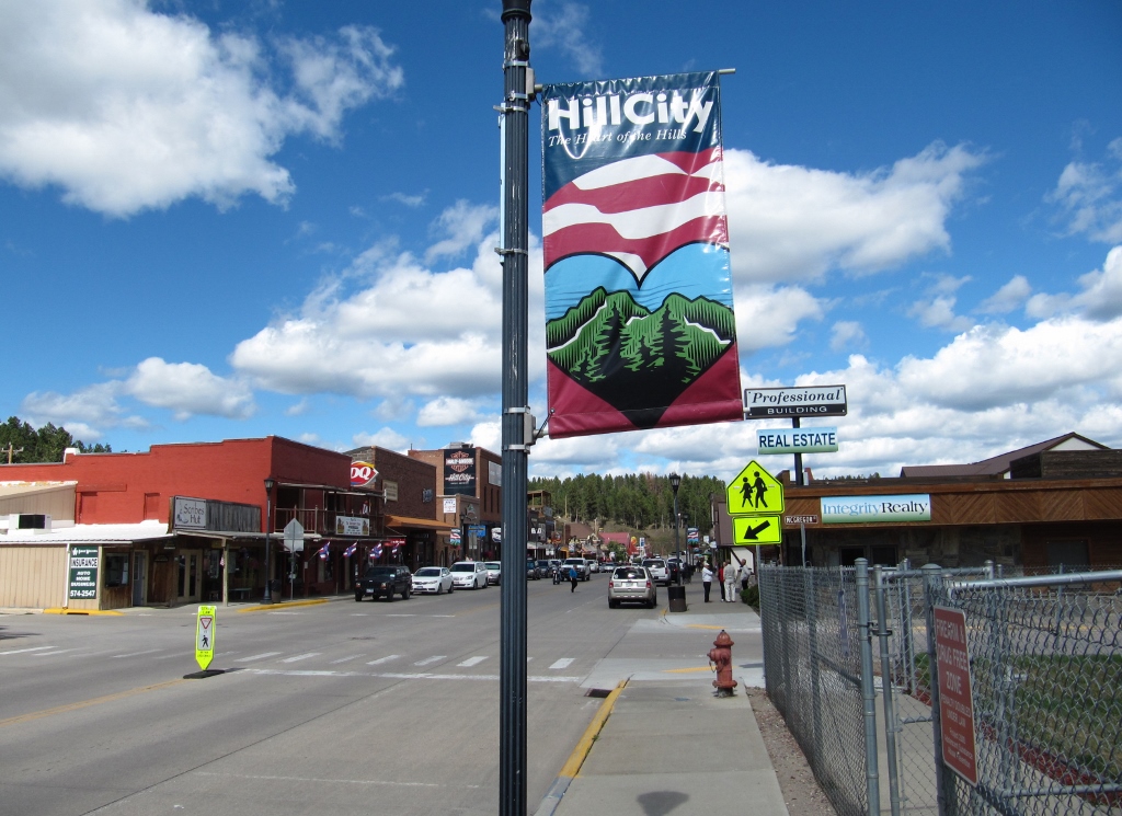 "The Heart of the Hills" is Hill City's motto. Nice. 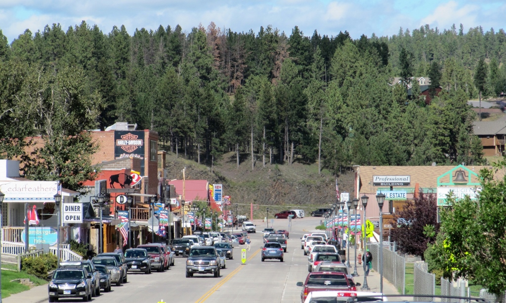 I thought this metalwork downtown was exceptionally nice!
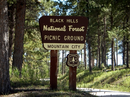
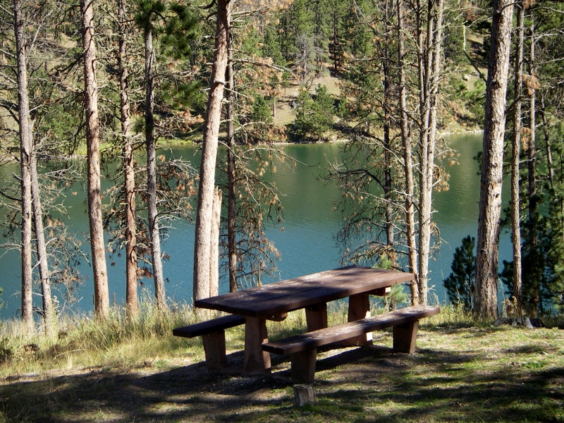
There are several wineries just on the edge of town; we visited PrairieBerry. The free tasting was fun and the wines were delicious. We bought a few bottles to take home with us, of course! 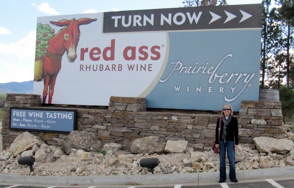 Black Hills PicnicOn one of our rest days between hikes and bike rides, we packed a picnic lunch and headed to Deerfield Reservoir on national forest land, which was gorgeous and SO peaceful. Mind you, this was on a Saturday, and there were only a few other fishermen there, much to our surprise. Speed on the lake is limited to 5 mph so there are no loud powerboats. And the temperature was perfect, in the mid-70s. Couldn't ask for more!
The lake was lovely, and Paisley even got to go for a little swim. She is our little water dog! 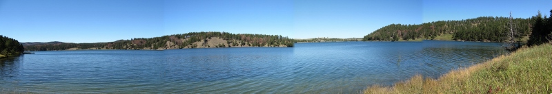 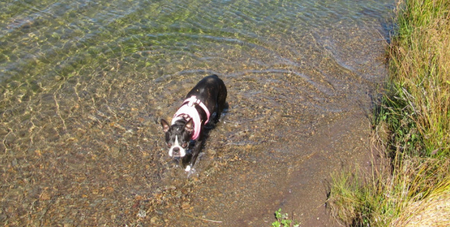 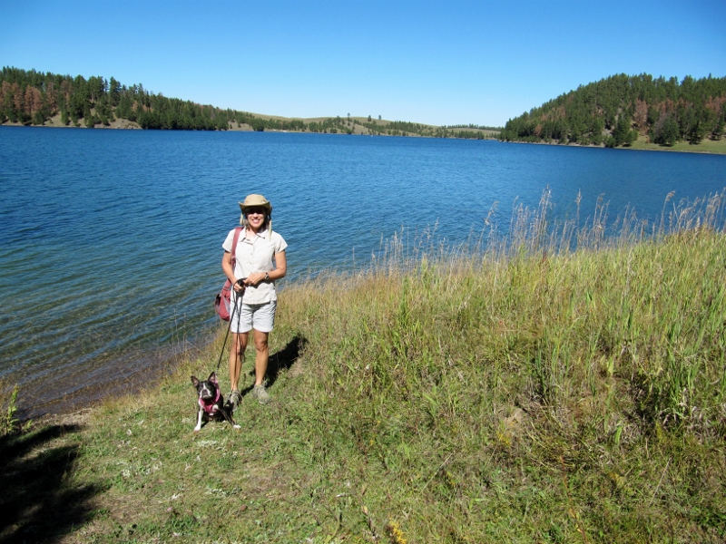 We'll be doing several more South Dakota blog posts on the Michelson Trail, Harney Peak, and (of course!) Mount Rushmore, but I'll leave you with my favorite Black Hills photo for now. I took this at Mt. Rushmore looking away from the monument. 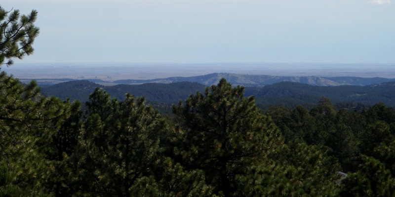 Stay tuned for much more from South Dakota!
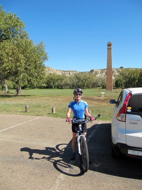
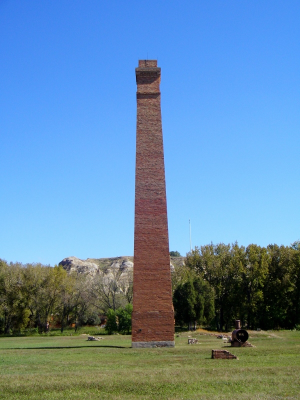
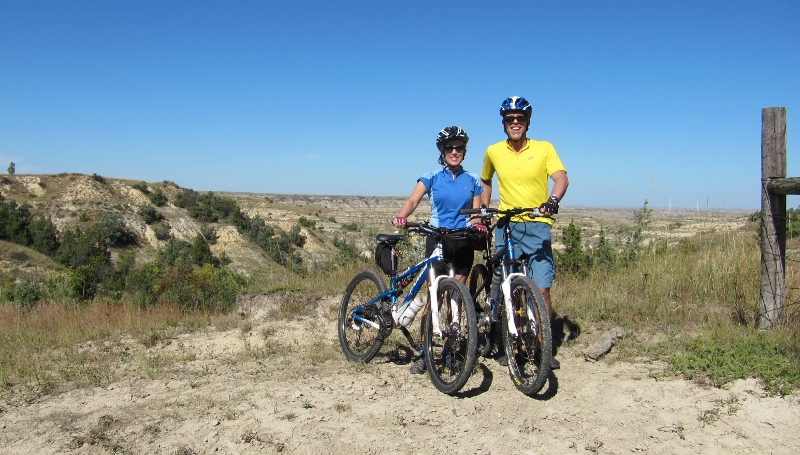 The Twosome on top of the world on the Maah Daah Hey Trail One of the things Barry really wanted to do during our time in North Dakota was to ride a portion of the Maah Daah Hey Trail. "Maah Daah Hey" is a phrase used by the Mandan Indians meaning "a place that has been and will be here a long time." It is a long (over 100 miles) singletrack trail that begins south of Theodore Roosevelt NP and extends all the way to the northern section of the park. (Of course we only rode a small portion of it!) The trail is shared with equestrians and hikers and no mountain biking is allowed within the park boundaries, so we picked it up south of Medora after a short ride from town. 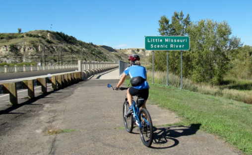 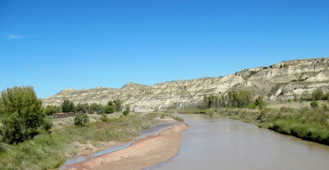 Little Missouri River We headed south once we accessed the trail at MM 5. 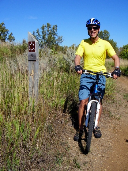 There were several creek crossings early on -- nothing too wide, deep, or muddy, fortunately. It's difficult to clean the bikes when traveling, so it's best to keep them as clean as possible. Love this action shot Barry snapped. 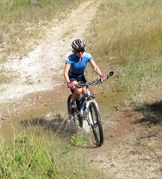 We are singletrack novices, so on this moderate trail with some challenging climbs, we walked some and both took a couple of slow-speed tumbles (no injuries). But it was beautiful, fun, and we didn't see another soul the entire time. Wow! If you love singletrack, you owe it to yourself to get to North Dakota and ride this trail! 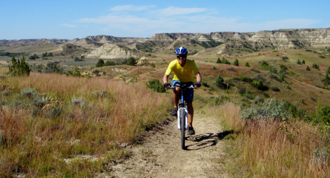 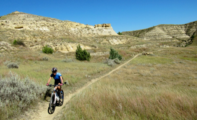 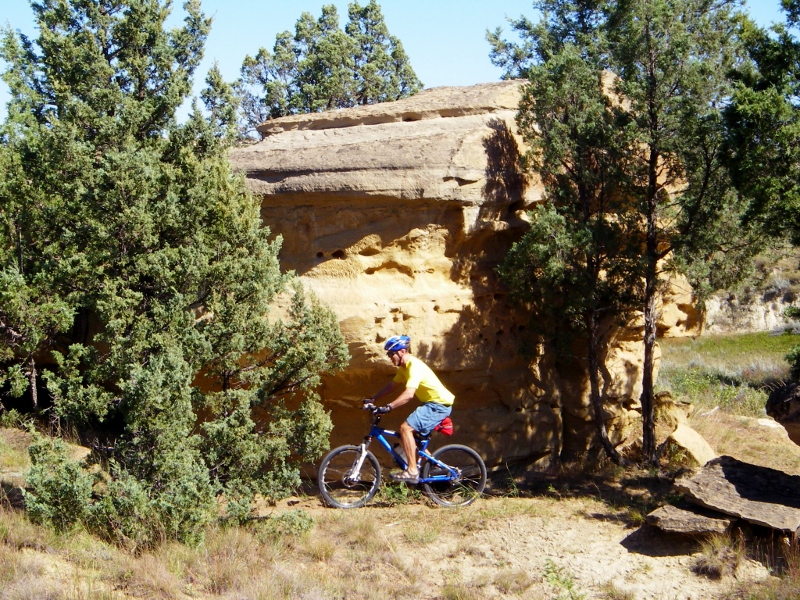 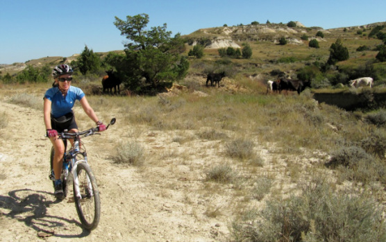 Riding among open-range cows 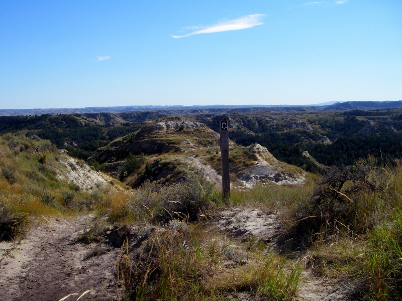 Whatta view 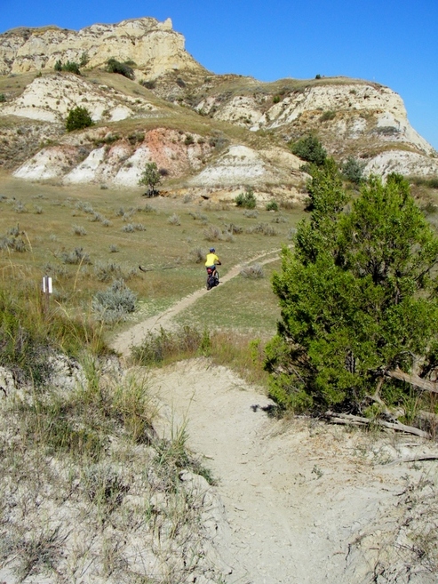 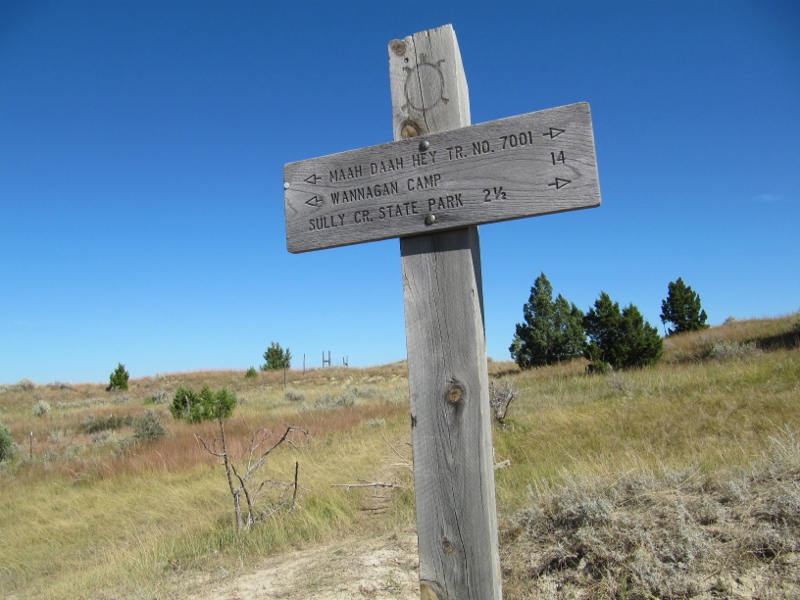 As we headed south, the scenery got even more rugged and dramatic. It was hard to believe we had this all to ourselves! We did this ride on a Monday; I expect it would be more well-used on the weekends. 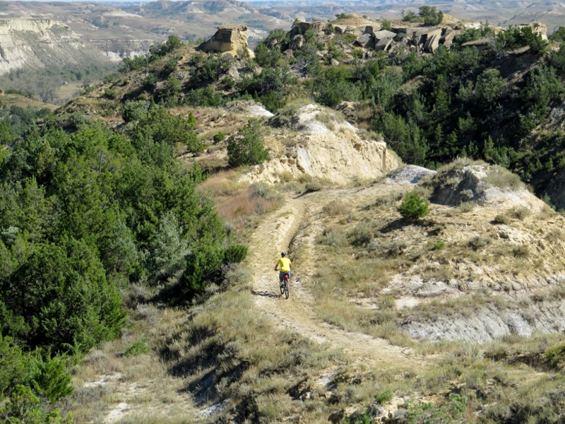 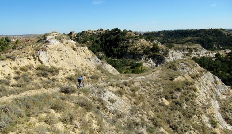 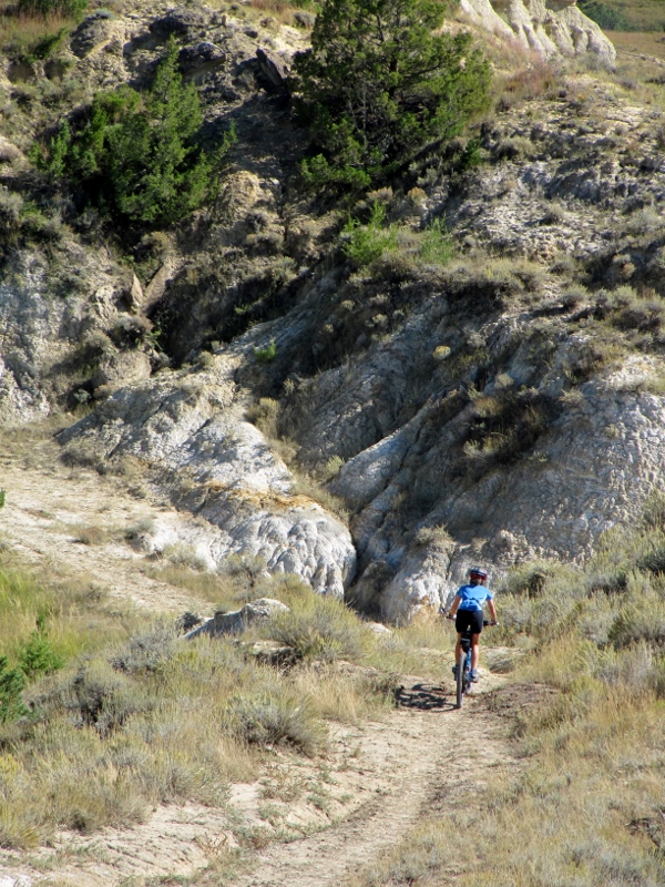 After climbing and then descending, we were rewarded with some flat riding as we approached the river. We were able to fly on this part. 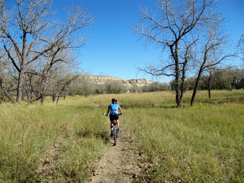 But when we reached this deep, alluvial sand by the Little Missouri, we couldn't even ride. This part of the trail is used mostly by people on horseback. 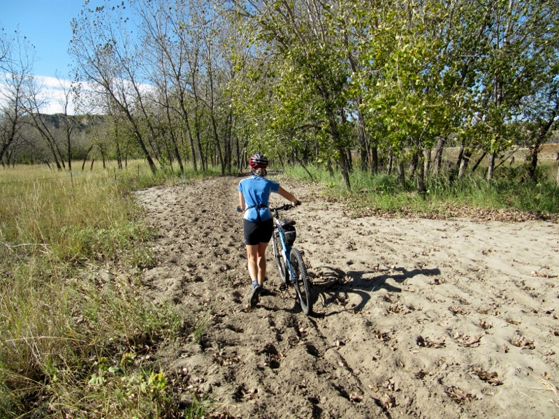 To access the Sully Creek State Park campground on the other side, horses can make this river crossing. Sometimes even hikers and mountain bikers can manage it, but the river was too high for us to get across on this day. From what I read, it's been a wetter than normal year in North Dakota. 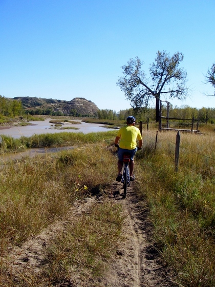 Barry riding by the Little Missouri River After turning around and backtracking through the deep sand, we spied a gravel road we could take part of the way back. Although there were some long climbs, it was faster and easier than singletrack. 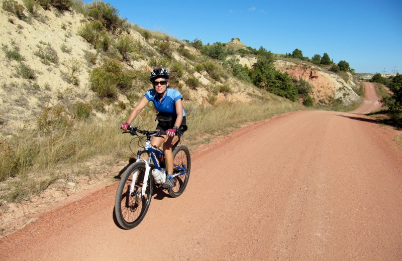 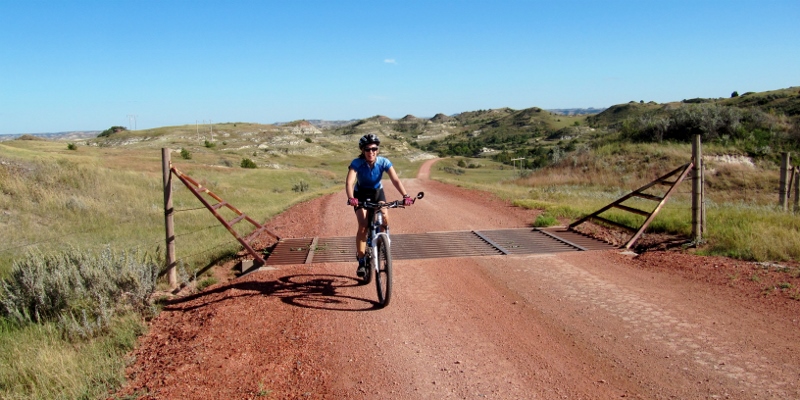 Crossing one of numerous cattleguards We made a turn and found ourselves on the Custer Trail. The views of the Badlands were gorgeous. 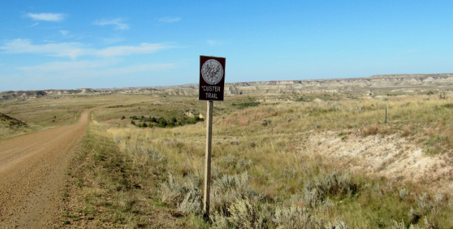 Barry had been looking for the trail marker for the Buffalo Gap Trail as he wanted to ride at least a part of it. Finally, he spied it! This trail allows mountain bikers to skirt around the Theodore Roosevelt National Park to access the Maah Daah Hey again farther north, since biking on the trail within park boundaries is forbidden. 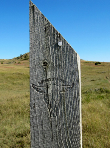 Buffalo Gap Trail marker He went for a short ride on it while I caught my breath! He proclaimed it a wonderful trail. I hope we'll be able to come back to this area and ride more one day. 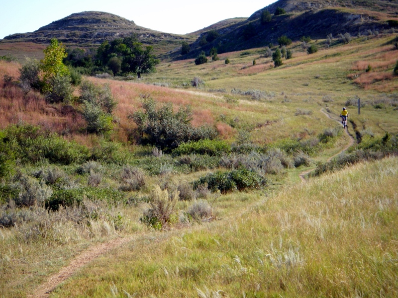 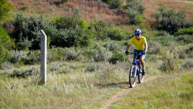 The end of our ride was interesting. We got to a point in the road where we had to make a choice. One option was to turn back down the gravel road (Custer Trail) and take the Buffalo Gap Trail to the Maah Daah Hey, then the Maah Daah Hey back to where we originally accessed it. This option would have been maybe six miles of riding, most of them on singletrack, and a lot of hills. The other option was riding on the Interstate for one mile. In the west, bikes are allowed on certain interstates because there just aren't that many roads. We had already seen cyclists riding on I-94 so knew that it was allowed. I was initially nervous about riding on an interstate, but as it was getting late in the day, and I wasn't sure I had much more singletrack riding left in me, I chose I-94. I am sure Barry wanted to ride back on the trails, but he was thoughtful enough to let me decide. Thanks hon! Fortunately, the shoulder was wide, and we only had to travel about a mile downhill. It was fun! 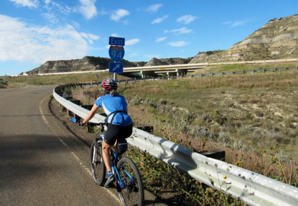 Interstate ramp -- no traffic 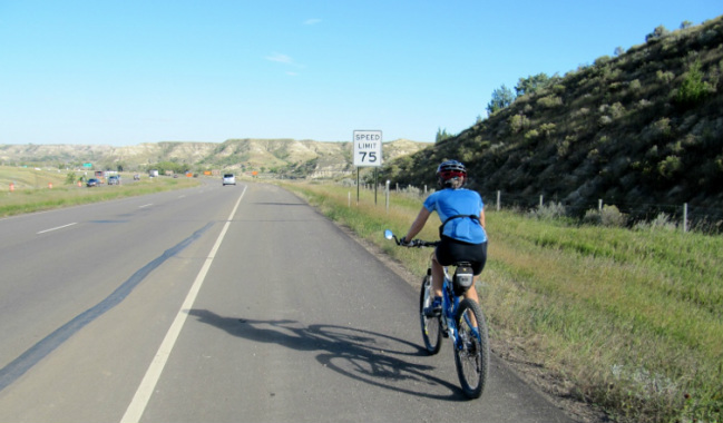 Riding I-94. No danger of exceeding the speed limit! 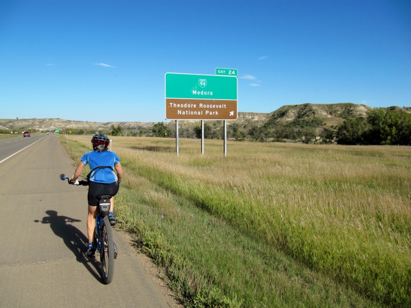 Our exit just a mile east After taking the exit, we had to deal with some pretty intense headwinds to make it back to our parking place at Chimney Park, a small park in Medora. All in all, it was a great day for a wonderfully varied bike ride!
|
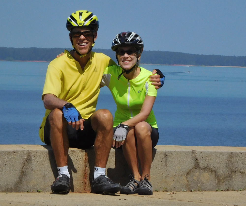
Emily & BarryWe're a long-married, early-retired couple who are currently traveling as nomads with no fixed home base. After years of living in North Carolina (Emily's home state), we spent 18 months living oceanfront on Ambergris Caye, Belize, a year road-tripping the US in a Honda CR-V, a year in Playa del Carmen, Mexico, and are now roaming North America in our 32' motorhome, Pearl, following warm weather whenever possible. 
Paisley, May 2016
States visited (pre-RV)
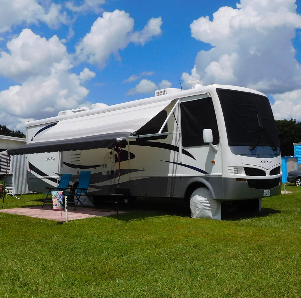
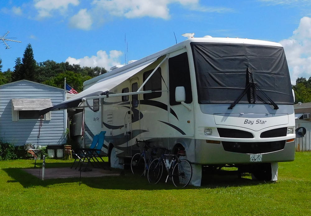
Pearl, a 2007 Newmar Bay Star
States visited in "Pearl"
Archives
July 2019
Favorite Travel Blogs |
 RSS Feed
