"Pearl" in Winter Garden, Florida
|
Long shadows in Wyoming
|
|
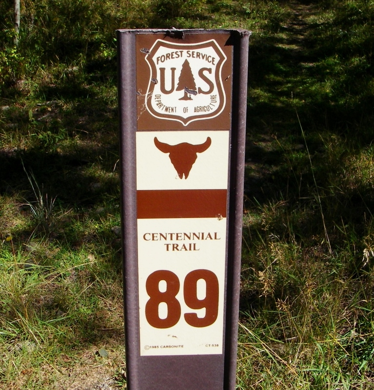
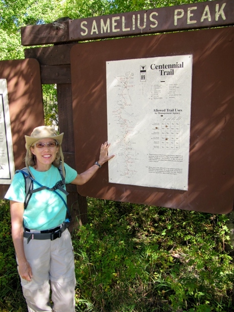
On yet another beautiful day in the Black Hills of South Dakota, we decided to hike a portion of the 111-mile Centennial Trail. A short drive from our rental in Hill City, we were able to access the trail at the Samelius Trailhead.
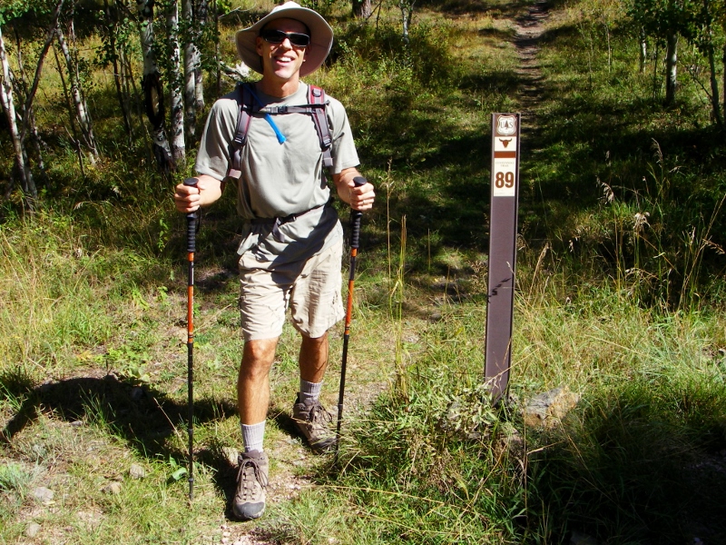 We had a great day for a hike with picture perfect weather. 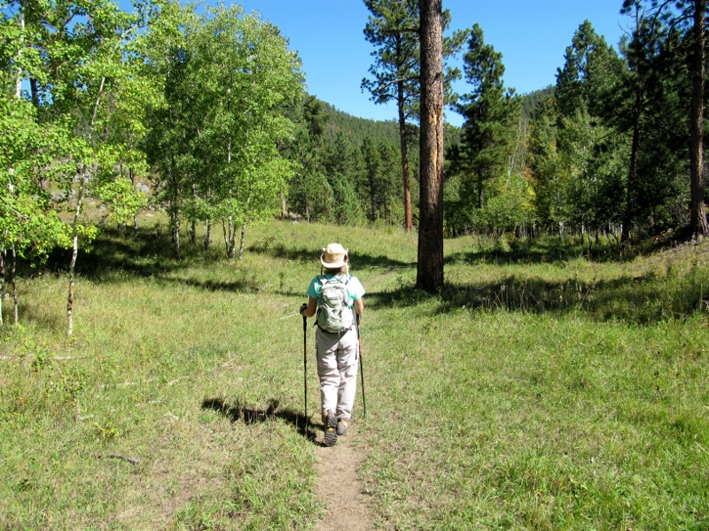 Early on in our hike, we saw many huge piles of cut pine trees. These are trees that have been killed by the Mountain Pine Beetles devastating the Black Hills, or thinned out in order to prevent future attacks. 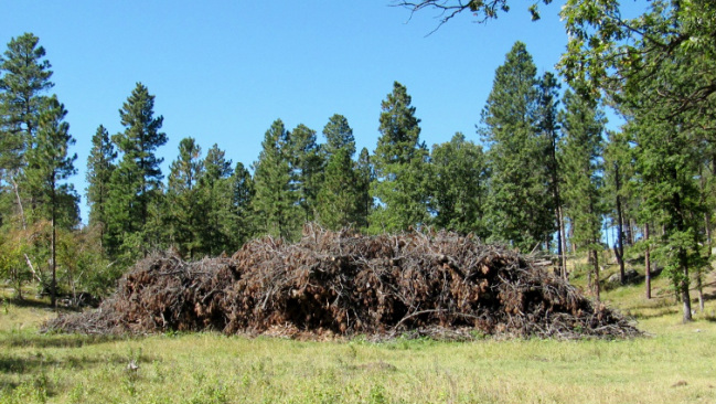 We saw Harney Peak off in the distance again. We'd summited this mountain earlier in our trip. 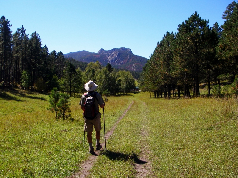 I was glad we didn't have to climb up all that way again, but on this hike I wore the t-shirt I bought celebrating our achievement. 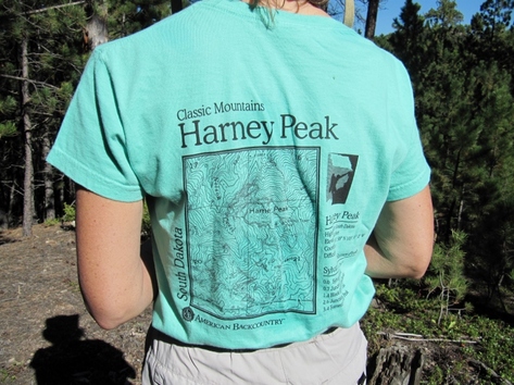 Been there, hiked it, got the t-shirt About 3.5 miles into our hike, we passed through the Big Pine Trailhead and had to cross a road. We didn't see another soul for our entire hike except parked at this trailhead. 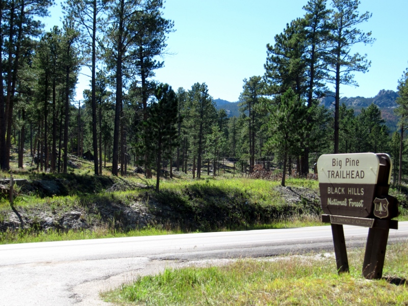 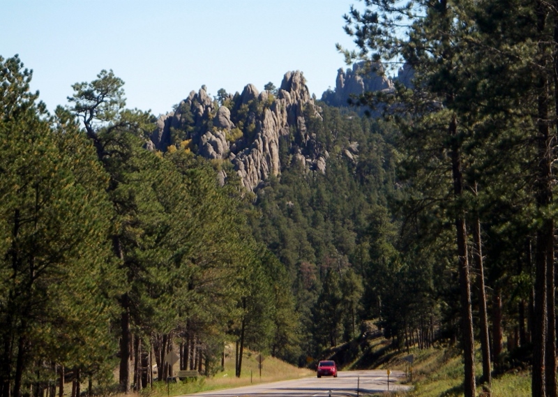 View down the road The trail became rockier and started climbing after we crossed the road. Fortunately we were warmed up by this point. 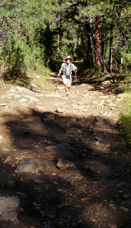 Less than a mile later we arrived at the Black Elk Wilderness. This is the same area where we'd picked up the trail to the Harney Peak summit on our previous hike. This time we'd be sticking with the Centennial Trail (#89). You have to sign in when entering the wilderness, but there is no use fee. 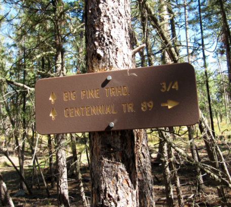 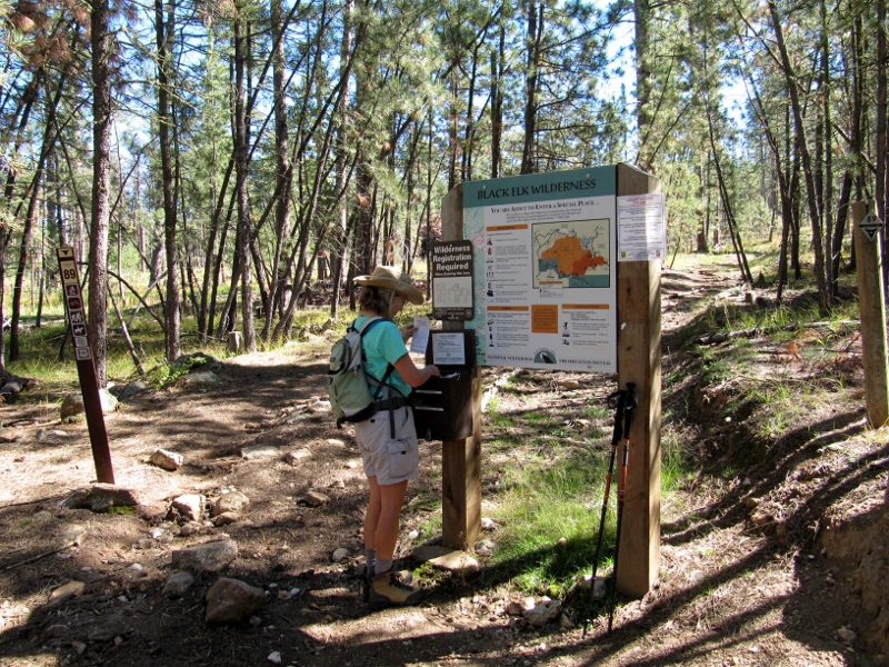 Signing in In the wilderness, the trail became much more lush, and there were a few obstacles along the way. The hiking was gorgeous, though. 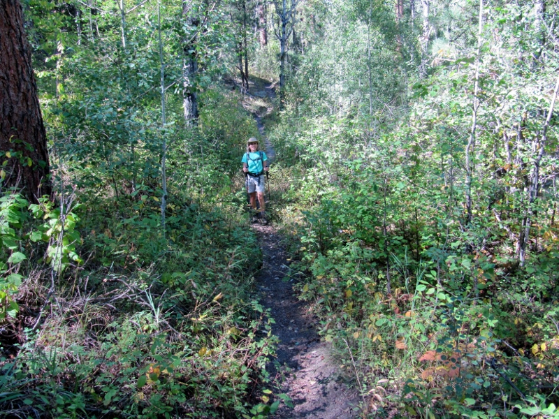 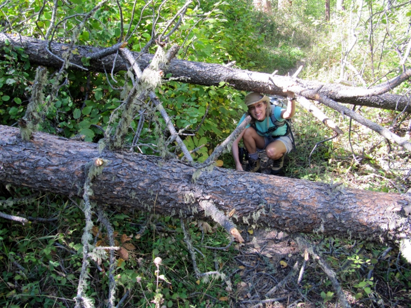 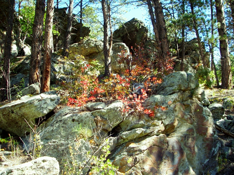 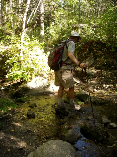 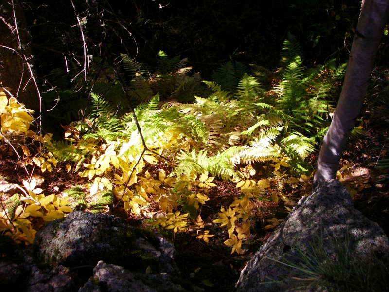 We were hoping to hook up with Trail #14, Horse Thief Lake, which would take us around to Horse Thief Lake and Campground. We thought we could make it when we checked the Black Elk Wilderness map, but by the time we reached six miles of hiking and had still not encountered the trail crossing, we decided we needed to turn back. Today was "supposed" to be a rest day before our last bike ride on the Michelson Trail, after all, and we wanted to get back while it was still light out. 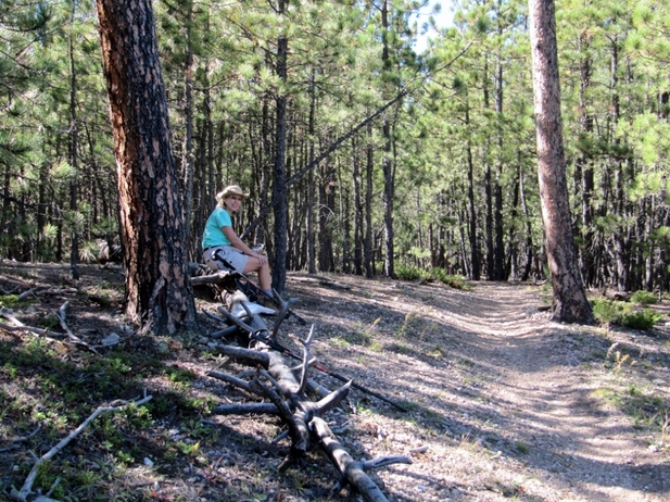 Snack time at turnaround point After a snack break, it was time to turn around and head the six miles back to our car. Fortunately the way back was more downhill, and the late afternoon sun was illuminating the trees so nicely, it was a real treat. 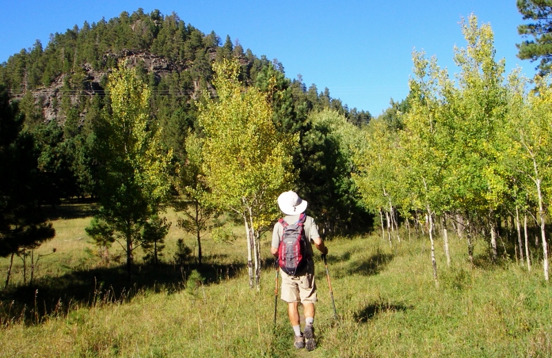  We had another treat as we flushed out a small herd of white-tail deer and then the largest flock of wild turkeys we'd ever seen as we walked nearby. There were many, many more than this photo shows, all heading away from a road and up to the top of a steep hill. 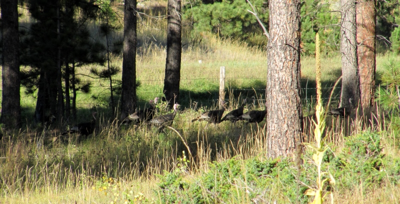 Poultry Parade! We returned to the starting point as the shadows were growing long. We'll have to come back one day and hike more of this beautiful trail. 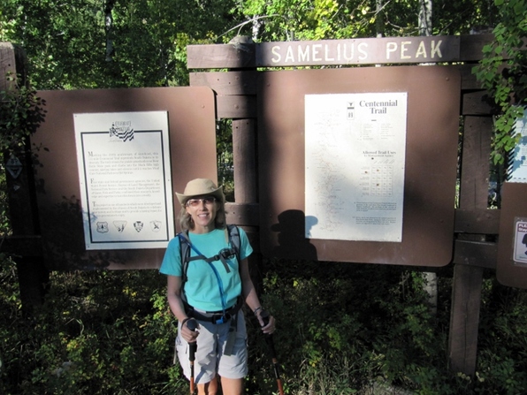 12 miles done! Stay tuned as we head east for our next stops: Wall Drug and Badlands National Park....
4 Comments
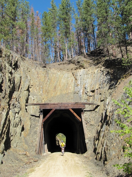
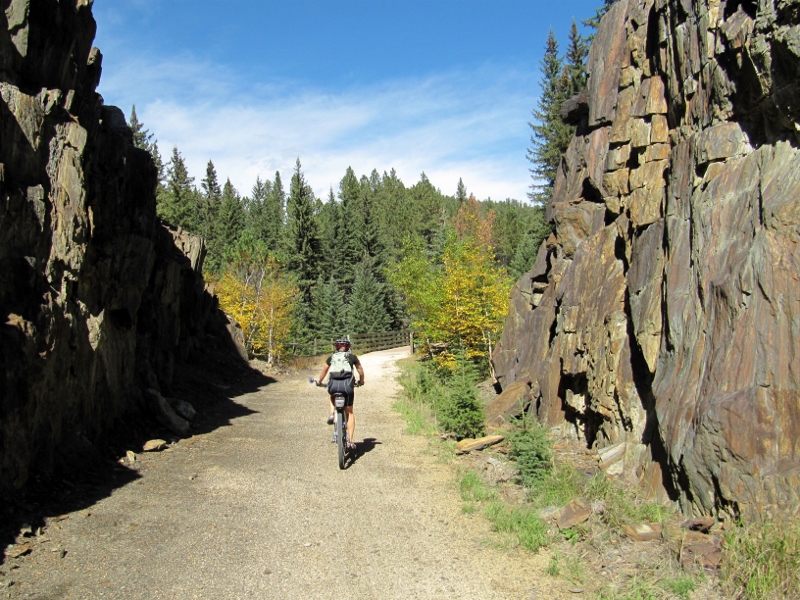
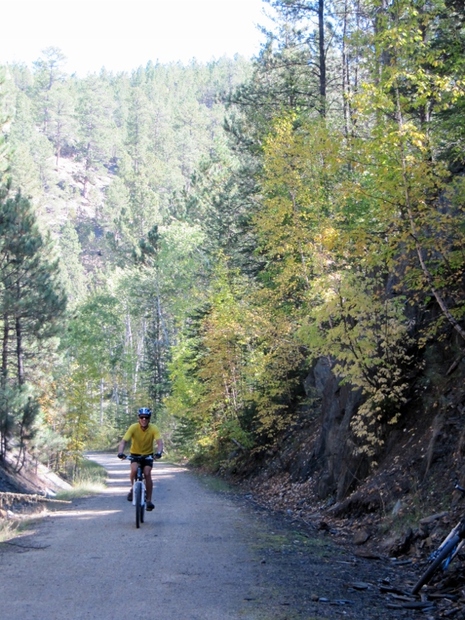
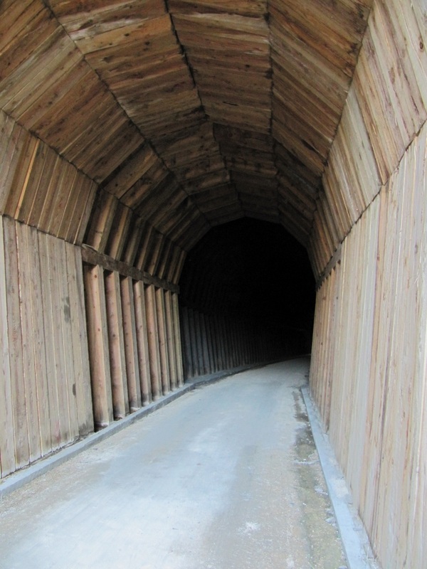
 Barry's stated reasons for returning to the South Dakota Black Hills, which he'd visited with his parents decades before, were (1) to show the area to me and (2) to ride the George S. Michelson Trail, not necessarily in that order. ☺ I really didn't know much about the trail before our trip, but I now know that it is in the Rails to Trails Hall of Fame and deservedly so. This 109-mile rail trail is a real gem, with some of the most beautiful scenery we've encountered in our travels around the USA. And it's a blast to ride, with no super steep climbs (most 4% grade or less, though they can be long), since it was formerly a rail line. But there are sufficient climbs and descents to keep it interesting, dramatic tunnels, rocky cliffs, rolling pastures, bold creeks, native wildlife, cooling forests, and mountain views galore. And no cars, of course! I just can't say enough about this lovely packed-limestone trail. We were fortunate too in that we planned enough time in the Black Hills -- and had cooperative enough weather -- to ride on the trail at length on three different days. Barry's goal was to complete the trail end to end, which he did in two separate day's rides, but mine was just to enjoy riding what I could, and to support him in his efforts to ride the entire trail by driving the car to the appropriate pick-up points. If you are interested, here's a map of the trail and the various trailheads mentioned in this blog post. Ride 1: Hill City to DeadwoodOn our first Michelson ride, Barry pedaled to the Hill City trailhead from our rental suite about a mile and a half down the road. He then headed north to Deadwood. In the meantime, I drove up to Deadwood with my bike, parked the car, and rode south on the trail until I met him. By our calculations, we'd meet up at the Dumont trailhead at approximately 1:30 pm and whoever got there first would wait for the other. Cell phone coverage on this rural trail is practically non-existent, so there would be no calling each other; we'd just have to hope that neither of us had any mechanical issues.  Barry heading from our rental to ride to the trail 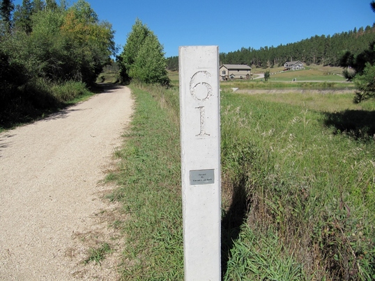 First milepost in Hill City where Barry started northward 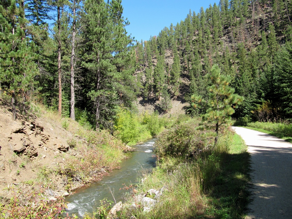 Gorgeous scenery near Mystic 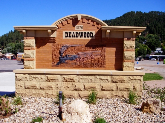 The trail's northern terminus in Deadwood, SD, where I started riding south 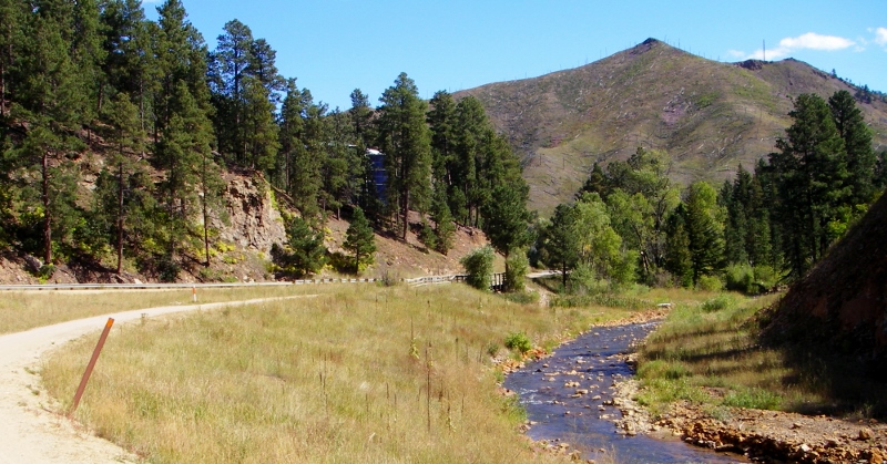 Michelson Trail scenery near Deadwood 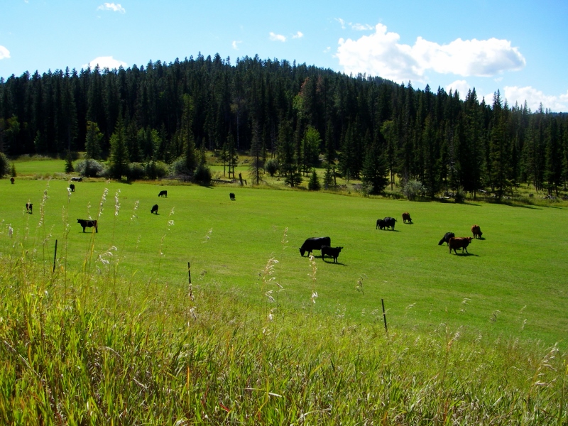 Perfectly pastoral pasture near Englewood Trailhead 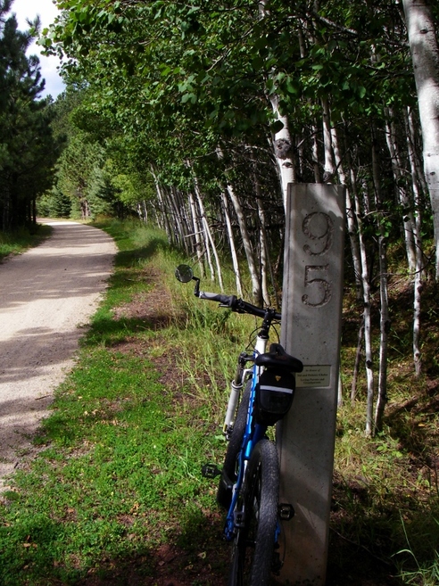 A rest break for me during a long climb south to Dumont trailhead Fortunately, everything went even better than planned. We both underestimated how long it would take us to get to Dumont as this is the highest point on the trail so we both had long climbs to get there. Despite this, we rolled up at exactly the same time -- 2:18 pm, to be precise. Amazing! 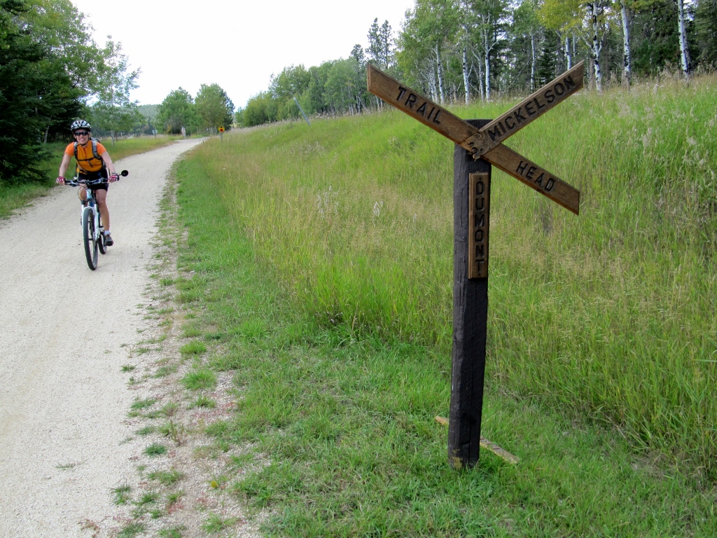 I'm rolling up to the Dumont Trailhead just as Barry is coming the other way! 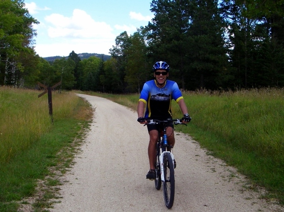 Here he comes, right after taking my photo After comparing notes and eating a quick snack, we headed north to Deadwood. In this direction, it is nearly all downhill, so we were able to fly, especially fortunate since the skies ahead were looking threatening. Just as we pulled into the trailhead at mile marker 108.8, raindrops started falling. 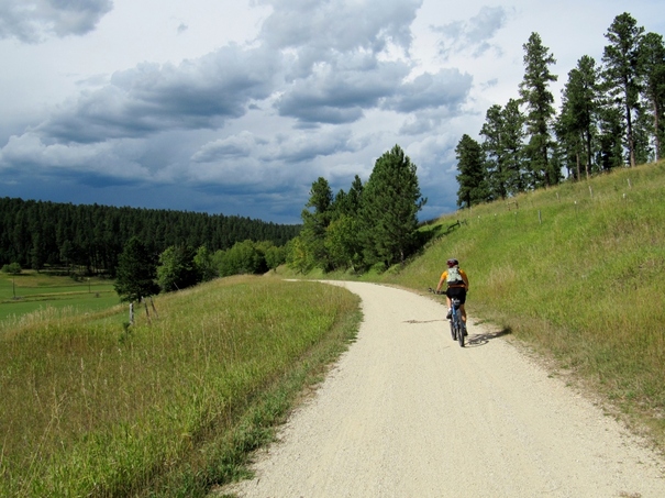 Ominous clouds to the north 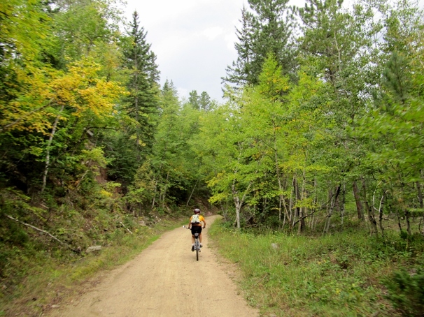 Beginnings of leaves turning color 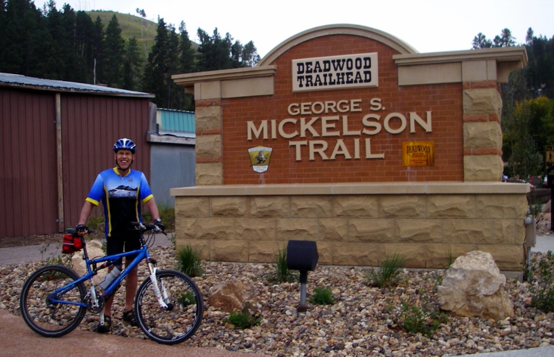 Raining lightly, but we made it! On the day, Barry ended up with 49 trail miles, and I got in 32.4. It took me 2.5 hours to ride the mostly uphill direction from Deadwood to Dumont (including stops for photos and snacks) and just an hour to ride the other direction, almost all downhill. Fun! Ride 2: Hill City to EdgemontA few days later, it was time for Barry to ride the southern portion of the Michelson. Once again, he set out from our rental in Hill City, this time pointing his bike southward on the trail. I drove down to Edgemont, parked the car at mile marker 0.0, and began pedaling north to meet him. 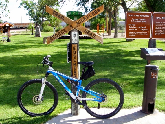 Edgemont, South Dakota - milepost 0.0 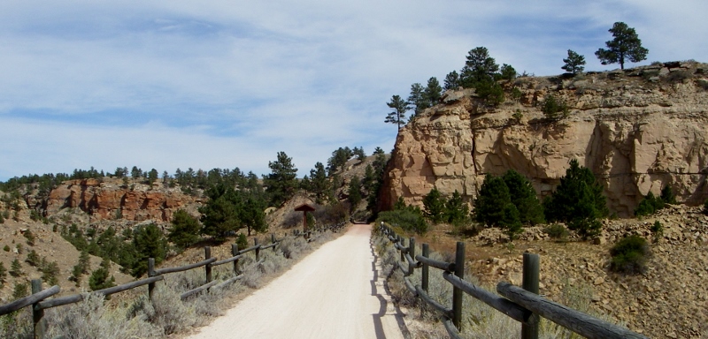 Stunning Sheep Canyon area north of Edgemont 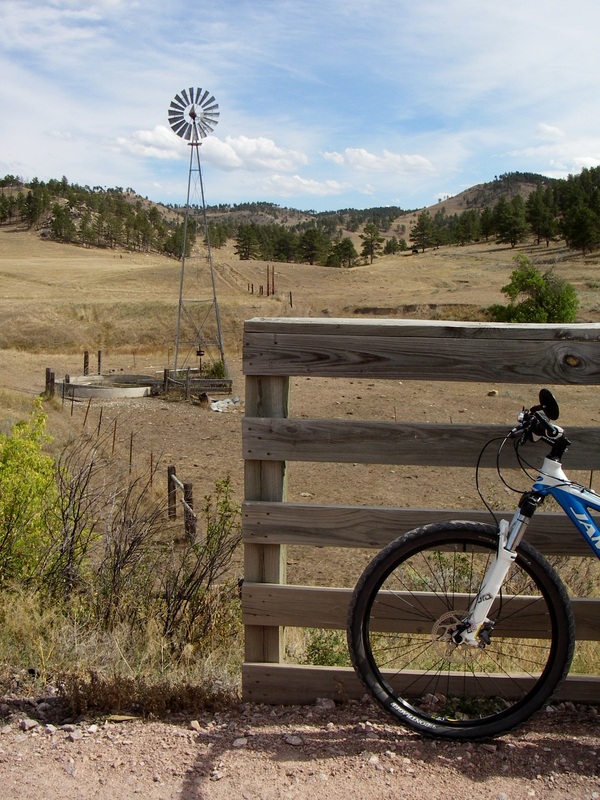 My rest stop 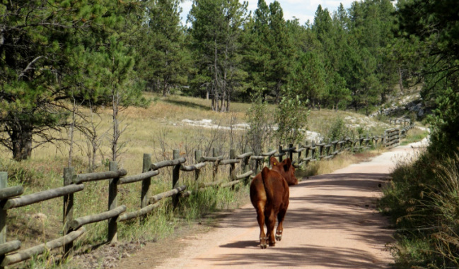 Barry shared the trails with this trail user, who was obviously "hoofing it"! 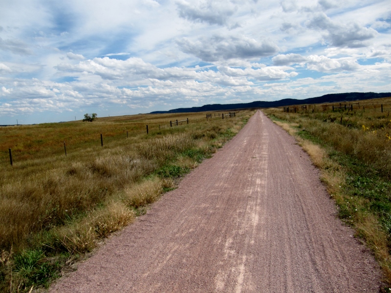 Beautiful sky This was a slightly longer day for Barry mileage-wise but mostly gradually downhill. Once again we'd calculated that we'd meet at approximately 1:30 pm at the Minnekahta Trailhead (milepost 16.2). This time we calculated more accurately based on our experience a few days ago. I actually rolled in a little early, and Barry rolled into Minnekahta just four minutes behind me at around 1:25. Once again we had no mechanical or other issues. 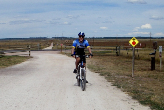 Barry arriving at Minnekahta Trailhead 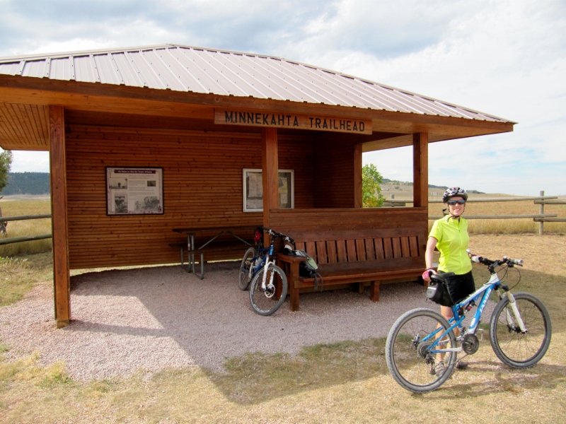 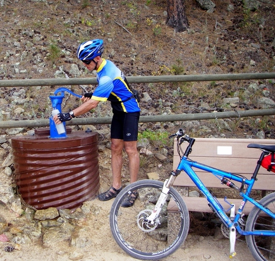 Water break! There are old timey water pumps at most of the trailheads along the way. After meeting up, we headed south to Edgement. Overall, this section of the trail was not as scenic as the part north of Hill City, being lower in elevation, more open, and at times close to the roads, though it was still pretty. We had a stiff headwind, so even with the slight downhill tilt of the road most of the time, I was feeling a little tired and slow towards the end. Edgemont was our least favorite "trail town". They make you ride on the road for a mile between the parking and sign-in area at the trailhead and the trail itself. While we like road riding, this is pretty lame. Not everyone is comfortable riding on roads, some have young children with them, and the like. So Edgemont got a thumbs down from us for this reason. 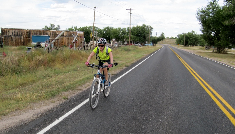 Riding on the road between trail and trailhead in Edgemont -- at least traffic was light! With this second ride, Barry had now ridden the entire Michelson Trail and achieved his goal! Mileage tallies for the day were Barry 60 trail miles and me, 32.4 again. 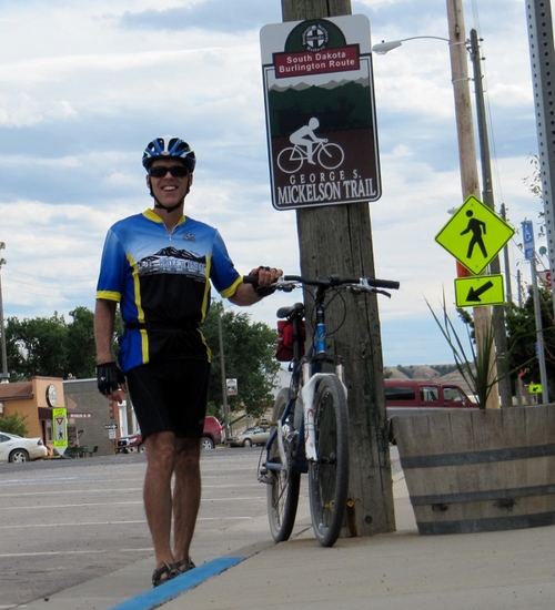 Michelson Trail - done!  Ride 3: Rochford Round-TripThis last ride a few days after Ride 2 was just for fun and to be able to ride together. Barry wanted me to see some of the trail north from Hill City that I'd missed out on, including several tunnels. This was an exceptionally beautiful part of the trail, he said. And it was! 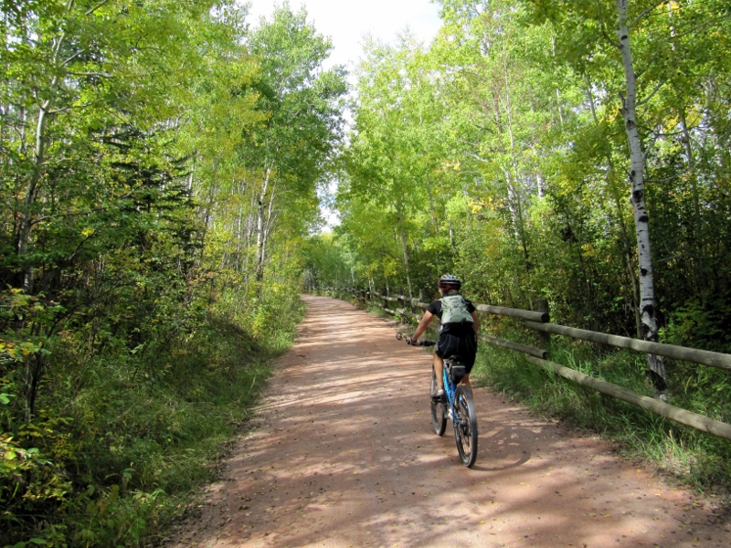 We rode out from our rental on the road and accessed the trail in Hill City, then rode north to Rochford. Actually, we'd planned on going "only" 20 miles one-way (so 40 total for the day), which would have put us somewhere between Mystic Trailhead and Rochford, but I was feeling good, so we went ahead to Rochford, giving us 23.5 miles for the first half of the ride. 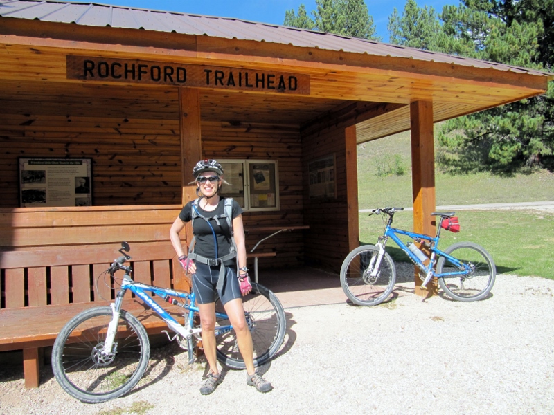 This was a especially pretty stretch of the trail, as Barry had said, and I am so glad I got to see it. Around almost every curve I found myself oohing and ahhing from the beautiful scenery, including many high rock cliffs and a bold stream with several small waterfalls beside us much of the way. There were also lots of tunnels to go through, and we got to see a horse round-up off to the side of the trail. 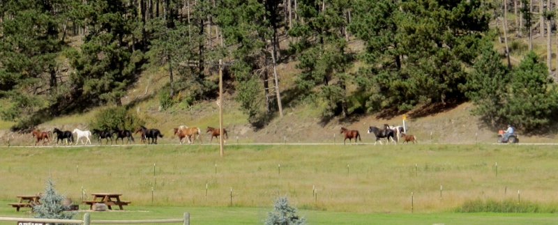 Modern-day cowboy on four-wheeler -- I prefer the old-fashioned kind on horses! 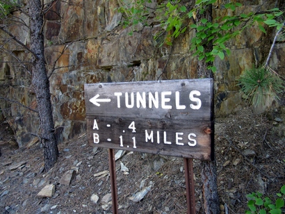
  What a beautiful day for a ride -- nope, I sure don't miss working! 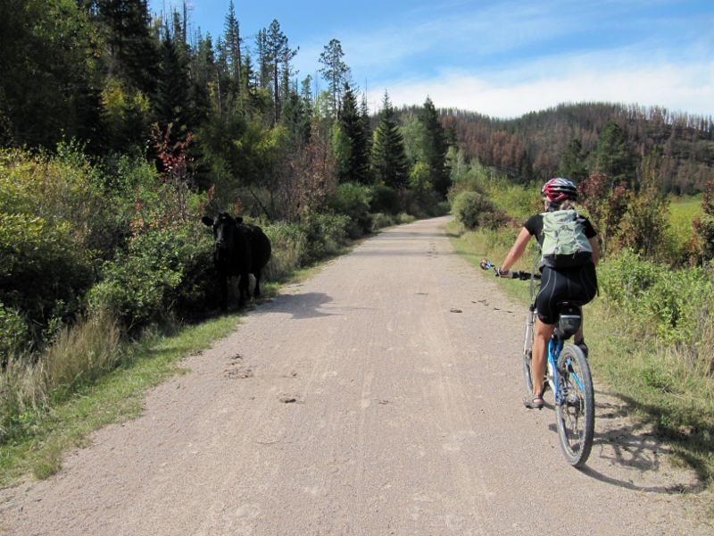 Another lone cow on the trail -- hope she found her way home! 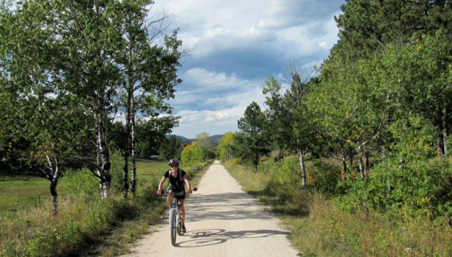 Once again some storm clouds were building, but we didn't get caught in any rain There were some interesting and creative cairns along this stretch of trail. We wondered if they had been built by the Michelson Trail Trek riders who were just through here a couple of days earlier? 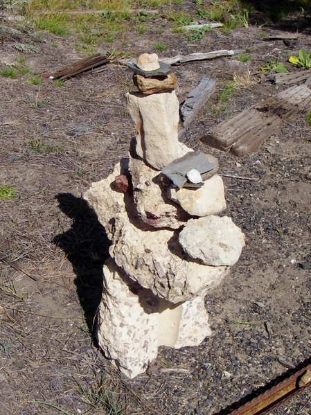 The ride back from Rochford to Hill City had its share of long climbs, and I was getting fatigued, but the last seven miles or so are downhill. Unfortunately another headwind scrubbed off our speed. Along this last stretch, we caught a view of Harney Peak, which we'd summitted just a few days before. Hard to believe we were up that high! 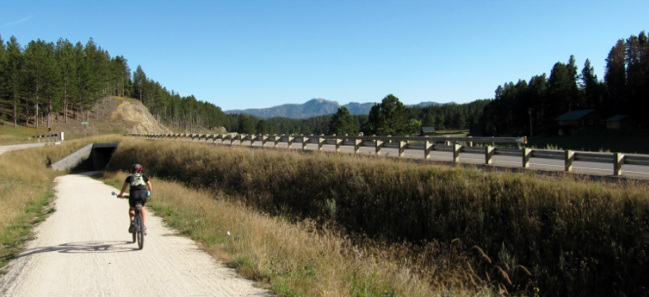 That's Harney, in the middle of the photo, in the distance... 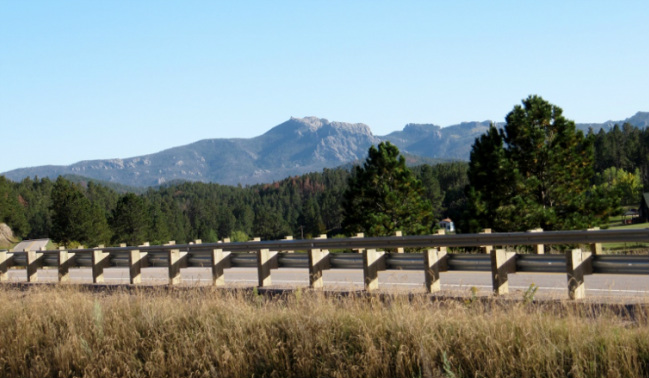 ...and closer up 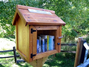 Little Free Library box Little Free Library box And back in Hill City, just beside the trail, I was astonished to see that the Little Free Libraries I've come to love in Prairie Village (Kansas) are -- gasp -- a chain?! (But this is a chain I can totally get behind!) They even have a website and a Facebook page! I ended the day with 47 miles, my longest ride of the year, and Barry got a couple of extra miles by going ahead and turning back to find me. We were running a little late finishing up as we met several friendly cycling pairs at various trailheads and had nice chats while we stretched and grabbed a snack. So we stopped at the grocery store on our bikes and picked up dinner on the way back to our rental suite. All in all, a great ride and finally a day with no carbon burned! If you like to ride...The Michelson trail is beautifully maintained and supported by user fees ($3/daily pass or $15/annual). It's worth every penny. If you like riding on packed limestone (best for hybrid, cross, or mountain bikes) without worrying about cars, you need to plan a trip to South Dakota to ride in the Black Hills!
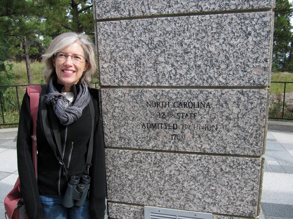
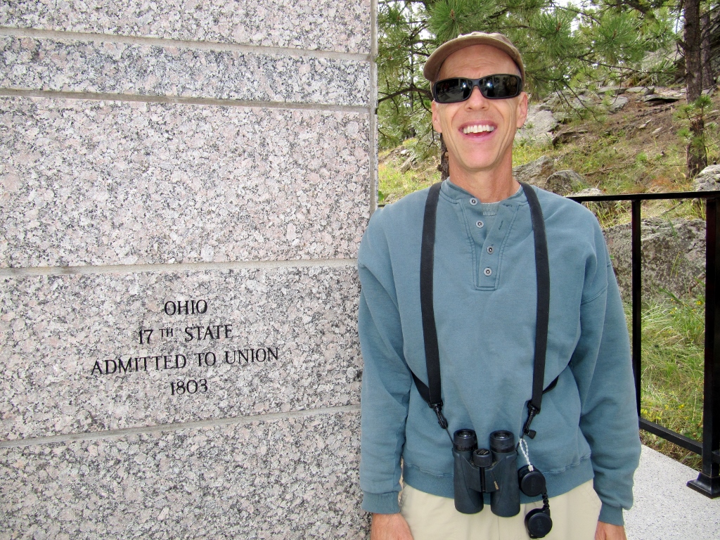
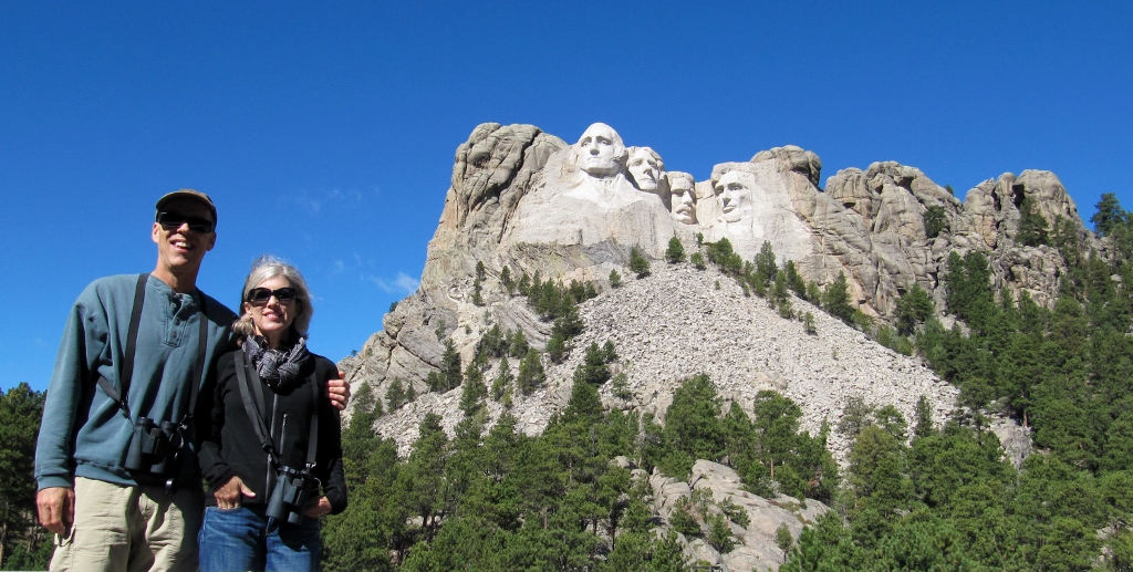 On our recent trip to South Dakota, one thing I didn't want to miss was visiting the Mount Rushmore National Memorial. The monument is in Keystone, just down the road from where we were staying in Hill City. Although Barry had visited Mount Rushmore on a family trip many years ago, I had never been. And it was a great experience. The monument is spectacular to see in person. Watching the film shown in the visitor's center showing how it was constructed made us appreciate it all the more. There were cars from so many different states in the parking lot -- this monument draws 'em from all over, nearly three million visitors per year! We also enjoyed the promenade with flags from each U.S. state. This was not here when Barry first visited. Along with many other visitors around us, we had to find our home state for a photo by its column. 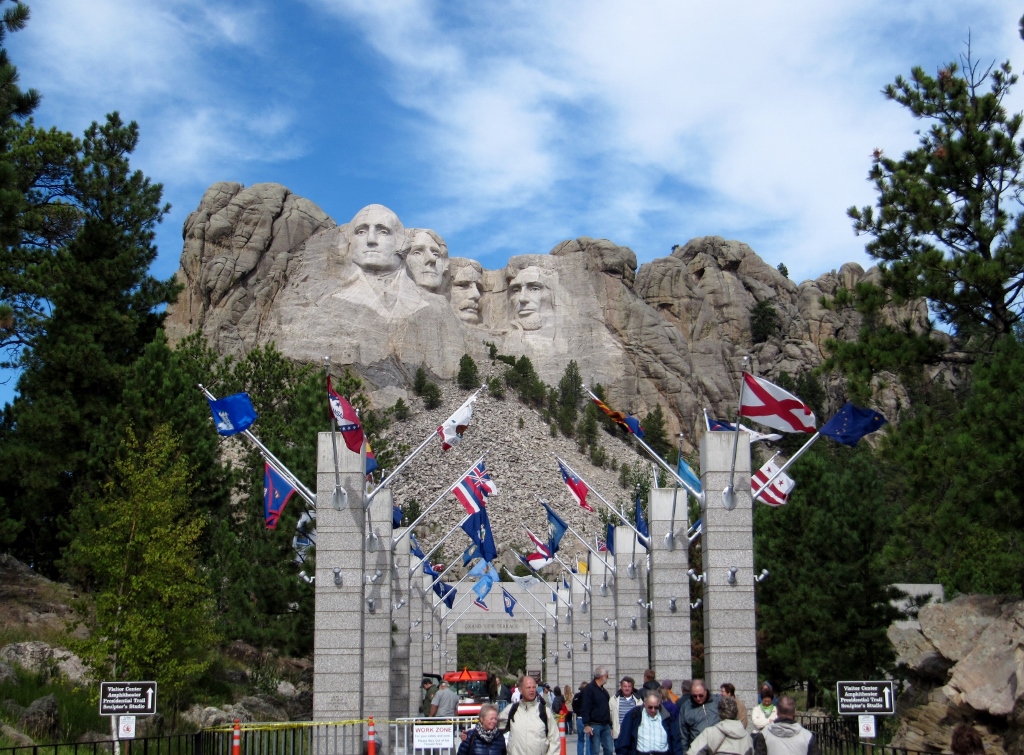 Promenade with flags from each US state
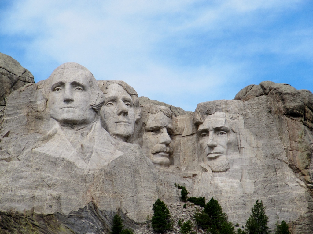 The monument up close and personal There's a huge amphitheater where people come nightly for the memorial lightning ceremony. This is also a newer addition since Barry was first here. 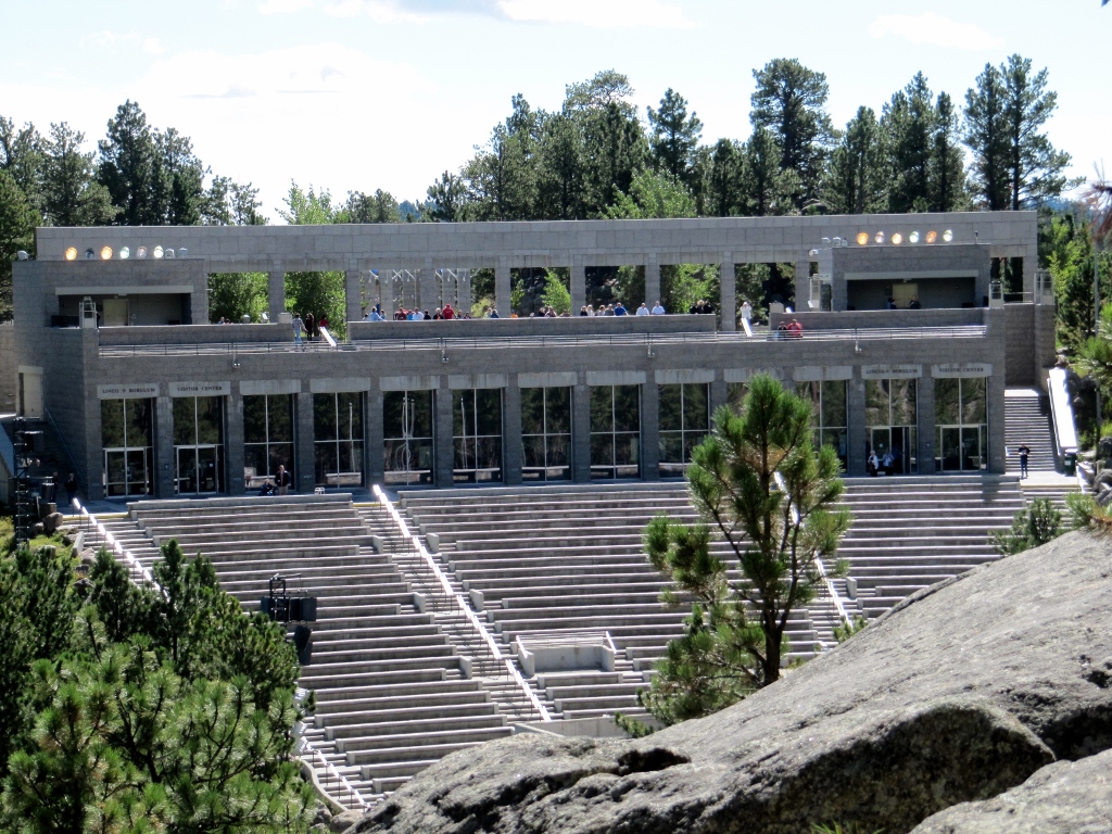 There's also a nice 1/2 mile walkway that allows visitors to get closer to the monument while climbing and descending many stairs. You can view the memorial from all angles from this walkway. 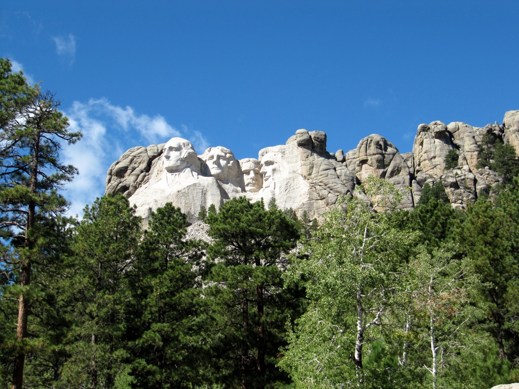 This view in particular got a lot of comments when I posted it to Facebook. I got a great view of George Washington from between a couple of giant boulders along the walkway. Did you know that Washington is the only president on the memorial without nostrils? I guess the sculptors got better as they went along, as Washington was the first face completed. 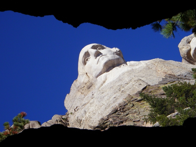 Along the walkway, there was a studio showing how the monument was created. This model is on a scale of 1' to 12' to the mountainside sculpture and allowed accurate measurements to be made when sculpting on the mountainside. A plaque explained that the lower portions like the coats were not intended to be part of the mountainside monument. I guess that would have been way too much work! 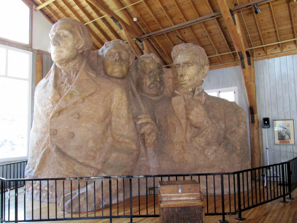 As we drove away, we were able to get one last look at George Washington in profile. 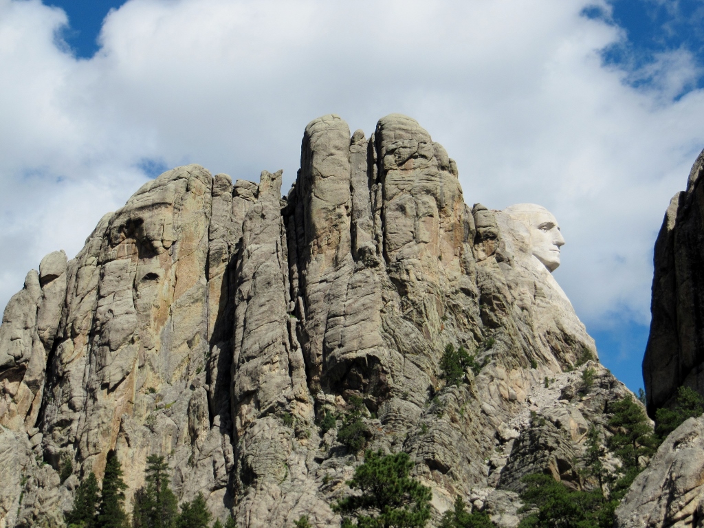 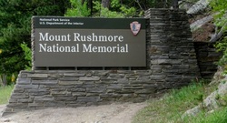 It is ironic that I am writing this post on October 1, 2013, the very day that the US government has been shut down. As a result, all national parks are closed, and the National Park Service web pages are not functioning. I hope that this impasse will be resolved very soon so that citizens will once again be able to visit important and historic places in the US National Park System. |
Emily & BarryWe're a long-married, early-retired couple who are currently traveling as nomads with no fixed home base. After years of living in North Carolina (Emily's home state), we spent 18 months living oceanfront on Ambergris Caye, Belize, a year road-tripping the US in a Honda CR-V, a year in Playa del Carmen, Mexico, and are now roaming North America in our 32' motorhome, Pearl, following warm weather whenever possible. 
Paisley, May 2016
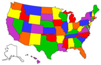
States visited (pre-RV)
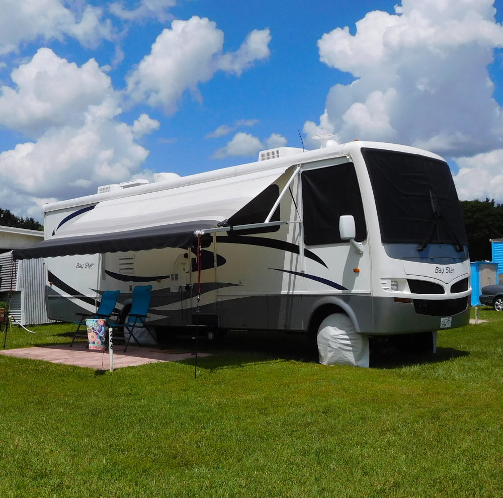
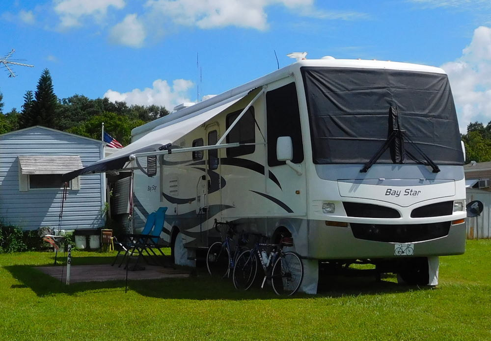
Pearl, a 2007 Newmar Bay Star
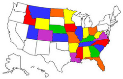
States visited in "Pearl"
Archives
July 2019
Favorite Travel Blogs |
 RSS Feed
