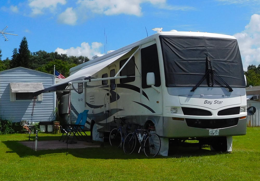
"Pearl" in Winter Garden, Florida
|
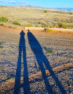
Long shadows in Wyoming
|
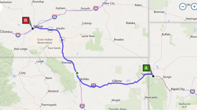 Spearfish, South Dakota to Billings, Montana After a couple of great days in lovely Spearfish, South Dakota, it was time to continue our westward journey. We were hoping to stay in Sheridan, Wyoming, which looked like an attractive town, but we would be arriving on the weekend, and there was a big camping and music event going on. This made lodging options pretty much nil, especially with a pet and for a reasonable cost. So, we had to content ourselves with driving through beautiful northeast Wyoming but staying in Montana over the weekend. 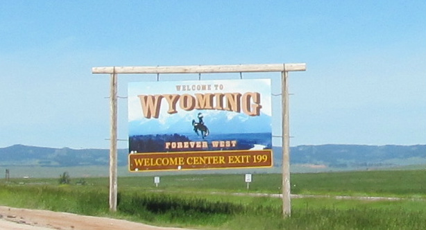 We took a detour off the highway to head up to Devils Tower National Monument. Thanks to my high school friend Danny who reminded me just how close we'd be -- one of the great things about Facebook! It was only about an extra hour of driving (it's north of Gillette in the map above) and well worth the drive, especially since we have our national park annual pass, so entrance was absolutely free. Long before we arrived at the site, we could see it up ahead. This is one impressive "igneous intrusion"! Gotta think back to your high school or college geology class for that one, and that's been quite awhile for us! Devils Tower rises an impressive 867 feet above its base. 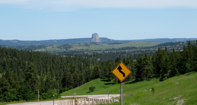 Approaching Devils Tower It kept getting more dramatic as we drove closer. We pulled off the road several times for photos. This one was my favorite. 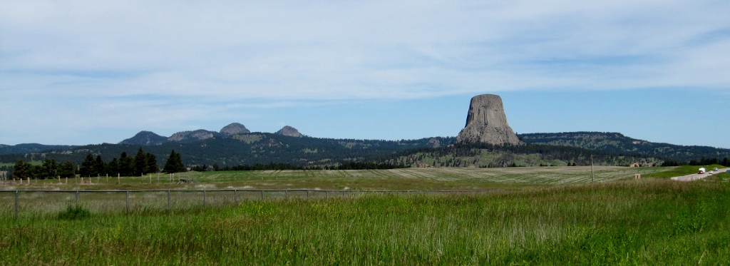 But this zoomed-in one wasn't bad either! 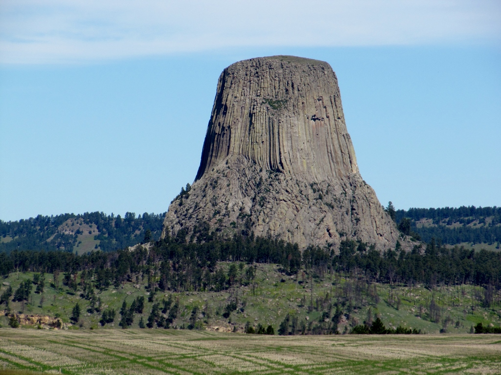 Impressive! Finally we reached the entrance to the NPS site. We couldn't stay long since it was a hot day, and dogs aren't allowed on the trails, so no hiking for us this time. A lot of folks had the same idea as us as the monument parking lot was packed on this Friday morning. We took a few more photos, bought a refrigerator magnet for our collection (even though we have no fridge to put it on!) and left. 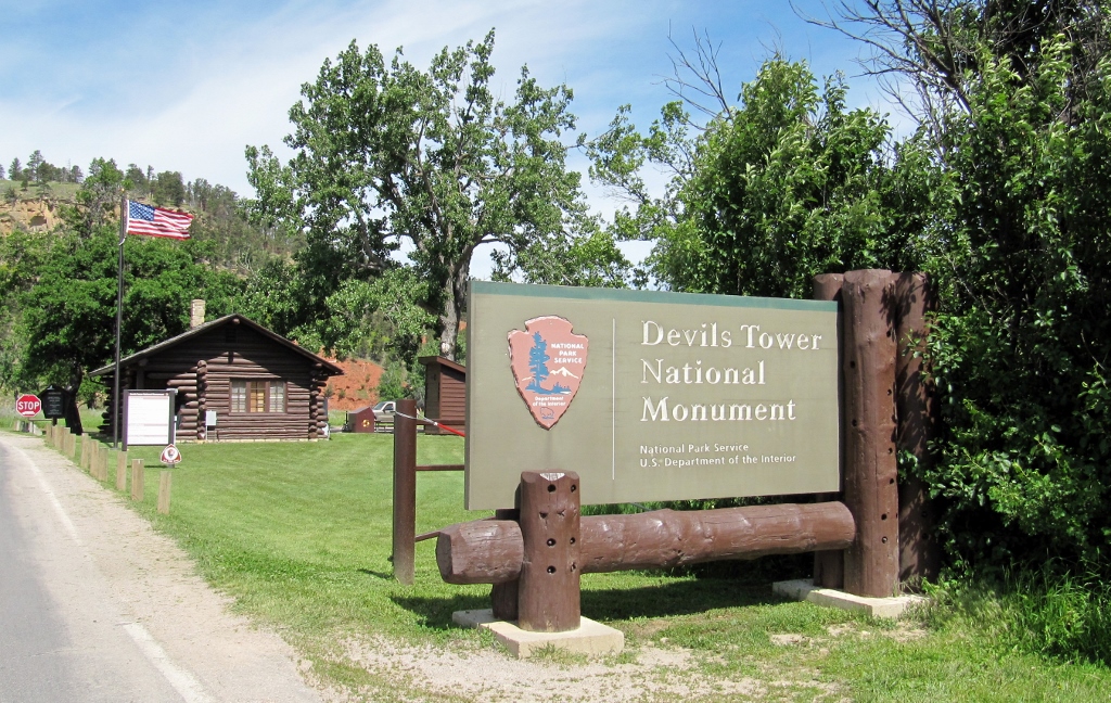 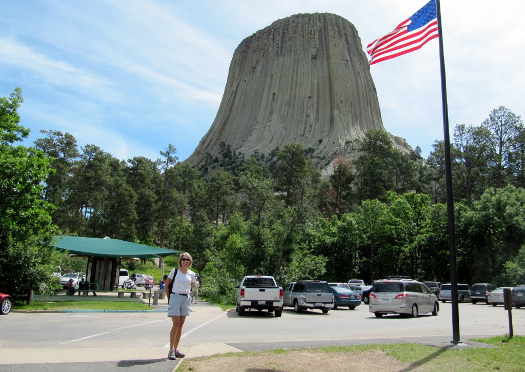 On the way out, we stopped to check out the prairie dog village in the park. Cute and busy little rascals! 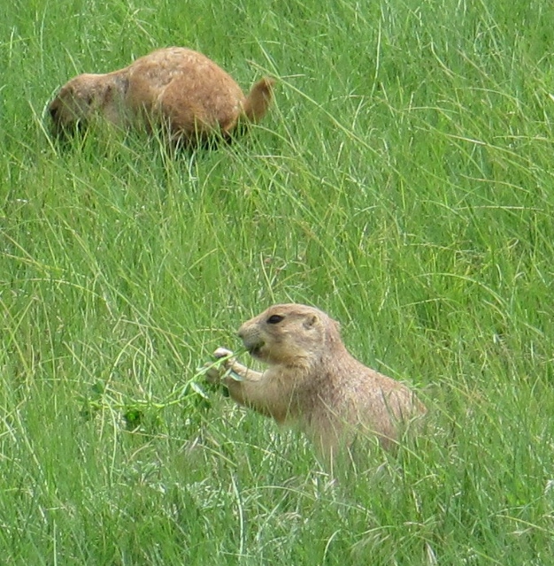 Continuing on, we pulled off for a pit stop at a Wyoming information center. Turns out that this place was along the old Texas Trail (which I'd never heard of prior to reading this monument). It's much more interesting to me learning about American history by traveling the country than from books in school. MUCH more interesting. 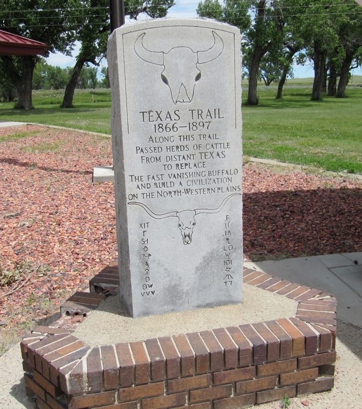 Before leaving Wyoming, we were treated to glorious views of the snow-capped peaks of the Bighorn National Forest to the west. Wow! You just don't see things like this back east. 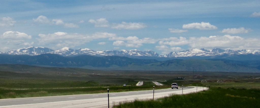  I was struck by how green and lush Wyoming looked as opposed to my first and only brief visit there when we were in South Dakota last fall and everything was pretty dried out and dusty. It was soon time to say goodbye to Wyoming as we entered Montana and made our way to our next stop, Billings. Wish this photo had turned out a bit better.... 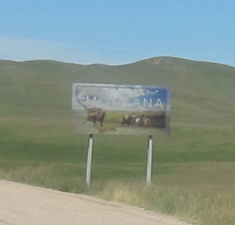 Stay tuned -- Montana is up next!
0 Comments
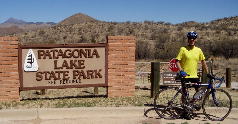
Earlier in the month, we rode our bikes down the very hilly road to the entrance to Patagonia Lake State Park (see photo above), but did not go in. This Wednesday, we drove down to the park from town and paid the $10/car fee to enter. The forecast was for a very windy day, so riding our bikes there would not have been fun and might have been dangerous with the wind gusts. And frankly, I couldn't face hills like this again! 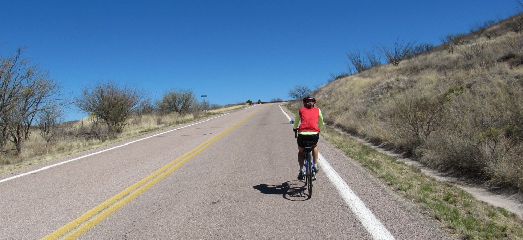
While not a good day for cycling, it was a fine day for checking out the park and escaping at least some of the wind on the long Sonoita Creek birding trail hidden among the green trees. 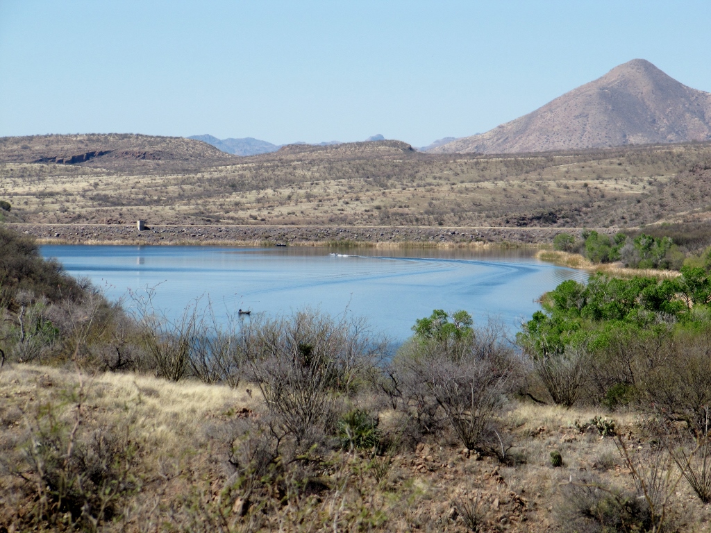
Zoomed in view of Lake Patagonia from the road into the park earlier in March -- it's greener now!
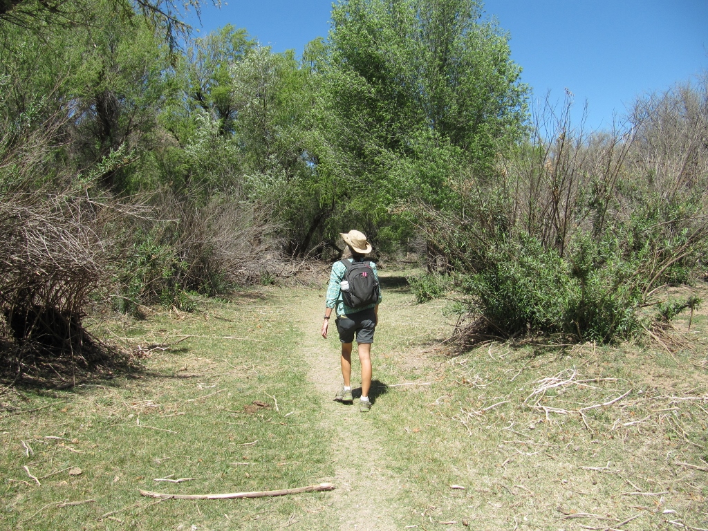
Upon arriving at the park, we headed directly for the Sonoita Creek Trail, knowing that the birds would be most active in the morning. We could check out the lake later. When we first started out, the trail was busy with other birders, but once we got farther down the trail, it thinned out, and we saw very few other people. At the beginning of the trail, we were at the eastern edge of the lake and got to see some ducks and shorebirds. 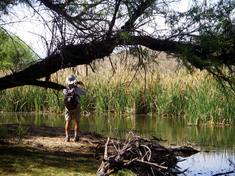
Barry trying to snap a photo of a Northern Shoveler pair who were playing hide and seek in the reeds
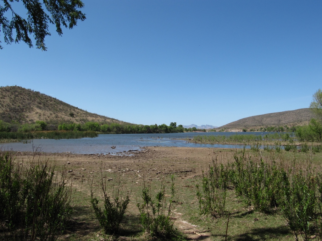
Eastern edge of lake
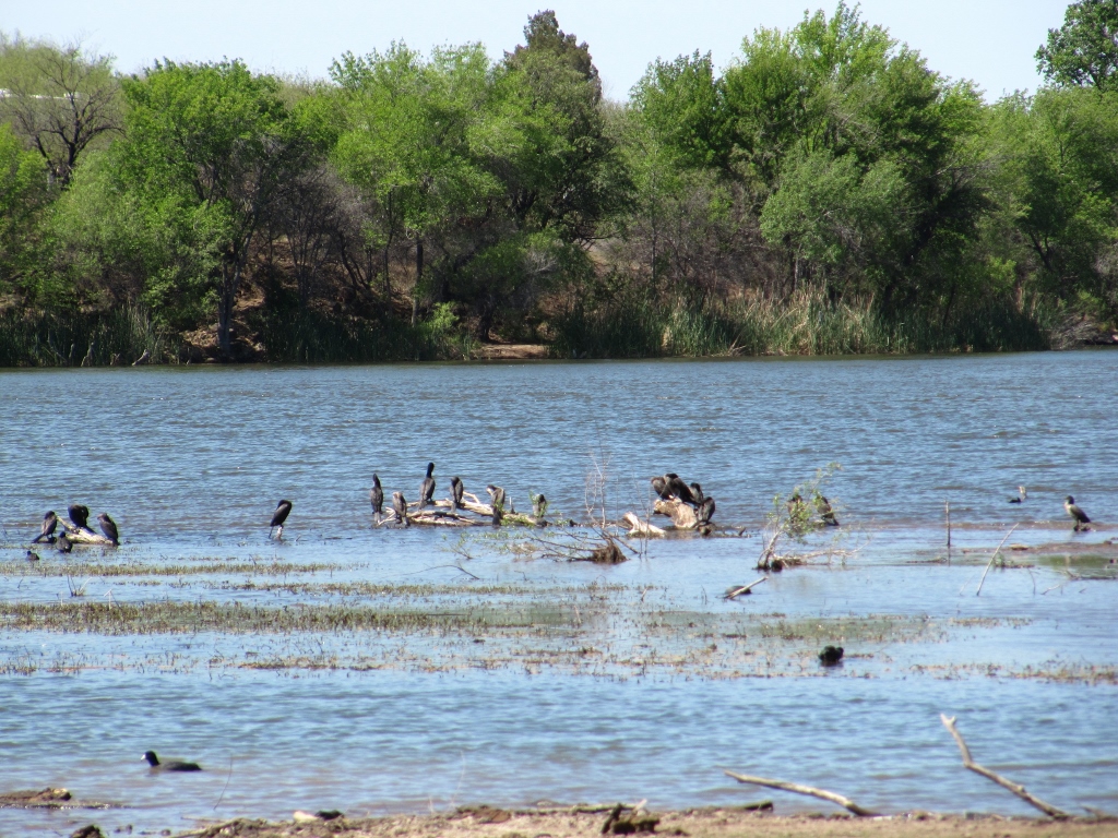
Zooming in, we could see cormorants and American Coots, primarily
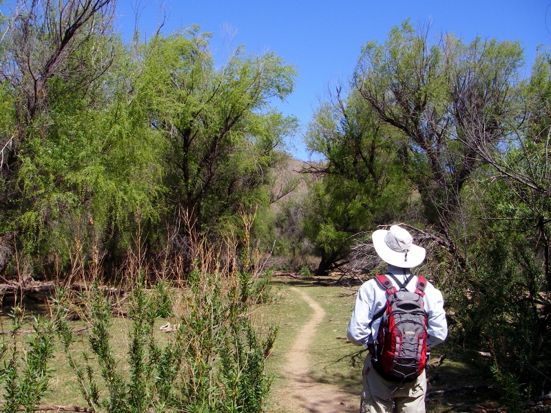
After checking out the shorebirds, we made our way on down the trail. The riparian environment near the creek was absolutely gorgeous -- green and lush. I couldn't get over how different it was from the typical southern Arizona Sonoran desert landscape. Since it is now migration season, there were many birds singing in the trees. This was no fitness hike as we had to stop many times to check out birds. 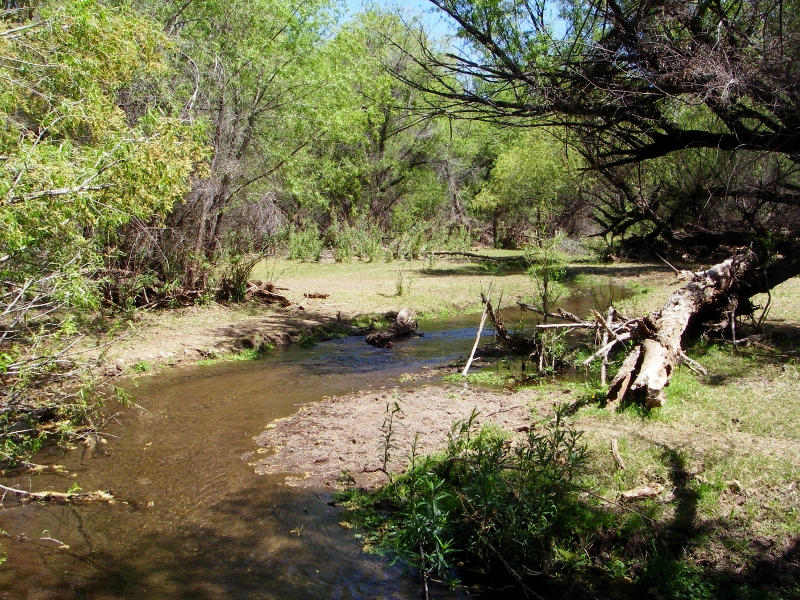
Sonoita Creek
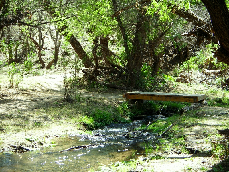
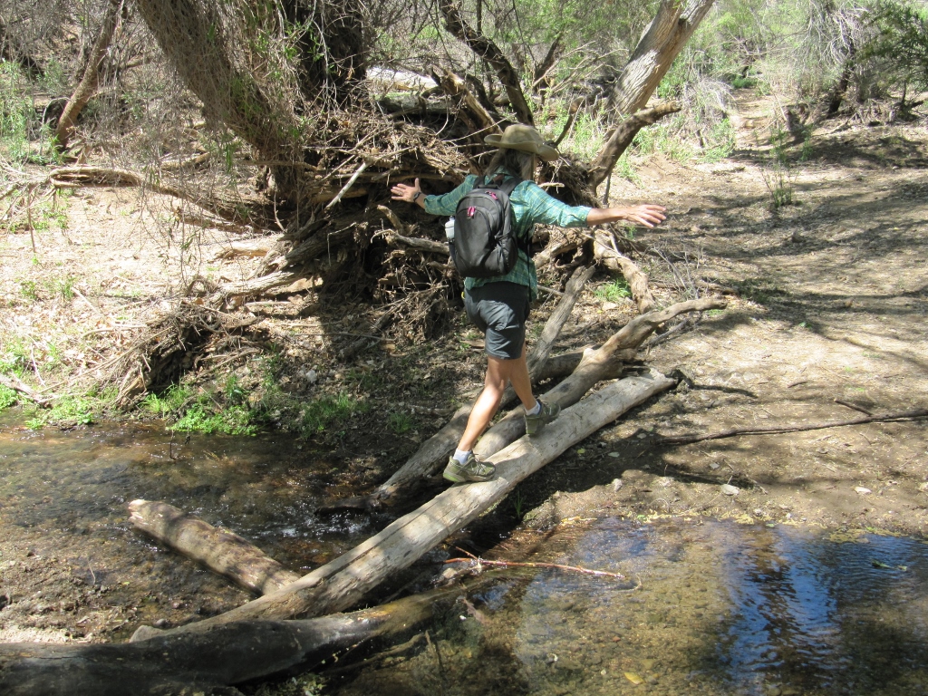
One of several Sonoita Creek crossings
So lush and green -- are we really still in Arizona?
Crossing again
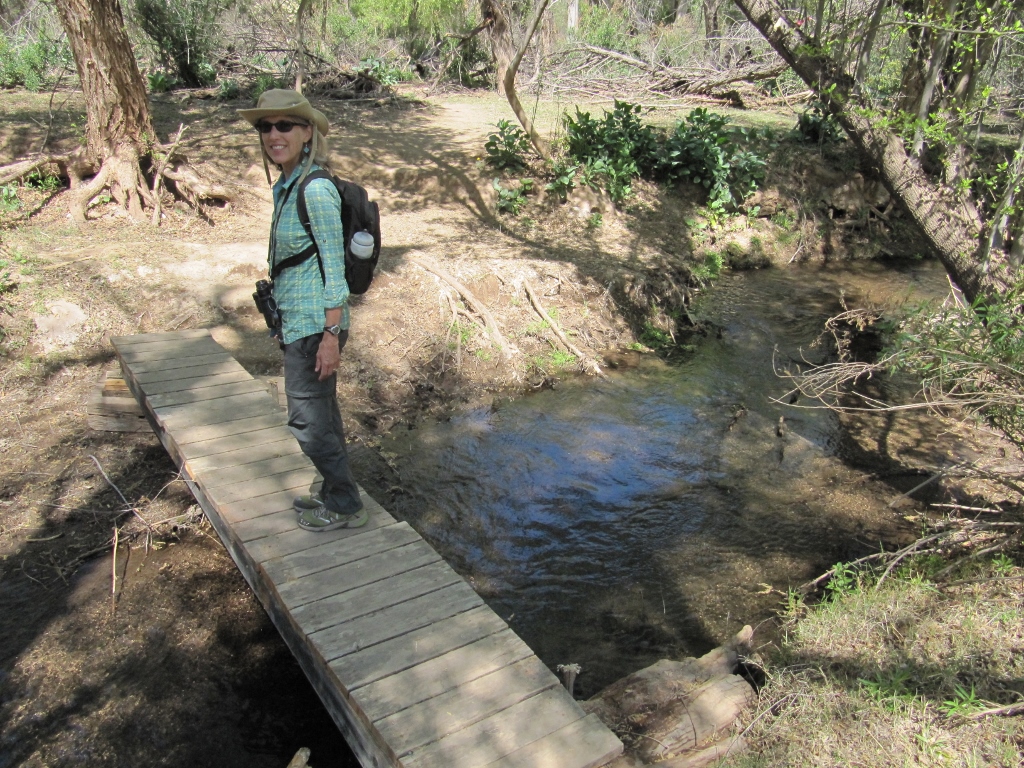
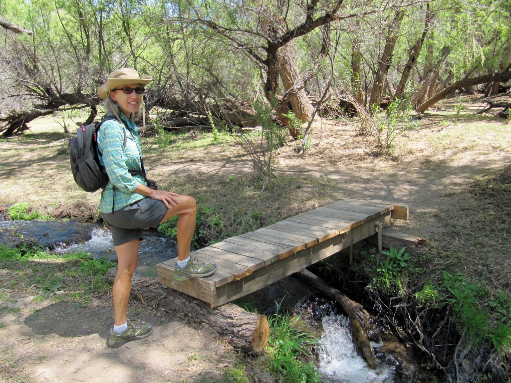
Right before we turned around to head back on the trail, we came to the most fun creek crossing. I made it across in both directions with no wet feet! 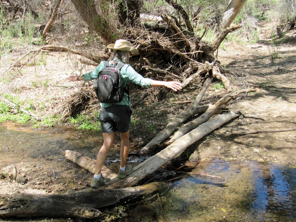
We did see quite a few birds on our hike, but we'll save those for a later blog post on Patagonia birds to keep this one to a reasonable length. After coming back on the trail, we walked around looking at the rest of the park. Patagonia Lake is a 265-acre man-made lake. It would be a great place to kayak or canoe since only low-power motorboats are allowed (and no jet-skis -- yay!) The lake is also very popular for fishing. There are two campgrounds that were pretty full, though the folks in RVs were faring much better than those in tents on this blustery day. We saw a couple of tents that were just about to take flight with the migrating birds! Wish we'd snapped a photo.... 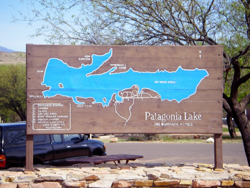
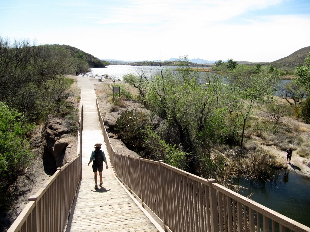
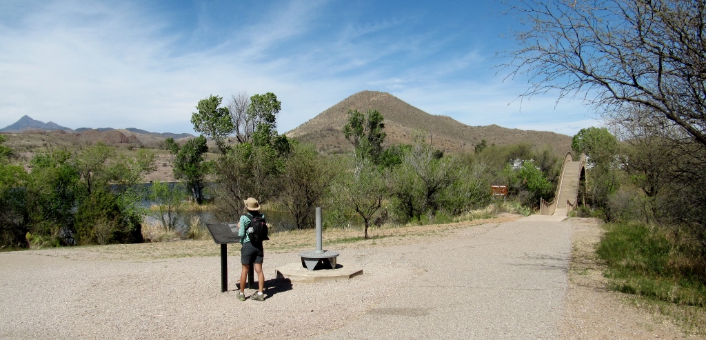
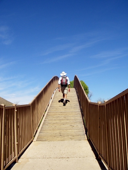
There's a highly arched pedestrian bridge over part of the lake. Perhaps they built it so high to let small sailboats pass under (just a guess). Walking across this bridge was a good workout with the steep slope on each side. On the other side of the bridge is a day-use picnic area. 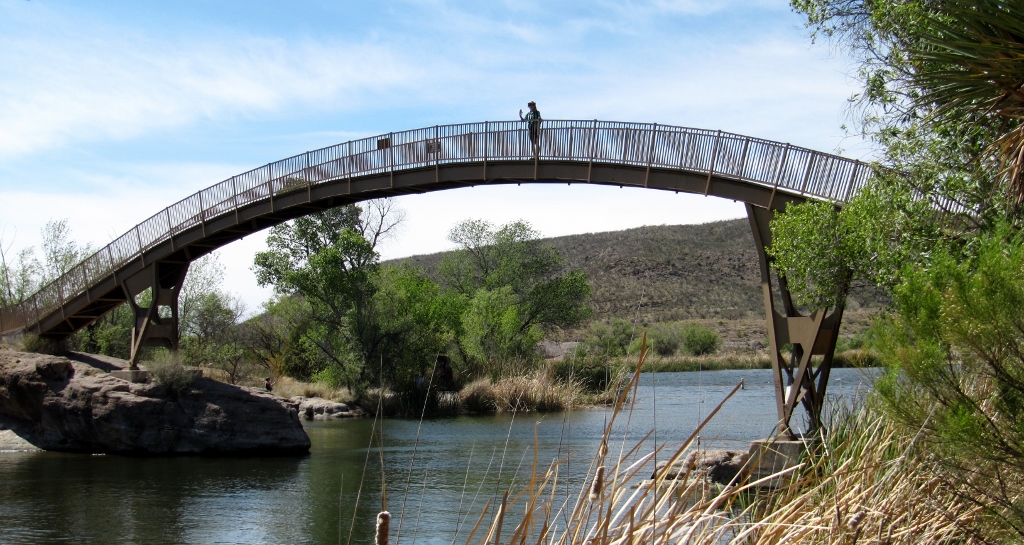
I'm up on the bridge!
I took the shot below from the top of the bridge. The folks in the canoe were really fighting the wind but finally got the boat back to shore. I don't think I would have been out there paddling today! 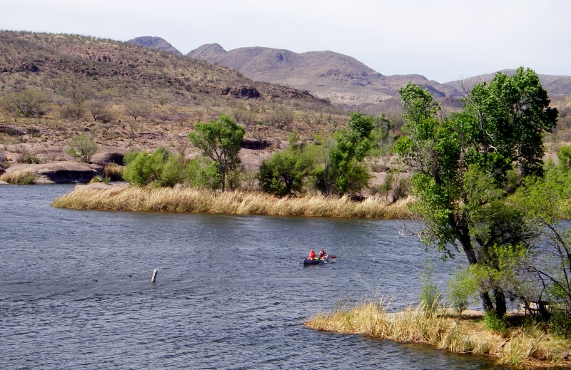
Heading down to check out the other side
Barry getting a workout too
Despite the wind, we had a great day visiting the park. We hope to come back for another visit one day! 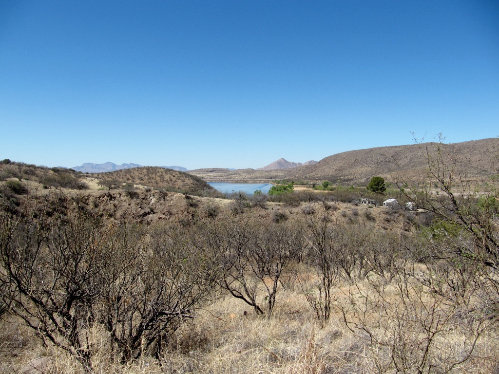
Patagonia Lake from a distance on the road in
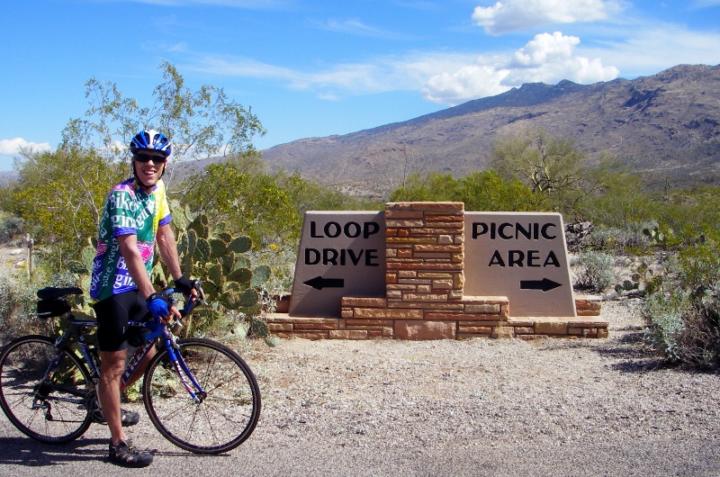
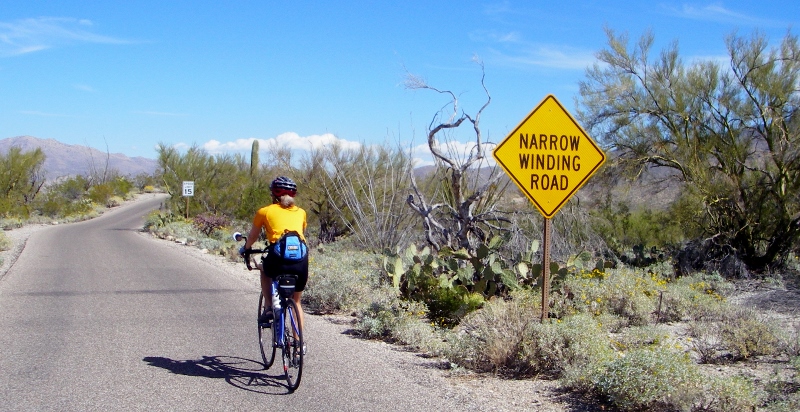
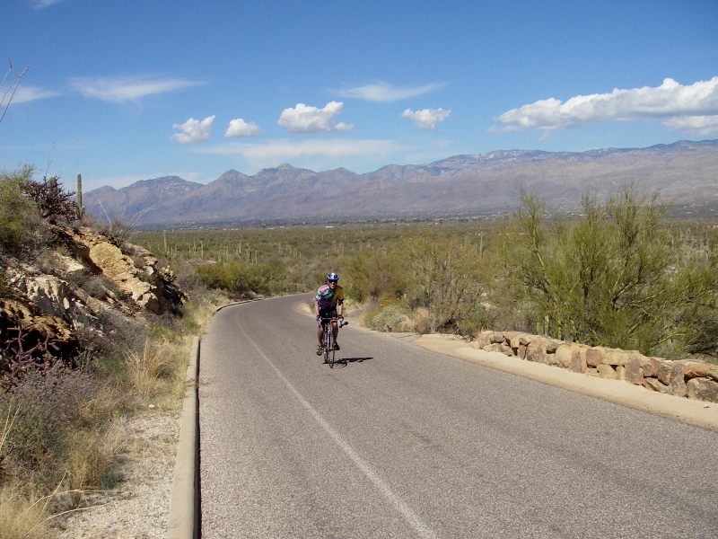
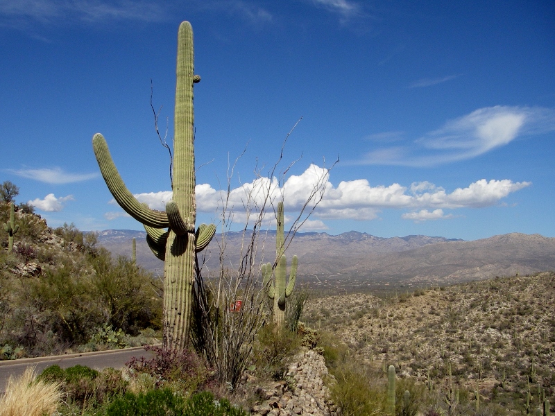
For the past two Wednesdays, we have ridden over to Saguaro National Park, about nine miles from the condo where we're staying in Tucson. Last week we went ahead and bought an annual national park pass, since we hope/plan to go to quite a few National Parks and monuments in the coming year. For $80, it's a great deal if you plan on going to several sites over the course of a year: one pass admits everyone in your vehicle, or up to four on bikes or on foot. If you're over 62, you can get a lifetime pass for only $10, but we have to wait a couple more years for Barry to qualify for that. There are actually two "districts" to this park. On the east side of the city is the Rincon Mountain District; and on the west side is the Tucson Mountain District. The districts are close to an hour's drive apart. Since we are staying on the east side of the city, that's the district we visited twice. We were right outside the Tucson Mountain District when we visited the Arizona-Sonora Desert Museum, but didn't actually enter the park. Inside the Rincon Mountain District of the park is a scenic one-way driving loop, the Cactus Forest Loop, that's a favorite of cyclists. This one-way road is like a roller coaster with swooping descents, a few short, steep climbs, and one long, challenging climb in the middle. Although it's listed at eight miles, if you add in a ride over to the picnic area and back, plus getting to and from the loop, you'll end up with around nine miles of very, very fun riding that will get your heart pounding. The views of the desert, Santa Catalina mountains, and oh yes, all those saguaros, are breathtaking! Here's the elevation profile for the loop. The climb includes grades of up to 19.4%, so it is not for the faint of heart, quads, or those with single-speed bikes. I was in my easiest gear for much of the climb and could have used one or two more! 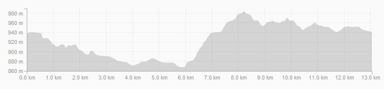
Cactus Forest Loop elevation profile
Since we visited the park mid-week, we encountered more cyclists than cars on the loop both times. Many of the cyclists appeared to be pro teams in training with their matching kits and super high-end bicycles. On the first visit, it was overcast, so our photos weren't as good. Fortunately, when we went back yesterday, we had brilliant sunshine. In just a week of warm weather, lots more flowers were blooming too, so it was much prettier in that way as well. Check it out! 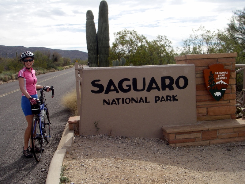
Our first visit was a bit overcast...
...but the second was a much prettier day.
Starting the loop
The park ranger warned us sternly about this steep descent with sharp curve both times we came through, but as long as your bike has good brakes and you exercise common sense, it's no problem. The sign is pretty humorous, though! 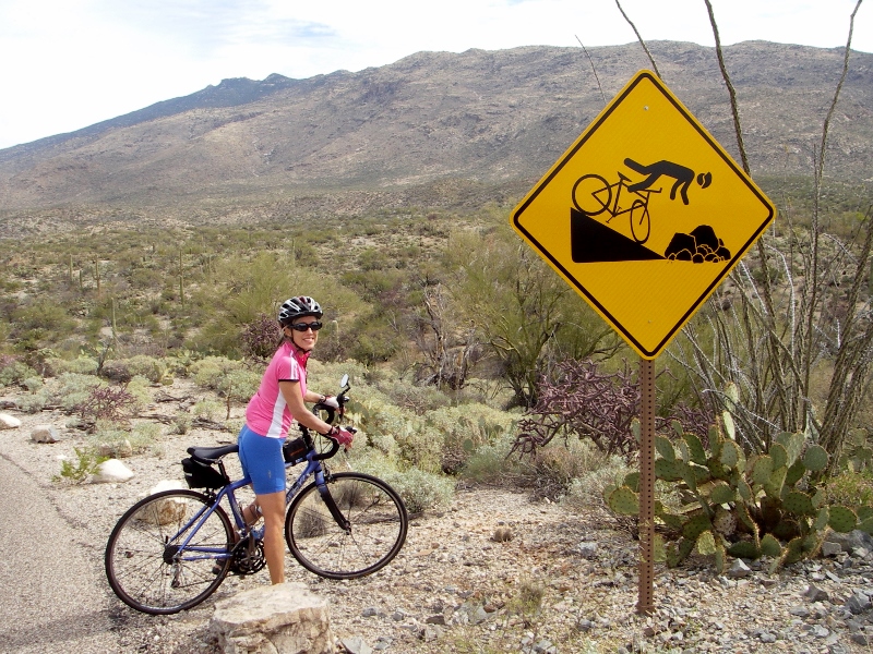
Eeeeek!
Here I am descending it on our second visit to the park. Keep in mind that cameras always flatten out hills -- it was definitely a steep one. 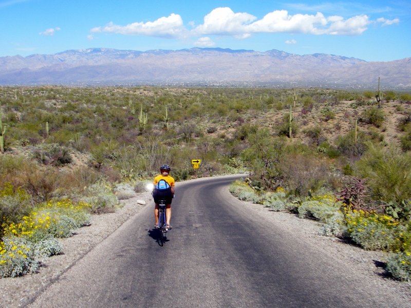
And here's one of the short, steep climbs. Loved the "Share the Road" sign including a desert tortoise! Wish we'd seen one. 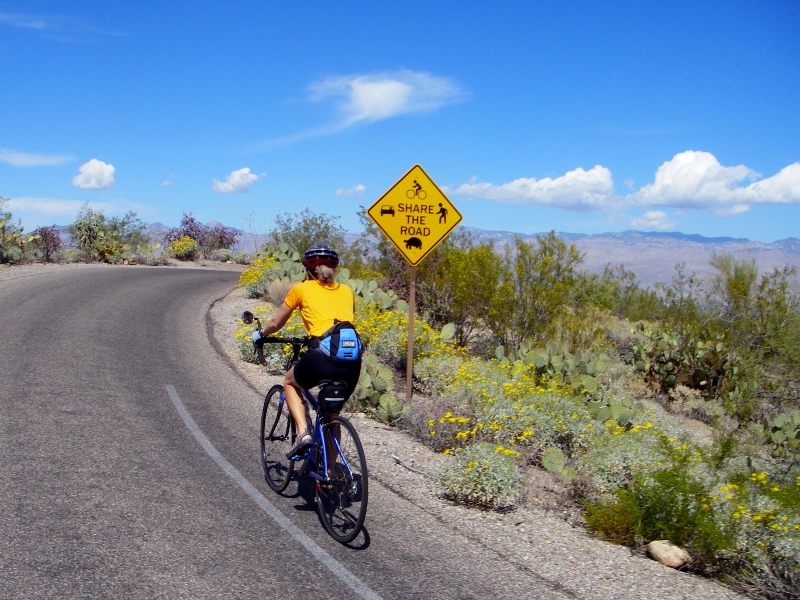
Speaking of wildlife, on our second park visit we were warned by the ranger that gila monsters had been sighted in the park recently. We didn't see one of those, but on our first visit, we did come across this guy right in the road. Our first-ever rattlesnake sighting! Fortunately, he was just sunning himself and didn't even move. 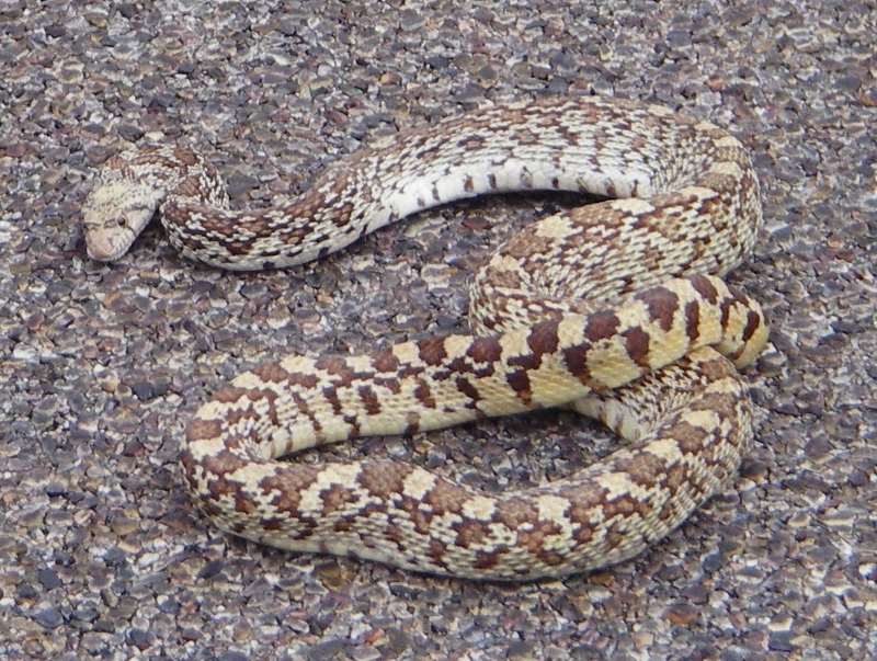
Pretty nicely camoflaged with the road surface, no?
But on our second visit, no wildlife other than birds were in evidence. 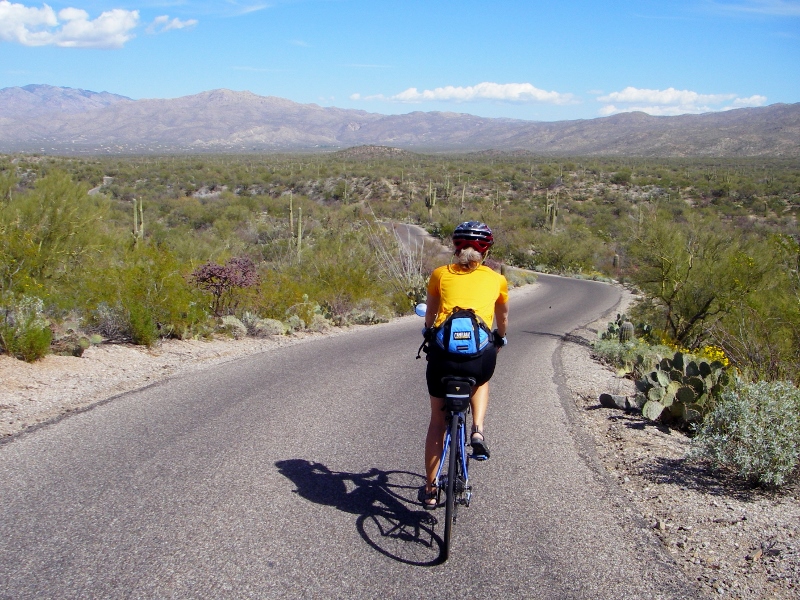
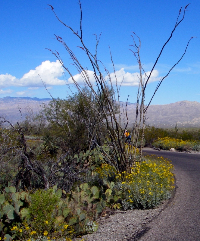
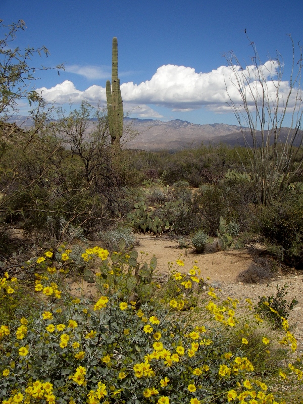
Desert cacti and flowers
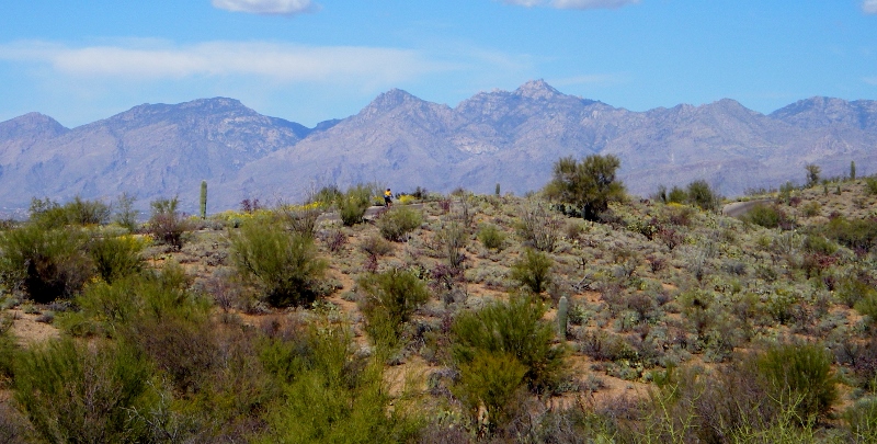
If you look closely you might be able to make out a tiny dot of orange -- that's me riding along!
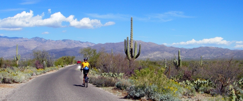
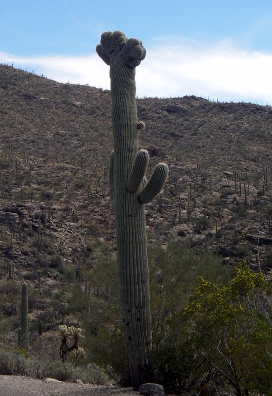
An especially nice Saguaro
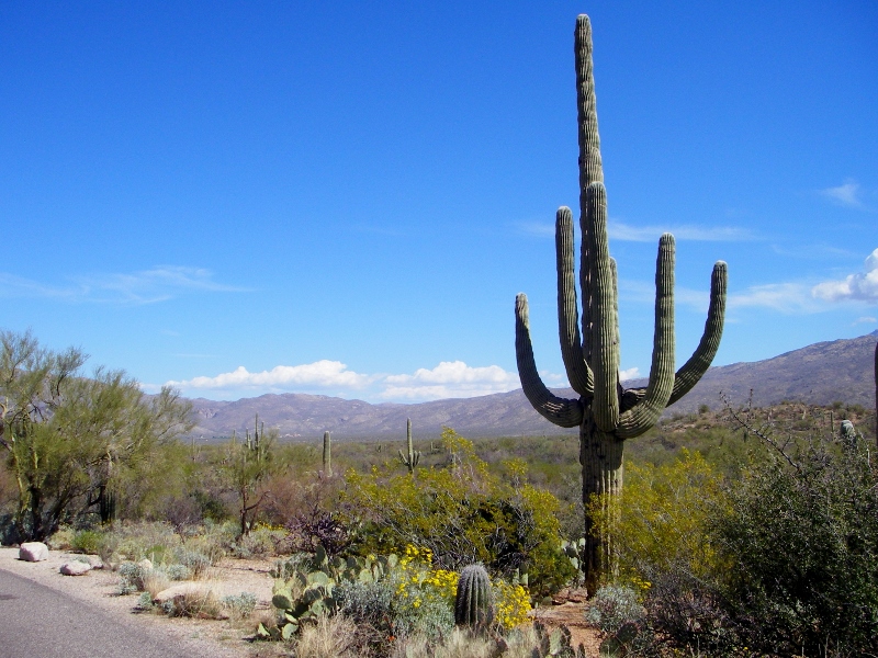
In close-up
Barry starting the climb up the long hill
Nice view from part-way up...still some more climbing ahead, though.
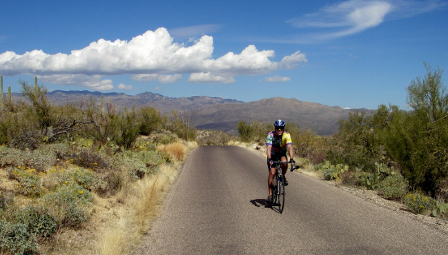
Barry finishing up the big climb
At the high point of the loop is "Javelina Rocks". Alas, no javelinas to be found, though. 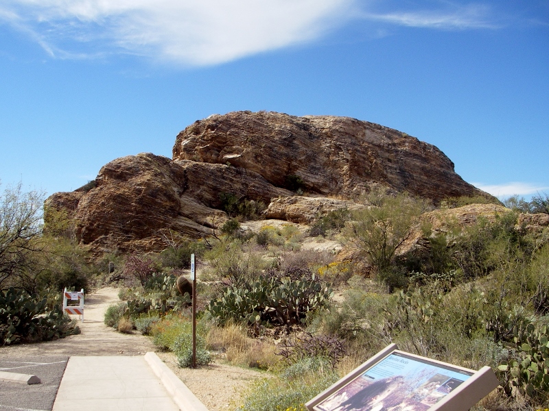
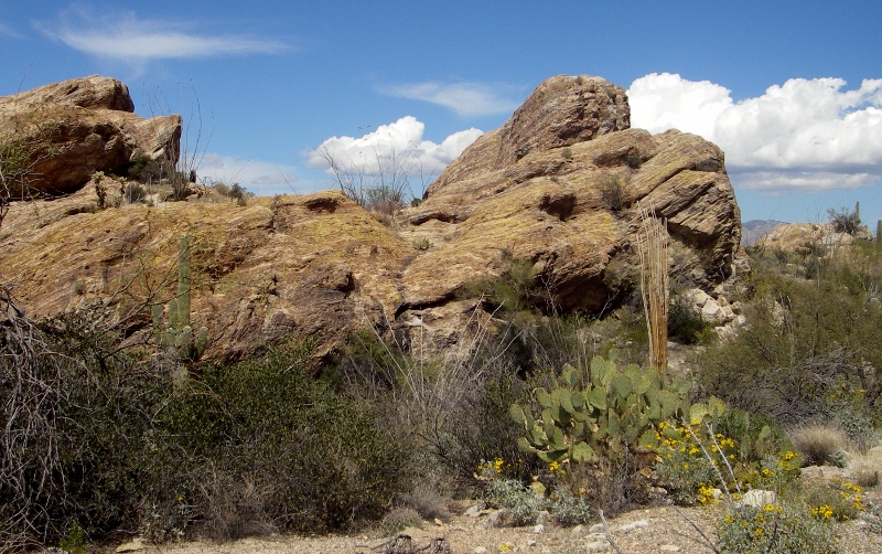
Another view of Javelina Rocks
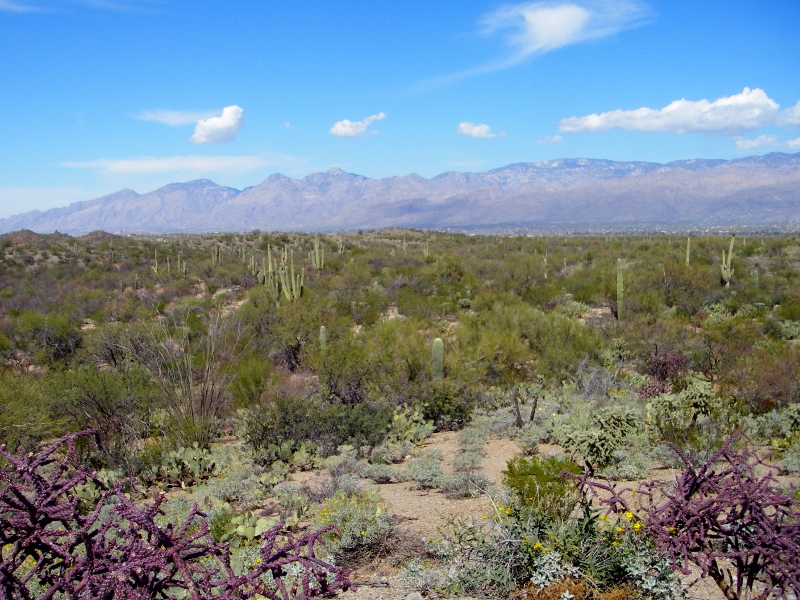
Another view from high up -- loved the wildflowers in bloom as well
Rare Crested Saguaro on the way to the picnic area
On our second visit to the park, Barry decided to ride the loop a second time without the burden of stopping to take photos numerous times. I didn't want to climb the hill again as we'd had a long climb just to get to the park as well, so I hung out outside of the Visitor Center while I waited. This Feather Tree right outside was interesting to me. 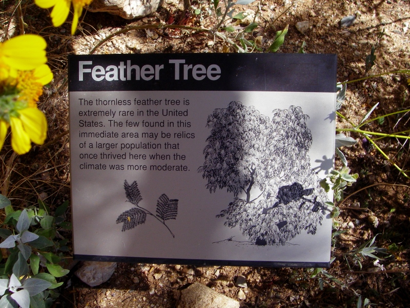
Climate change anyone?
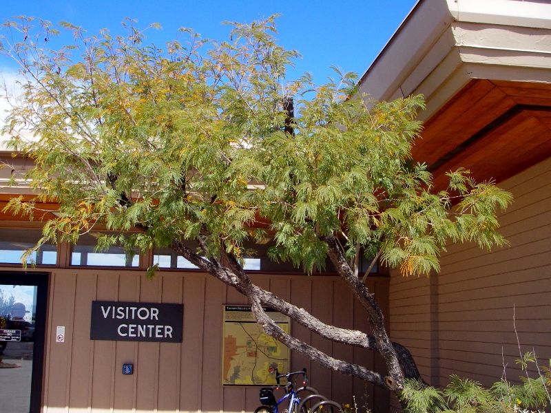
Feather Tree
We're looking forward to coming back to the park sometime in the future to hike, as the Desert Forest Loop is but a small piece of the entire park. There are numerous trails to explore on foot as well. Here's a map of the park, and you can see what a small piece of it the loop we rode covers. 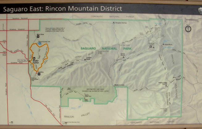
The Desert Forest Loop we rode is highlighted in yellow, but the Saguaro National Park East District is much, much larger!
This plaque in the garden by the Visitor Center really summed up this park -- and indeed the entire region -- to me. 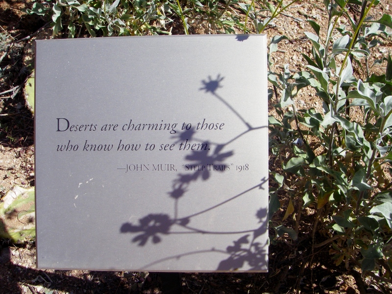
"Deserts are charming to those who know how to see them." -- John Muir, "Steep Trails", 1918.
|
Emily & BarryWe're a long-married, early-retired couple who are currently traveling as nomads with no fixed home base. After years of living in North Carolina (Emily's home state), we spent 18 months living oceanfront on Ambergris Caye, Belize, a year road-tripping the US in a Honda CR-V, a year in Playa del Carmen, Mexico, and are now roaming North America in our 32' motorhome, Pearl, following warm weather whenever possible. 
Paisley, May 2016

States visited (pre-RV)
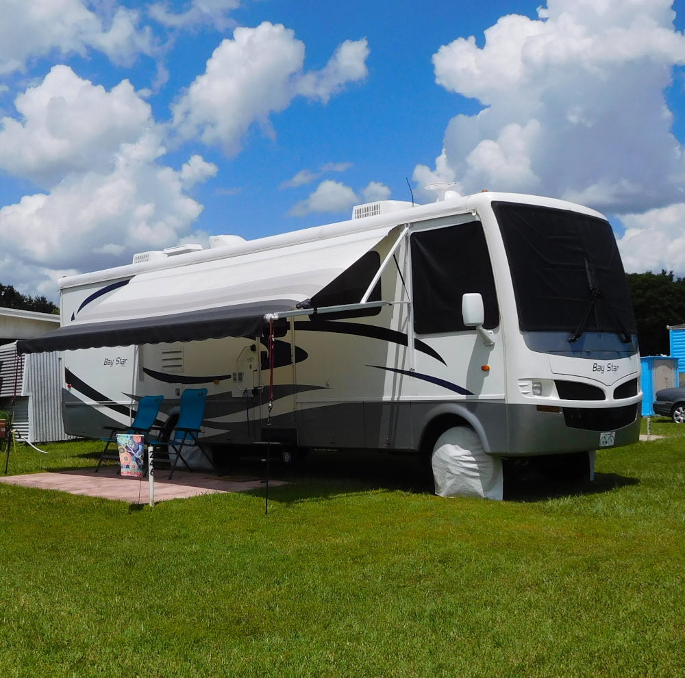
Pearl, a 2007 Newmar Bay Star

States visited in "Pearl"
Archives
July 2019
Favorite Travel Blogs |
 RSS Feed
