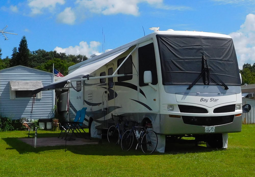
"Pearl" in Winter Garden, Florida
|
Long shadows in Wyoming
|
|
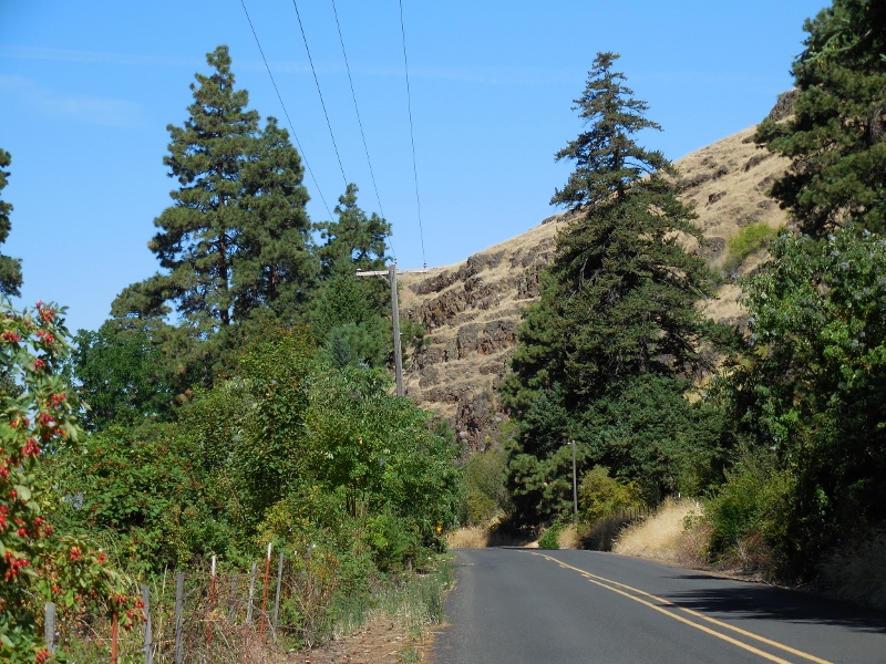
Time for another short road trip! This week on our day off from cycling we took a road trip north up to Palouse Falls State Park and spent a brief time in charming downtown Dayton on our way back. We were concerned on the way up when we saw this huge plume of smoke in the distance. 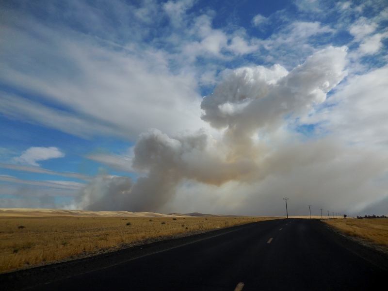
Where there's smoke, there's probably fire...
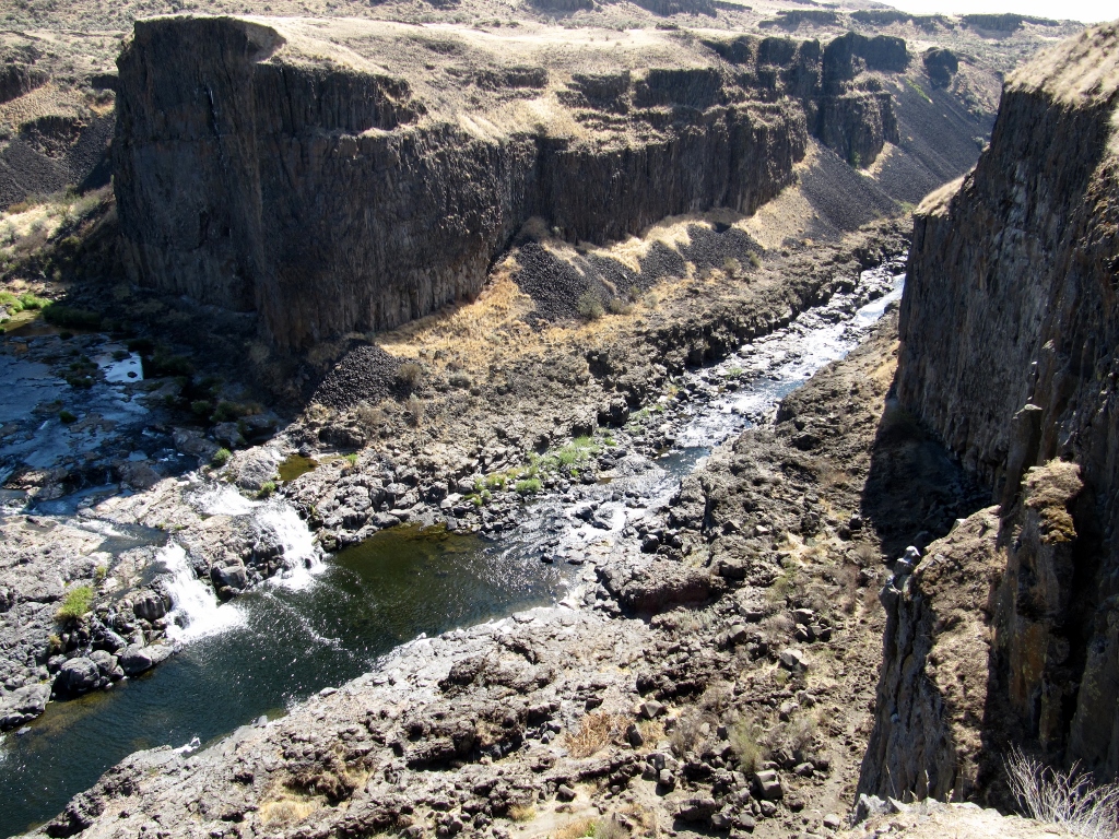
Not long after, we were smelling and driving through smoke and had very low visibility. We were afraid that we'd barely be able to see the falls, much less get any good photographs. Here was the hazy view greeting us at the Snake River bridge. Not good. 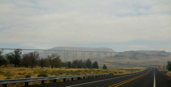
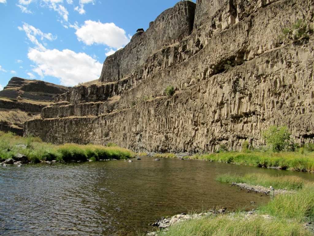
Luckily just a mile or two farther north we left all the smoke behind us. We did find out on the local news later that the smoke came from a rather large wildfire that broke out that morning. The fire fortunately occurred in a grassland with no population, but it did burn about 30 square miles before being contained. By the time we left the park in the afternoon, the smoke was gone. We arrived at the park in the late morning and were the only people there! That didn't last long, but it was nice for a short while anyway. 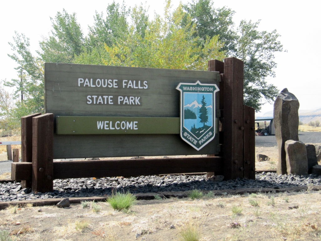
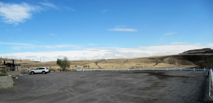
Our lone Honda CR-V
There's a $10 fee per car to park if you don't have a Washington State Discovery pass. We don't, so we paid up at the honor fee station. 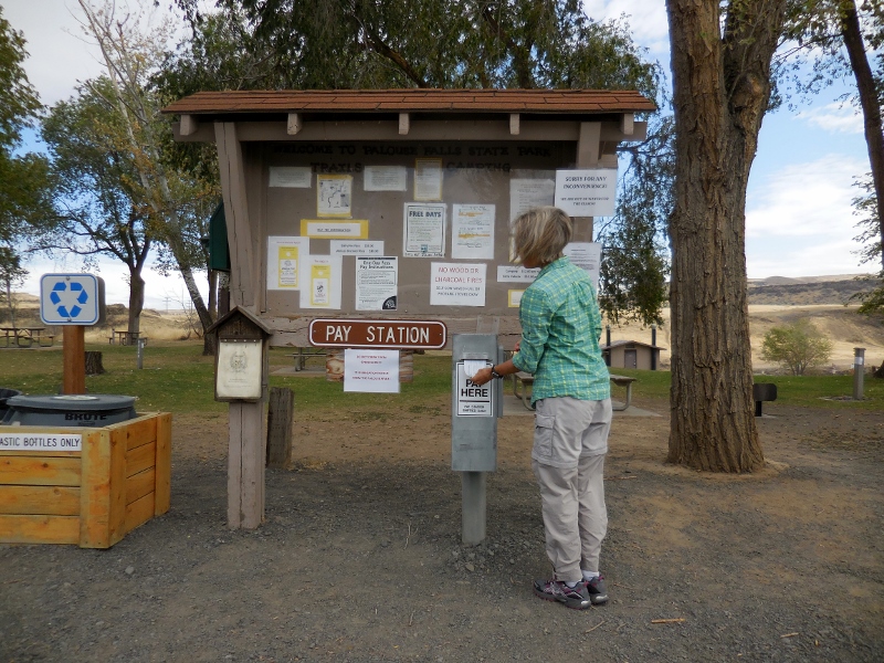
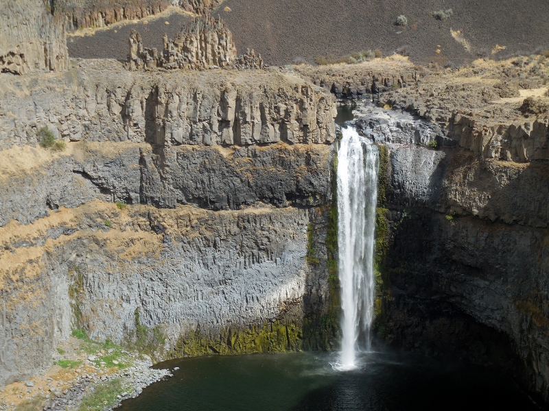
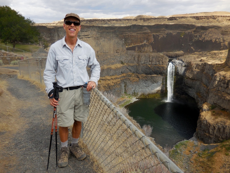
We didn't venture into the picnic and camping area, but there is a small area for primitive tent camping and one pit toilet. There are numerous picnic tables scattered around the park as well. Soon after arriving, we realized that the falls were very close at hand. We're used to parks where you have to hike a bit to see waterfalls hidden in the woods, so this was a bit different. We also quickly discovered that maybe the reason we were the first people at the park was because the light was not great for photographing the falls in the morning. Mid-afternoon looked to be the best time. So, it looked like we were in for a longer stay than I'd first anticipated if we hoped to get some decent shots. Shooting in this direction, the photos were a little washed out at this time of day. No worries -- they get better, but I figured I better give you an early preview of the 200' falls. After all, that is the main attraction here! 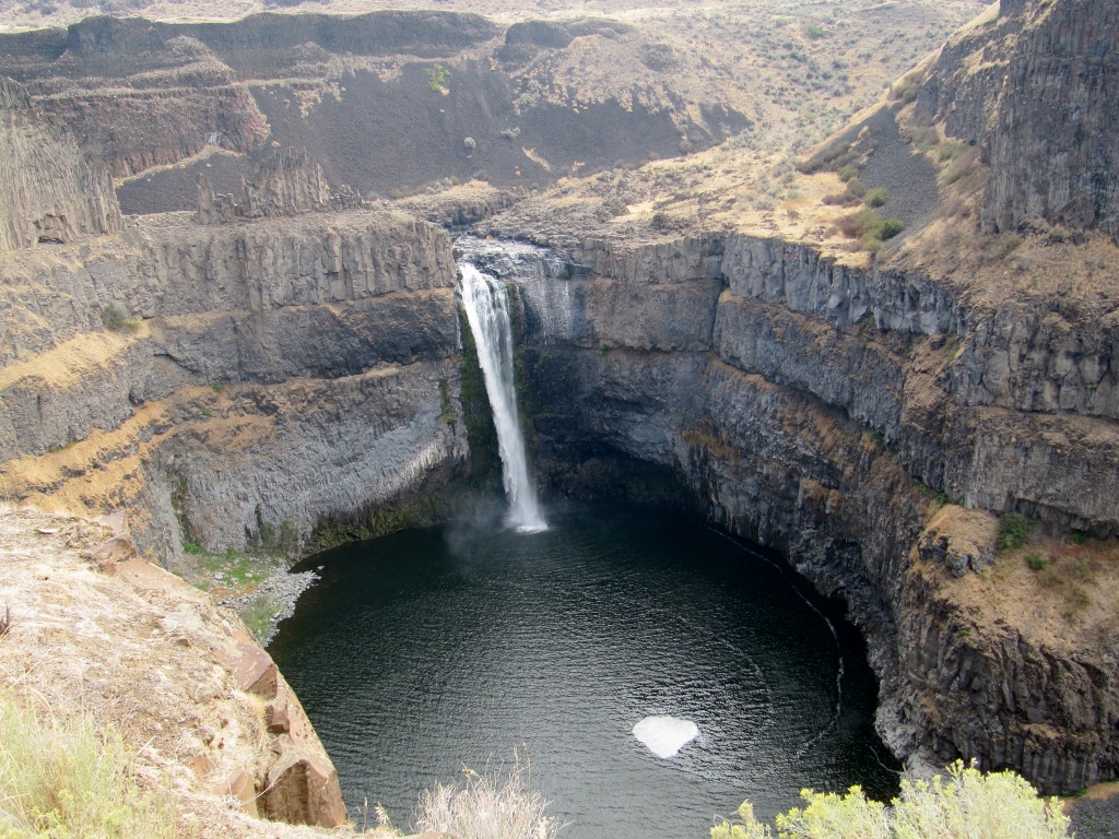
Palouse Falls in the morning
This information board explained how the dramatic landscape here was carved by huge floods at the end of the last Ice Age. 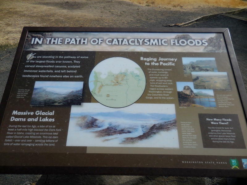
We hiked around on some of the shorter trails near the falls. My only complaint about this park is that none of the trails were marked or rated. It's always nice to know how long and how difficult a trail is. In addition to wider trails that were obviously "park trails" (even though unmarked), we could see where other, narrow trails criss-crossed down into the canyon and closer to the falls. We weren't sure if they were legitimate park trails or just "rogue" trails that determined folks had blazed. We still don't know for sure. The views and sights were pretty anywhere you looked, though. 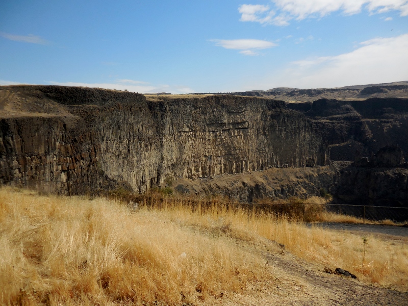
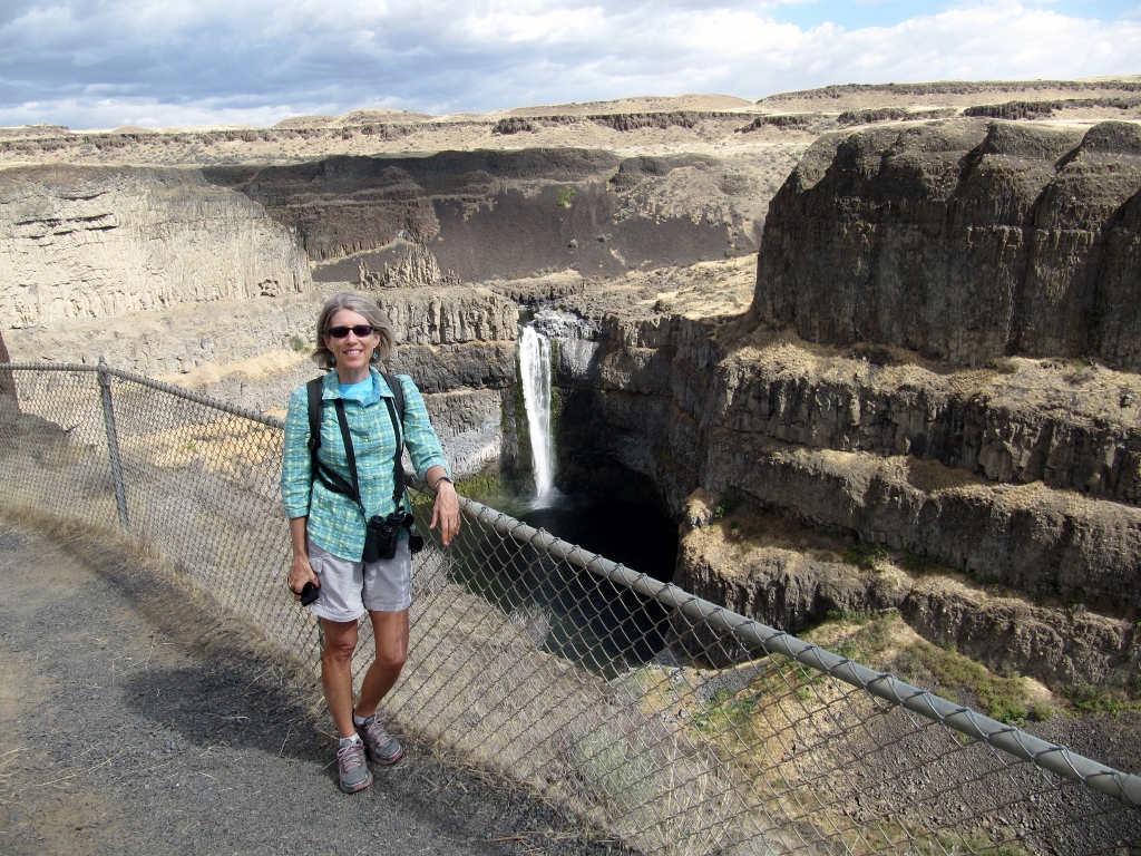
This photo turned out nice even though the the falls were still partially shaded. 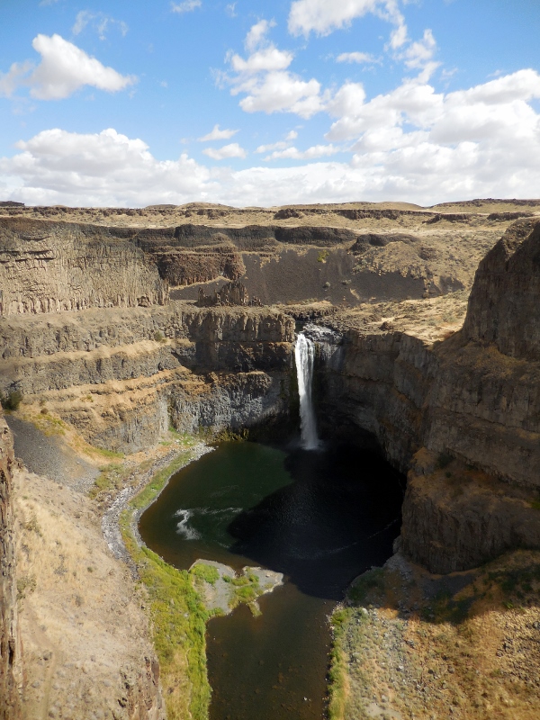
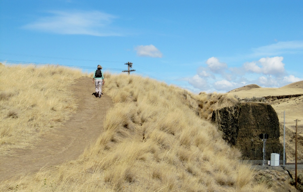
Barry, never one to content himself with a short walk around a park, decided to investigate a trail we found at the west end of the park trail. This is one of those trails we weren't sure was "official" or "rogue" as there were no markings, but we could see that it descended rather sharply down talus into the canyon and appeared to eventually wind around to the falls. Our hiking poles were in the car, and he'd worn his hiking boots, so of course he couldn't resist giving it a try. I decided to pass and take photos from above; after all, this was supposed to be our "rest" day! Here he is, starting down the trail. You'll have to look closely to see his tiny figure in the upper right of this photo. And the all-talus (loose rock) trail dropping steeply down in front of him. Yes, he's an adventurer! 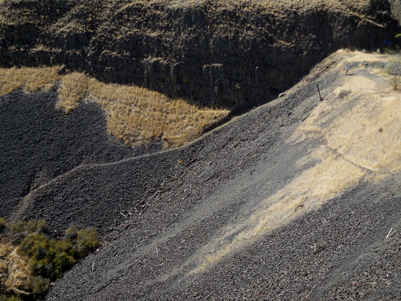
It actually worked out well that I stayed up top so I could take photos of his efforts. I'd brought my binoculars in case of interesting birds (which I didn't see), but turned out they were great for Barry sightings as well. I ended up getting plenty of exercise as I walked back and forth, back and forth looking for him on the trail and taking photos, up and down a hill over and over. My shins were sore the next day! Here's more of his hike as seen from above. Zooming in... 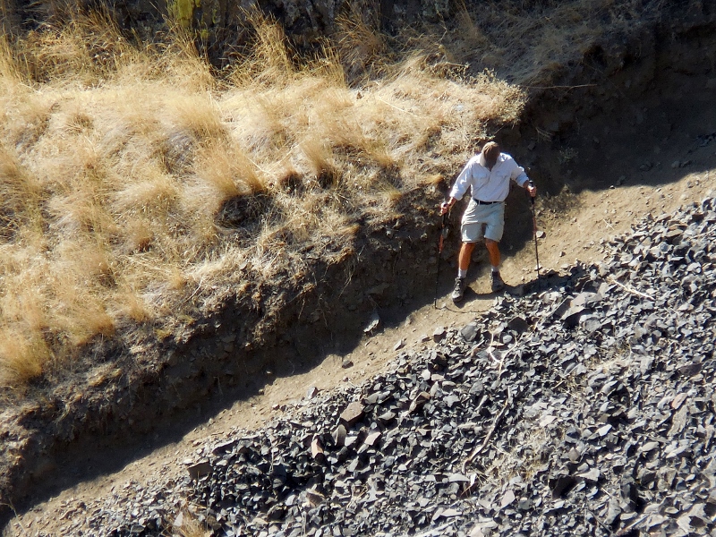
And back out a bit... 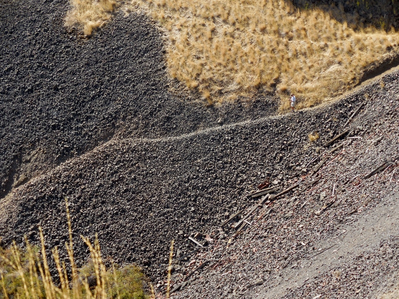
Now's he made it down the rock and onto a flat, grassy area. He's right in the center of this photo. 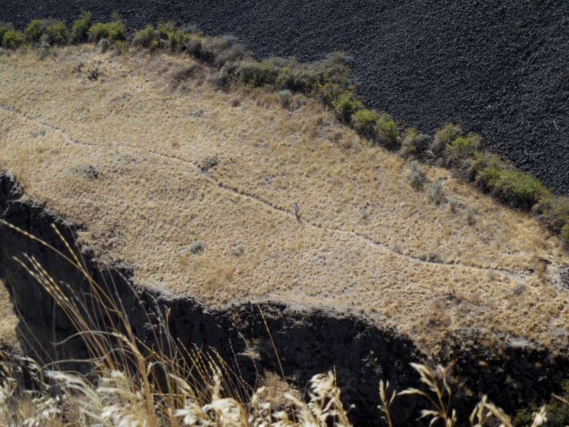
He made it to the foliage down by the river! Can you see him among the greenery? 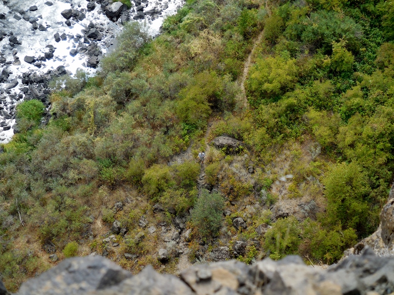
And finally to the little island near the falls! 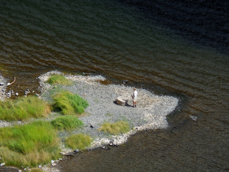
Looking at the big picture; can you see where Barry is on the little island? Impressive, right?! 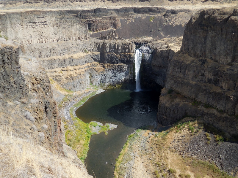
Here are a few shots he took while on the trail. 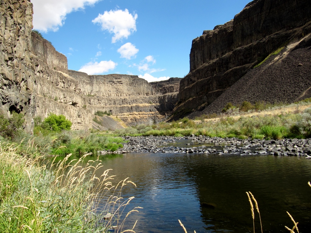
Uhhhh....don't think this trail gets a lot of use! 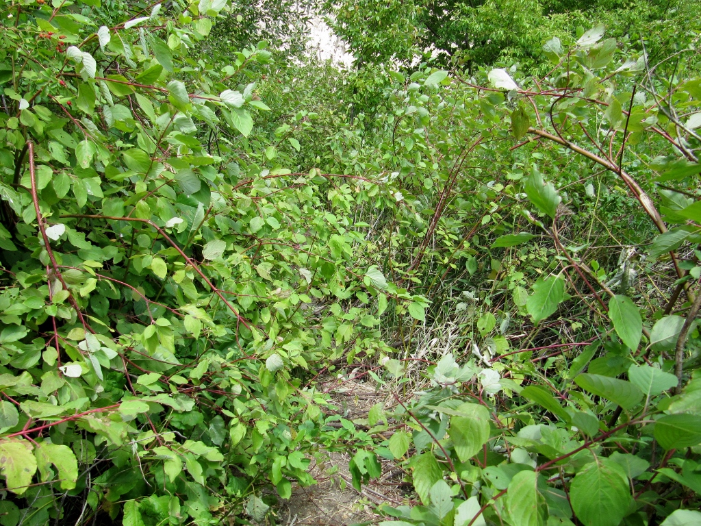
This looks like some pretty tough hiking conditions. One slip and you're in the drink! 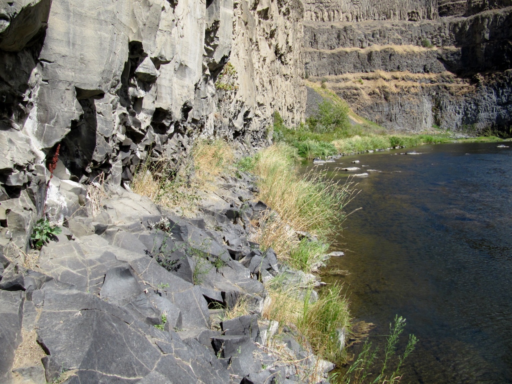
Peek-a-boo waterfall view! 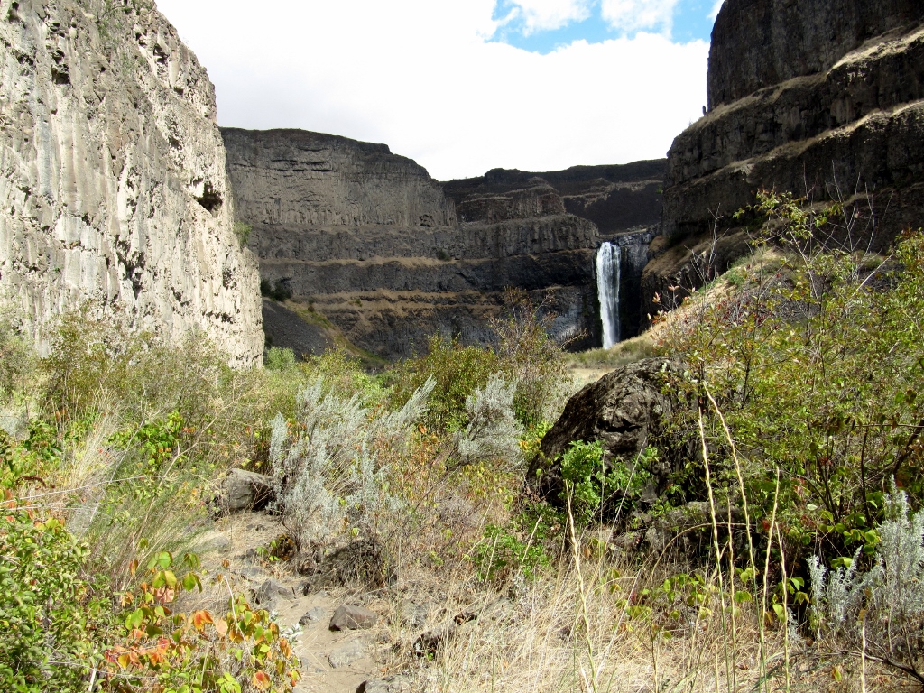
And he's there! 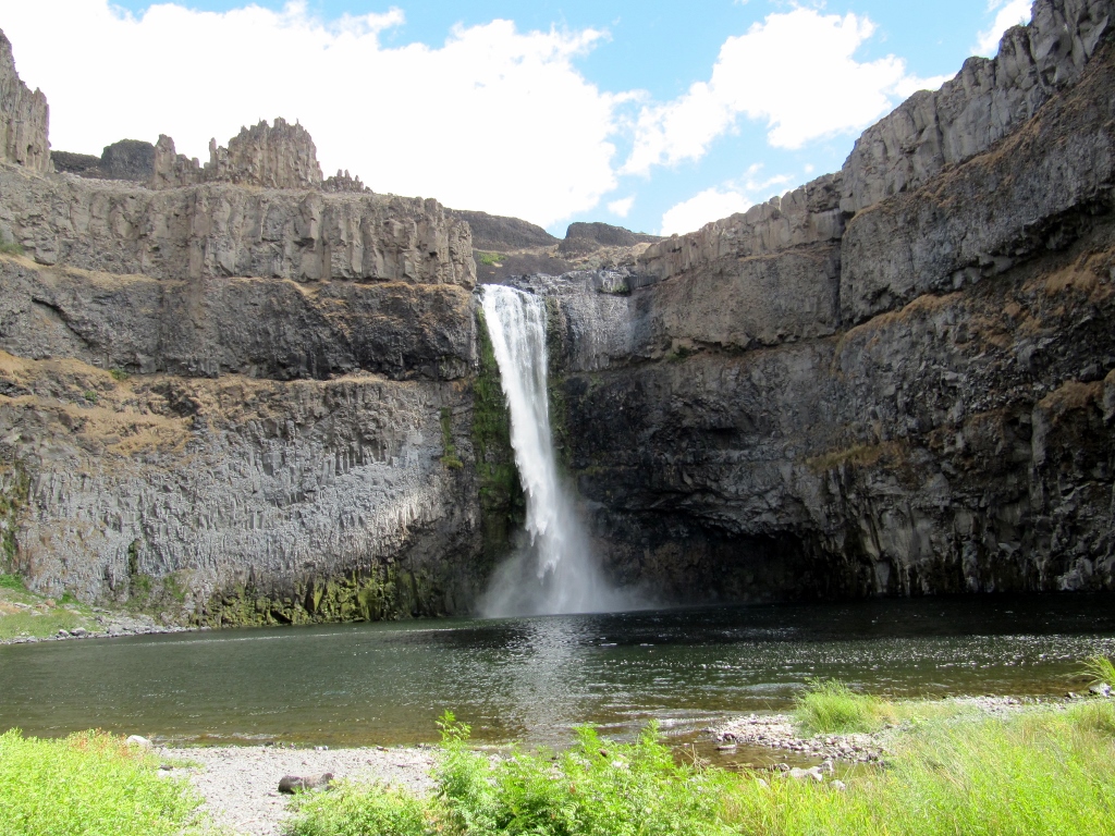
He was able to walk a bit further for a good view of the side of the falls. 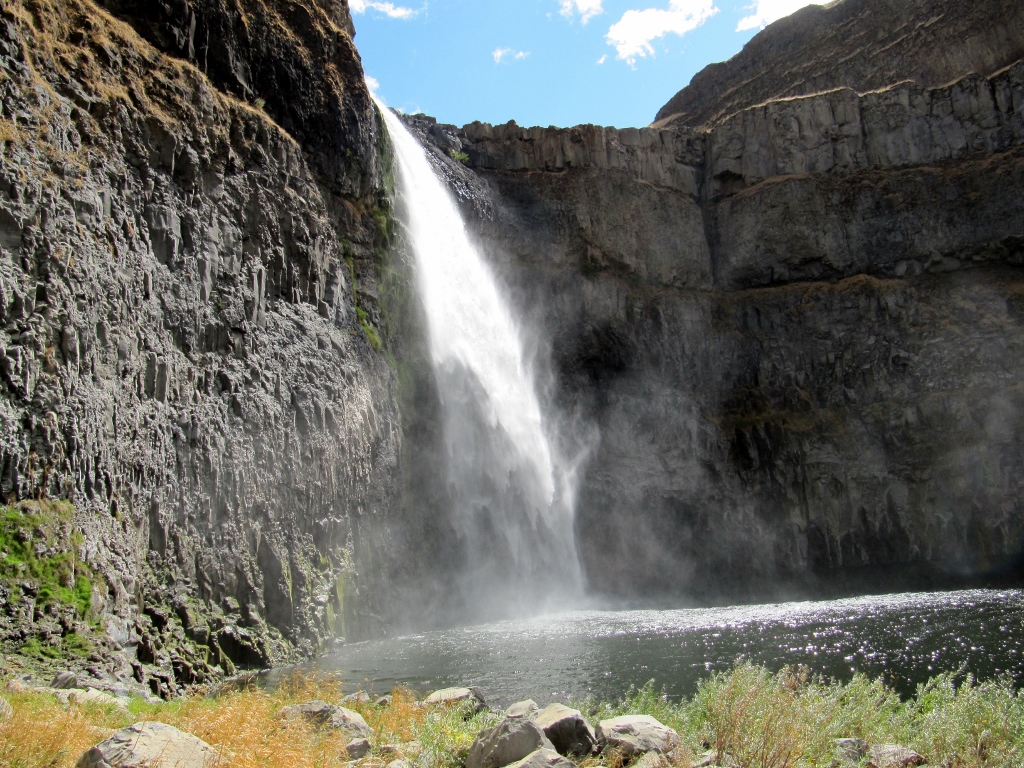
Trail conditions were awfully rough. This was not a long hike, but it took him a fairly long time because of the need to walk so carefully. Fortunately, he did great, with no injuries. 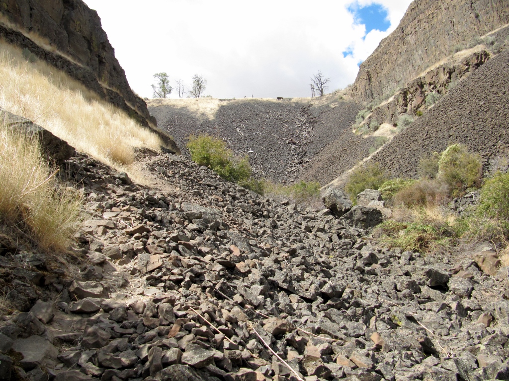
Not very comfy underfoot, I'm sure
Back to my photos, the sky was getting very dark towards the east, but it never rained where we were. Check out the start of fall color up here! 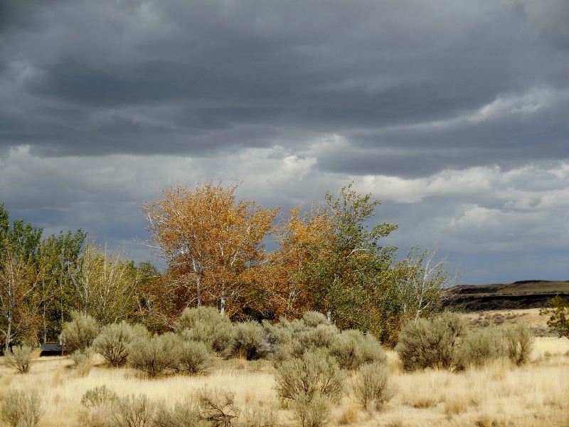
Barry's on his way up -- once again a tiny figure in the middle of the photo. 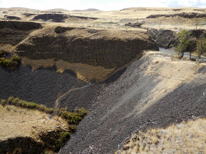
A freight train rumbled by at the top of the trail while he was climbing. 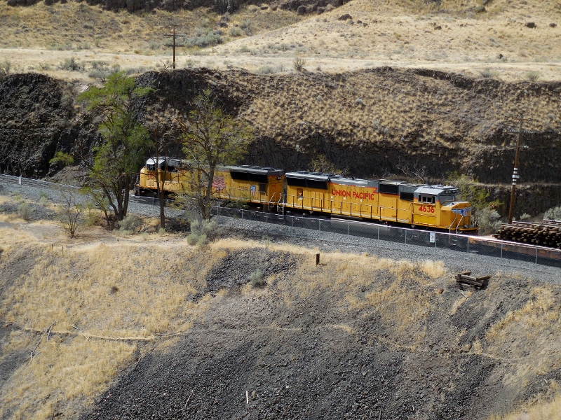
And he made it! 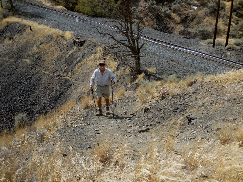
Once he was up, the light was better for a few more photos, so we snapped away before leaving the park. 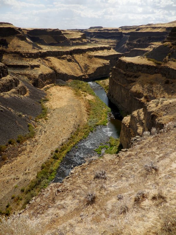
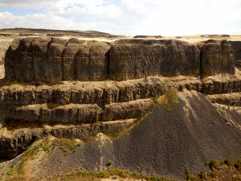
This formation to the left of the falls is aptly named "Castle Rock". Reminds me of the castle at Disneyworld! 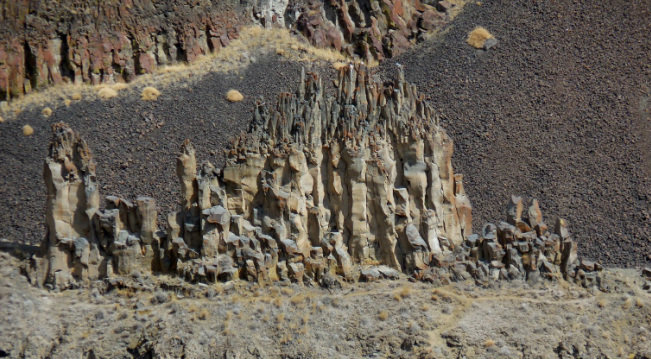
Castle Rock
The intrepid hiker!
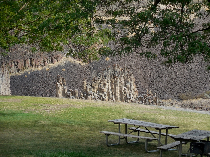
Nice view of Castle Rock beyond a picnic area
A final long view with afternoon sun... 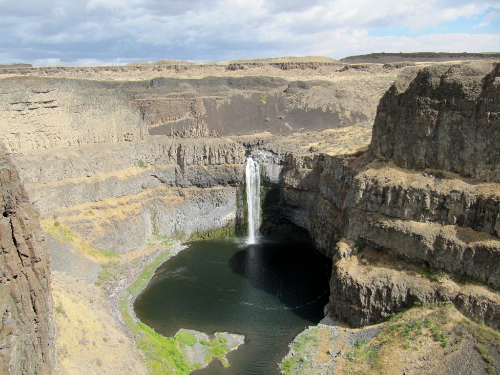
Stay tuned for Part 2 as we head down to Dayton for a look around!
0 Comments
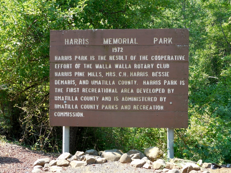
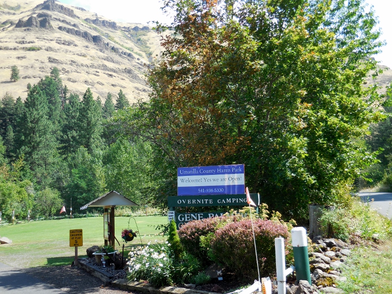
Continuing our series of favorite road rides in the Walla Walla Valley, this ride takes us up to Harris Park in Umatilla County, just over the border in Oregon. It's one of the longest rides we do, and we tend to add on a few extra miles by riding farther west to begin the ride than this map indicates. Fortunately, we go right through Milton-Freewater in each direction so can stop for a rest room or food stop, as needed. 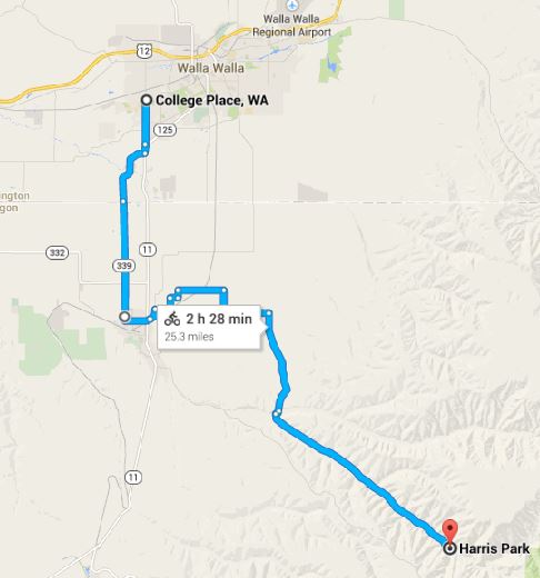
This is also one of the hillier rides we do in the area, as it climbs up out of the valley into the hills along South Fork Walla Walla River Road to the park. Of course that makes for some fun riding on the way back, once we've paid the piper on the way there! 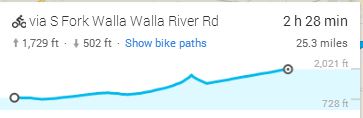
This county park is a true hidden gem. And amazingly, we usually have it almost completely to ourselves when we ride up on a weekday, though I'd imagine it gets more use on weekends. That's exactly the reason we avoid it then -- to avoid traffic coming and going on the road. 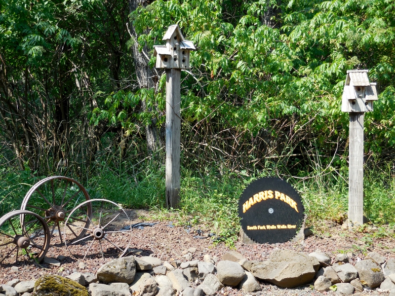
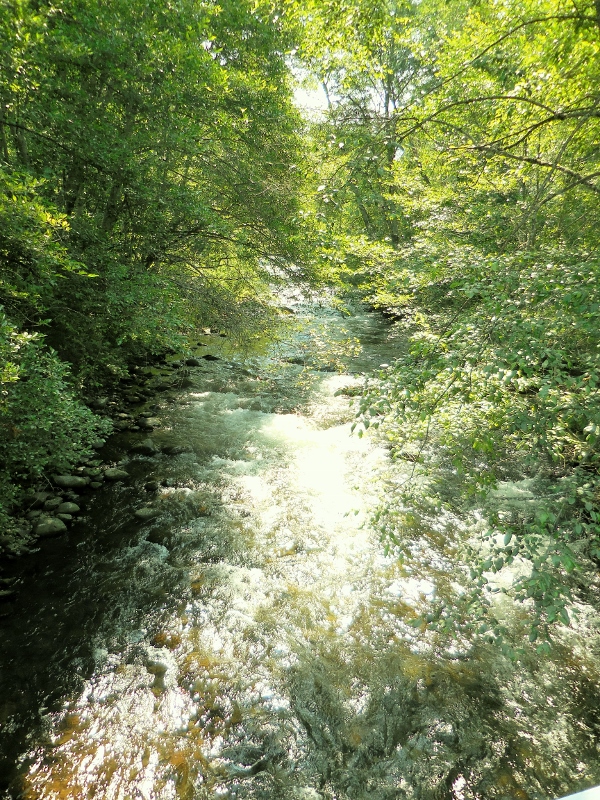
South Fork Walla Walla River
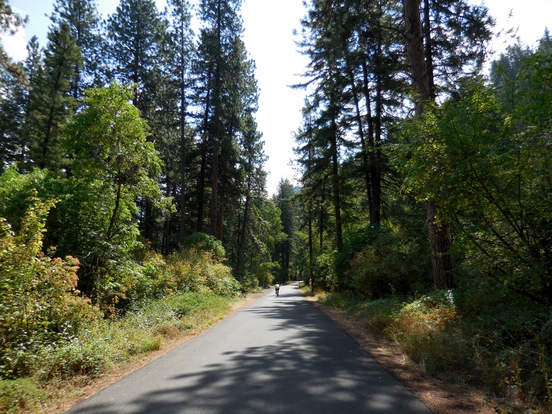
Barry riding in Harris Park -- we have it to ourselves!
Once the road turns to gravel, you can ride for many more miles...wish we'd brought our mountain bikes! 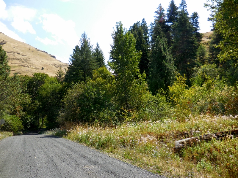
The day-use picnic area -- empty, as usual. Does no one know about this beautiful place but us?! 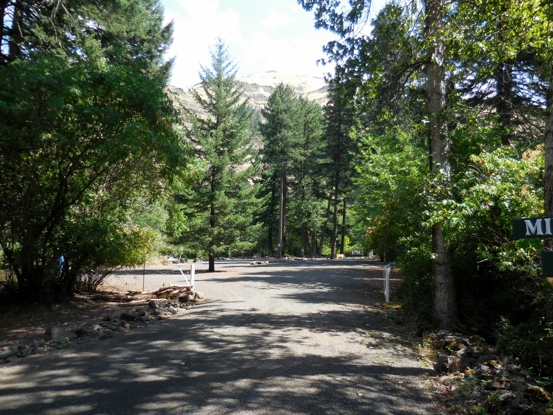
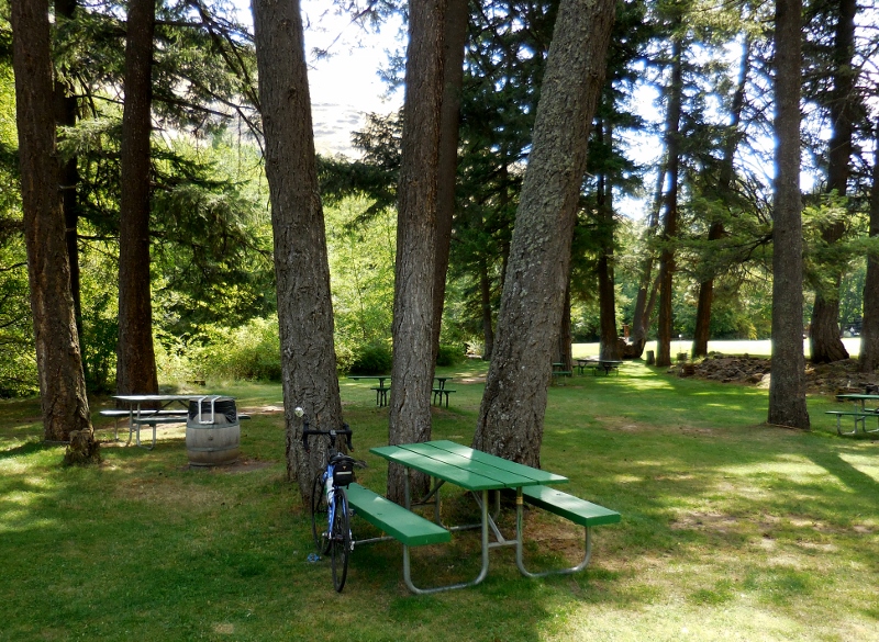
Day-use area...just me and my bike taking a break
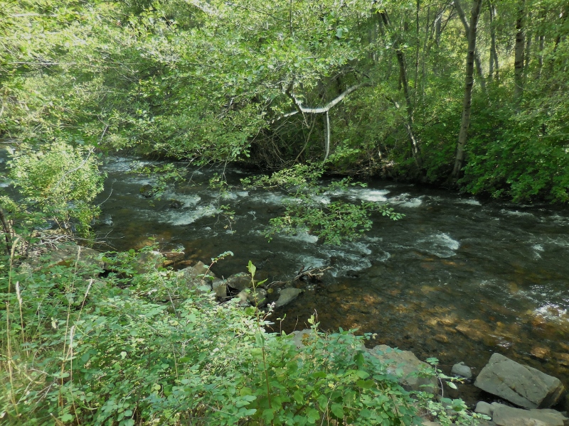
South Fork Walla Walla River running behind day-use area
The small campground is equally deserted, save the camp host. What a lovely place to camp this would be. You can hear the roaring Walla Walla River from the road, so it would be even louder from the tent and RV sites that back right up to it. Ahhhhh.... 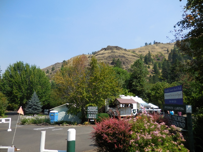
Campground with RV sites to left and camp host in center
Tenting area at campground
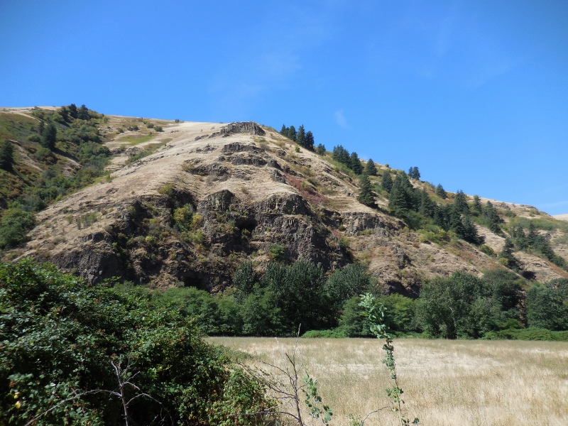
The ride to and from the park is as special as the park is and includes some of the prettiest scenery we've seen in this entire area. The terrain is more varied than down in the valley as well, and there's actually some shade here and there -- rare in the valley. 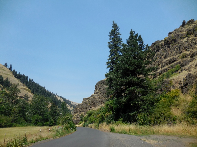
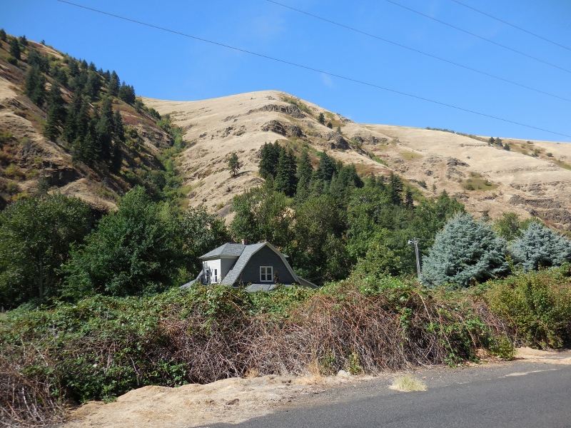
I always admire this neat, tiny farm right by the road. I could live here...well, a few months a year anyway! 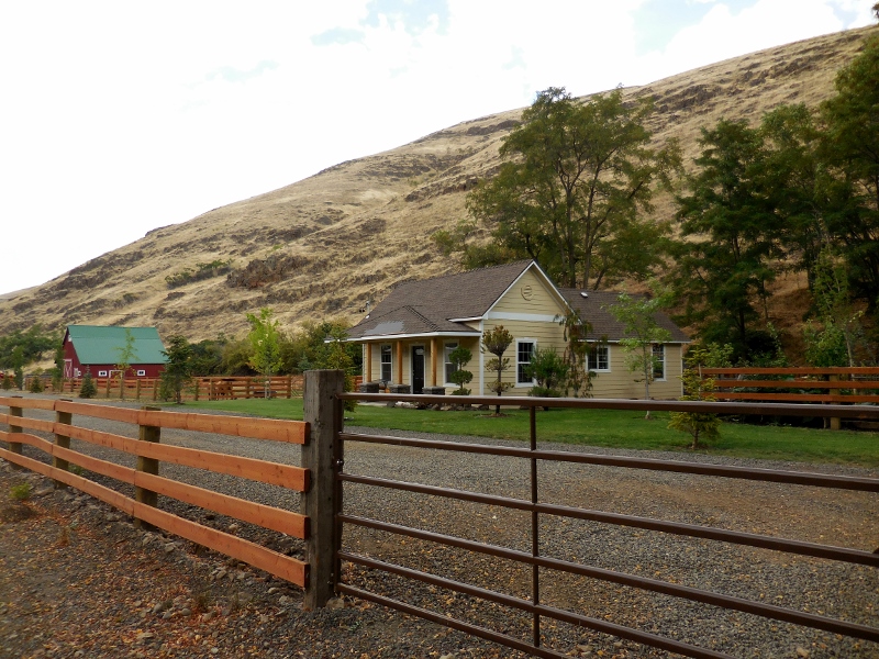
There are loads of blackberries dripping from each side of the road, free for the picking. Oh yes! 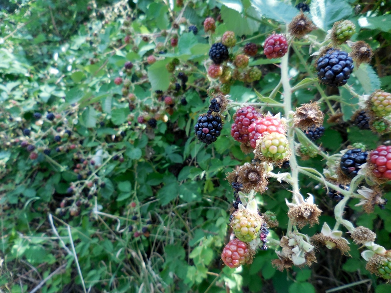
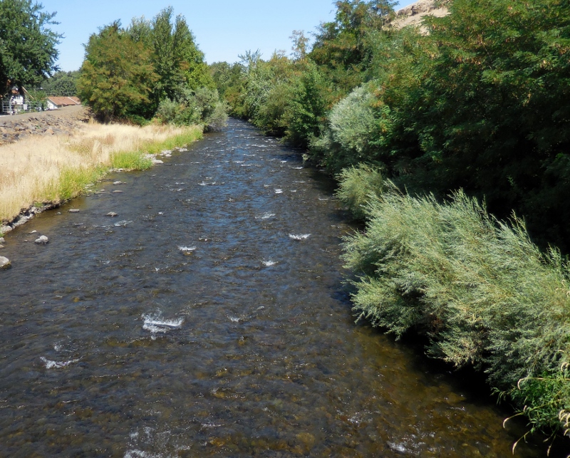
There are numerous river crossings along the way. 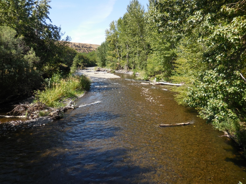
South Fork Walla Walla River
The water is seriously clear! 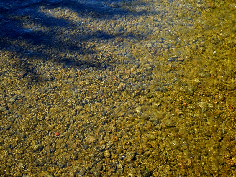
In a flashback to our former lives, we came upon a piece of Northern Telecom switching equipment right on the way to the park, a DMS-1 Urban. Barry and I both worked for NT for many years, so seeing this old logo brought back a lot of memories. 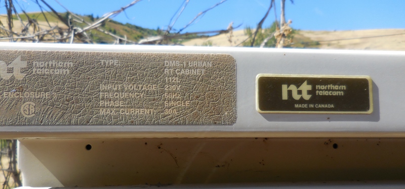
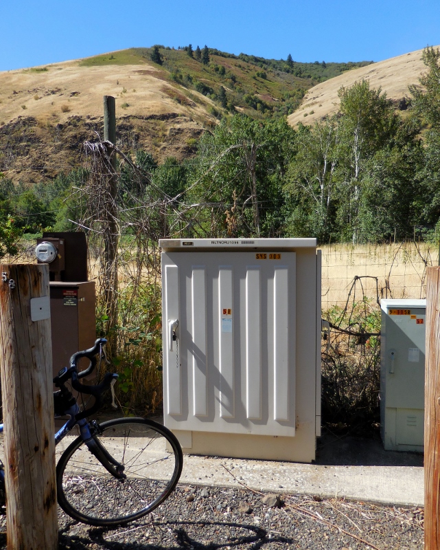
DMS-1U in cabinet along WW River Road
So, there you have it, another of our favorite bike rides in this beautiful area.
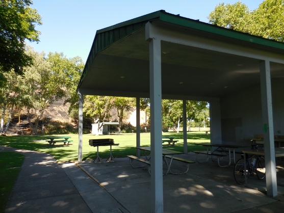
Yesterday morning we hopped on our bikes, as we do most mornings, and headed south into Oregon. Walla Walla is so close to the WA/OR border that we end up doing a lot of cycling in our neighboring state. Since there's a perfect city park for a rest stop in Milton-Freewater, it's a rare ride where we don't end up there at some point on the ride. The ride started the same as many of our rides: ride to Milton-Freewater for a quick pit stop at Yantis Park. There are decent rest rooms, plenty of picnic tables, shade trees, and even a nice sink with running water in the shelter where we usually stop. 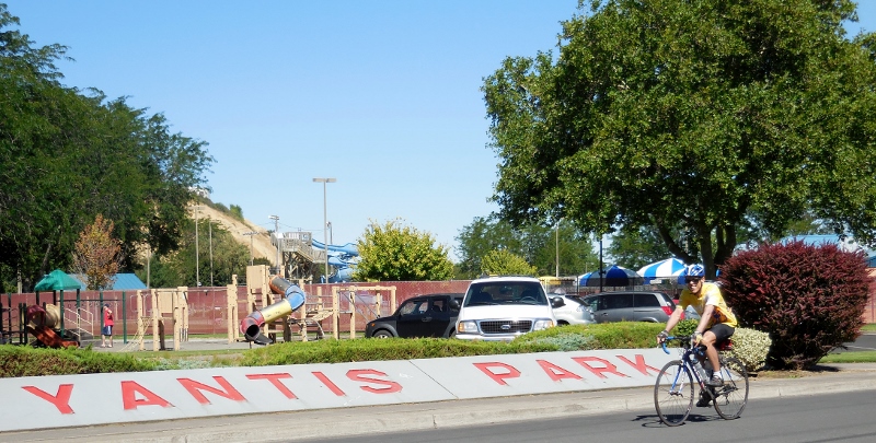
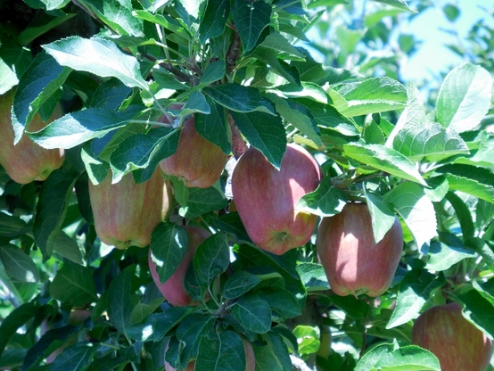
We then headed west to Lower Dry Creek Road, passing numerous apple orchards on the way. Apples are starting to get red! 
Up until this point the roads are primarily quite flat in the valley, but once we reach Lower Dry Creek Road, we started hitting some rollers and a long gradual gain in elevation as we continued south. Here's the elevation profile for the full ride. So far we're still on the less steep portion to the left of the profile, but things would start to change soon. 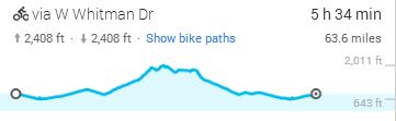
Elevation profile of our three-town tour
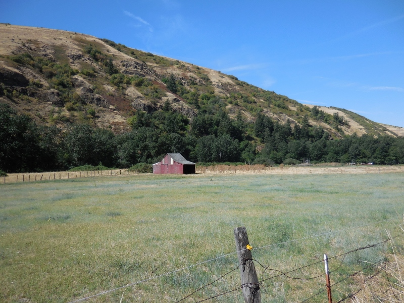
I always seem to have a difficult time on Lower Dry Creek Road, with its rolling hills and gradual ascent, so Barry did his best to motivate and coach me along, coming up with some "Bear-isms" for me, like "This is the last climb," and "It's all downhill from here", "it's like the bike is pedaling itself," and "it doesn't even feel like a hill". These pithy sayings are optimistic, but unfortunately never quite true. But I do appreciate his efforts! There's a steep, short climb at the end of the road as it climbs up to meet Highway 11. Then, after crossing the highway and enjoying a nice descent (the dip about 1/3 of the way from the left on the elevation profile), there is a very long climb to a ridge prior to descending into the small town of Weston. The scenery is gorgeous, though, and we especially loved this beautiful barn. A sign said that it was built in 1916. 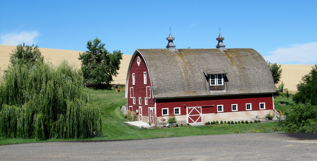
Climbing to the ridge amidst fields of wheat -- legs don't fail me now!
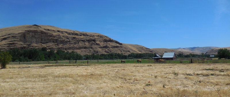
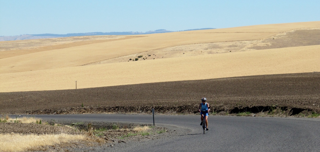
Once we got to the top of the ridge and almost to Weston, we looked down and could see the "empire" of Smith's Frozen Foods. (No relation!) There is a nice descent into town, but you can't go too crazy, as there is a stop sign and left turn at the bottom. 
Smith's
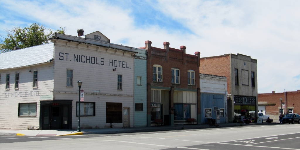
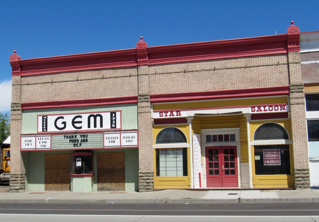
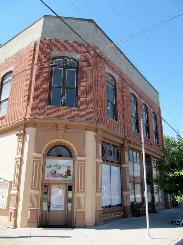
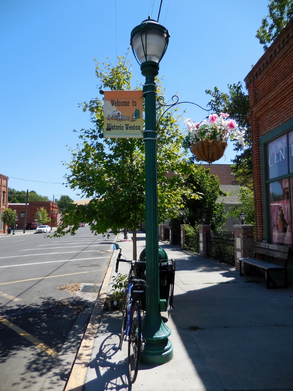
Weston is small and quaint and was quiet on this Sunday morning since most everything was still closed. Love little historic downtowns like this! 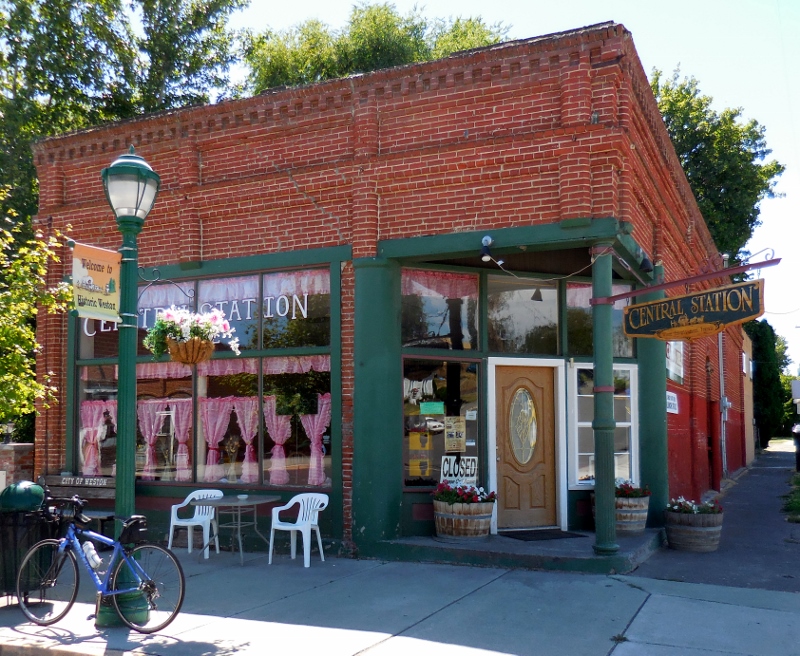
Weston has one of the cutest public libraries I've ever seen. Fun-sized, just like in Belize! 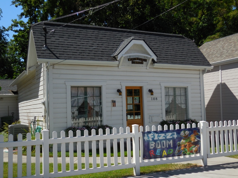
Weston Public Library
Not much action at the Police Department! 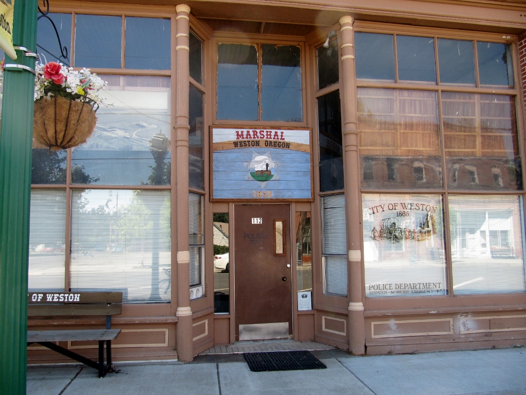
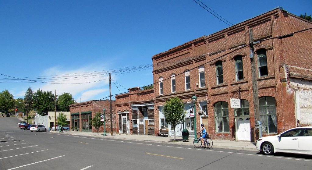
Downtown Weston, Oregon
After checking out Weston, it was time to head a few miles west towards the next small town, Athena, not too many miles down the road. There was a long climb out of the other side of Weston. On the elevation profile above, we're at the high point and pedaling up and down the little bumps in the ridge. The worst, as Barry would say, really is almost over at this point...or so we thought. 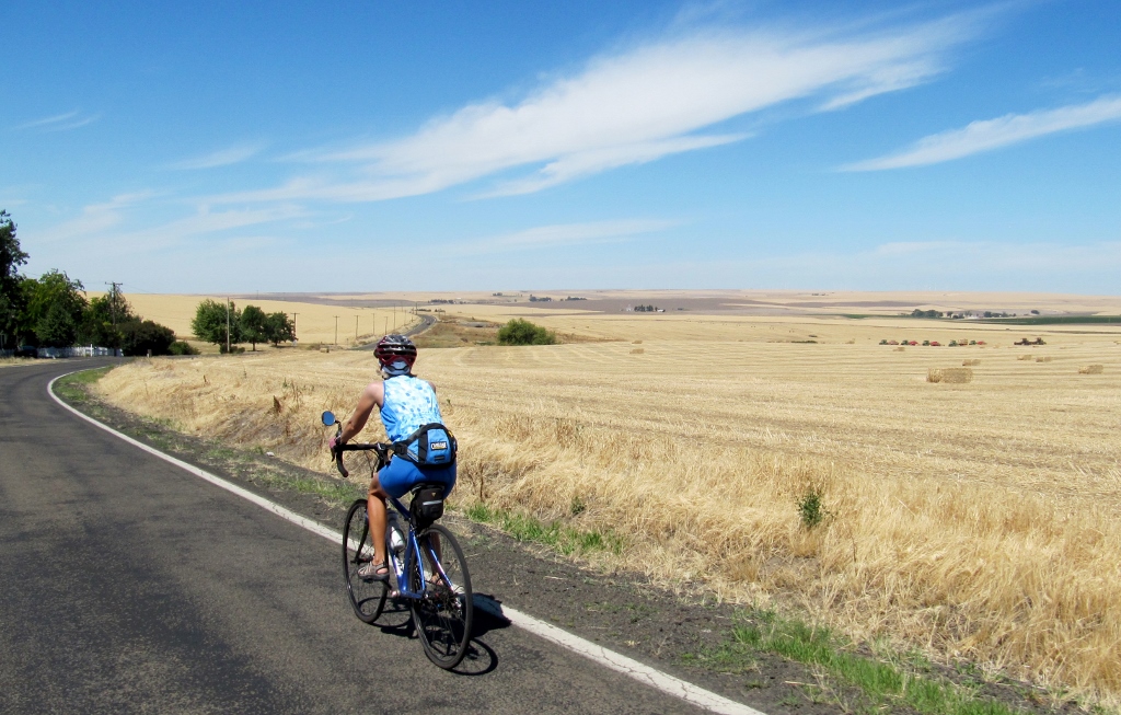
We crossed Highway 11 again and had a nice descent into Athena. 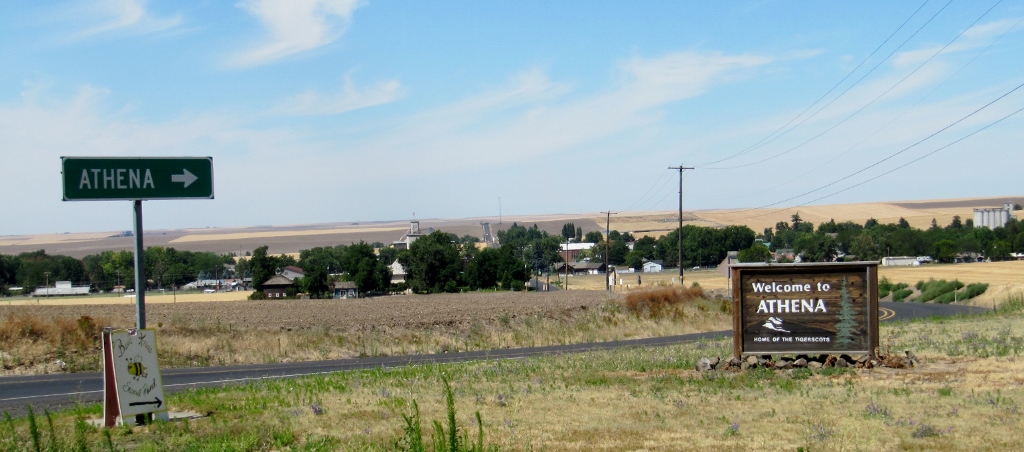
Athena also had a charming historic downtown with a slight edge on Weston because it had a bike lane. Surprising in such a small town, but we'll take it! Though with the amount of traffic at this time of day on Sunday, we really didn't need it. 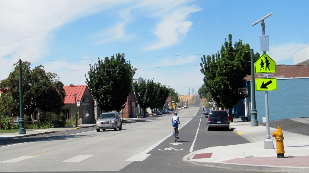
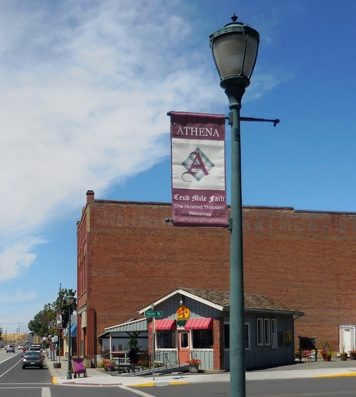
Some of the old buildings were a little shabby and/or boarded up and for sale. Ripe for historic preservation...let's hope someone sees the potential here, as the architecture is gorgeous. 
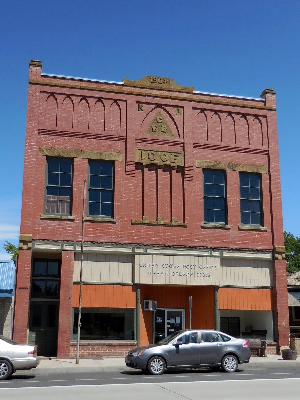
The post office is housed in this 1904 building
Hate seeing an old movie theater boarded up...
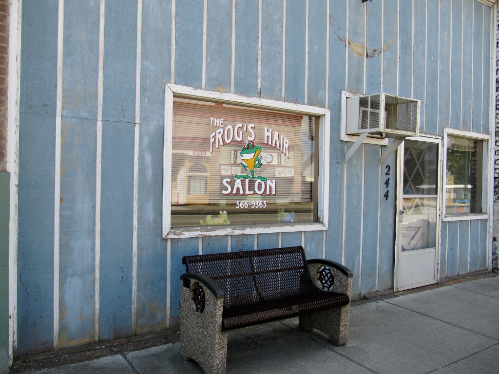
Not sure I'd be brave enough to get a cut promising "frog's hair" :-)
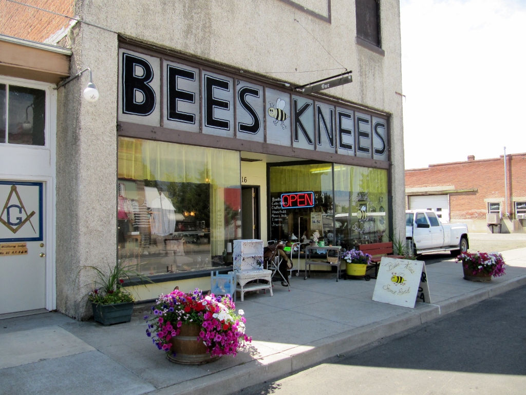
Cute second-hand shop
Leaving Athena, we climbed back up to Highway 12 and turned towards the north. There's a huge shoulder on the highway, and soon we'd hit a several-mile descent. Sounds great, right?! Well, up high on the ridge, all of a sudden there was a strong wind blowing -- right in our faces. We really hadn't had any wind all day, and when we least needed it and from the worst possible direction, there it was. Even pedaling downhill can be challenging with a stiff headwind, so we had to put our heads down and pedal hard. So much for this part of the ride being fun. It was simply to be endured. We were relieved to reach our turn at Lower Dry Creek Road since the minute we got off the highway, the wind didn't seem as bad. The lower we went, the less of a factor wind was. 
Along Lower Dry Creek Road
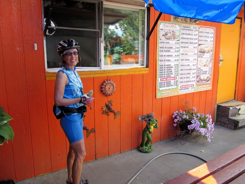
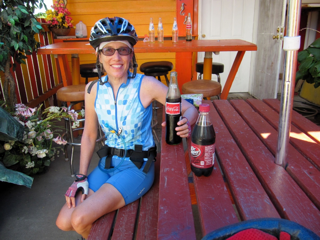
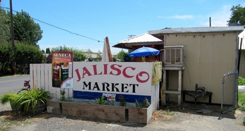 Once we got back to the valley and were cruising fast along Old Milton Highway, heading north back to Walla Walla, I realized I could really use a cold beverage. The water I had left was very warm, as was the day (mid-90s), so it was just not refreshing. We've been wanting to stop at this little Mexican place, Jalisco Market, right at the Oregon side of the border, so today was our chance. It proved to be a good choice indeed. This place is Mexican-run and completely authentic, homemade tortillas and salsa (muy caliente!), and everything made to order. The food was delicious and inexpensive, and the sodas were exactly what we needed at that time -- sugar and caffeine. We don't drink sodas normally, but on a long, hot bike ride, we make exceptions. 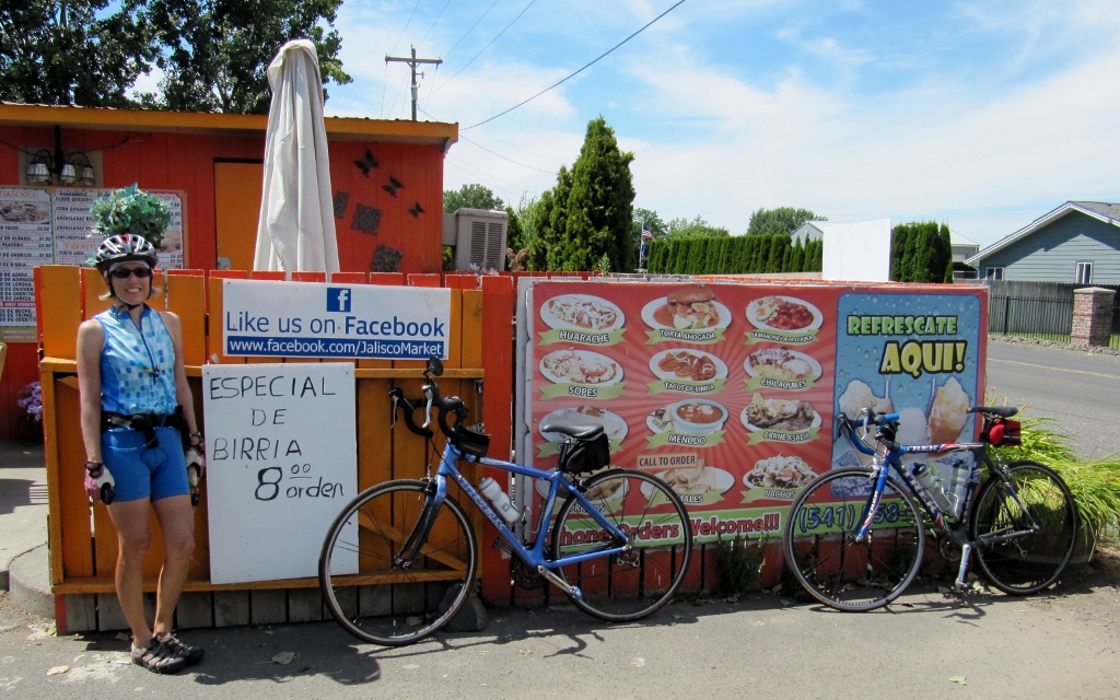
I wasn't all that hungry (mostly thirsty), so ordered just one Taco Placero (pork), but Barry went for broke and got the huge Burrito Veggie. 
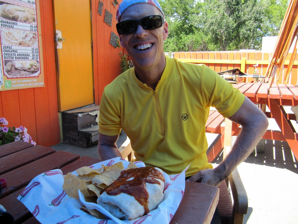
And he ate it all, minus a few chips he shared with me!
We just adore little places like this and will certainly be back!
We finished up our ride by riding the last ten miles or so back for a total of 62.7 miles (for me, Barry did a bit extra to get 65). I hadn't intended to ride a metric century (62.5 miles or 100K), but riding with Barry, I often ride more than I planned. It's those "Bear-isms" that get me! |
Emily & BarryWe're a long-married, early-retired couple who are currently traveling as nomads with no fixed home base. After years of living in North Carolina (Emily's home state), we spent 18 months living oceanfront on Ambergris Caye, Belize, a year road-tripping the US in a Honda CR-V, a year in Playa del Carmen, Mexico, and are now roaming North America in our 32' motorhome, Pearl, following warm weather whenever possible. 
Paisley, May 2016

States visited (pre-RV)
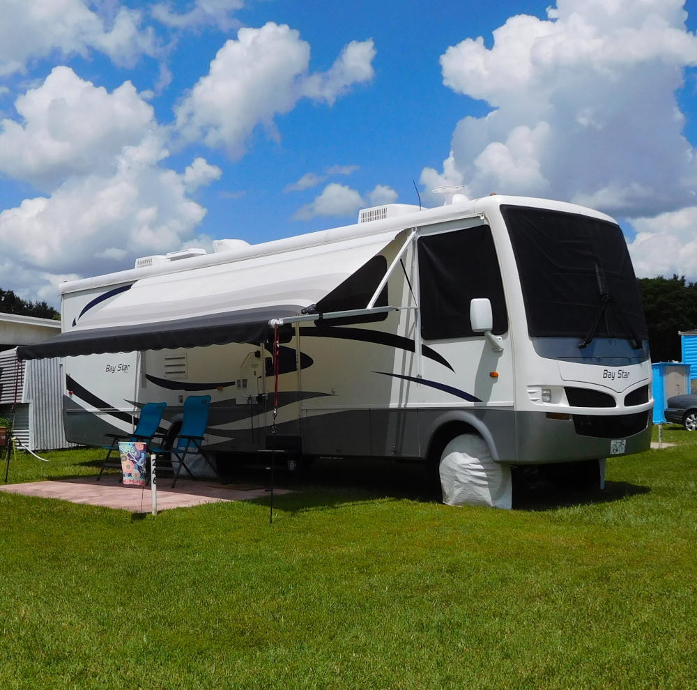
Pearl, a 2007 Newmar Bay Star
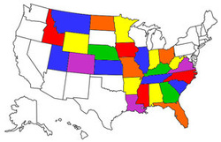
States visited in "Pearl"
Archives
July 2019
Favorite Travel Blogs |
 RSS Feed
