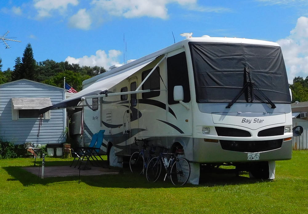
"Pearl" in Winter Garden, Florida
|
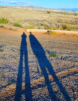
Long shadows in Wyoming
|
|
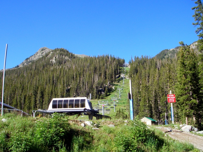
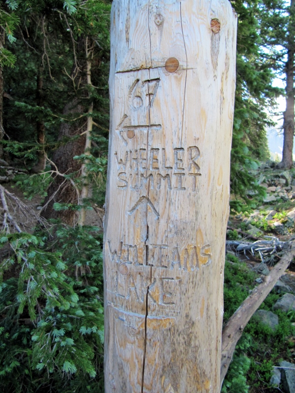
We never came to New Mexico with the intent to hike to the summit of the highest peak in the state, Mount Wheeler (elevation 13,167'). We're not really what you'd call "peak baggers"; in fact, we didn't even know what the highest peak in the state was until we got here and read a brief blurb about it in a travel brochure. Once we learned of it, though, we thought "Wouldn't that be a fun thing to do while we're here?" Well, why the heck not? Perhaps because we really hadn't been training for a hike of this intensity? Nah...that wouldn't stop us. We'd been hiking and biking quite a bit, and since we'd been in New Mexico for ten days at this point, we'd become pretty acclimated to the higher elevation. So, we decided to give it a go -- nothing like a little adventure to keep things fresh, right? So on the morning of July 19, we got going and made the drive up to Taos Ski Valley to start our hike. The weather was perfectly clear at the start, but storms were in the forecast later in the day, and one place you don't want to be is above the treeline when lightning is striking, so we knew we couldn't dawdle. 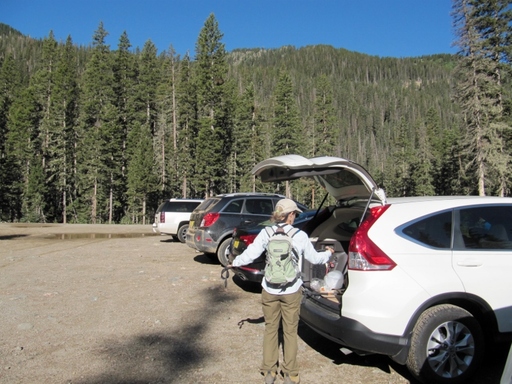 We hiked through the ski area and over to the official starting trail, Williams Lake. We'd already climbed some just getting to this trailhead, and this two-mile trail would give us plenty more climbing before we got to the really strenuous part of the hike.
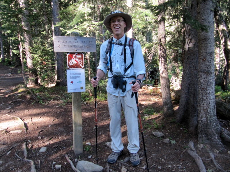 Williams Lake Trailhead
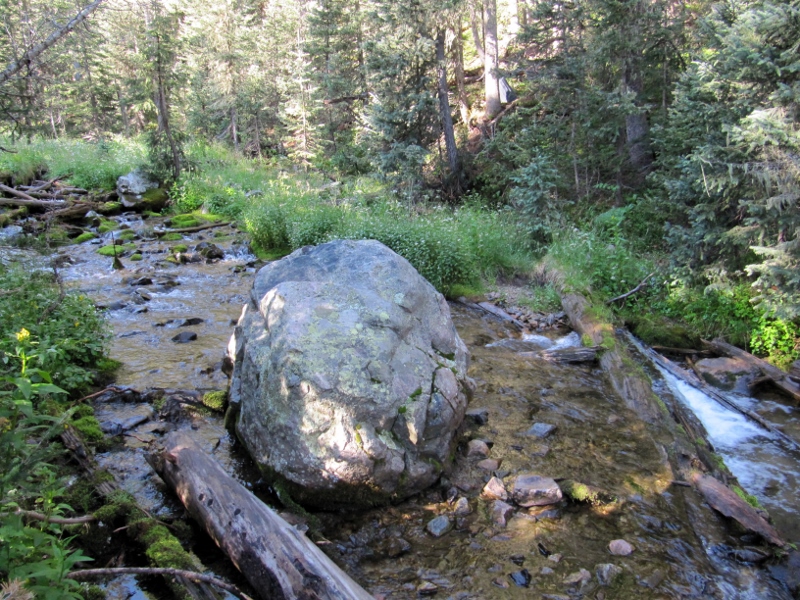
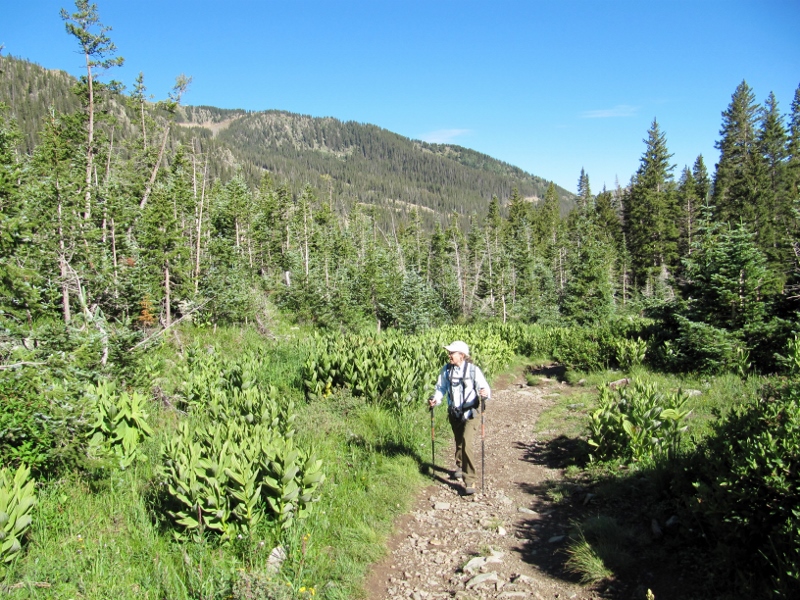
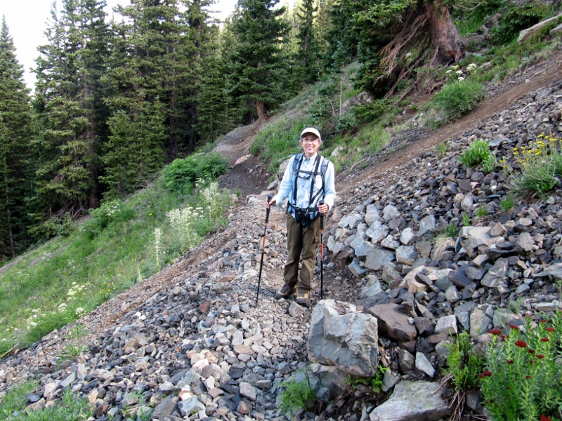 We thought this was rocky, but it was nothing compared to the talus we'd have to cross numerous times on the last 1/2 mile of the trail 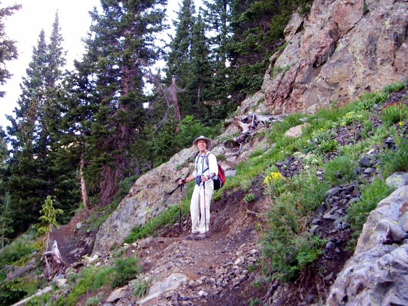 There were some pretty wildflowers, and even more beautiful views, along this part of the trail. I felt like we were in the Alps (though I've never been there!) 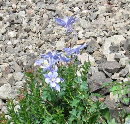 Wild Columbine Continuing upward, we caught of a view of Williams Lake below us. If you look closely, you can see small patches of remaining snow on the peaks across the way (left side of photo). 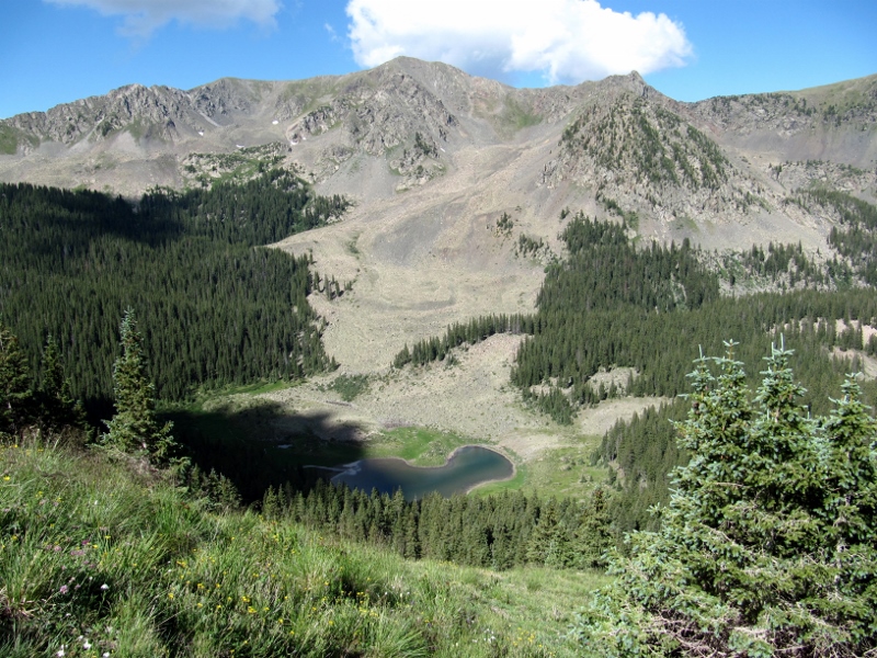 Williams Lake As we emerged from the treeline, we could see the trail before us going up, up, up. Kind of daunting! 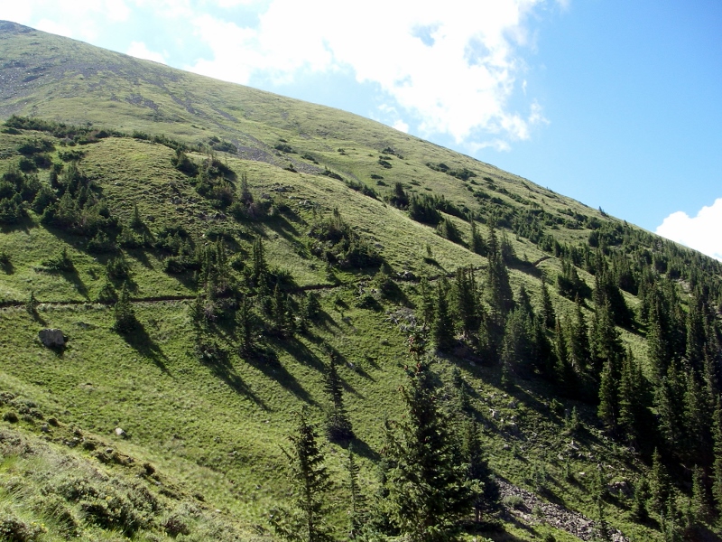 I love the photo below. I call it the "Sound of Music" shot as Barry looks like he is singing "Climb Every Mountain". What do you think?! He was definitely loving this hike. 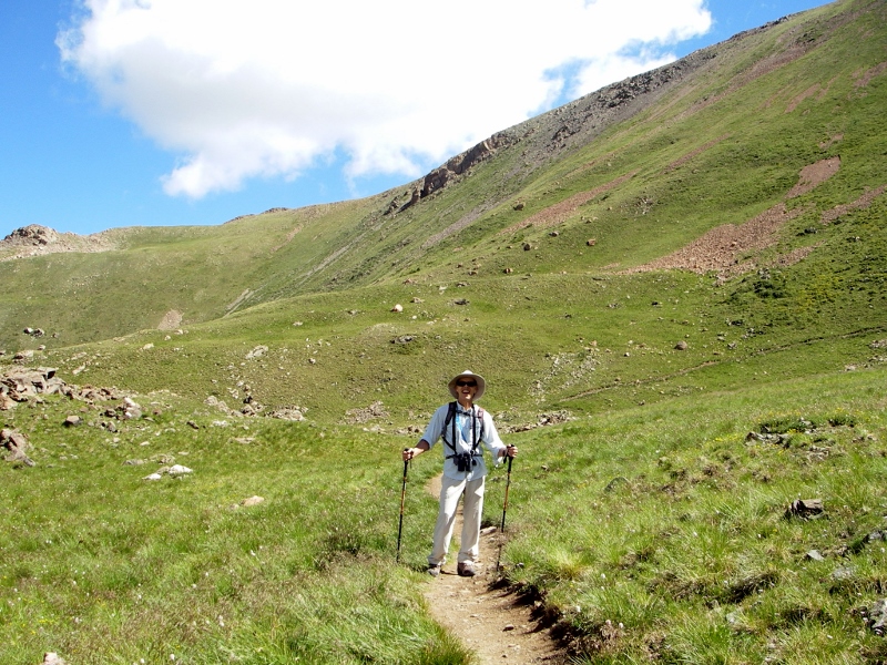 Next up, we started hitting the talus/scree areas. Basically these are parts of the trail where the terrain is comprised of loose stone. Smaller stones are called scree, and larger are called talus. These areas can be slippery and difficult to traverse, and we were glad for our hiking poles to help us keep our balance. We saw other folks doing the hike who were not wearing appropriate hiking boots or using poles, and I wondered how they did it. Of course, it helped that they were mostly a lot younger than us! 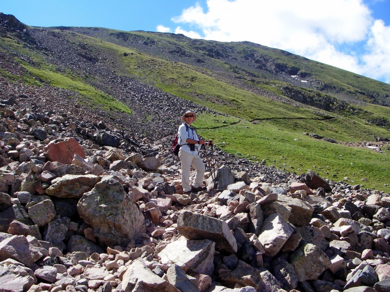 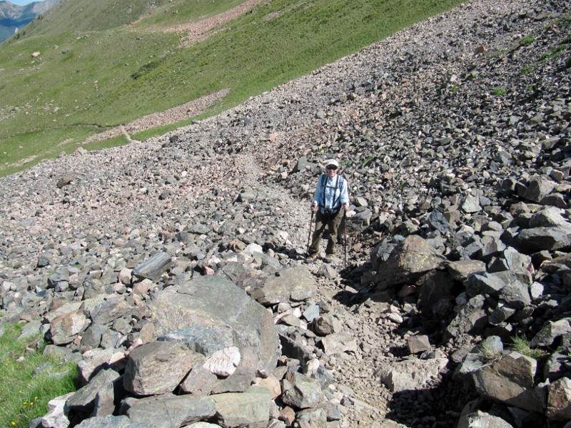 If you think I wasn't huffing and puffing like crazy, you would be mistaken. This talus/scree was not only slippery, it was steeper than the photos can show. I had to stop several times just to let my heart rate get back to something resembling normal. The air is very thin up here, as the elevation went from just over 10,000' up to over 13,000', and we are used to living at sea level or just a bit above. Fortunately we weren't plagued with any altitude sickness, but it was hard to catch your breath. 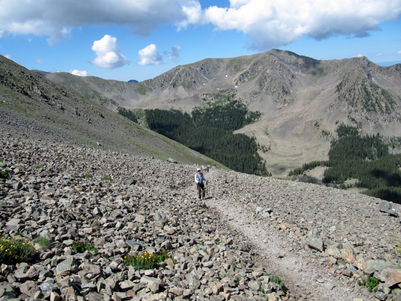 Scree, scree as far as the eye can see! The views were just getting better all the time, though, making all the pain worth it.
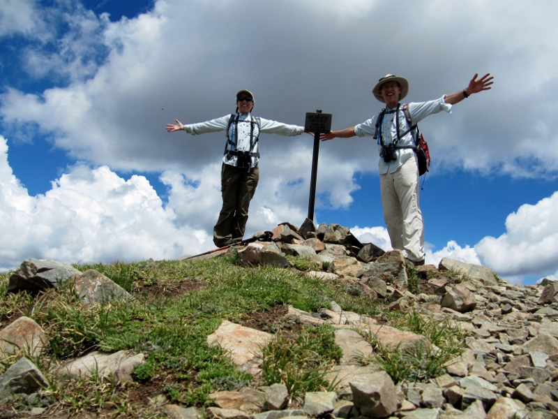
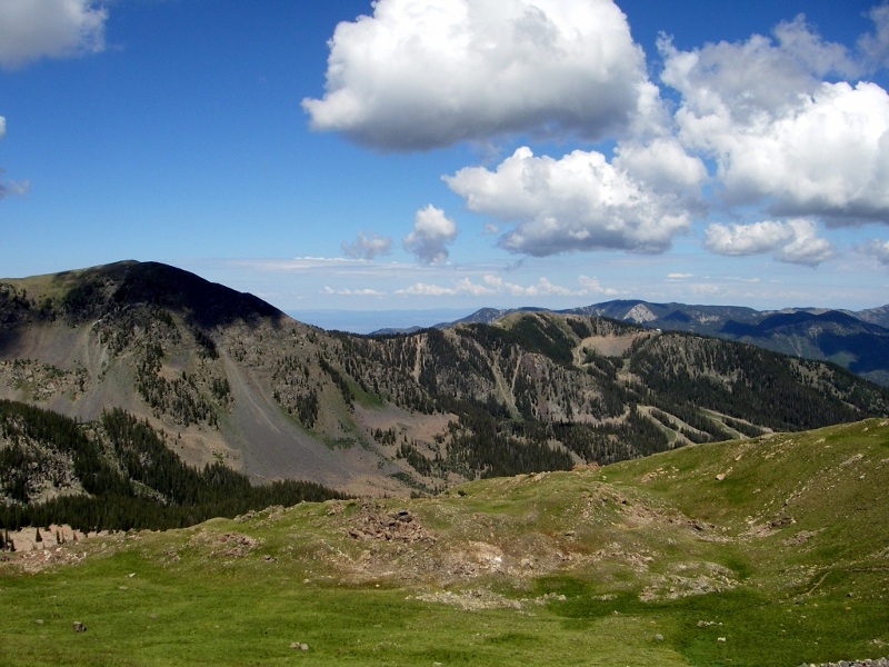
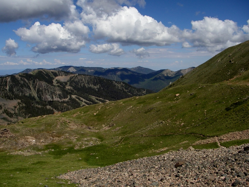
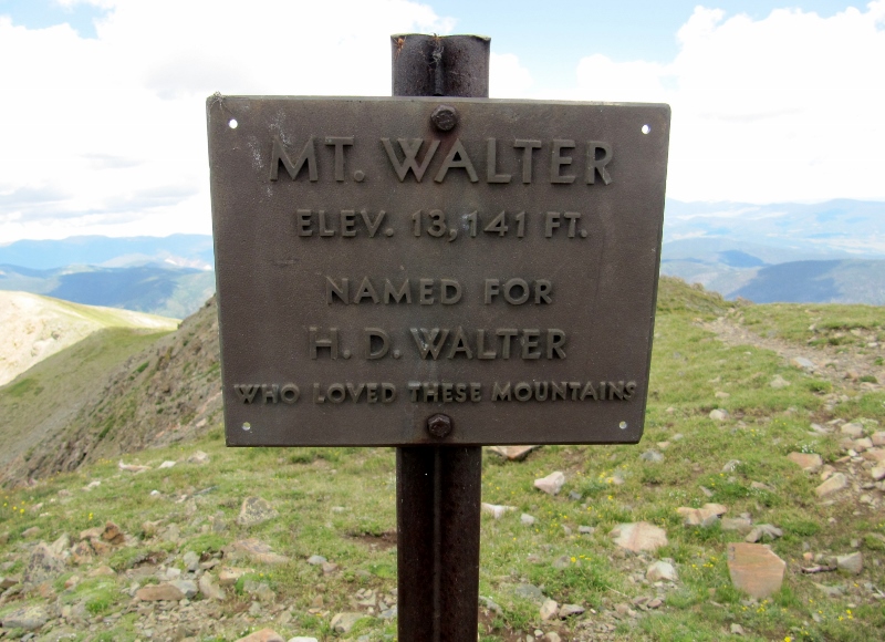
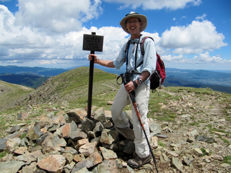
Once we finally got up high enough, we had to hike along the ridgeline to get to the Wheeler Peak summit. 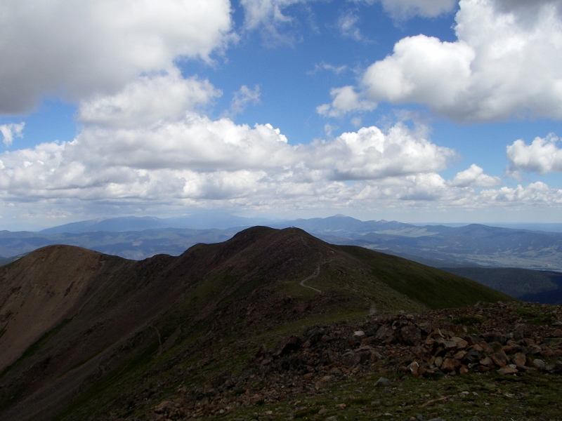 After what seemed like forever, we could finally see the light at the end of the tunnel. And it appeared we had a guide to help us the now-short distance to the summit! This female mountain goat was so tame we practically had to chase her off the trail so we could continue. 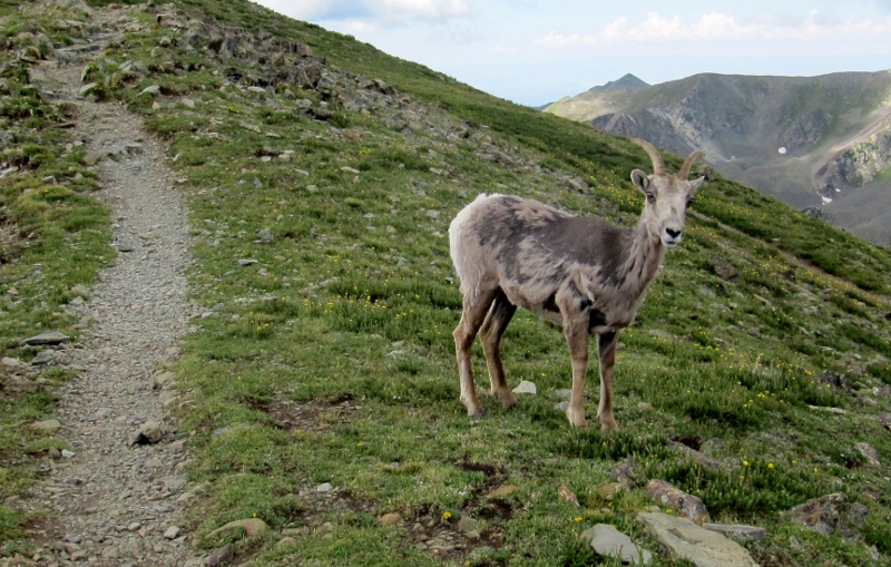 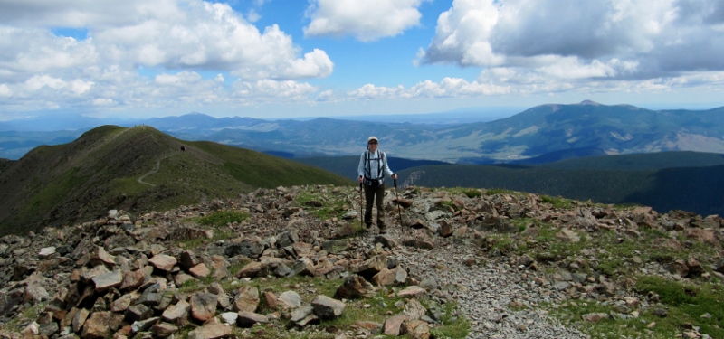 We did it!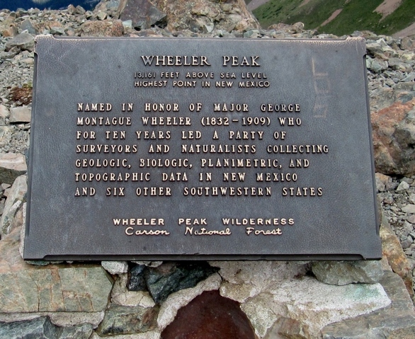 We met another friendly couple at the summit, and we took photos of each other. They were taking the longer way, around the back side of the mountain, both ways. Then again, they were a lot younger than us. 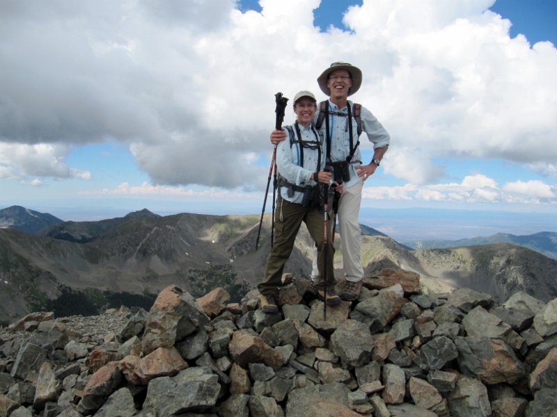 I think our "guide" was a bit of a ham too -- she surely didn't mind posing for photos. It was very cool being so close to this wild, but very tame, creature. 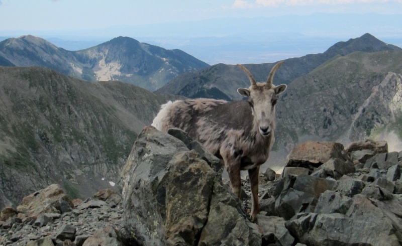 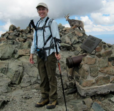 Of course we signed the logbook showing that we made it to the summit, for posterity. 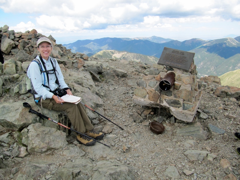 We then hiked over to Mt. Walter nearby, the second highest point in New Mexico (elevation 13, 141'). While we were in the neighborhood and all... 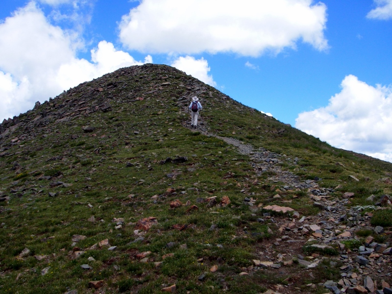
 Mount Walter summit (taken with self-timer as no one else was around) There were quite a few marmots near the peaks. This one seems to be wondering what the fuss was all about. 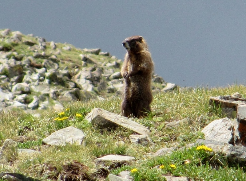 As we turned and started making our way down from the summit, we could see storm clouds off in the distance, and we were very glad we were heading down. We actually had to hustle quite a bit to get below the treeline as storms move in quickly in the mountains here. 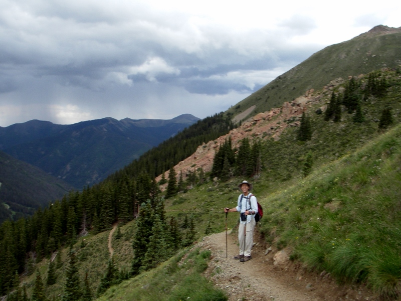 Storms not too far away now -- we were starting to hear thunder Fortunately, by the time we started hearing thunder, we were almost down to the treeline. We were going pretty fast now that we'd made it through the most challenging, rocky terrain. 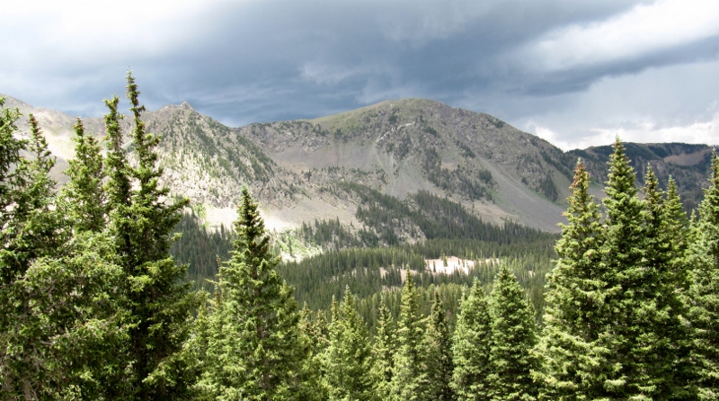 Gorgeous views with the storms in sight We made it safely below the treeline as thunder rumbled. Would we make it down before the rain began? We had to skip our planned picnic on the way down in the interest of staying safe and dry, so I was starving by this point and practically jogging down the trail. Glad it was downhill! 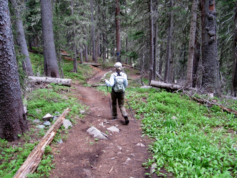 We did take a slight detour to see Williams Lake, and managed to eat a quick snack there before continuing. 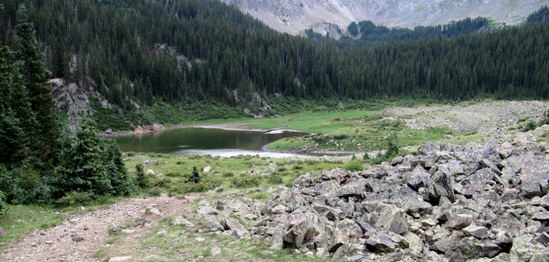 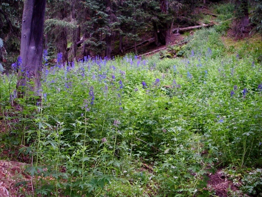 Pretty wildflowers near the lake Amazingly, even with the storms approaching, we still passed other hikers heading the other way. Not sure what they were thinking! We didn't quite beat the rain -- it started just as we were a bit past the lake, though the thunder and lightning had moved a safe distance away by this time. Barry had not brought his rain jacket on this trip, but we did have this great garbage bag, which worked well to cover him and his pack with our valuables. 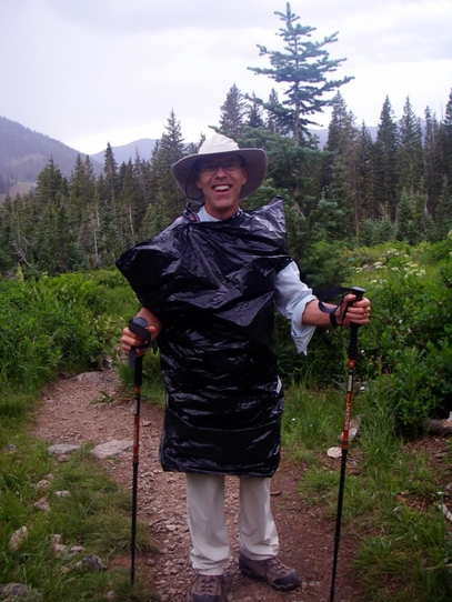 By the time we got back to the car, it was raining pretty hard and it even hailed tiny pellets for just a couple of minutes. We were so glad to be finished with the hike! 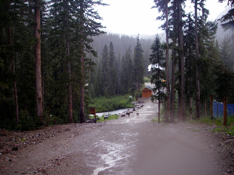 And this is what we saw as we headed back into Taos -- what a change from the morning's bright blue skies and sunshine. 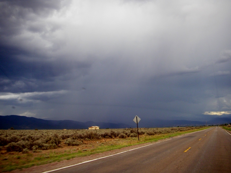 All in all, despite the rain at the end, this hike was truly a "peak" experience. We were tired but felt very proud that we'd accomplished it, especially since we hadn't really planned for or specifically trained for it, as we had for other difficult hikes in the past, like the Grand Canyon. Our total mileage including the walk to and from the Williams Lake Trailhead was 9.4 miles.
1 Comment
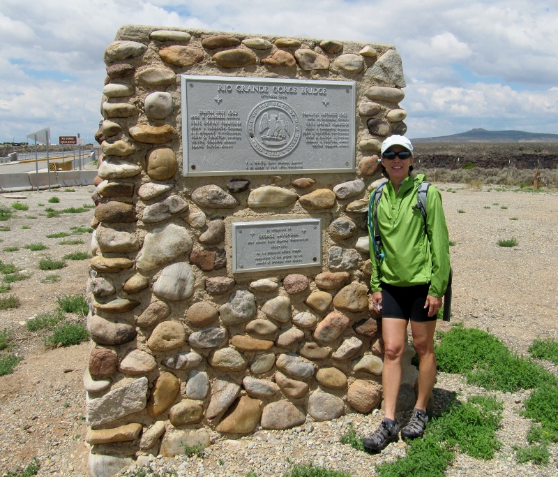
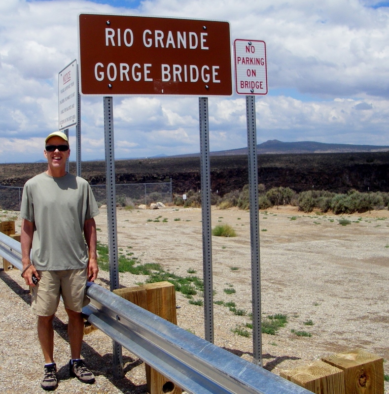
There is a ton to do in the Taos, New Mexico area. No time for boredom here! In the six days we were here in July, we could only brush the surface of all the nearby places to see, hike, bike, and photograph. Here are the highlights of a few of our adventures in the area. Rio Grande Gorge State Park and BridgeOne of the most impressive places we visited in the Taos area was the Rio Grande Gorge bridge. Turns out this is the seventh highest bridge in the US. The views of the gorge are amazing, and the bridge isn't half bad either! We walked the entire bridge in both directions -- a thrill that those scared of heights might want to pass on. It was quite windy and a little cool up on the bridge, but we had a beautiful day to visit.
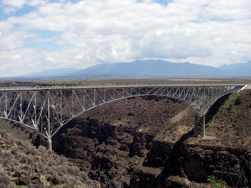 Rio Grande Gorge Bridge 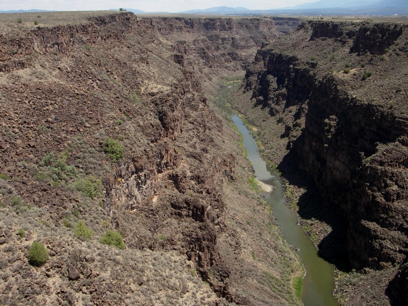 Rio Grande Gorge as seen from the bridge 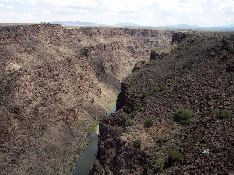 The Rio Grande Gorge State Park runs along the river and includes trails for hiking and mountain biking. This northern part of the park (Rio Grande del Norte) was declared a national monument as of March 2013. After walking the bridge, we took a mountain bike ride down the West Rim Trail. The trail started out nice and smooth, but soon became quite rocky, so we made a short ride of it. Since we're no longer spring chickens, we prefer smoother terrain. We did get to take in some additional fine views from the trail. 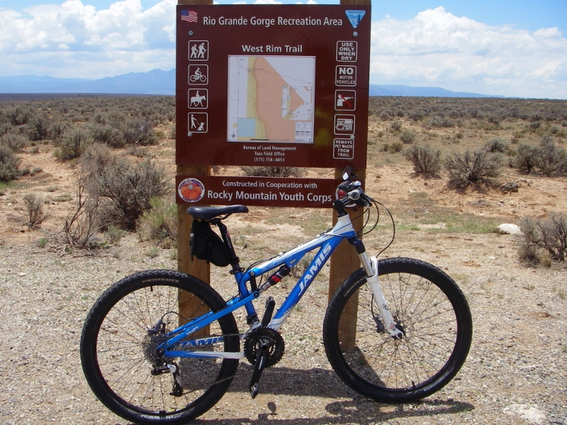 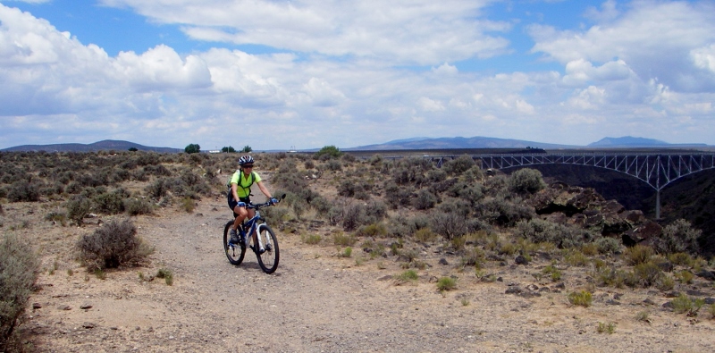 Trail started out great...  ...but soon became very rocky 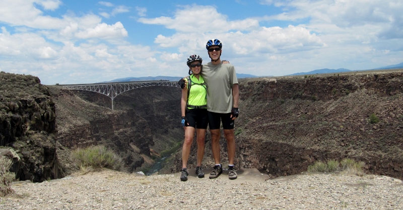 La Senda del Medio TrailOn another day in the area, we returned to a different part of the Rio Grande del Norte National Monument for a hike on the La Senda del Medio (The Middle Path) Trail. There were five small campgrounds along this trail, and most sites were primitive (i.e., no hookups). This would be a great area to camp in. It's incredibly tranquilo. All you see is lush green trees and foliage near the river and beautiful views in all directions. 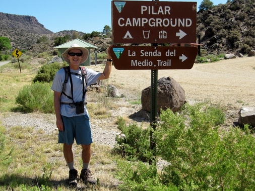 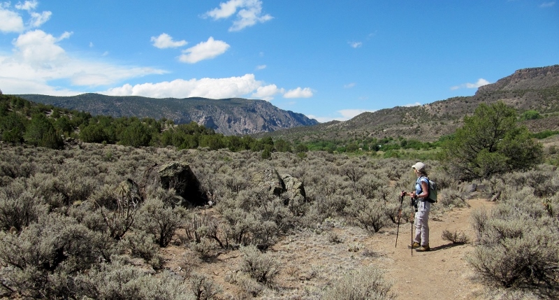 Gorgeous views and no crowds 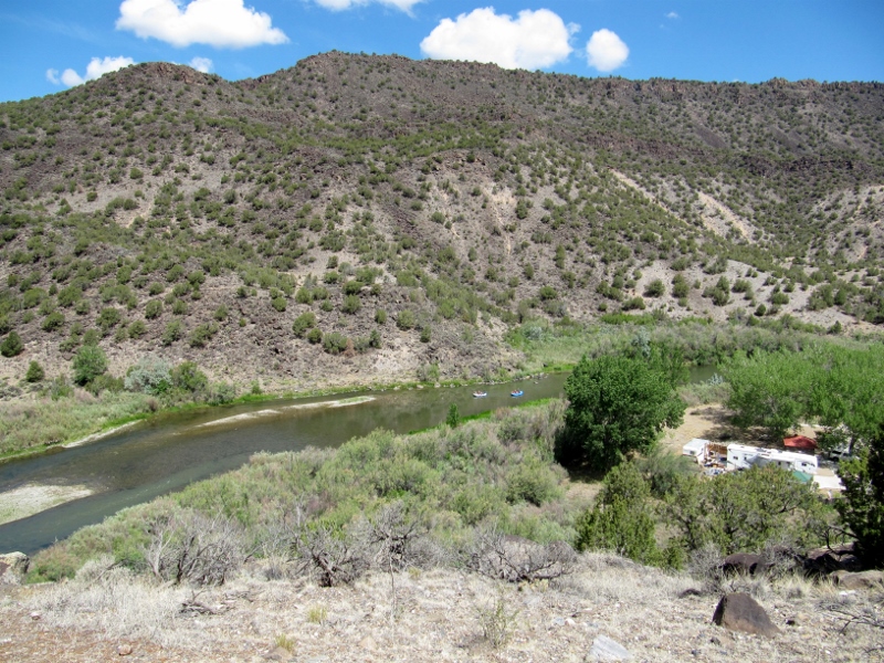 Boaters on the Rio Grande and view of one of the campgrounds 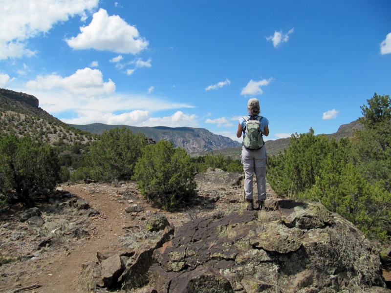 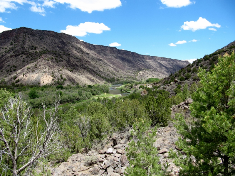 Lush greenery along the river contrasts with the rocky gorge walls 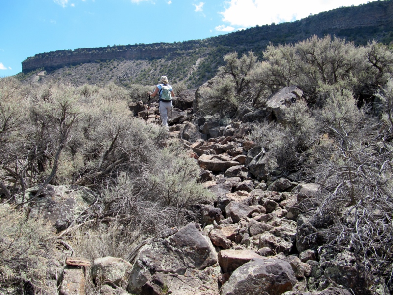 There is challenging terrain to negotiate on parts of the trail -- hiking poles recommended! The total mileage of the trail out and back is just five miles, but we did extra by taking spurs to most of the campgrounds. The terrain is primarily moderate, with some rocky terrain and steeper climbs, especially near the far end of the trail (see photo below). 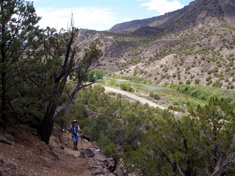 Barry climbing up, up, up near the end of the trail We stopped for lunch in this unoccupied shelter in the Petaca Campground before turning around and returning on the trail. 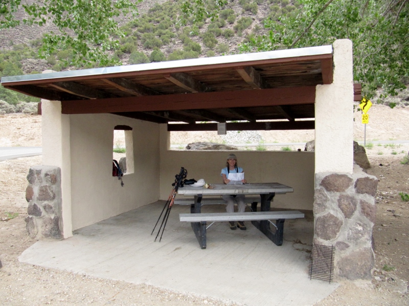 Taos Valley Overlook TrailsAnother "hidden gem" (not so hidden, really, but that always sounds good!) just south of Taos is the network of trails called the Taos Valley Overlook -- you really can see for miles and miles here. Also in the Rio Grande Gorge Recreation Area, these trails are available for use by hikers, mountain bikers, and equestrians. If you're hiking, you'd want to go on a cooler day as there is no shade. But on this day we were mountain biking, and we had a beautiful day for it. And only a few other people were using the trails mid-week. I suspect weekends would be busier. 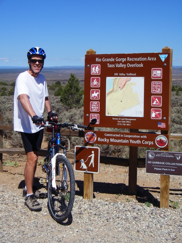 We started out on a double-track trail that took us slightly downhill to the gorge overlook. 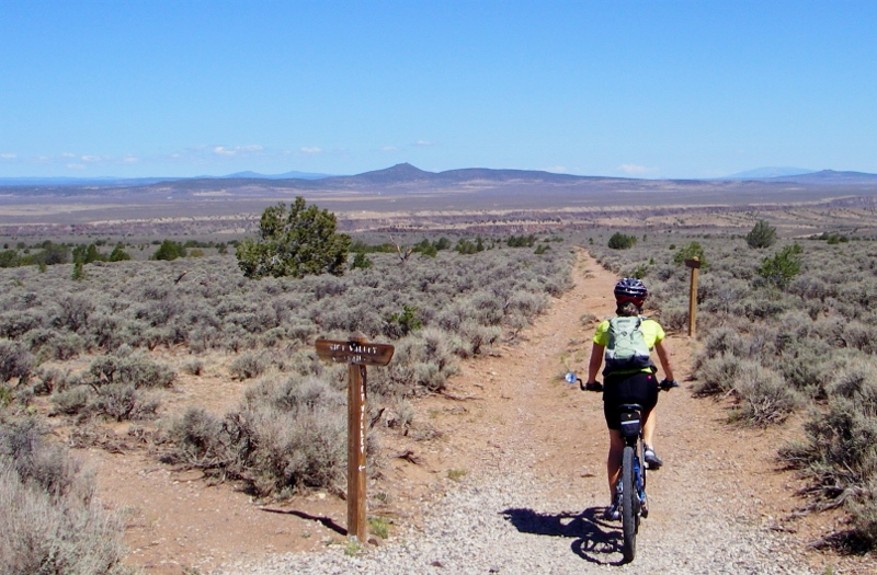 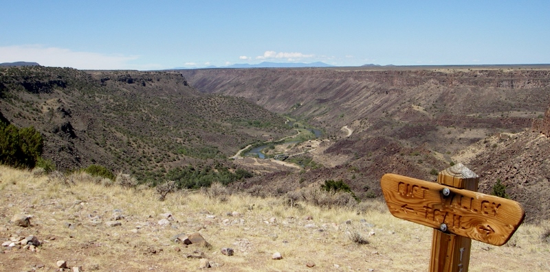 Rio Grande Gorge We rode the double-track trails until they got too rocky and washed out, then switched to singletrack, which was in much better shape. Sure, we (especially I) had to walk in a few places as we're not that experienced with singletrack, but it was still a great time. Barry did really well and seemed to enjoy himself quite a lot. 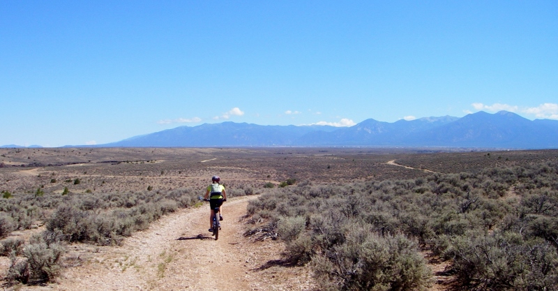 Double-track 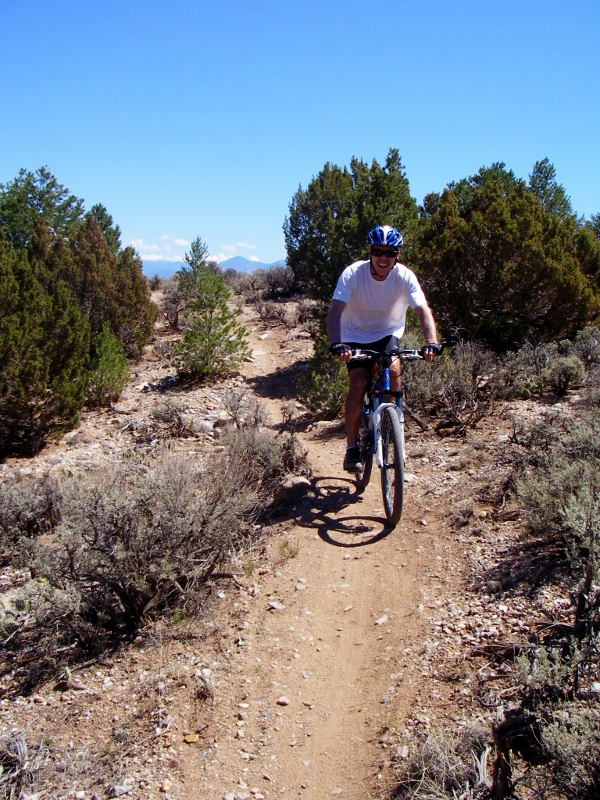 Singletrack  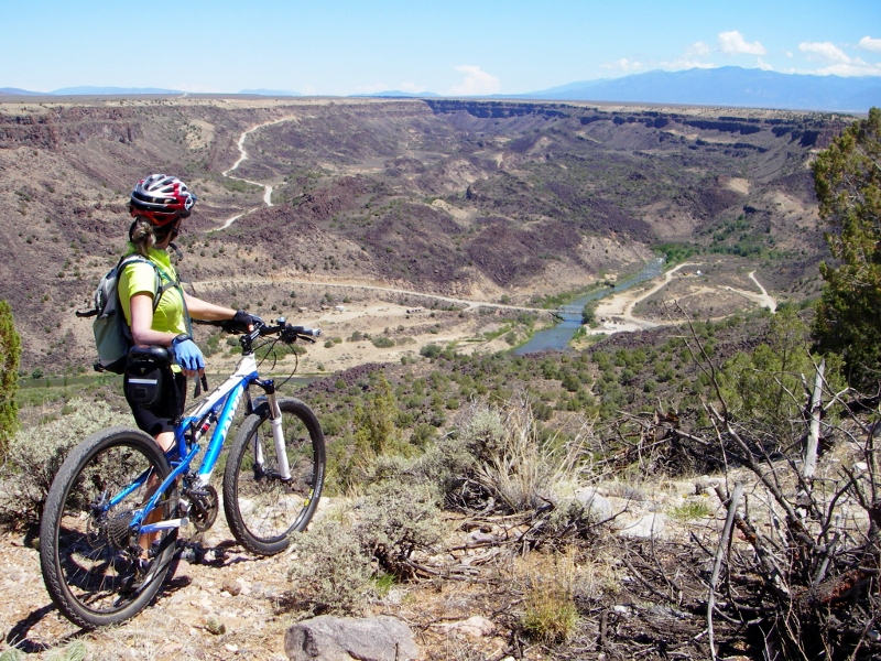 Fantastic views Barry was having so much fun, he headed back out for a little more riding while I took some final photos. 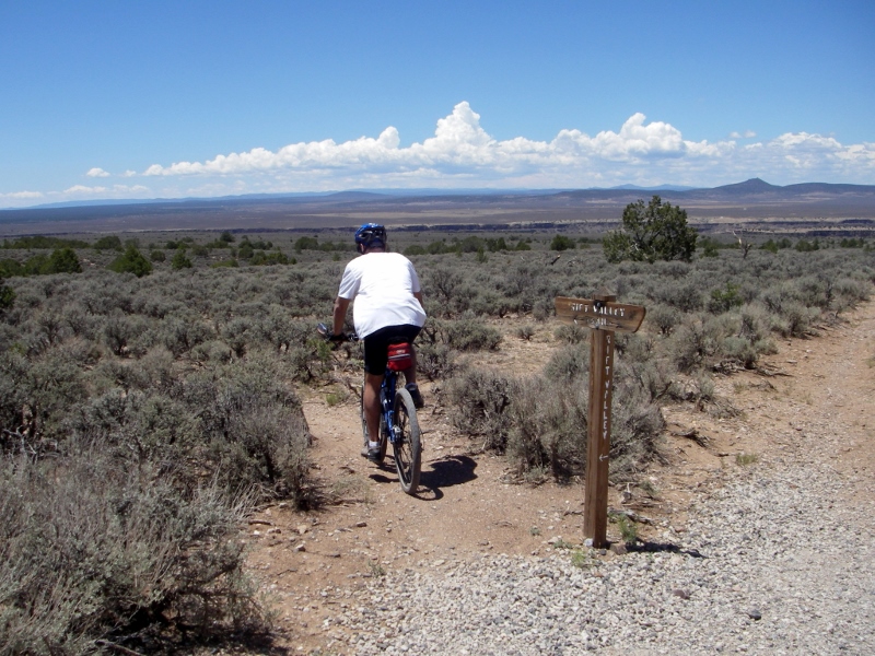 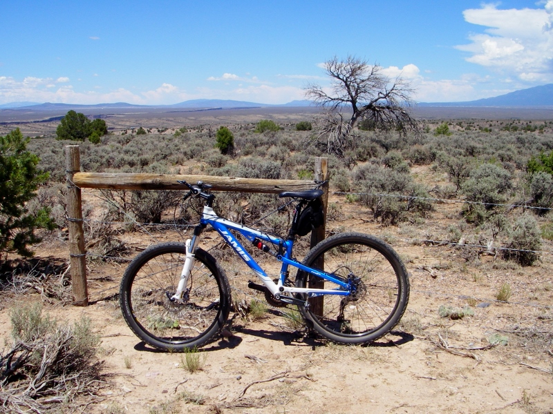 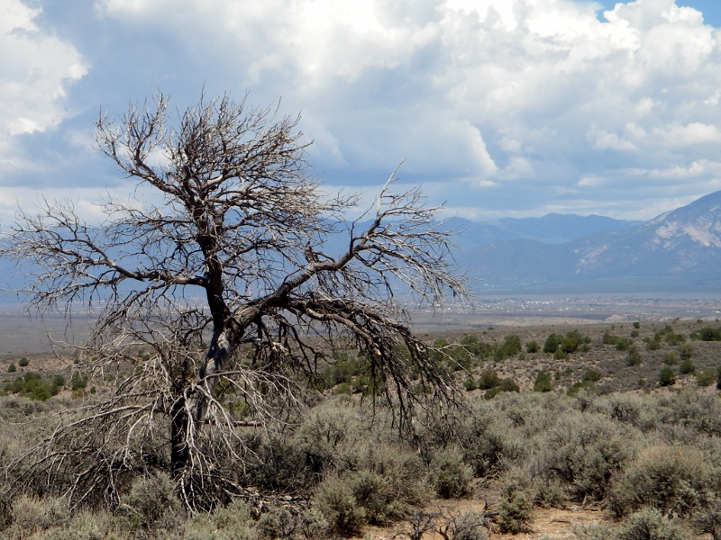 Stay tuned for more from Taos...next up: the FOOD -- and it was dynamite!
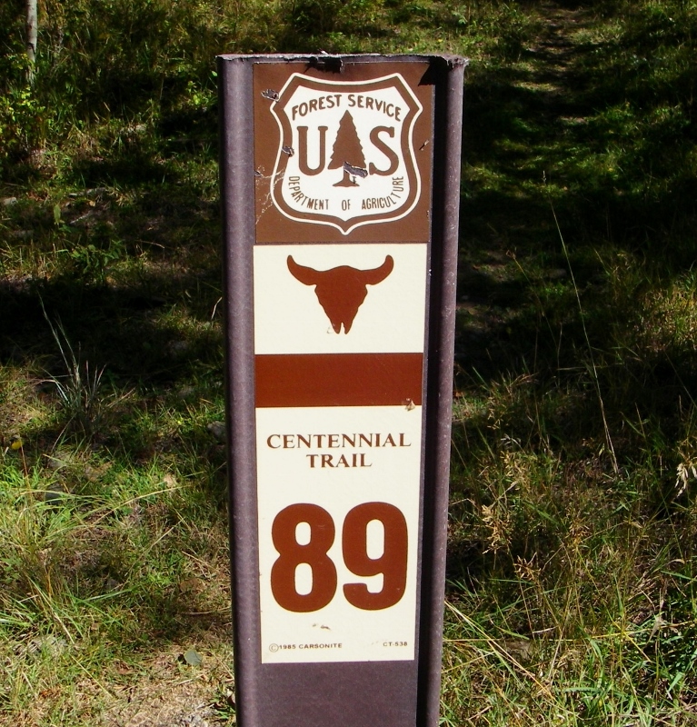
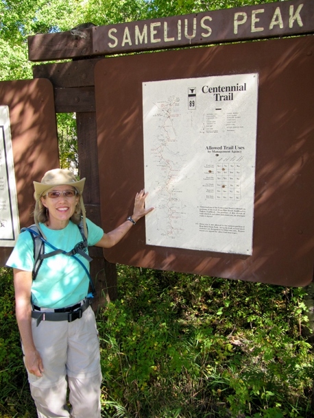
On yet another beautiful day in the Black Hills of South Dakota, we decided to hike a portion of the 111-mile Centennial Trail. A short drive from our rental in Hill City, we were able to access the trail at the Samelius Trailhead.
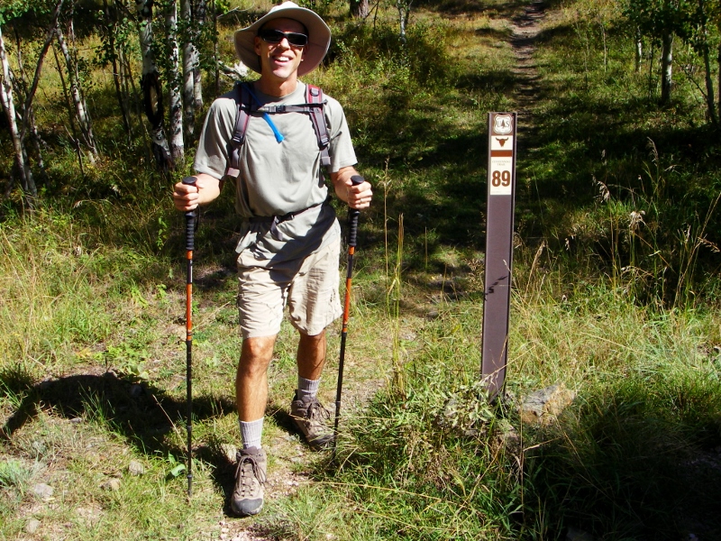 We had a great day for a hike with picture perfect weather. 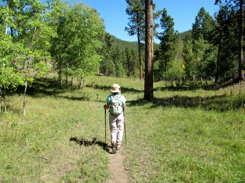 Early on in our hike, we saw many huge piles of cut pine trees. These are trees that have been killed by the Mountain Pine Beetles devastating the Black Hills, or thinned out in order to prevent future attacks. 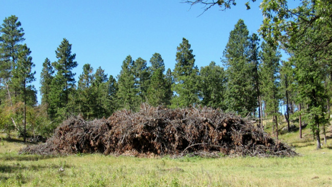 We saw Harney Peak off in the distance again. We'd summited this mountain earlier in our trip. 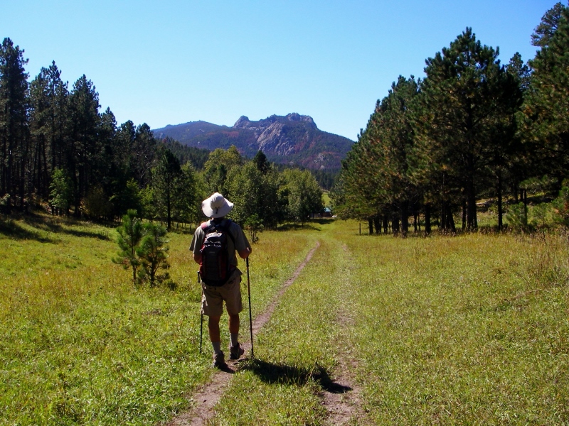 I was glad we didn't have to climb up all that way again, but on this hike I wore the t-shirt I bought celebrating our achievement. 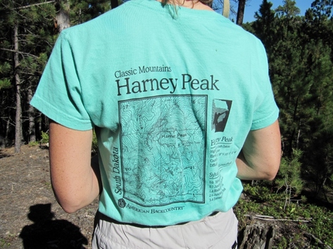 Been there, hiked it, got the t-shirt About 3.5 miles into our hike, we passed through the Big Pine Trailhead and had to cross a road. We didn't see another soul for our entire hike except parked at this trailhead. 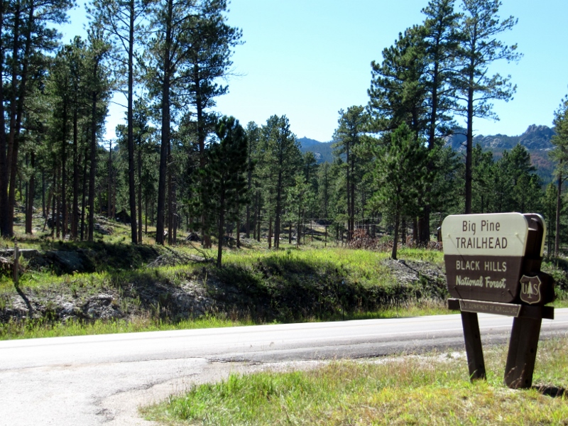 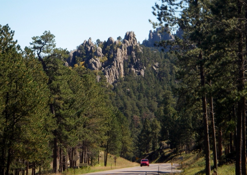 View down the road The trail became rockier and started climbing after we crossed the road. Fortunately we were warmed up by this point. 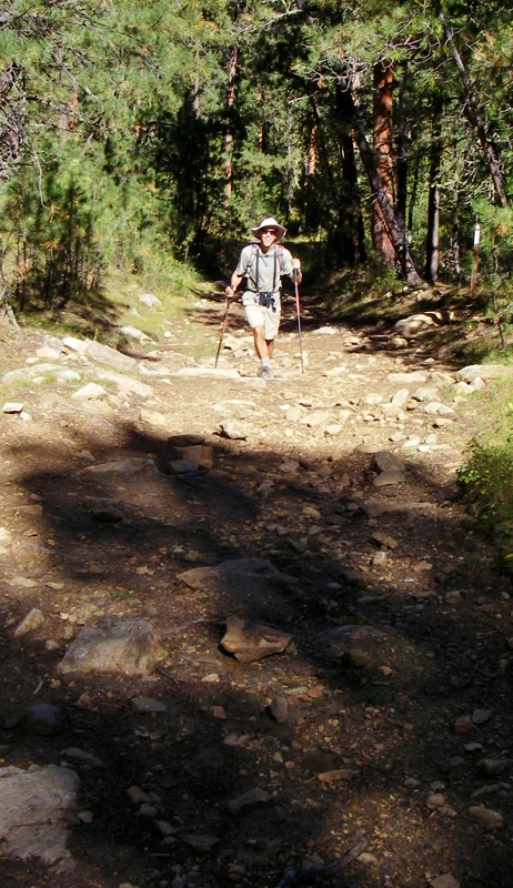 Less than a mile later we arrived at the Black Elk Wilderness. This is the same area where we'd picked up the trail to the Harney Peak summit on our previous hike. This time we'd be sticking with the Centennial Trail (#89). You have to sign in when entering the wilderness, but there is no use fee. 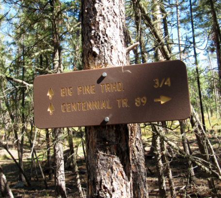 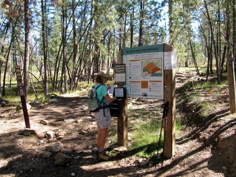 Signing in In the wilderness, the trail became much more lush, and there were a few obstacles along the way. The hiking was gorgeous, though. 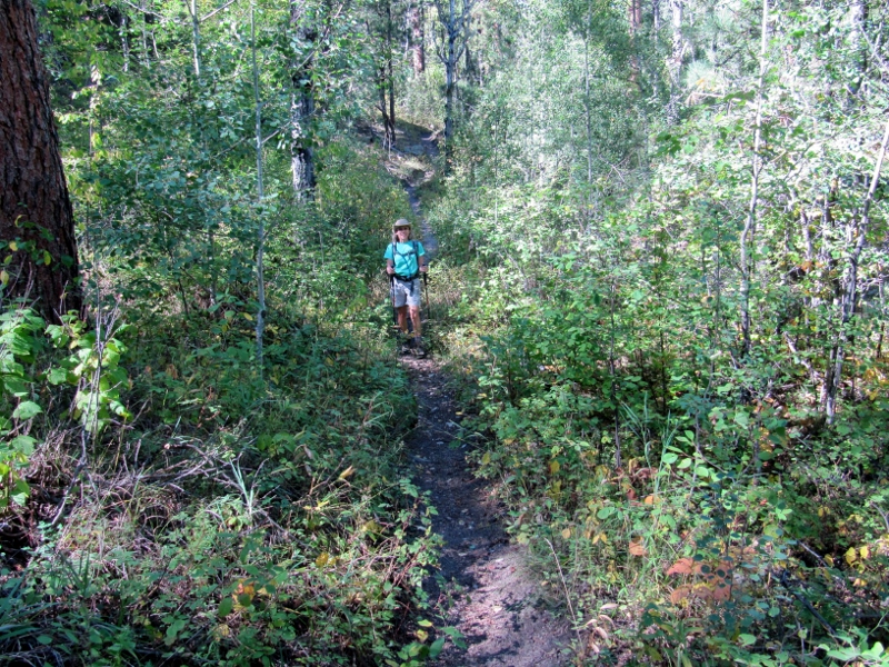 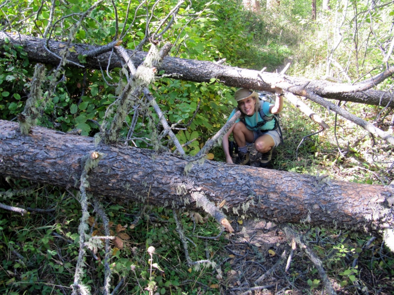 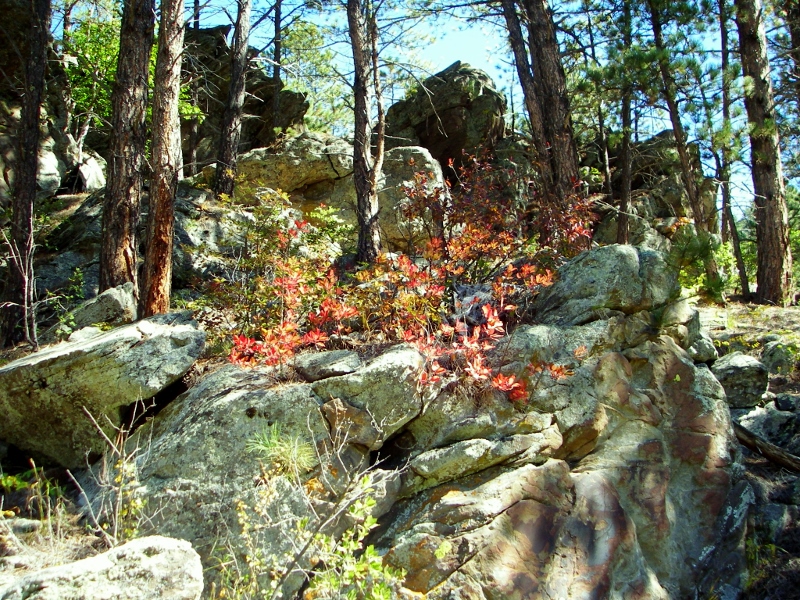 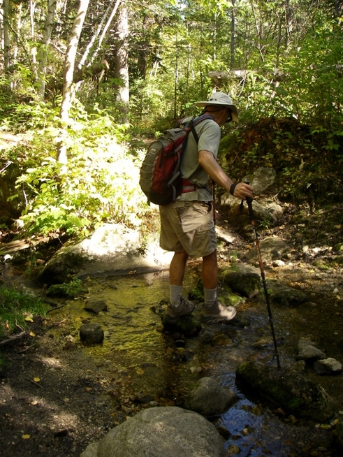  We were hoping to hook up with Trail #14, Horse Thief Lake, which would take us around to Horse Thief Lake and Campground. We thought we could make it when we checked the Black Elk Wilderness map, but by the time we reached six miles of hiking and had still not encountered the trail crossing, we decided we needed to turn back. Today was "supposed" to be a rest day before our last bike ride on the Michelson Trail, after all, and we wanted to get back while it was still light out.  Snack time at turnaround point After a snack break, it was time to turn around and head the six miles back to our car. Fortunately the way back was more downhill, and the late afternoon sun was illuminating the trees so nicely, it was a real treat. 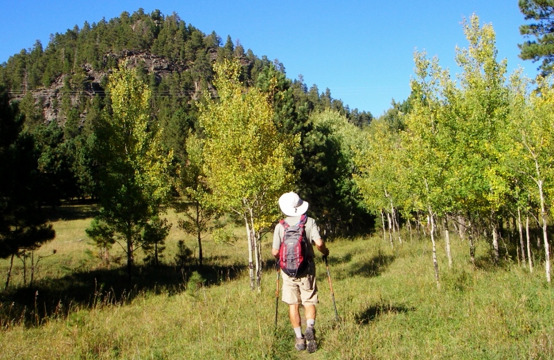  We had another treat as we flushed out a small herd of white-tail deer and then the largest flock of wild turkeys we'd ever seen as we walked nearby. There were many, many more than this photo shows, all heading away from a road and up to the top of a steep hill. 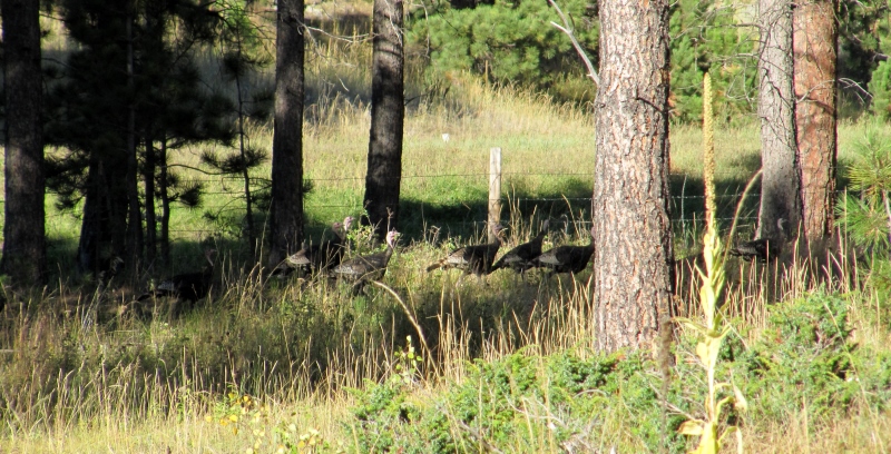 Poultry Parade! We returned to the starting point as the shadows were growing long. We'll have to come back one day and hike more of this beautiful trail. 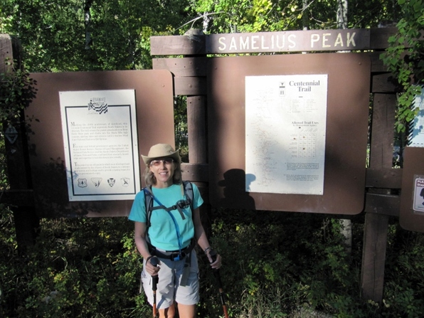 12 miles done! Stay tuned as we head east for our next stops: Wall Drug and Badlands National Park....
|
Emily & BarryWe're a long-married, early-retired couple who are currently traveling as nomads with no fixed home base. After years of living in North Carolina (Emily's home state), we spent 18 months living oceanfront on Ambergris Caye, Belize, a year road-tripping the US in a Honda CR-V, a year in Playa del Carmen, Mexico, and are now roaming North America in our 32' motorhome, Pearl, following warm weather whenever possible. 
Paisley, May 2016

States visited (pre-RV)
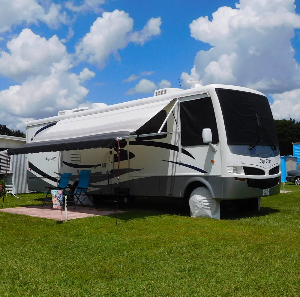
Pearl, a 2007 Newmar Bay Star

States visited in "Pearl"
Archives
July 2019
Favorite Travel Blogs |
 RSS Feed
