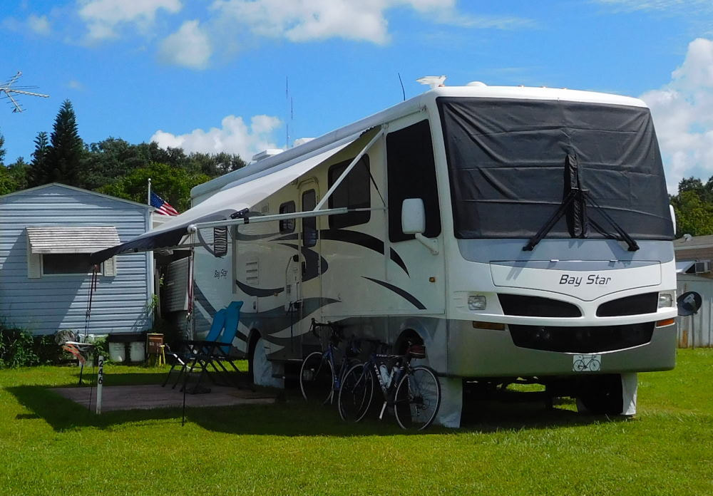
"Pearl" in Winter Garden, Florida
|
Long shadows in Wyoming
|
|
On our last day in Crescent City, we wanted to see more redwoods, but we also wanted to ride our bikes. Problem solved: Barry planned a ride through the redwoods for us! We drove down to the Newton B. Drury Scenic Parkway, the scenic alternative to coastal Highway 101. This ten-mile parkway is in the Prairie Creek Redwoods State Park and is a great place to see redwoods. There are numerous hiking trails intersecting the parkway we would love to check out one day, and thanks to the lower speed limit of 45 mph and ban on commercial vehicles, it's also a perfect place to get a fine bike ride in. 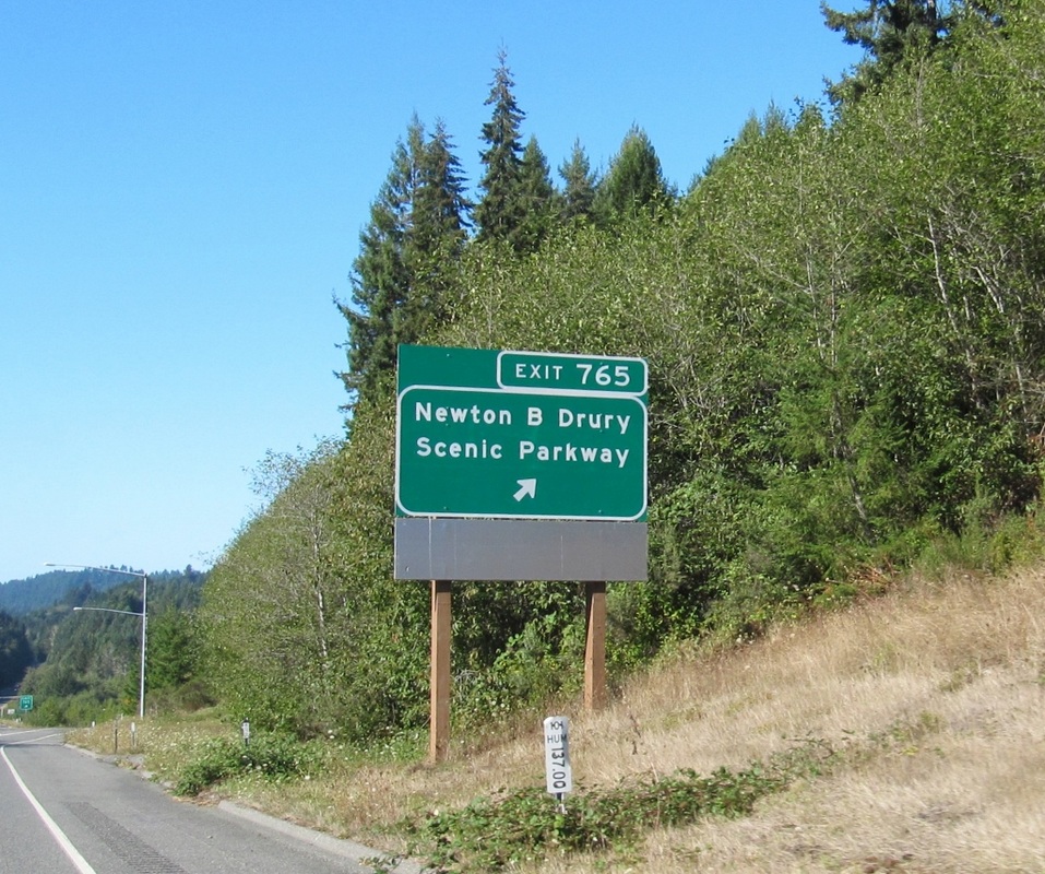 At the southern end, where we started our ride, there's an open area in the park before you enter the redwood forest. Although we had nice sunshine in this section, you can see by what I'm wearing that it was not a warm morning. And the temperature in the shady, damp redwood forest felt even cooler. 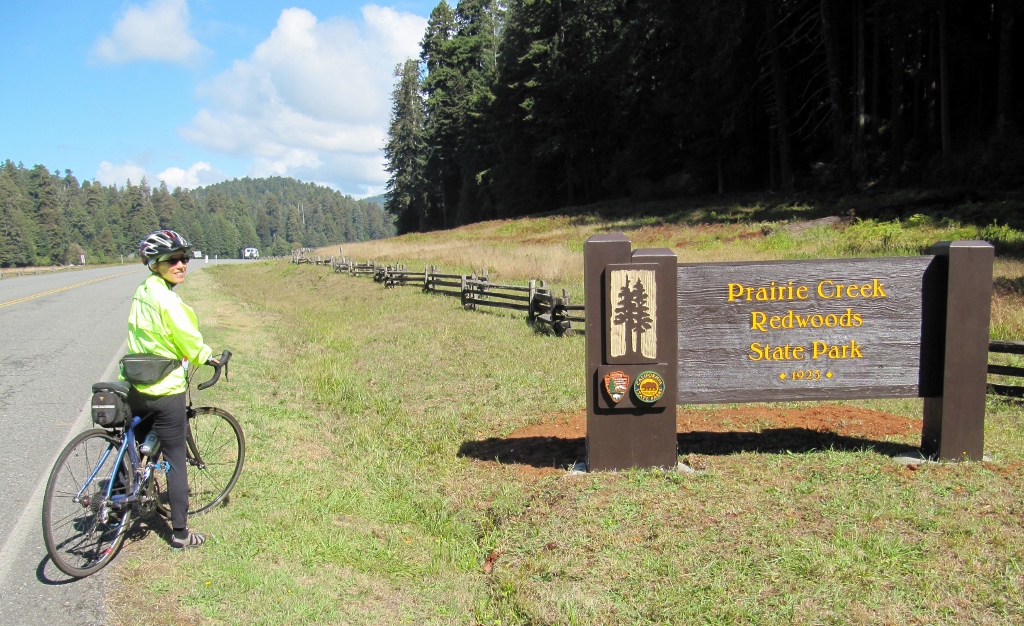 In the open park fields before we entered the redwood forest, there were numerous signs warning of elk, and we were delighted we got to see a couple of them when we first arrived. They were gone later, so we felt lucky that we got to see them. 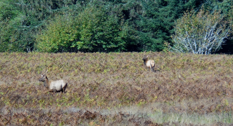 According to information in the visitor's center, it is rutting season for the males, so you definitely don't want to piss these guys off. And don't worry, we weren't as close to them as it appears -- we used our zoom lens! 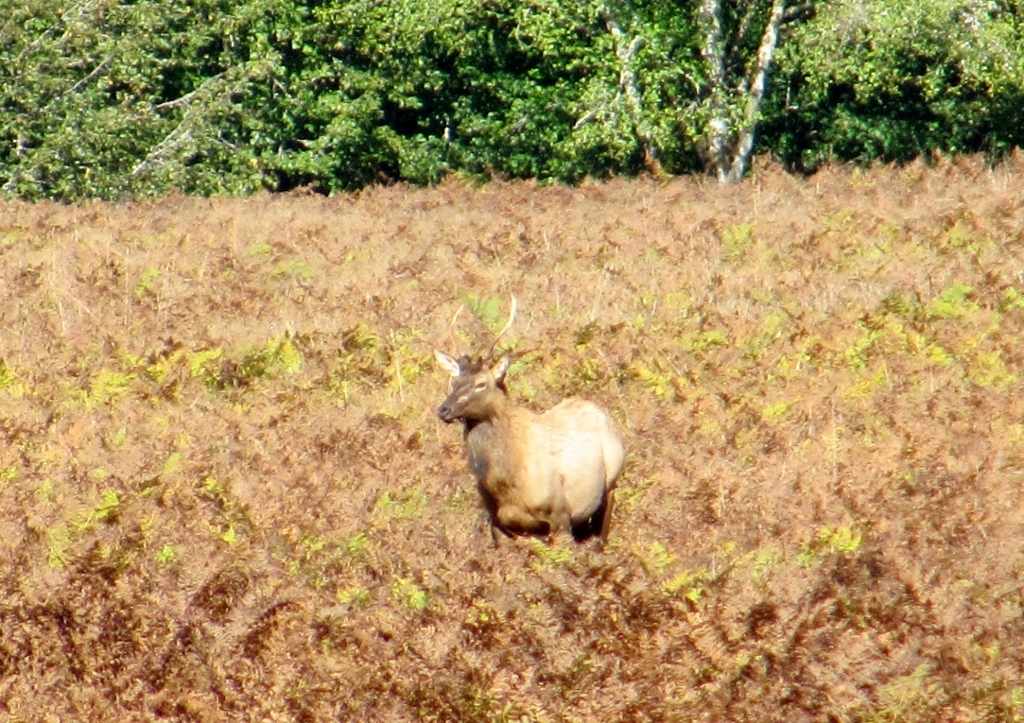 Here I am about to enter the redwood forest. 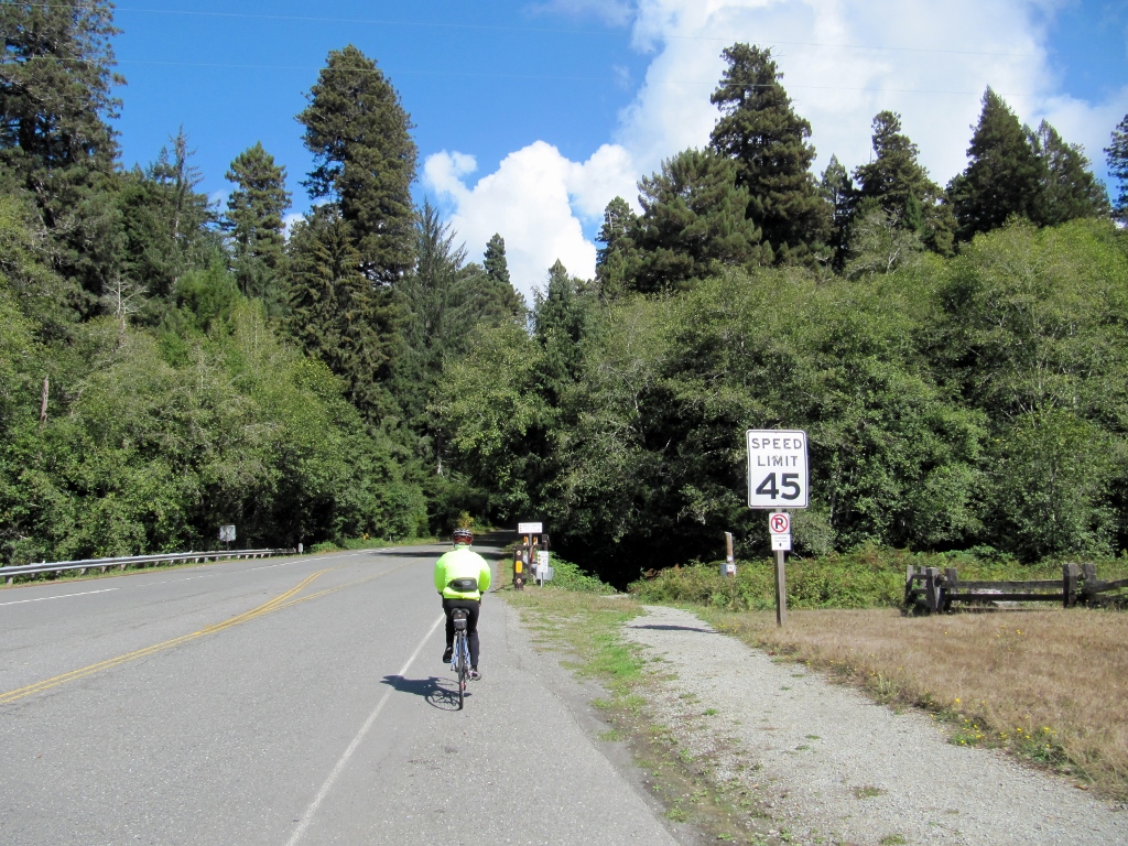 It looks very different in here! The road was still damp in places from rain the previous day and the moist, shady micro-climate. 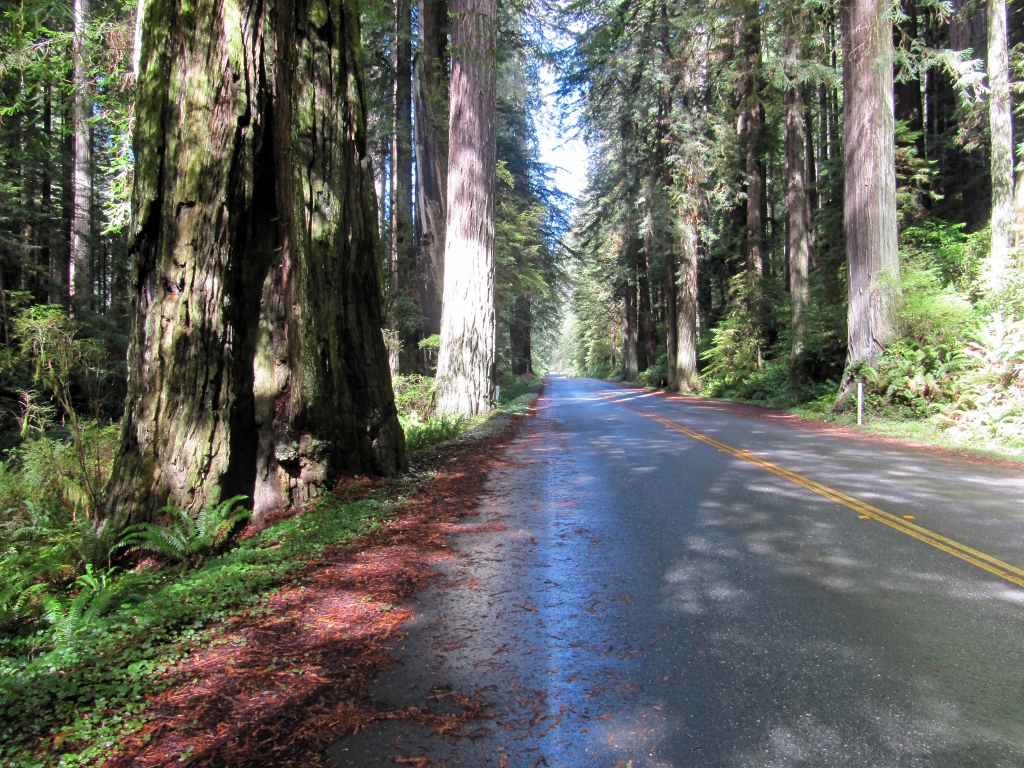 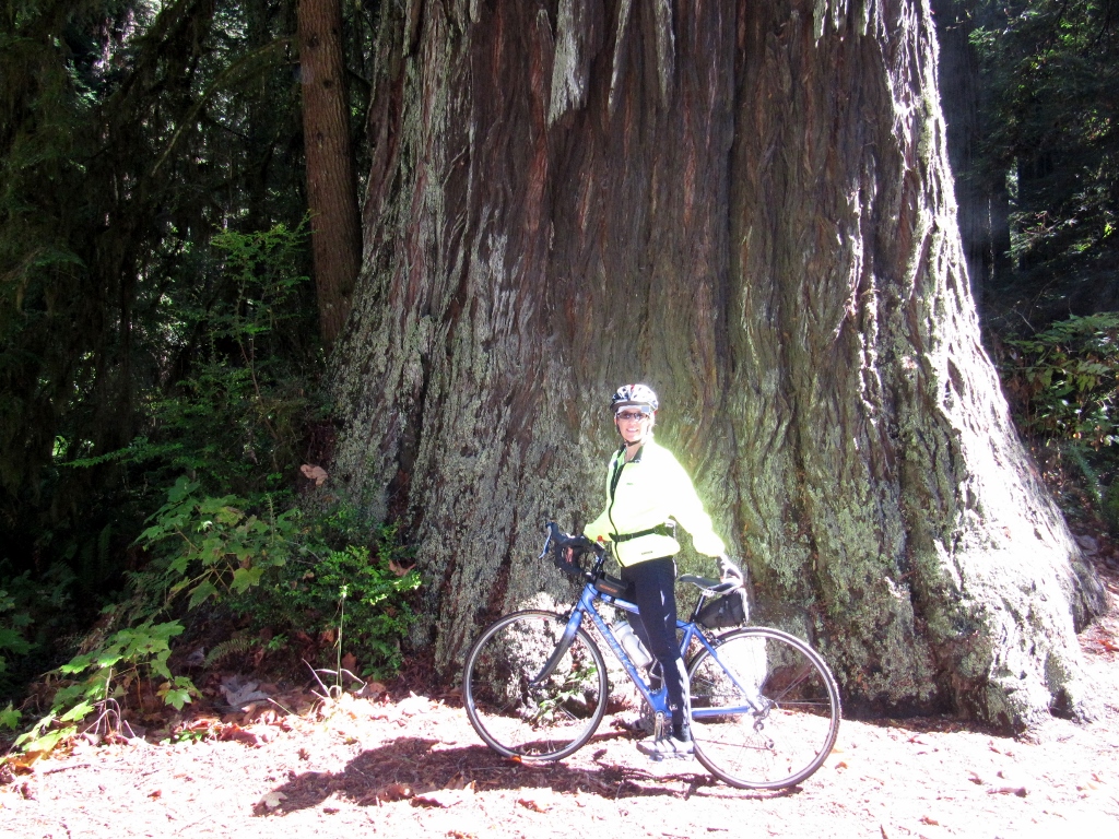 The road starts out mostly flat as you head from south to north. It does climb slightly, but the grade is barely perceptible. However, in the last couple of miles, the road steepens and begins climbing...and climbing. I was really huffing and puffing. When I got to the top and turned around to head back down, I saw why it was so tough without my mountain gearing. The descent was fast and fun, but I had an RV on my tail, so it was a bit less enjoyable than if I'd had a clear road behind. Fortunately, it couldn't go much faster than me on the curves, so I don't think I held them up. As soon as the road straightened out, I pulled over so they could get around me. 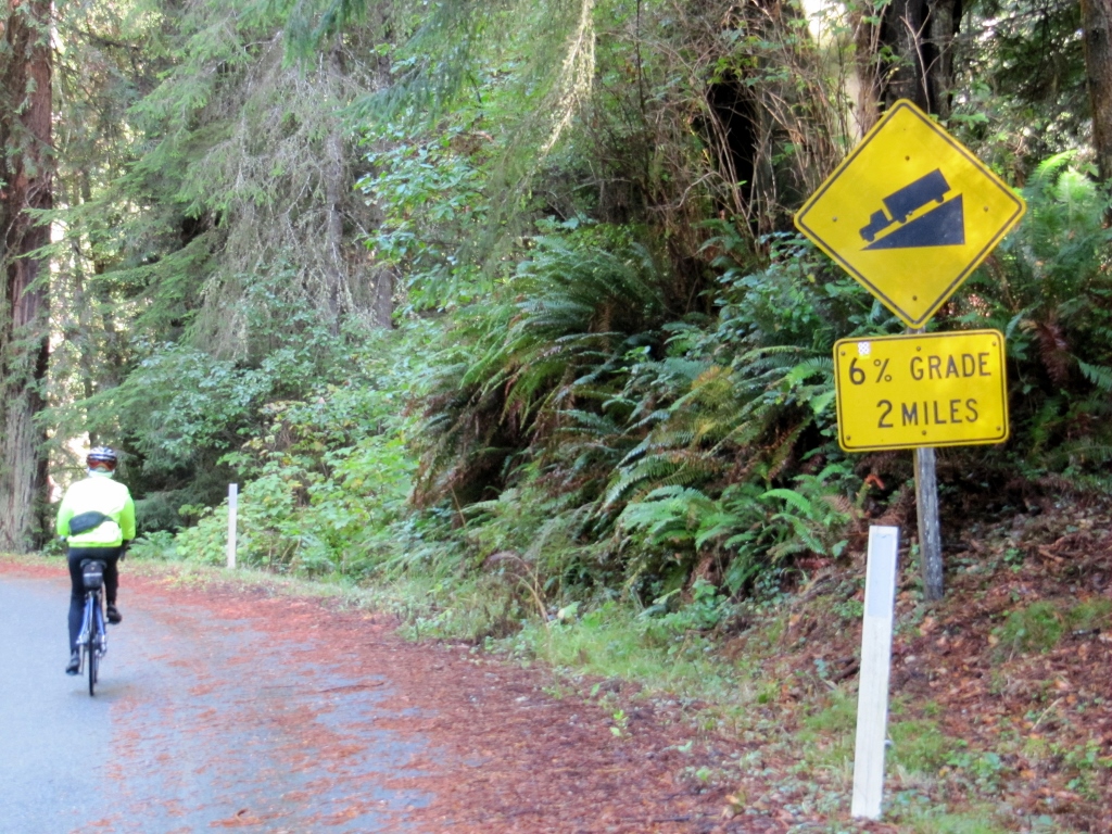 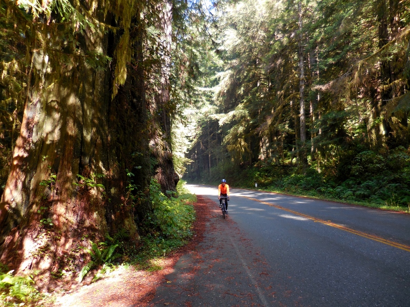 We stopped to take a picture in front of this huge redwood whose innards were partially hollowed out, and a man taking a break from riding his touring motorcycle offered to take our photo together. It's not so good because of the angle of the sun, but it was nice of him and the only one we have of the two of us together on this ride, so I wanted to include it. We chatted with him for awhile in the parking lot later, and turns out he used to be a bicycle tourist, so I guess that's why he was so nice to us. 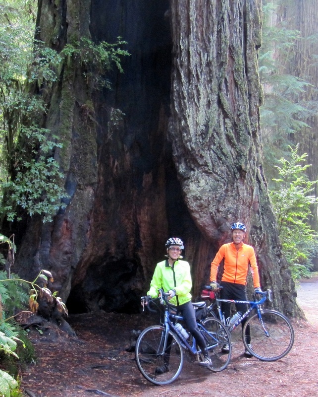 Here's the Memorial Grove named after the couple who gave the scenic parkway its name. 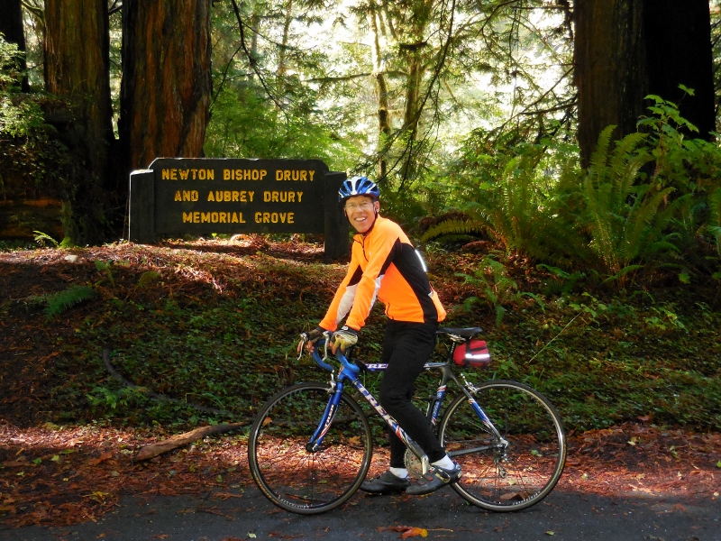 I thought this was a particularly pretty trunk with all the moss growing on it and greenery all around. 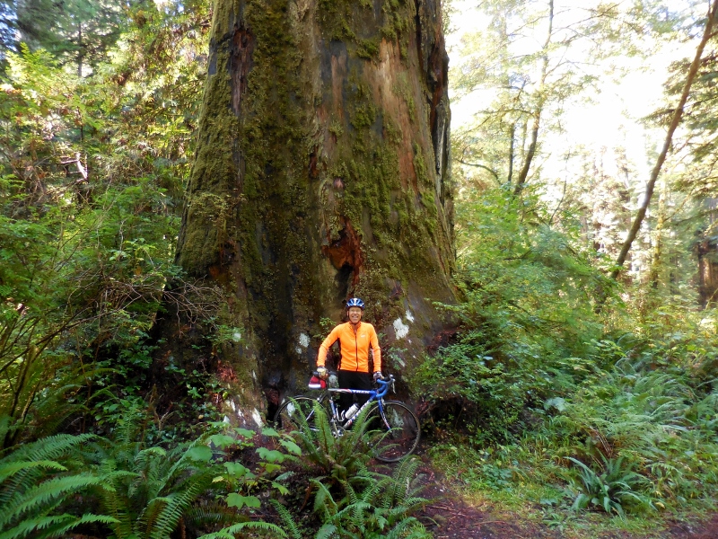 Barry ended up riding out and back on the parkway twice (would you expect any less of him?) I didn't want to face that climb again so only rode it part way the second time. One monster climb per day is plenty for me! We both had a great time, though. This is my favorite photo of the day. 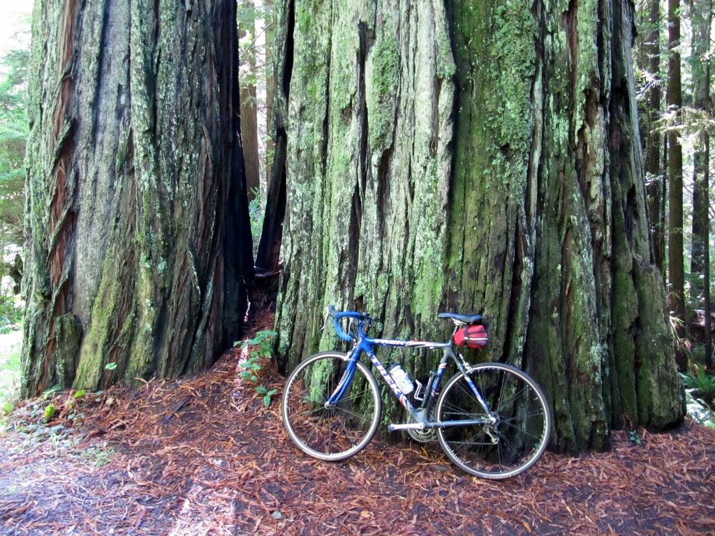 Stay tuned as we leave the beautiful California coast and the amazing redwoods and head inland to Redding!
0 Comments
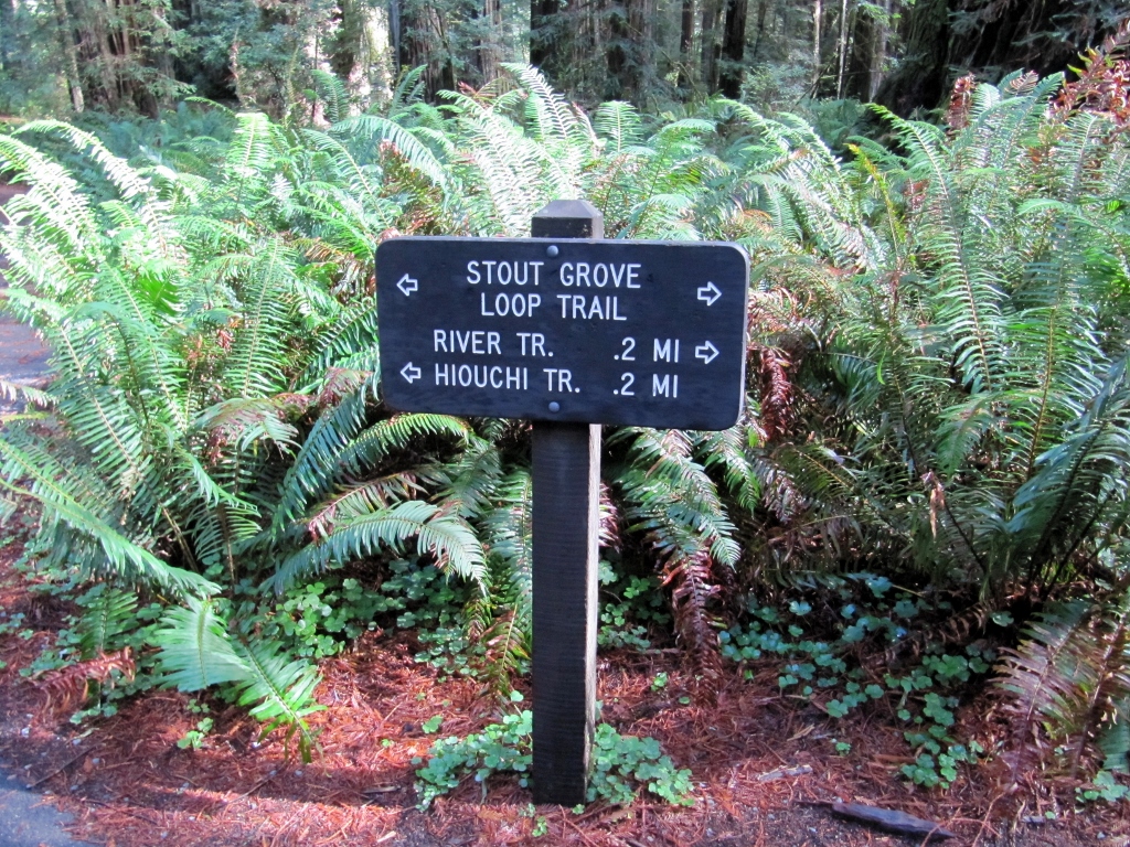
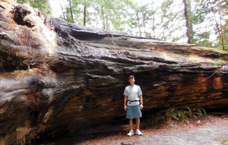
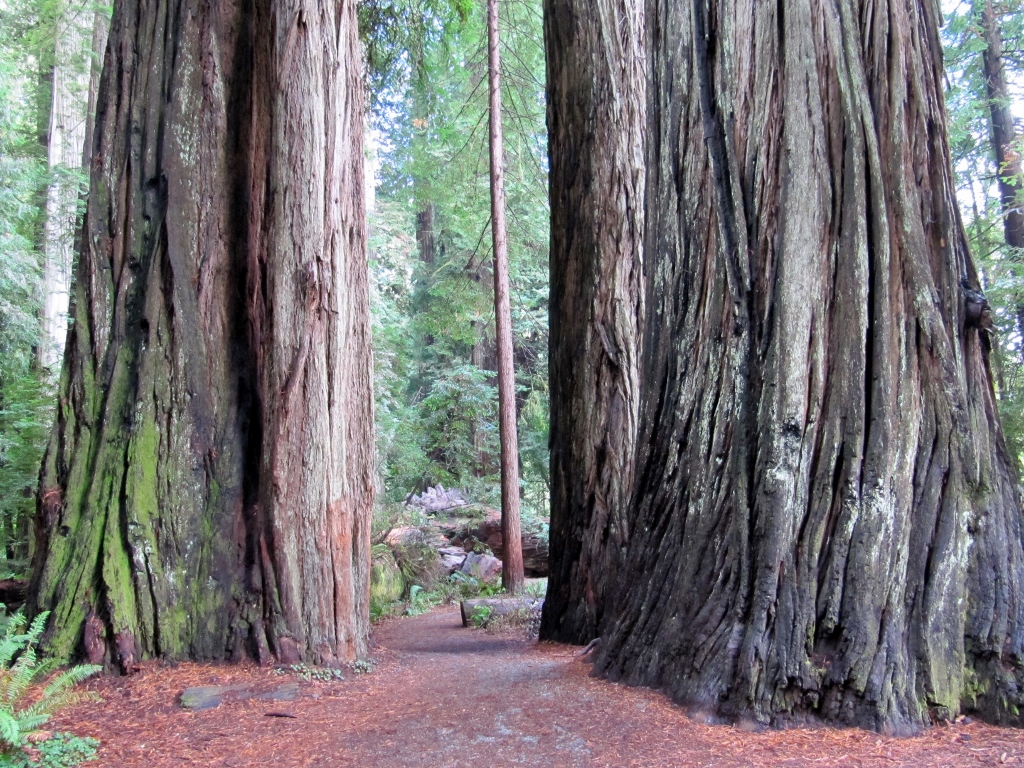
 The primary reason we traveled through northern California was to see the coast redwoods -- a first for both of us. And they were even more than I ever dreamed they'd be; it's truly impossible to imagine the size and breadth of these incredible trees until you stand beside one and realize just how small you really are. There are numerous state parks and a national park in the north coast section of the redwood forest, and they are all free to visit (a real surprise to me). The parks kind of blend together so we didn't always know which one we were in; we just drove and parked in various spots and explored further on foot. There's always something beautiful to see! Here's a map of the entire area. Over a three-day period, we visited all three of the state parks near Crescent City. The Redwood National Park land intermingles with these, in partnership, but is not shown on the map. I did stop at the national park visitor's center to buy a magnet and sticker. 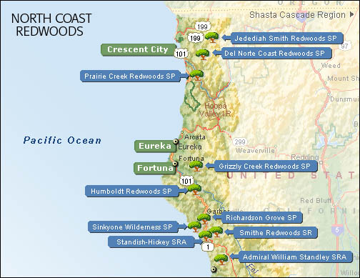
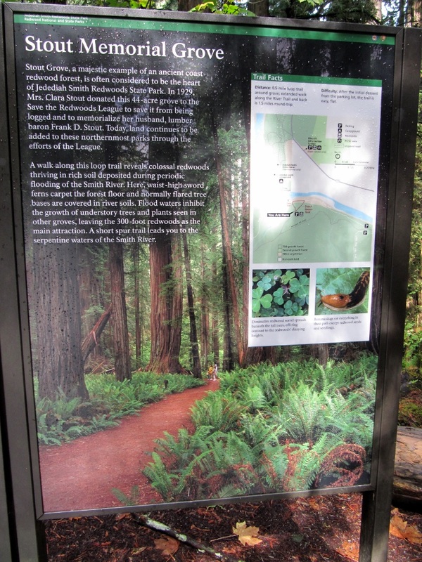
Here's some excellent information on this area and the redwoods that I pulled from Wikipedia: The Redwood National and State Parks (RNSP) are located in the United States, along the coast of northern California. Comprising Redwood National Park (established 1968) and California's Del Norte Coast, Jedediah Smith, and Prairie Creek Redwoods State Parks (dating from the 1920s), the combined RNSP contain 133,000 acres (540 km2).[3] Located entirely withinDel Norte and Humboldt Counties, the four parks, together, protect 45% of all remaining coast redwood (Sequoia sempervirens) old-growth forests, totaling at least 38,982 acres (157.75 km2). These trees are the tallest and one of the most massive tree species on Earth. In addition to the redwood forests, the parks preserve other indigenous flora, fauna, grassland prairie, cultural resources, portions of rivers and other streams, and 37 miles (60 km) of pristine coastline. ---- Source: Wikipedia We'd heard that the Stout Memorial Grove in Jedidiah Smith Redwoods State Park was one of the best places to view the redwoods and to take photographs, so we made sure to stop here and walk around on the lovely paths, gawking. 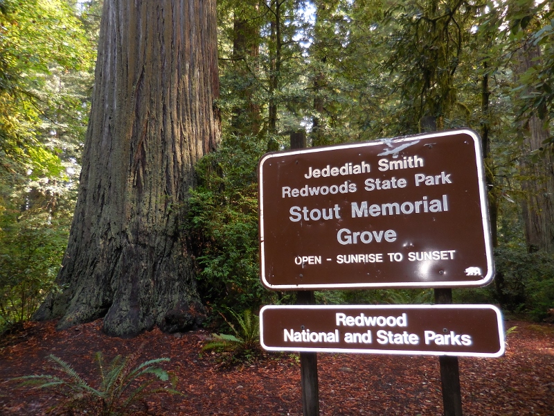
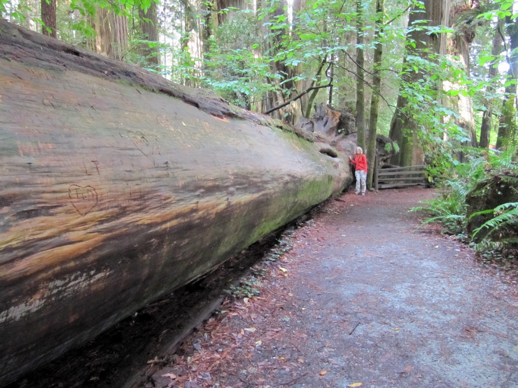
This one was a monster! 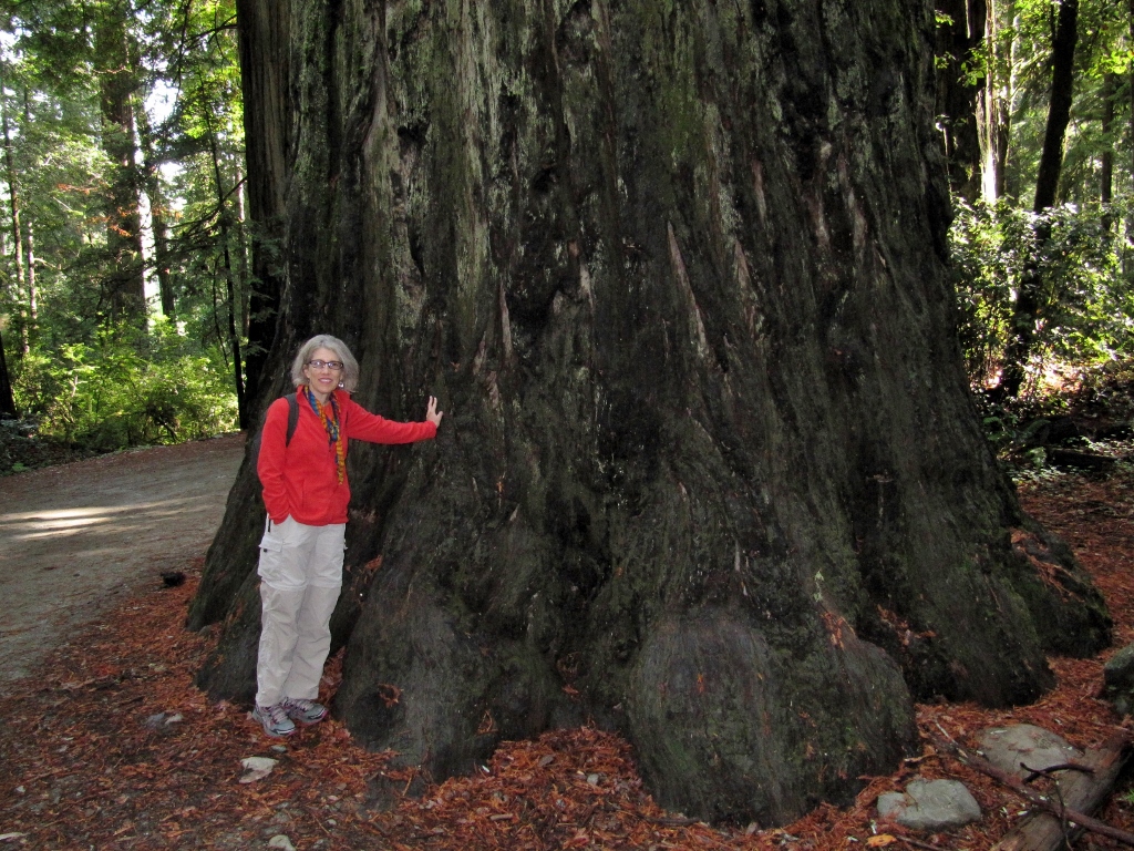
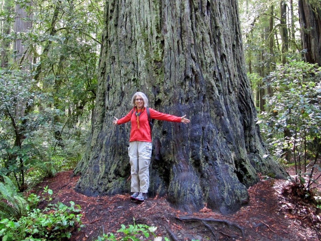
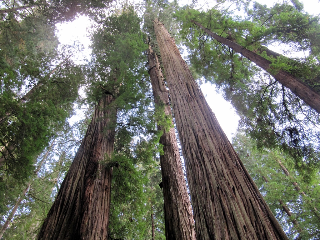
I felt like a character in "Land of the Giants"! 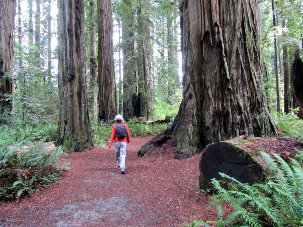
Even our car looks teeny when driving through the redwood forest! 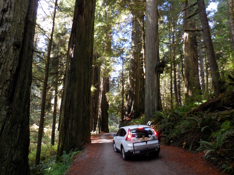
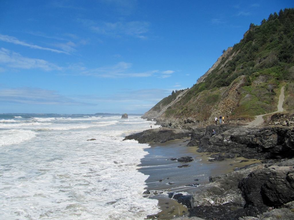
After checking out the redwoods, we drove just a bit farther south, parked again, and hiked a portion of the Coastal Trail, which spans 70 miles through the state and national redwoods park area. There's much more to see here than redwoods! 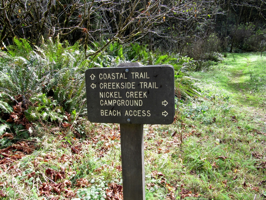
We took a side spur trail to check out Endert's Beach. It was rocky, rugged, and beautiful. It was hard to believe we'd been deep in the lush redwood forest literally minutes before, and now we were at the beach listening to crashing waves. 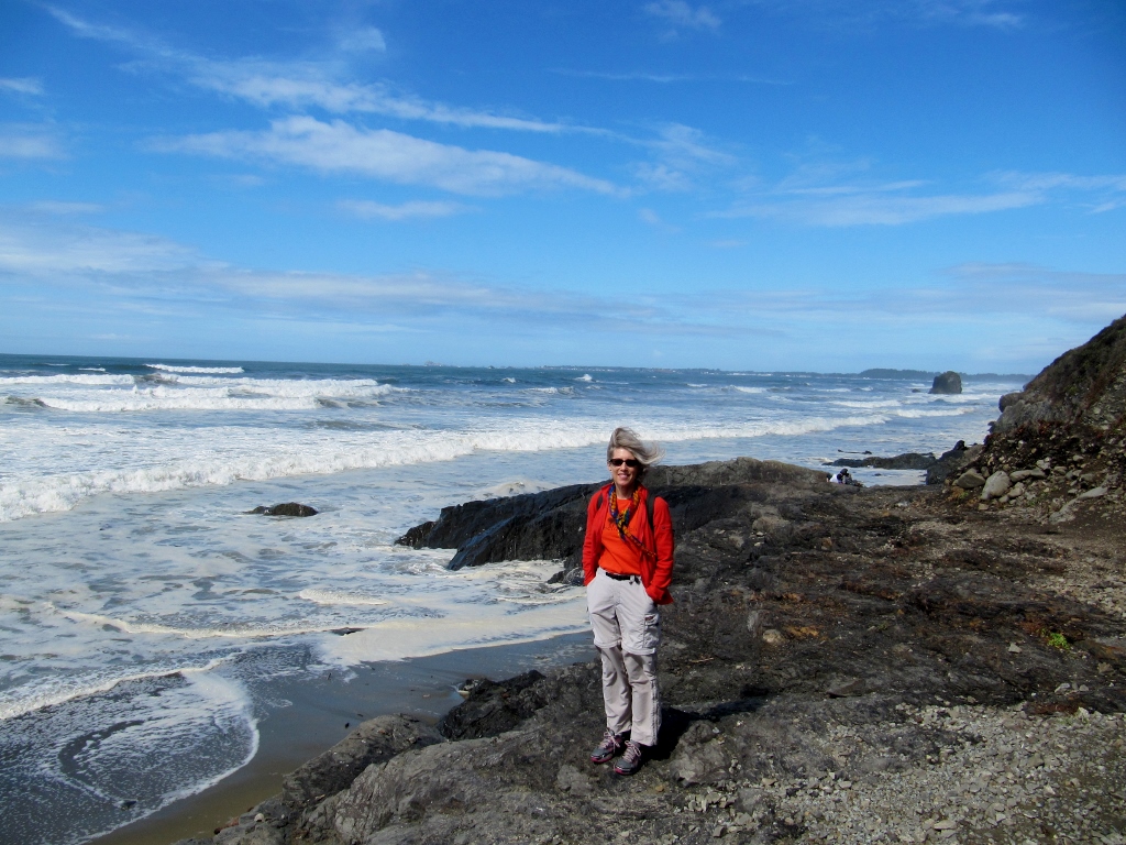
We continued down the trail enjoying the local flora and fauna. The ferns here were huge -- we almost felt like we were back in the rain forests of Belize; however, it was quite a bit cooler! 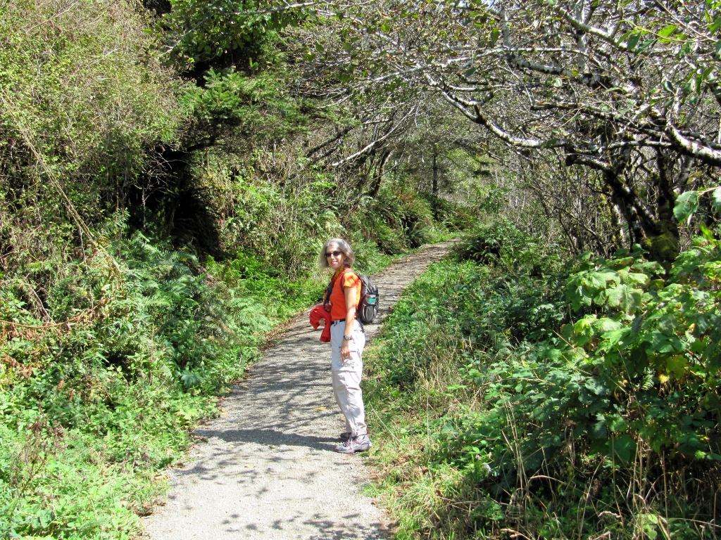
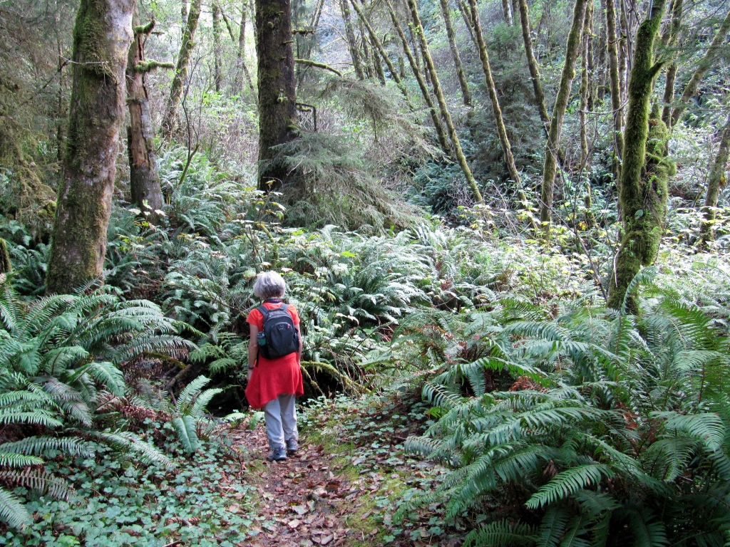
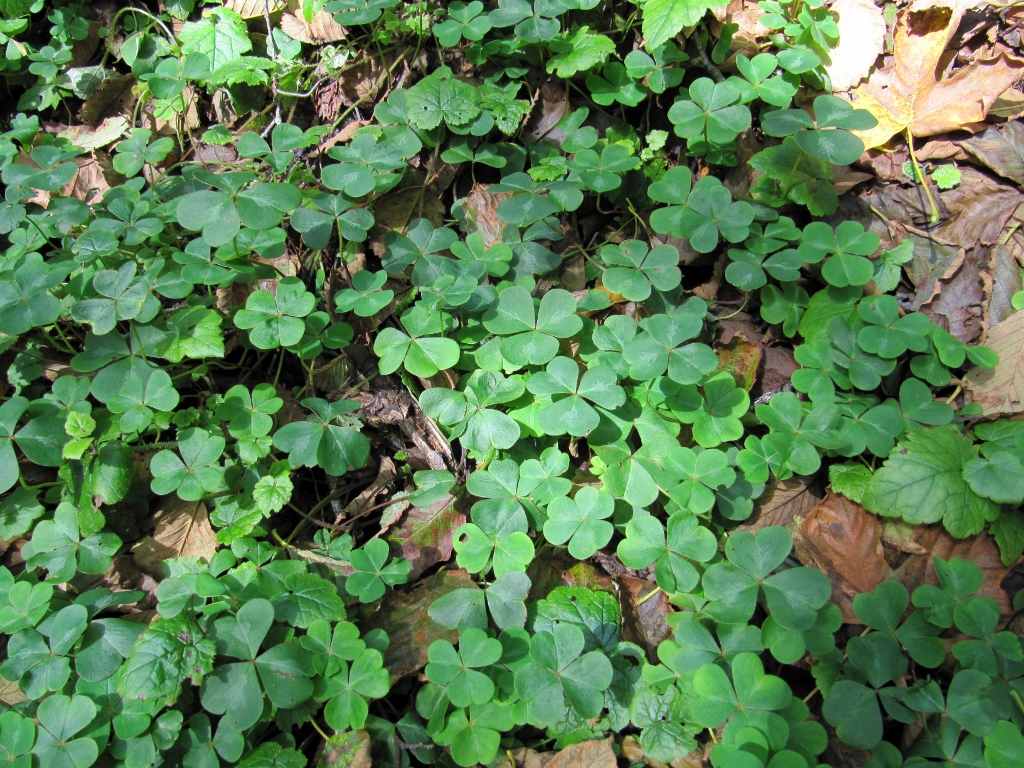
Pretty Redwood Sorrel ground cover
We encountered a well-known species in this area: the Banana Slug. These things are unmistakable, and large! I was amused to see all sorts of banana slug paraphernalia (aimed at kids) at the national park gift shop. Ha! 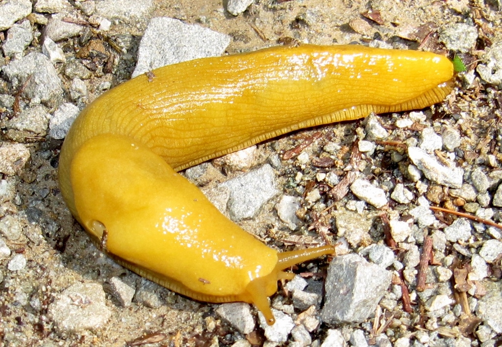
The second one we saw (below) was much smaller than the guy above -- I remembered to put my hand in the photo for a size reference. 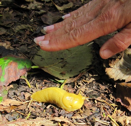
We drove a bit further down the coastal highway (101), stopping to look at another beautiful beach, before heading back to the hotel for the day. 
Stay tuned -- more redwoods yet to come!
One of the bike rides we wanted to do while in the Eugene area was the Row River Rail Trail, starting in nearby Cottage Grove. Since the trail is less than 16 miles long one way, Barry wanted to get some additional mileage, so decided to ride the 22 miles from our motel in Eugene to Cottage Grove, while I drove down and met him in town. He actually beat me to College Grove (of course I left a bit later!) and had time to take a few photos when he got here. He learned that Cottage Grove is the Covered Bridge Capital of Oregon -- cool. We'd get to see one of them later in our ride. 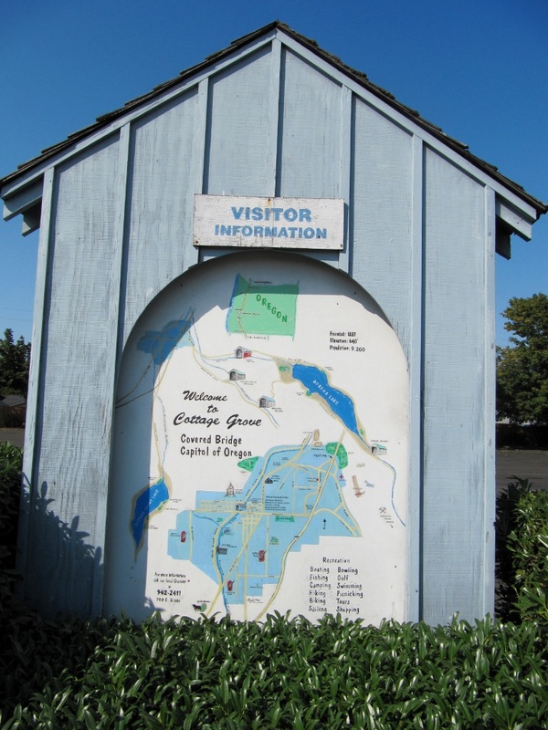
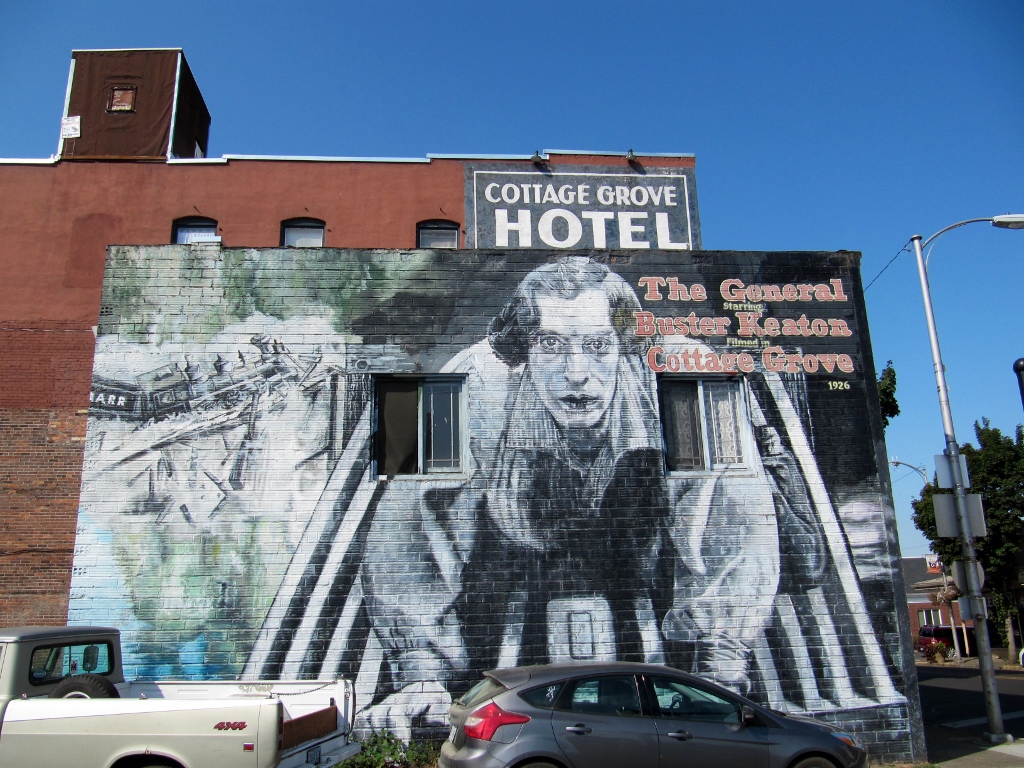
And he took a few minutes to ride through the charming historic district. 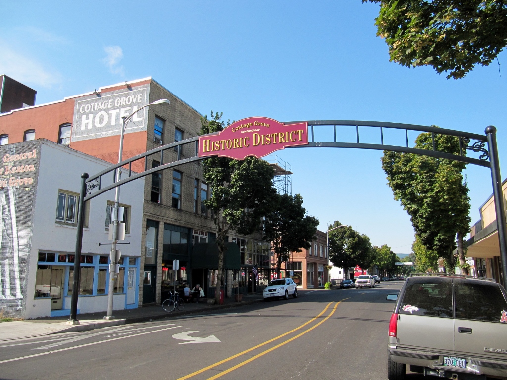
We saw yellow bike racks just like this in Key West! 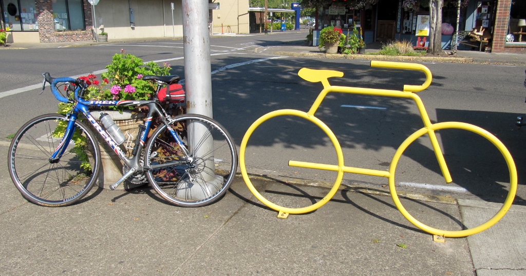
I parked at a nearby city park, and we pedaled over to the trailhead together. We had a beautiful day for it! 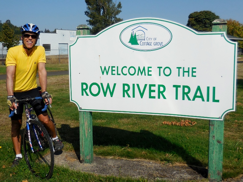
Here's a map of the Row River Trail. All the sections marked as (Proposed) on the map are now complete and paved. 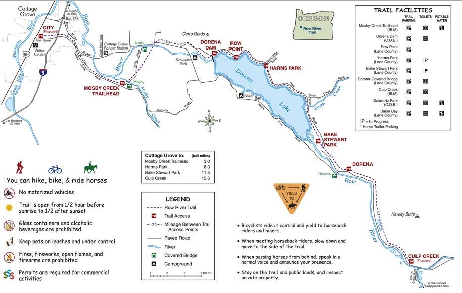
After starting in the city, we soon reached this lush, green forest and a long, gentle climb. This would be a cooling place to ride on a hot summer's day. 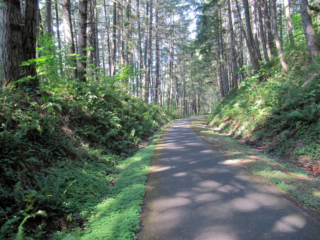
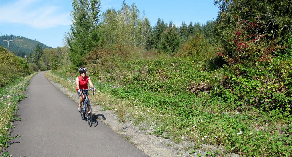
We rode alongside pretty and peaceful Dorena Lake for quite awhile. 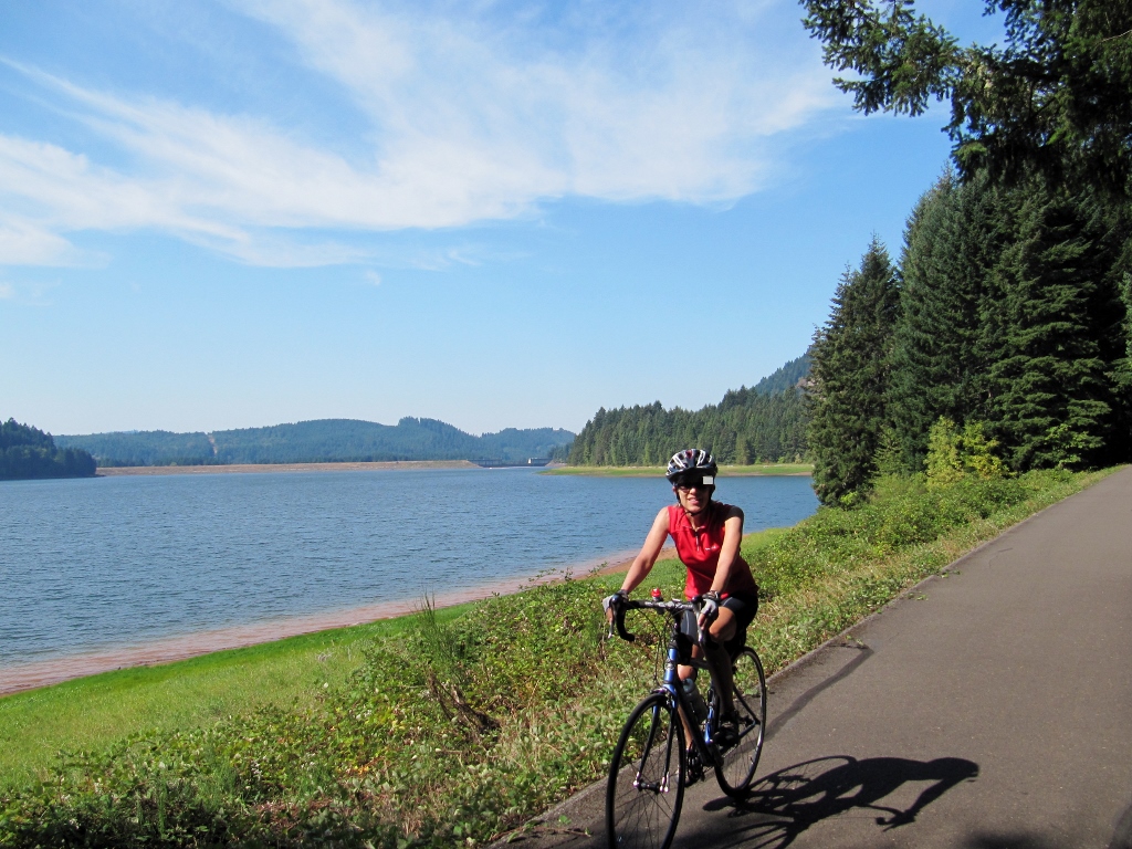
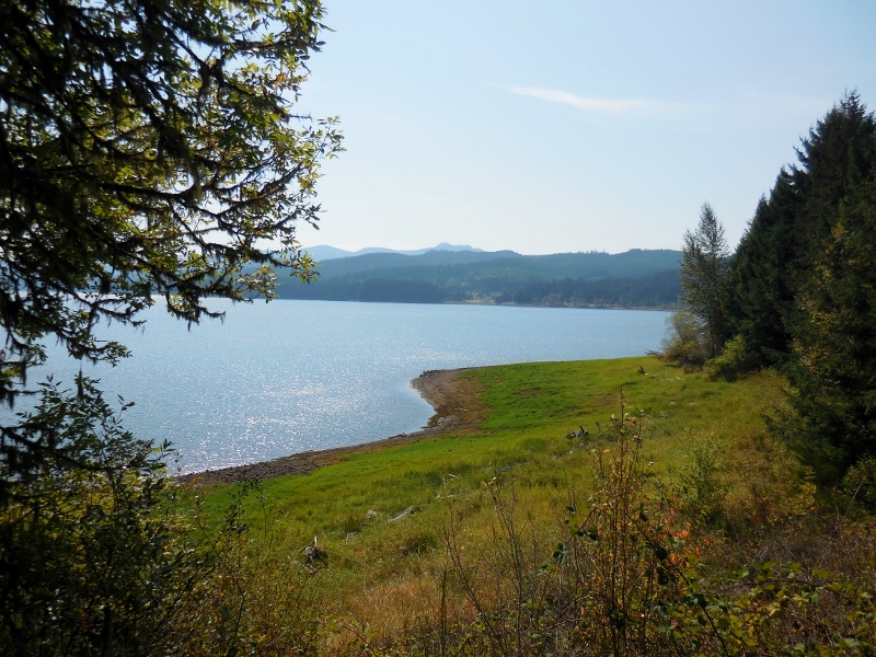
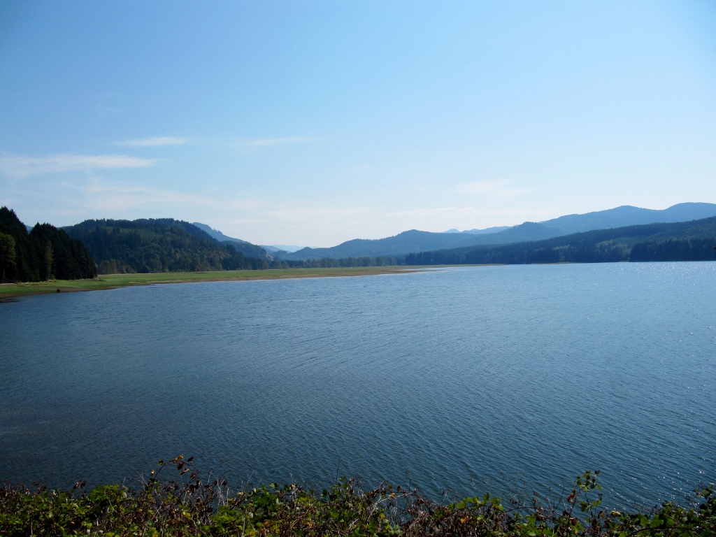
Dorena Lake
There are some big hills in the distance, but fortunately none we had to ride over. Barry did have one major climb on his way down to Cottage Grove, though. 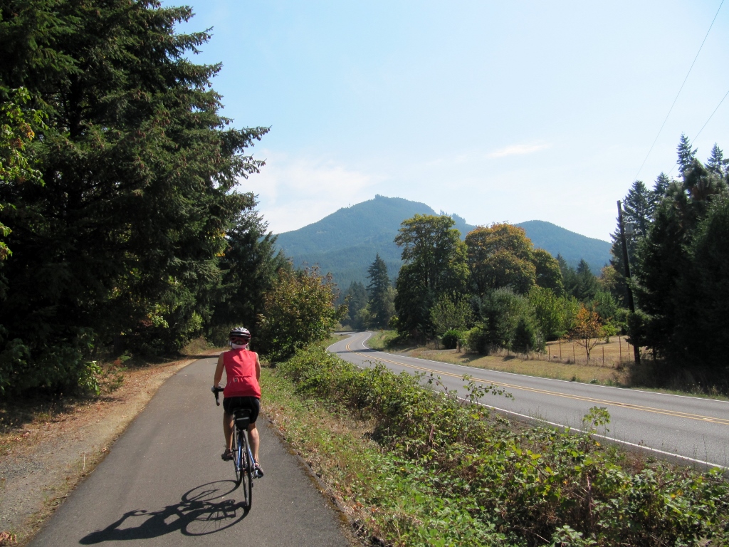
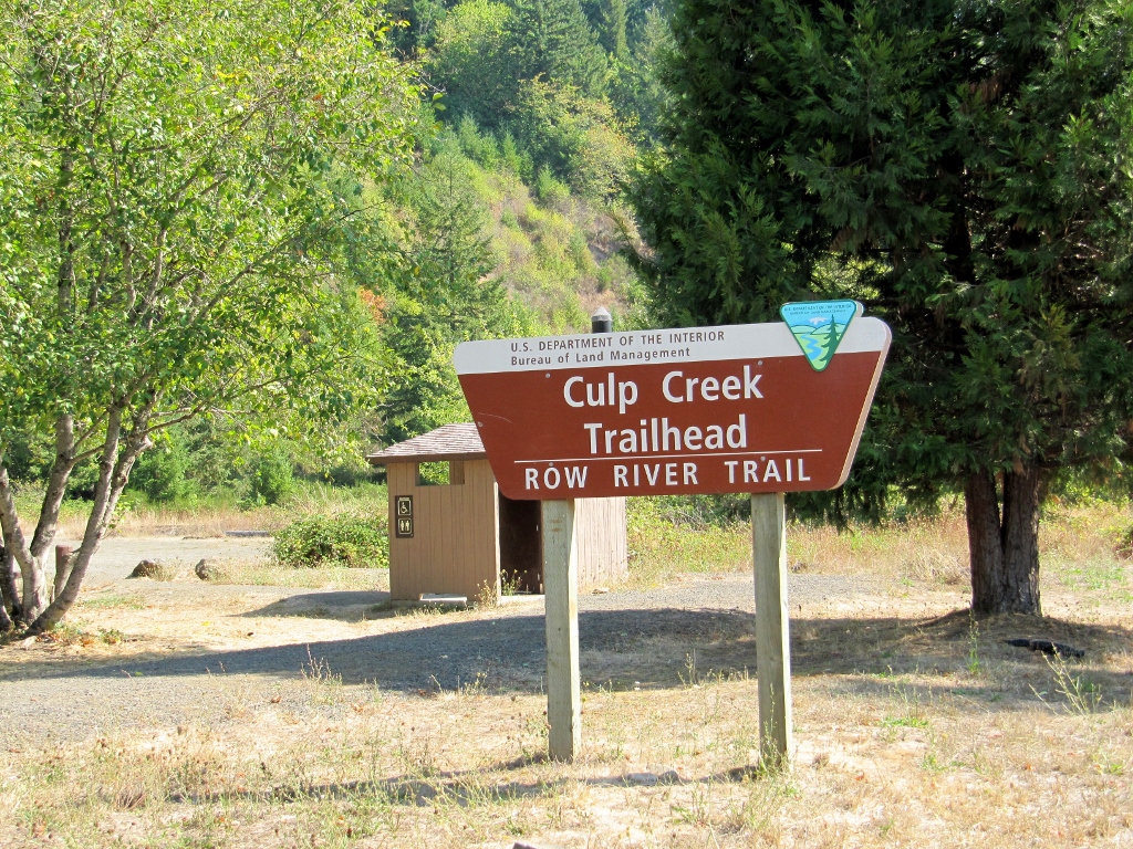
Before we knew it, we'd reached the Trail's End in Culp Creek. Time to turn around! 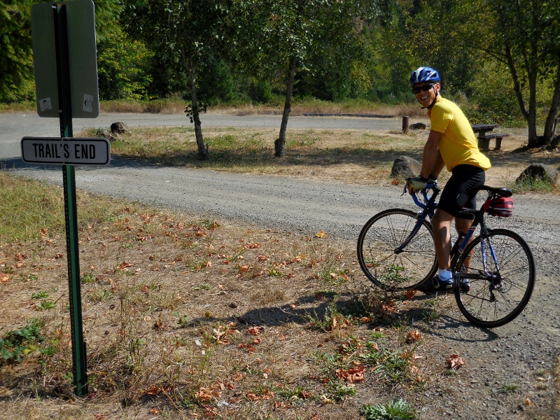
The Row River trail is part of the Oregon Scenic Bikeways program -- the only one of its kind in the nation. Yes, Oregon is a cyclist's paradise, at least when it's not rainy! 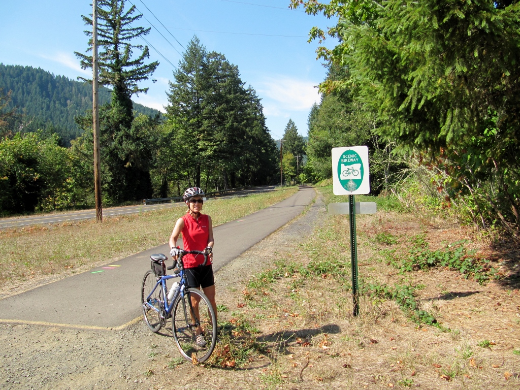
On the way back, we took a detour onto Row River Road for a short distance as it was also part of the Scenic Bikeway. What a lovely stretch this was with almost zero traffic, and it led to a nice surprise! 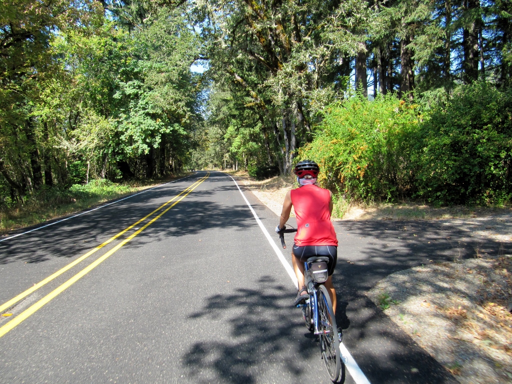
Riding Row River Road
This sign hinted at what we'd soon find.... 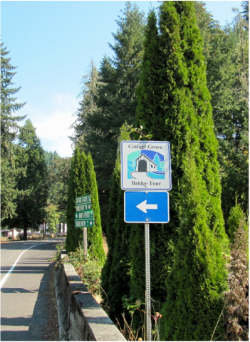
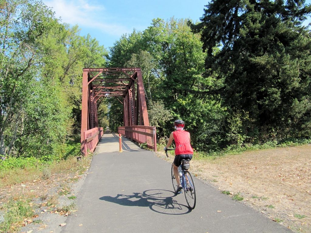
One of Cottage Grove's covered bridges! And a very pretty one at that. 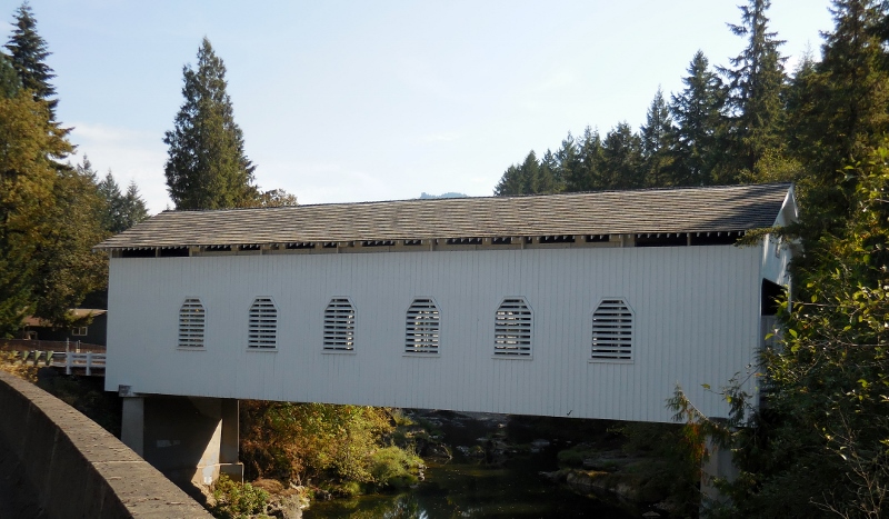
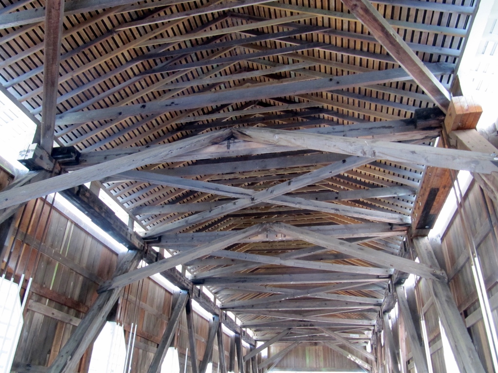
It was the Dorena Covered bridge, built in 1949. We enjoyed riding through it even though it didn't really go anywhere other than crossing the Row River. 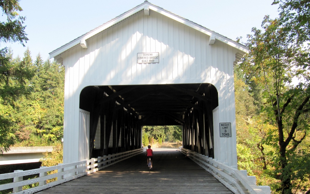
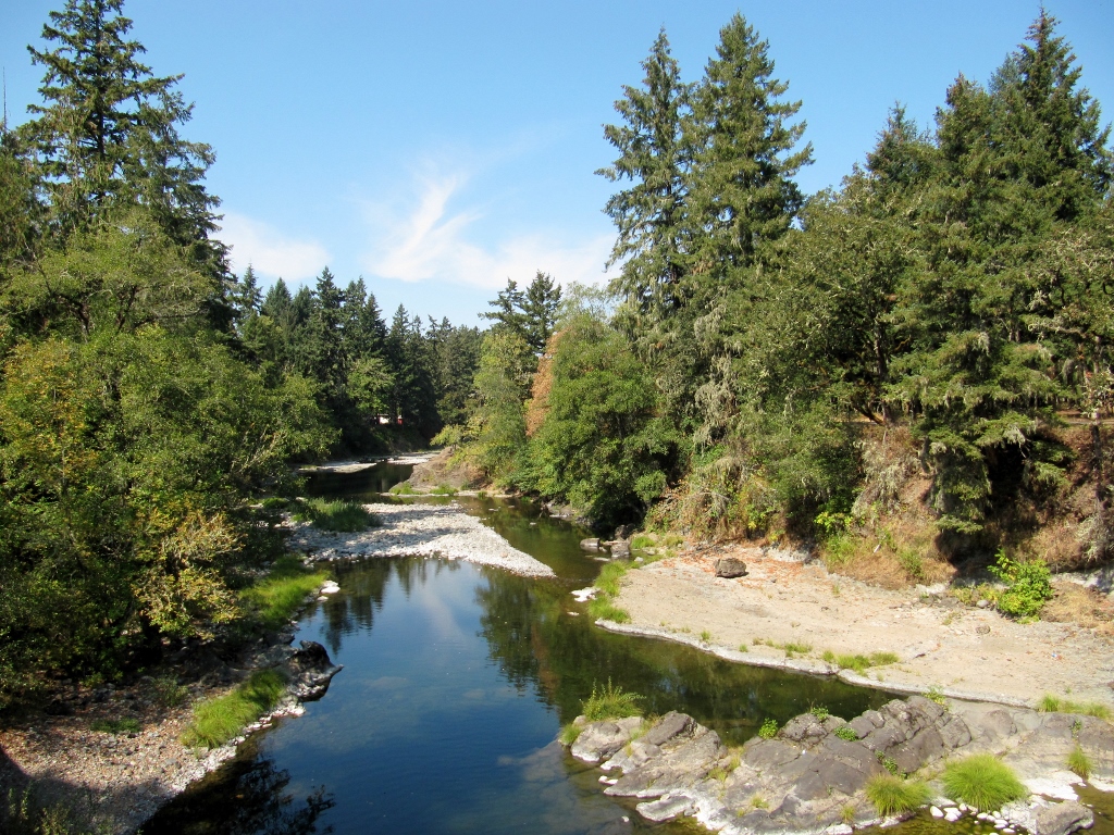
Row River
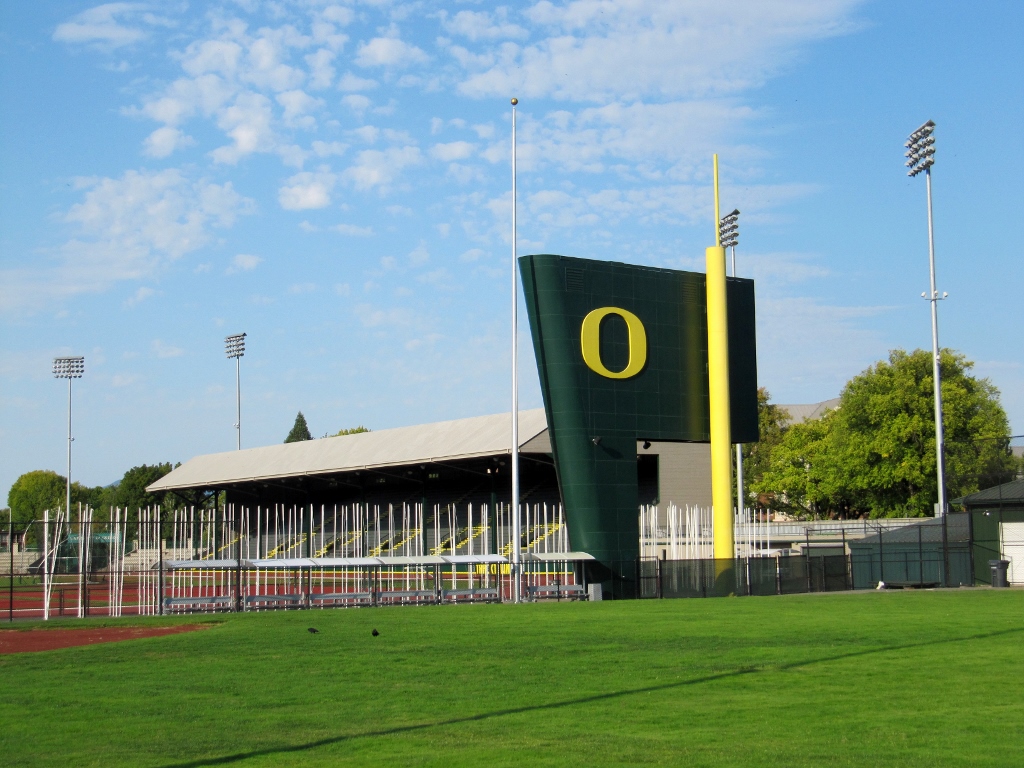
I see now from studying the map above that we could have seen a couple of additional covered bridges by taking other short detours off the trail. Too bad I didn't look at the map until after we rode the trail. D'oh! After completing the trail and the little extra on the road, I ended up with 35 miles and was ready to head back to Eugene. Barry set off on his bike to pedal back. He wanted to get a full century (100 miles) on the day, so he checked out a bit of the University of Oregon on his way back. 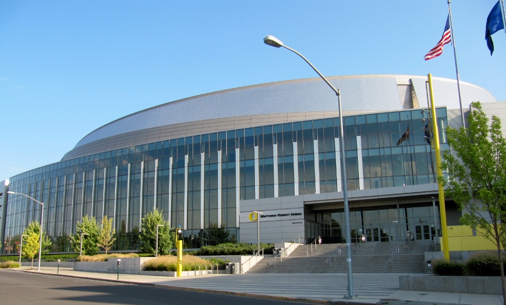
And the Eugene Pioneer Cemetery adjacent to the campus. 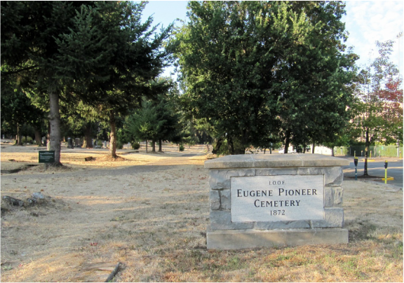
And this mural depicting logging activities in the area. 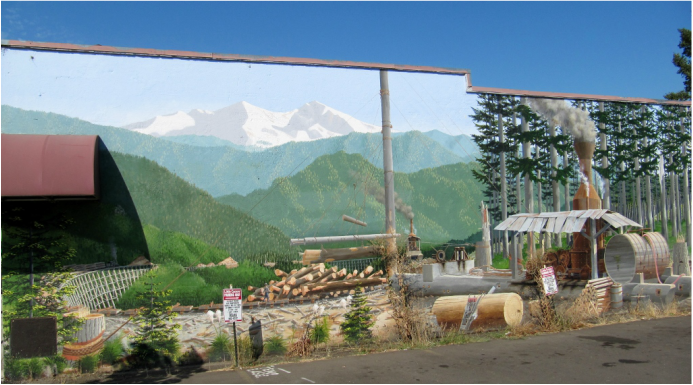
Barry got his 100 miles, I had a nice, easy ride, and we enjoyed some wonderful food that night.
Stay tuned for more from our last day in Eugene! |
Emily & BarryWe're a long-married, early-retired couple who are currently traveling as nomads with no fixed home base. After years of living in North Carolina (Emily's home state), we spent 18 months living oceanfront on Ambergris Caye, Belize, a year road-tripping the US in a Honda CR-V, a year in Playa del Carmen, Mexico, and are now roaming North America in our 32' motorhome, Pearl, following warm weather whenever possible. 
Paisley, May 2016
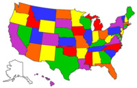
States visited (pre-RV)
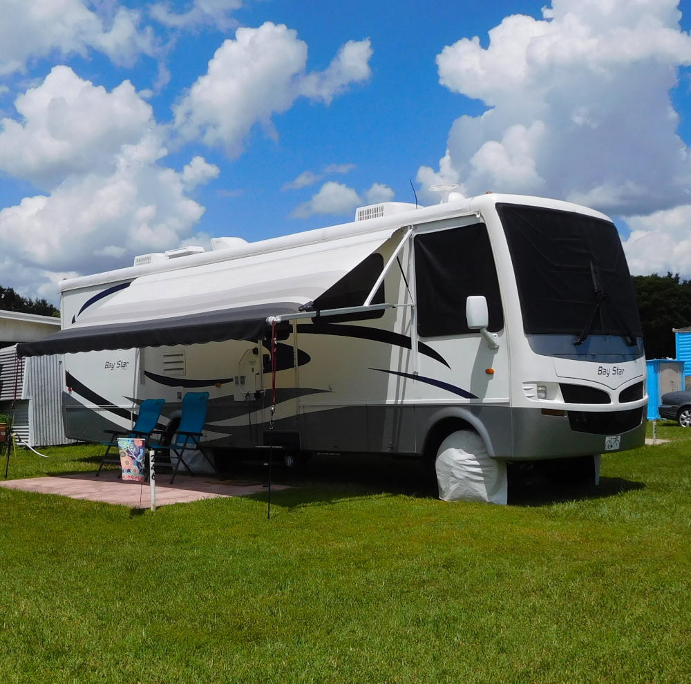
Pearl, a 2007 Newmar Bay Star
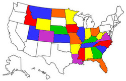
States visited in "Pearl"
Archives
July 2019
Favorite Travel Blogs |
 RSS Feed
