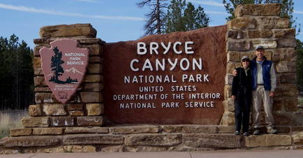
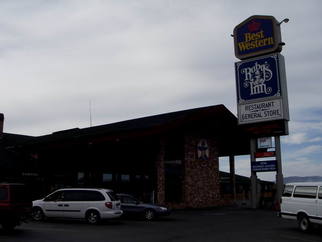
Thursday, May 11 - Bryce Canyon National Park
 |
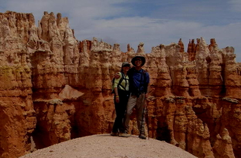 |
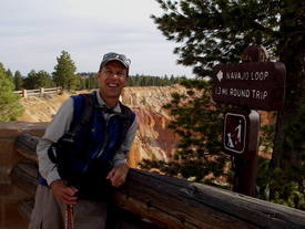
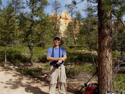
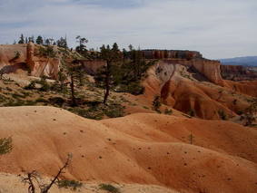
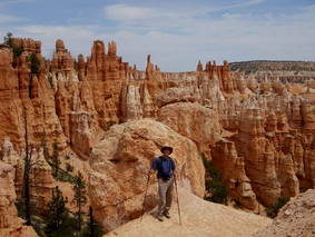
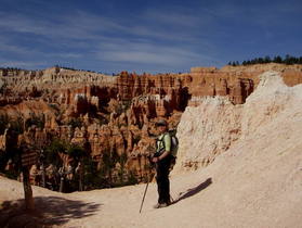
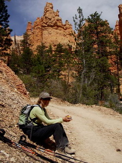
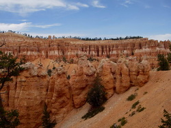
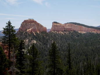
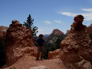
We had a great day today at this pretty-in-pink park. After a quick breakfast of an egg, cheese, and ham on a bagel sandwich from Ruby's Inn's fast-food restaurant (the line for the main restaurant buffet was too long as a busload of foreign tourists beat us to it by five minutes!), we drove the few miles to the park. The morning started with a chilly low of 27 degrees but warmed up very quickly. Our morning hike included three trails that inter-connected: the Navajo Loop, Queen's Garden, and Peekaboo Loop. These three trails are in the "Bryce Amphitheater" area, which is the most visited and apparently the most stunning area of the park. Unfortunately, this area near the park entrance attracts the largest crowds, and today was no exception. The parking lot was already quite full when we got there (before 9 am), including tour buses. On our first steep descent with many switchbacks on the Navajo Loop was full of Italian tourists talking and laughing loudly. It seemed an affront to this beautiful work of nature (as well as rude to those who preferred to appreciate her beauty quietly) to act this way, and we were relieved when we got a bit out of range and could no longer hear them. We figured, as is true in all of these parks, that once we got a mile or so away from the popular trailheads, we would leave the vast majority of tourists behind. Generally, past this point, the people we've encountered have been more serious hikers, quiet, and polite. And we don't encounter many people at all when we do the longer trails; yet another reason to do them - besides the amazing scenery that most tourists never see, of course!
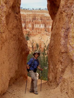
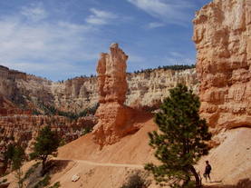
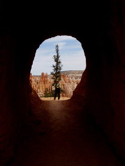
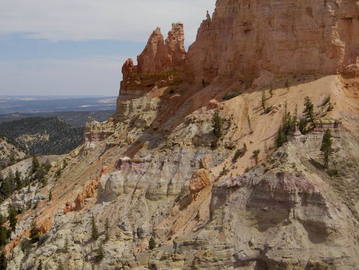
  Navaho Loop Trail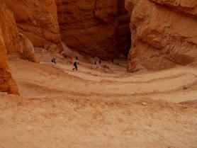 View of steep switchback trail down to canyon floor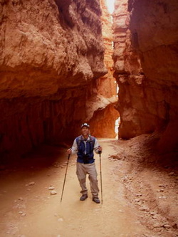 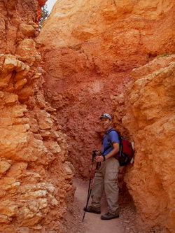 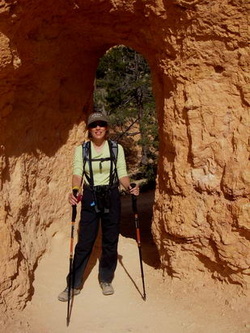 |
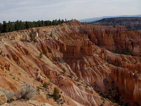
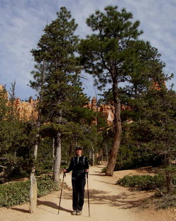
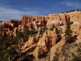
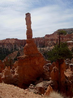
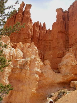
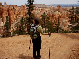
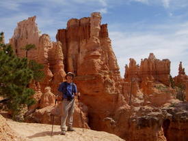
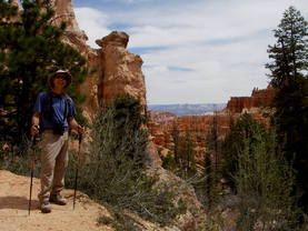
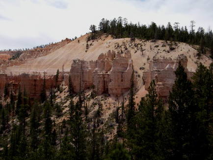
While the Queen's Garden trail is fairly easy, as it travels near the bottom of the canyon among Ponderosa Pine and junipers, the other two trails are rated strenuous as they consist of numerous short steep climbs and descents, with beautiful vistas and views of the colorful, lacy, and very unusual "hoodoos" in the park around every turn. We quickly peeled off our outer layers and were quite comfortable for the rest of the day; the temperatures were mostly in the 60s with an occasonal portion of the trail in the low 70s (depending on elevation, orientation, and sun). We felt very lucky as down at lower elevations very nearby in Utah, today's high was 93! The southwest has just begun experiencing a heat wave, which we will be dealing with tomorrow at the lower-elevation Zion National Park, but today we were very happy to be at Bryce.
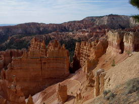
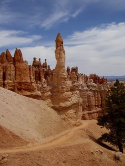
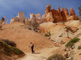
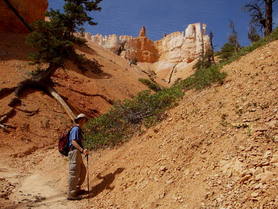
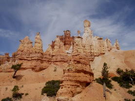
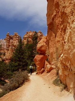
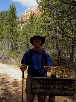
Queen's Garden Trail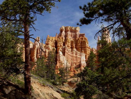 This formation really looks like a castle in the pines!
|
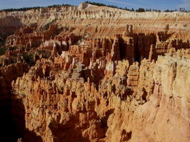
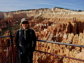
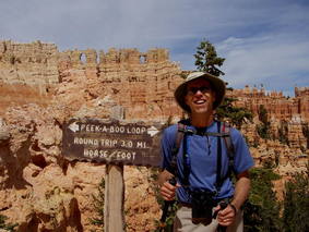
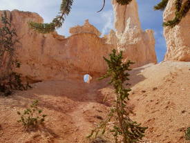
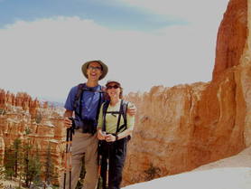
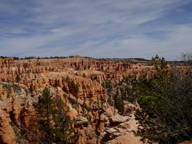
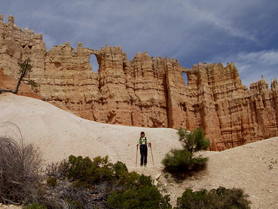
Peekaboo Loop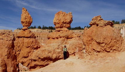 |
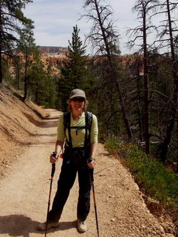
We also ran into a nice couple from Green Bay, Wisconsin that Barry recognized from Arches a couple of days ago, so we had a nice chat with them on the trail. They are into hiking as well, around our ages, and enjoy staying in less busy, less touristy places. They recommended the bed & breakfast where they are staying in the nearby town of Tropic, should we ever come here again, and also a couple of good hikes in Zion, since they had already been there. We are finding that many people have a similar trip plan as us and are visiting all the national parks in Utah on the same trip, some also adding the Grand Canyon, Sedona, and other areas, as we did. Between our many stops for pictures, and this rather long chat, we ended up on these trails for a little over 4 hours, logging 7.22 miles and 1825' of climbing. |
         |
|
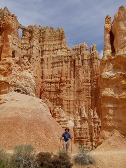

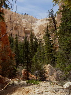
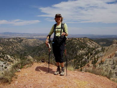
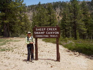
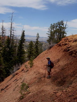
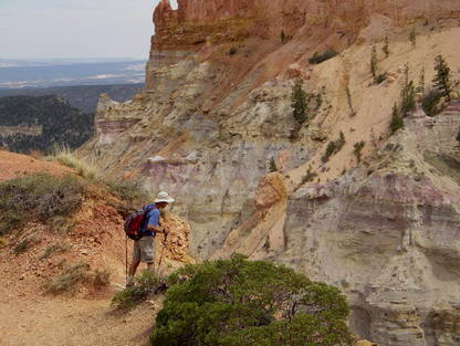
After returning to the Sunset Point area where we began our hike, we had our little granola-bar-and-peanut-butter picnic (just think of all the money we are saving not eating lunch out every day!) and talked about what hike we might do in the afternoon. I finally located a trail in one of the "backcountry" (i.e., non-touristy) parts of the park, the Swamp Canyon Loop, at 4.3 miles, so we headed up to the trailhead and took off, not realizing that we'd misinterpreted a sign at the very beginning of the loop and gone down the south side of the loop rather than the north side. After a one-mile descent from the canyon rim, the Swamp Canyon loop intersected the Under-the-Rim trail, a 23-mile backpacking trail, and since we started on the wrong side of the loop, we turned exactly the wrong way on the Under-the-Rim trail to return up the other side of the Swamp Canyon loop. We kept walking and walking (uphill) until I finally started realizing that we must have gone too far. But we decided to plug on just a bit longer just in case, knowing that we could always backtrack if we'd made a wrong turn, as the canyon wall was always to our right, so we were not lost, just a little misplaced! After a long, gentle climb, the incline suddenly steepened, and we found ourselves climbing switchbacks up the pink canyon rocks. High on a scenic overlook, we got a good look at a beautiful golden eagle soaring, which made all the climbing worth it. I should also mention that we never saw another hiker on this trail; it was incredibly secluded and peaceful, and mostly passed through conifer forests.
    |
   We trekked on a little farther on a narrow ledge of pink gravel that was pretty washed out so a little scary (it was a long way down if we slipped!), and finally, after another switchback, we saw the campsite that was supposed to mark our right turn back up Swamp Canyon loop. But oops! The sign indicated that this was the Whiteman Connector trail, the next trail south, which confirmed that we'd made a mistake early on in our hike and gone farther than planned.
No problem; we knew we could descend quickly and go back the way we came, and that we did. The mile climb up Swamp Canyon Trail was a bit strenuous, but the end was in sight at this point. When we got nearly to the top of the trail, we saw the turn we should have taken to begin with, in order to do a 4.3-mile hike. Because of our mistake, we ended up with 5.8 miles and close to double the climbing (around 950' total) since we climbed up the canyon most of the way again, prior to coming to the Whiteman trail. We were both hungry and tired at this point but very pleased with a 13-mile day (our longest hiking day and with the most climbing since our Grand Canyon hike ten days ago). We also knew that we could go pretty crazy at Ruby's buffet tonight! |
 |
 |
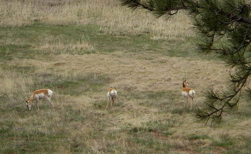
On our way back to Ruby's, we saw some cars stopped along the side of the park road and a few folks snapping photos out in the grassy area away from the road, so we knew there must be some wildlife to see. We stopped to check it out, and I jumped out and took a few photos. We didn't even know what the three beautiful creatures were until we read some park literature about wildlife seen here, and then realized they were pronghorn antelope! Very cool.
Next, on our drive back, we stopped at the Bryce Lodge gift shop and picked up a couple of souvenirs. This was a very nice shop (not tacky nor as overpriced as we'd found Ruby's gift shop), so I had to pull myself away from it! I did find a couple of pieces of jewelry I liked that were not too expensive, so I went ahead and got them, but told Barry they could be my anniversary present from him. He found a cap he liked so said that that could be his anniversary gift from me. We had already planned a very low-key 21st anniversary (on May 25), since this trip was such a biggie.
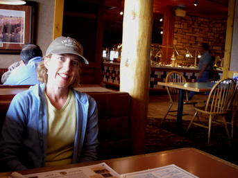
After cleaning up a bit back at the hotel, we headed down to dinner plenty early and really got our money's worth. We thought it was interesting that Ruby's buffet was exactly the same as last night, and normally I would have ordered from the menu because of that, but we were so starved that we didn't mind a repeat of last night's dinner. So, we ate salad, soup, pork ribs, and chicken, veggies, and cornbread once again. I was so full after all that that I could only manage a small bowl of soft-serve vanilla ice cream and caramel syrup for dessert, and Barry had butterscotch pudding and spice cake.
After cleaning up a bit back at the hotel, we headed down to dinner plenty early and really got our money's worth. We thought it was interesting that Ruby's buffet was exactly the same as last night, and normally I would have ordered from the menu because of that, but we were so starved that we didn't mind a repeat of last night's dinner. So, we ate salad, soup, pork ribs, and chicken, veggies, and cornbread once again. I was so full after all that that I could only manage a small bowl of soft-serve vanilla ice cream and caramel syrup for dessert, and Barry had butterscotch pudding and spice cake.
  Tomorrow we head to Springdale, Utah and Zion National Park; back to Vegas Saturday afternoon, then fly home on Sunday, arriving at our house just in time to catch the end of the "Survivor" finale, if I am lucky. I can hardly believe I'll be back at work on Monday. I wish this vacation never had to end, but it has been a wonderful one. Getting back to "reality" at home is going to take awhile!
|
  "Da Bear" with Da Bears! |
