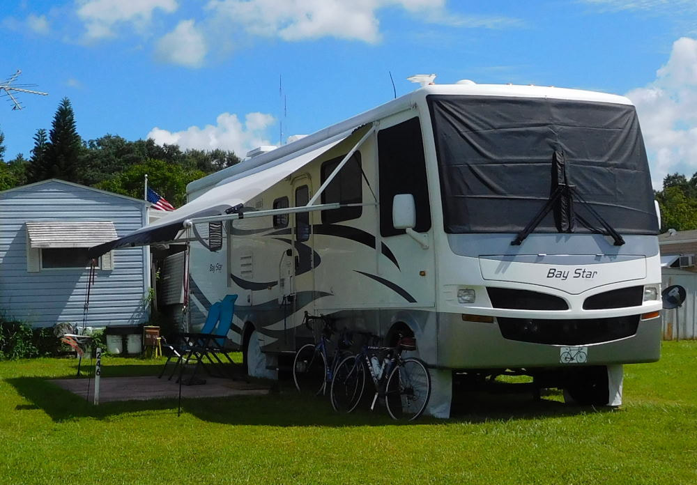
"Pearl" in Winter Garden, Florida
|
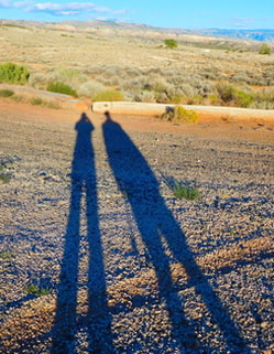
Long shadows in Wyoming
|
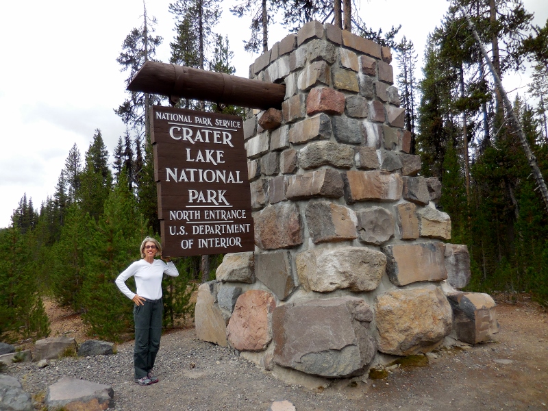 One of the things near the top of Barry's wish list during our time in the Pacific Northwest was to bicycle around Crater Lake, which is a stunning US national park near Klamath Falls, Oregon. The lake was formed by a volcanic eruption 7,700 years ago, which left a basin in the place where a mountain peak once stood. Over the centuries, rain and snow filled the basin, forming a deep blue lake -- the deepest lake in the United States, in fact, with unparalleled clarity. The lake is 1943 feet deep at its deepest point and holds 4.9 TRILLION gallons of water. Wrap your brain around that! Although the road around is "only" 33 miles long, a very reasonable distance to cycle, it very hilly and at high altitude, so I decided to let him go solo, since I wasn't sure how much fun I'd have riding it (huff - puff - hope to die!) Instead, I'd drive around with Paisley in the car, meet him from time to time, and take photos along the way. After seeing how hilly it is there, I definitely think I made the right decision! We were disappointed that we got an overcast and chilly day for our visit, but there was just no way around it. Even if we postponed a day or two, the weather was not supposed to improve for awhile. So, we had to go ahead and visit the day we left Eugene. Here's the Park Headquarters, just south of the lake, where Barry began his ride. On the plus side, since it wasn't the most gorgeous day, it was probably less crowded than usual. There were still a fair number of people there, though. 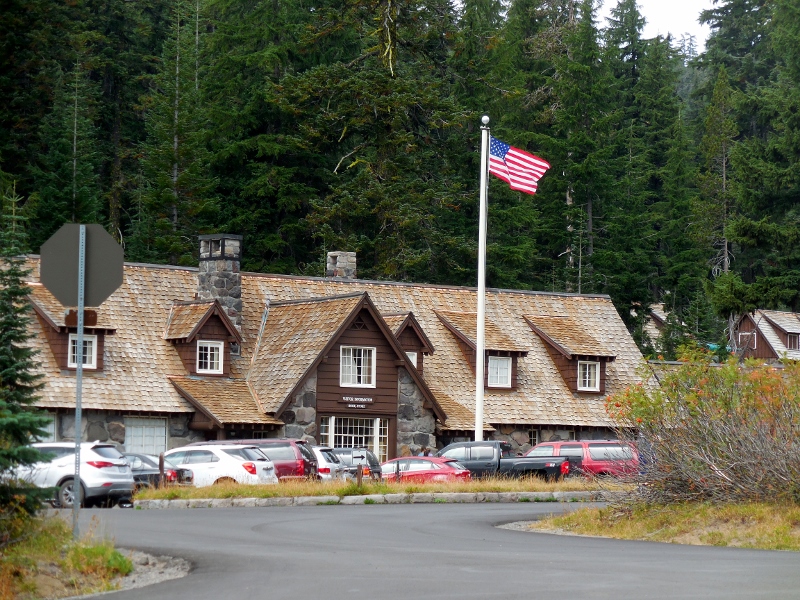 And he's off! 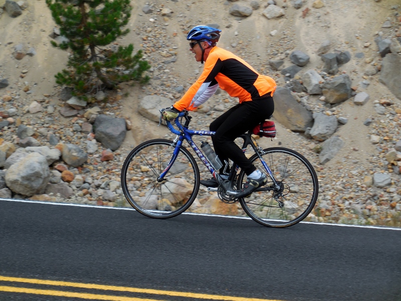 He got to start on one of the biggest climbs of the day. Lucky him (haha)! I drove it, and it went on and on. I don't know how he does it. 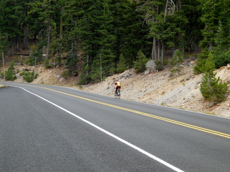 My first view of Crater Lake, from Discovery Point, was pretty gray and washed out. When the sun is shining, the water is a brilliant deep blue, so I was disappointed with the clouds. The lake was beautiful, of course, but I wanted to see BLUE water! The island in the lake is called Wizard Island. It is a cinder cone that erupted out of Crater Lake approximately 7,300 years ago. 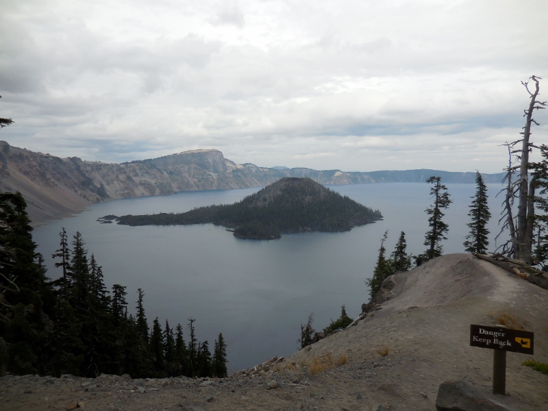 While waiting for Barry at one pull-out early in my circumnavigation of the lake, I saw a great hiking trail. You can barely see the hikers making their way up it as Barry comes up the road below them in his blaze orange. I was very glad he wore that brilliant jersey on such a gloomy day as it made him extremely visible. 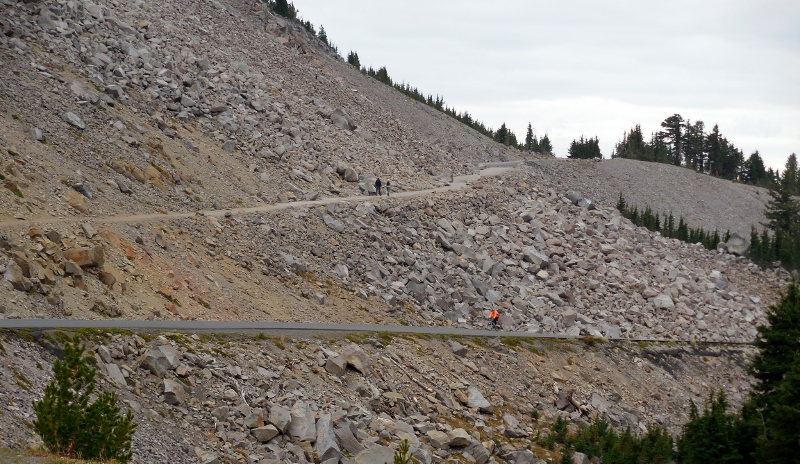 I'm not sure if this building at the top of the mountain with the hiking path is used or not. I bet the view from up there must be amazing. I would love to hike this trail one day -- perhaps we can go back again when the sun is shining and hike! 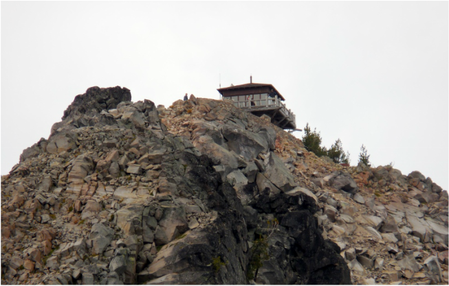 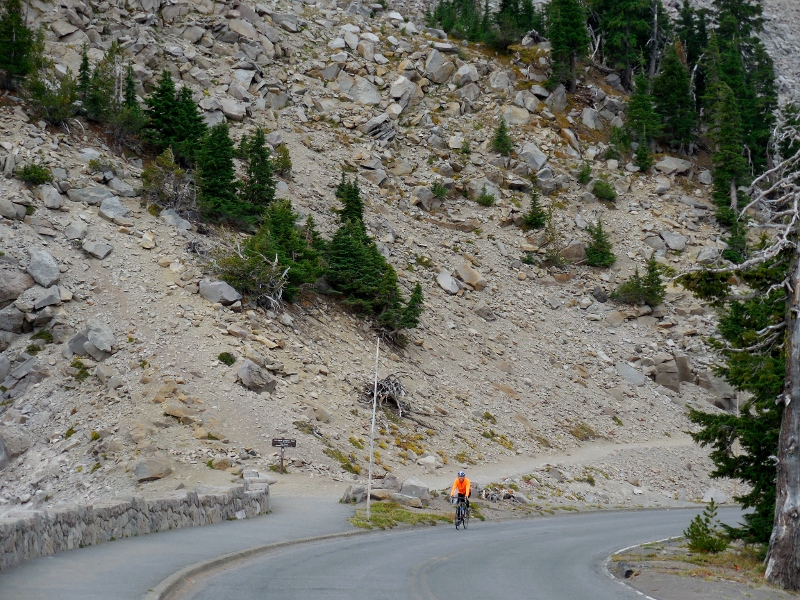 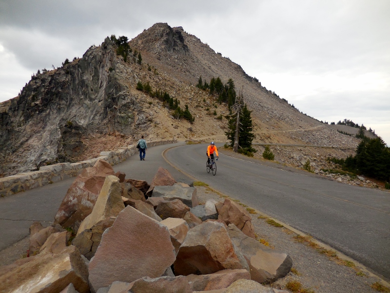 The mountains around the lake were gorgeous. 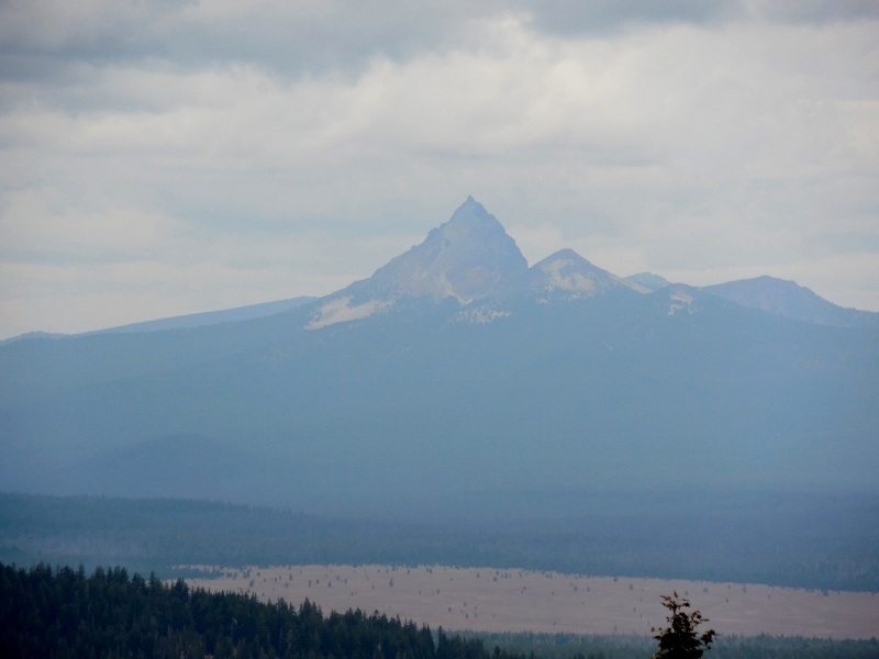 I've got to hand it to him, each time we met up, Barry was in great spirits, despite the gloom and difficult terrain. He just loves to ride his bike! 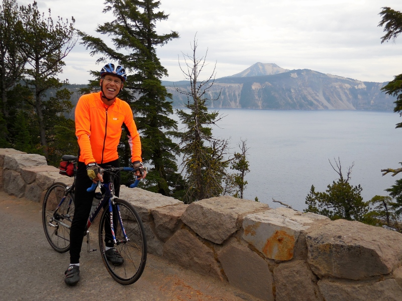 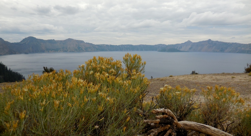 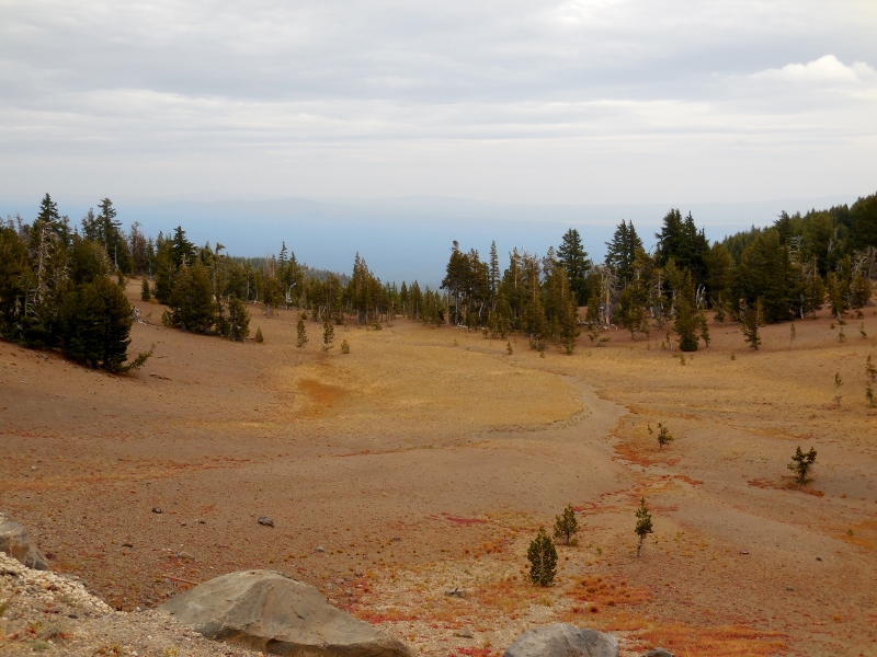 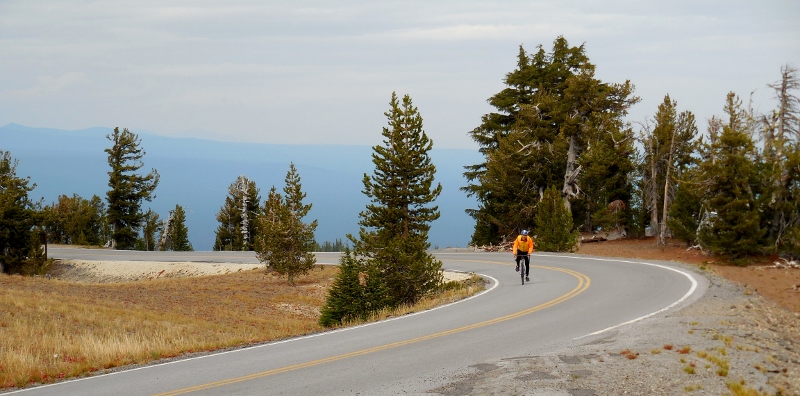 This photo reminds me of one of our favorite Phil Liggett commentaries during a Tour de France broadcast from several years ago: "This is a man who knows how to suffer". 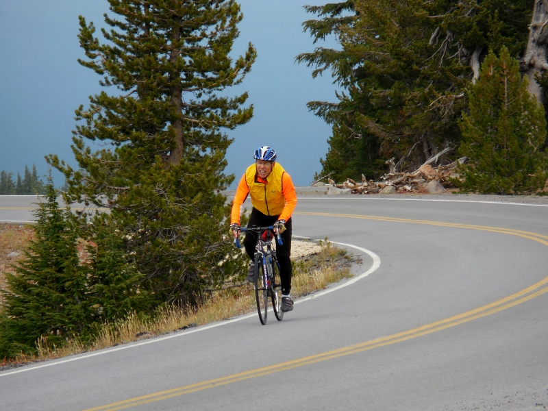 On the east side of the lake, I drove up a one-mile spur road to Cloudcap Overlook. This road is the highest paved road in Oregon! It was windy and harsh up here, but the view down to the lake was lovely. 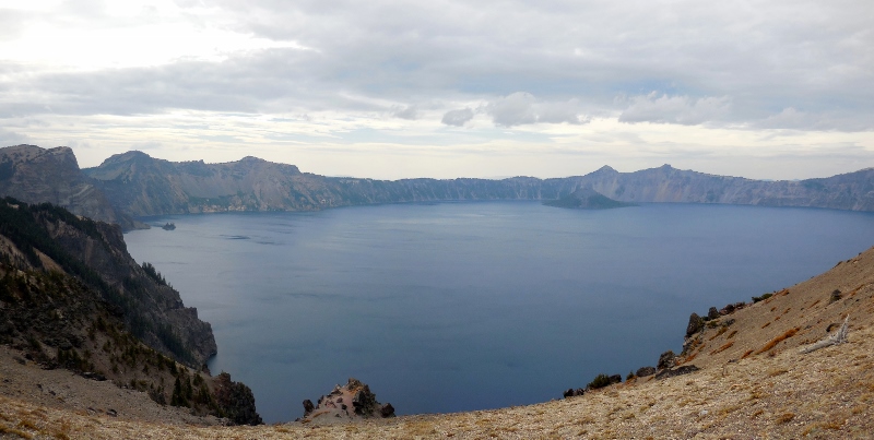 Here was the view to the rim road below from Cloudcap Overlook. I had just missed getting a photo of Barry (who would have been a tiny dot from this vantage point) going around the bend as he had a descent there and was flying! 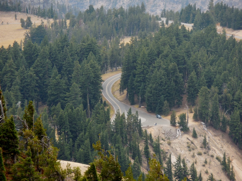 Here is Pumice Castle Overlook, one of the park's most interesting and colorful features. The orange pumice rock has been eroded in the shape of a medieval castle, or so says the park brochure. Do you see it? 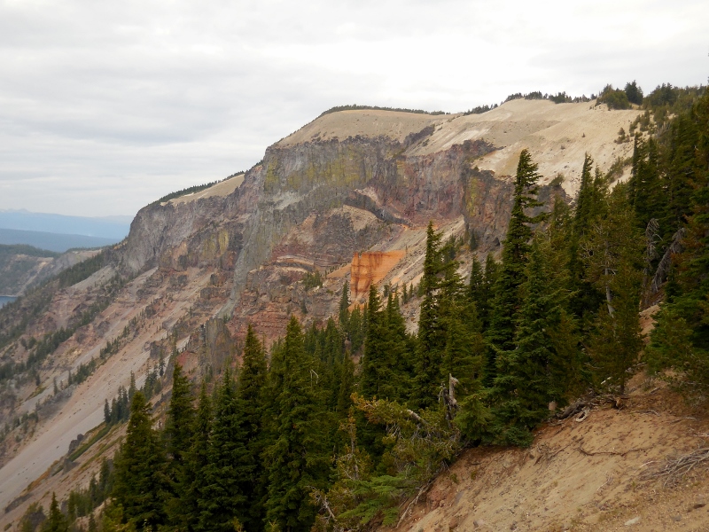 How about now? 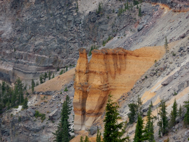 This area is called the Phantom Ship Overlook. This island is supposed to resemble a sailboat, but I actually though it looked more like a castle than the previous formation. 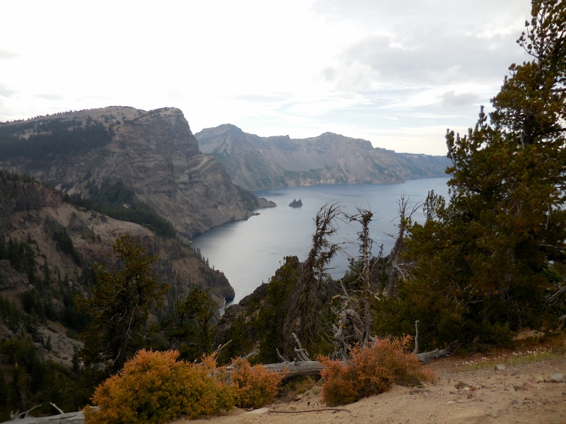 Castle or sailboat? You be the judge. A fun fact: this island appears so tiny, but is actually as tall as a 16-story building! It was formed of erosion-resistant lava, 400,000 years old. Mind-boggling, really. 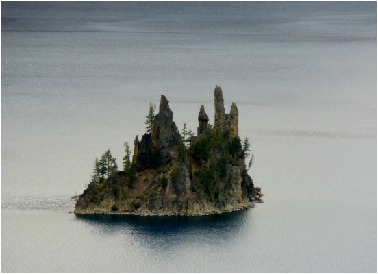 I still think it looks like a castle. But perhaps that is just my inner princess coming out! 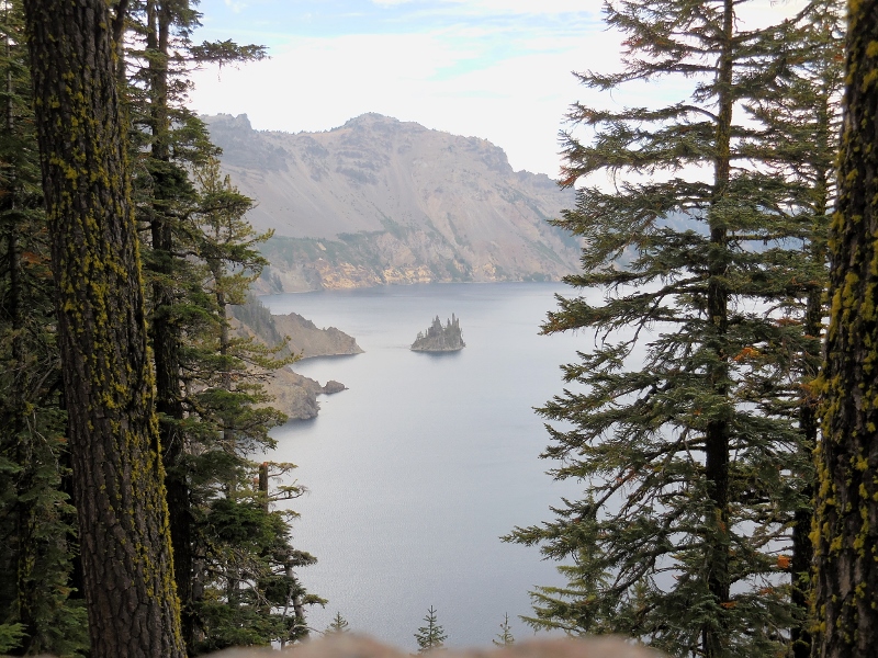 Here is Videa Falls. Very pretty. It is supposed to be glorious in summertime with wildflowers, but we were a little too late for that. 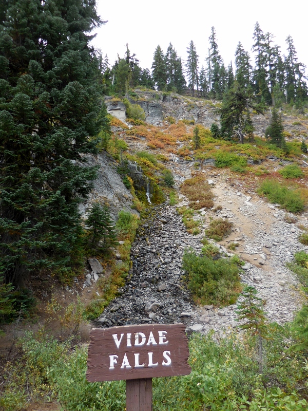 It was still really pretty with the moss and other greenery. 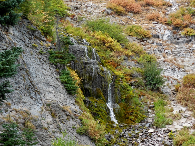 Videa Falls In the meantime, the sun was finally trying to peak through the late afternoon clouds, and the water was bluing up. FINALLY! 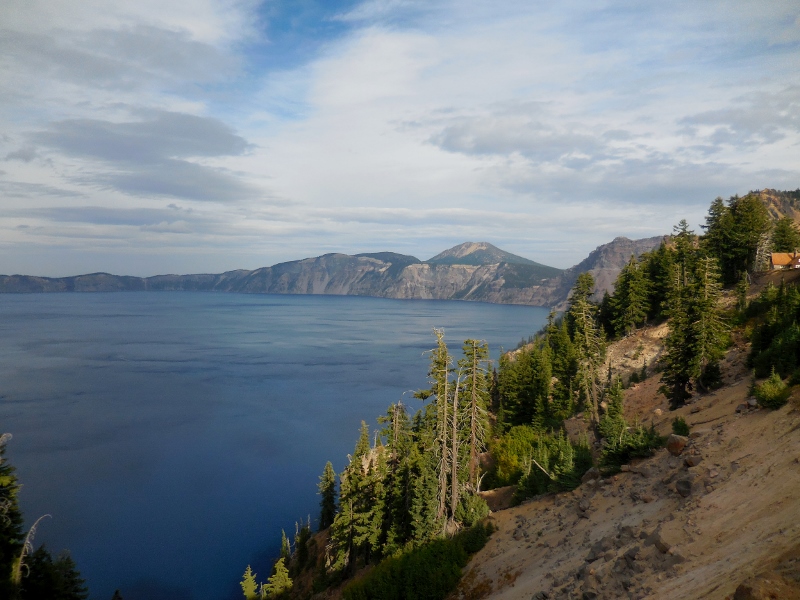 Up close -- so pretty! 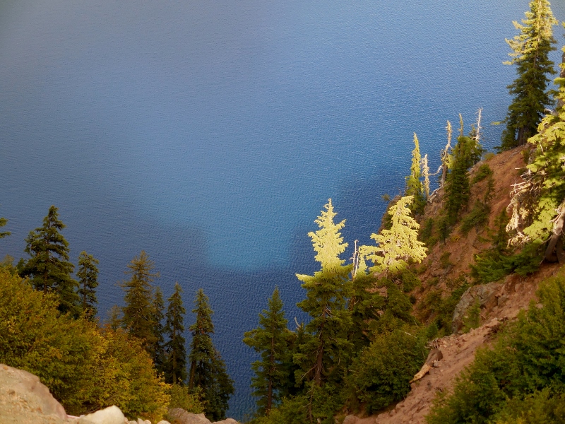 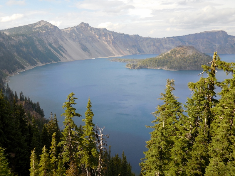 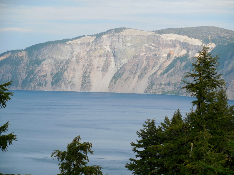 I'd now made my way all the way around the lake and waited for Barry at Rim Village on the southwest point of the lake. He had decided to make the initial climb a second time just so he could turn around and enjoy one last screaming descent! There's a visitor's center, cafe, and gift shop here as well as a lodge. You can see the trolley parked here as well. I saw it on the road many times as I made my way around. This takes tourists around the rim road to all the major outlooks if they prefer not to drive (or bike!) themselves. 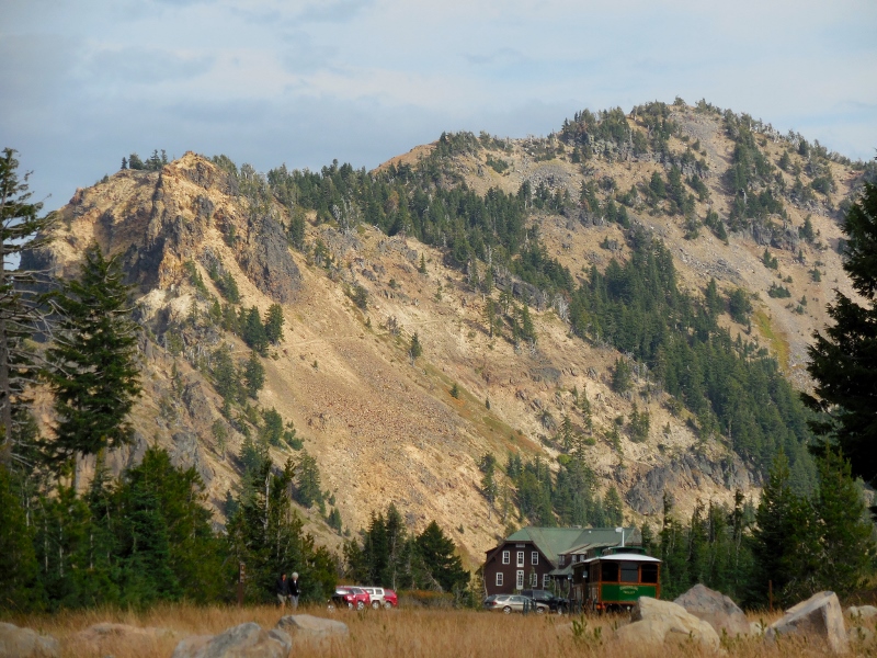 And Barry's done, looking no worse for the wear! He said the ride was incredibly challenging, but he was very glad he did it. 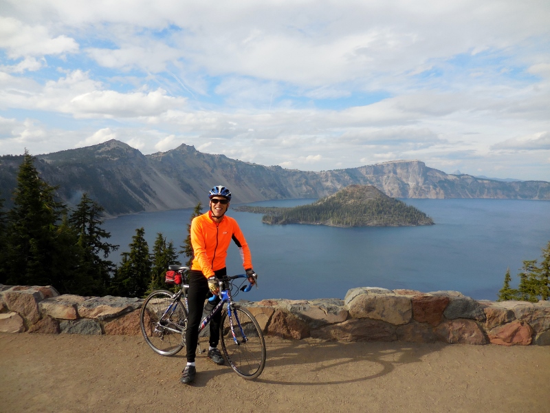 The lake looks much better than earlier in the day now that the sun is peaking through the clouds. We were so glad it came out at last. Better late than never! 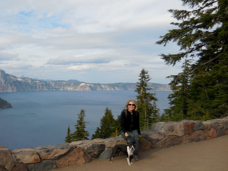 And one last look at a beautiful lake and national park before continuing south to our next destination. 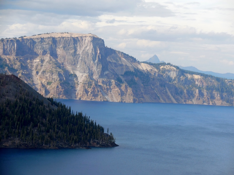 Stay tuned for northern California and the AMAZING redwoods, another must-see, bucket list destination!
1 Comment
10/8/2014 07:01:48 am
Breathtaking ... probably literally too! Still continue to be pleasantly surprised by the West. =) Leave a Reply. |
Emily & BarryWe're a long-married, early-retired couple who are currently traveling as nomads with no fixed home base. After years of living in North Carolina (Emily's home state), we spent 18 months living oceanfront on Ambergris Caye, Belize, a year road-tripping the US in a Honda CR-V, a year in Playa del Carmen, Mexico, and are now roaming North America in our 32' motorhome, Pearl, following warm weather whenever possible. 
Paisley, May 2016
States visited (pre-RV)
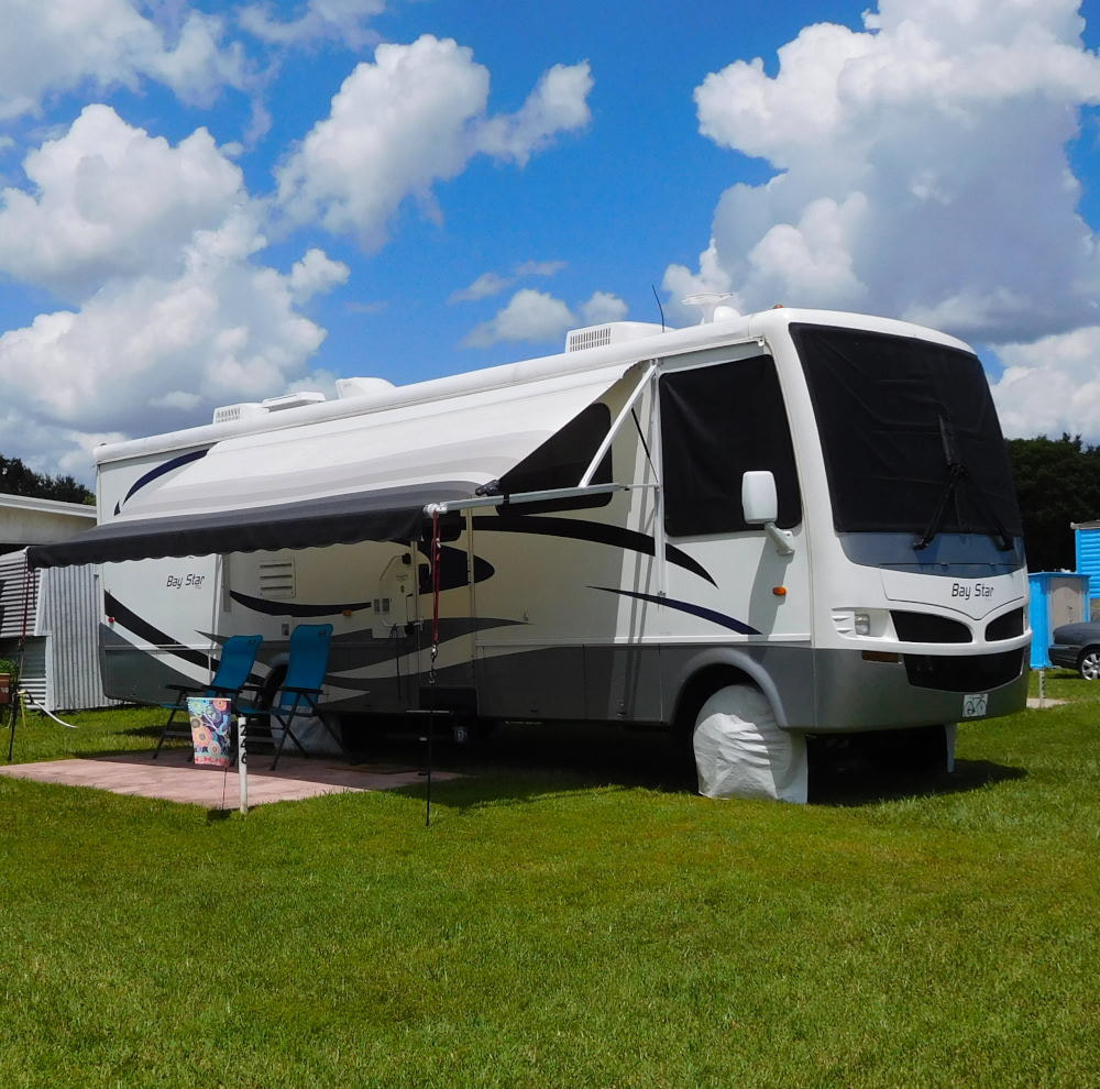
Pearl, a 2007 Newmar Bay Star
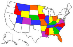
States visited in "Pearl"
Archives
July 2019
Favorite Travel Blogs |
 RSS Feed
