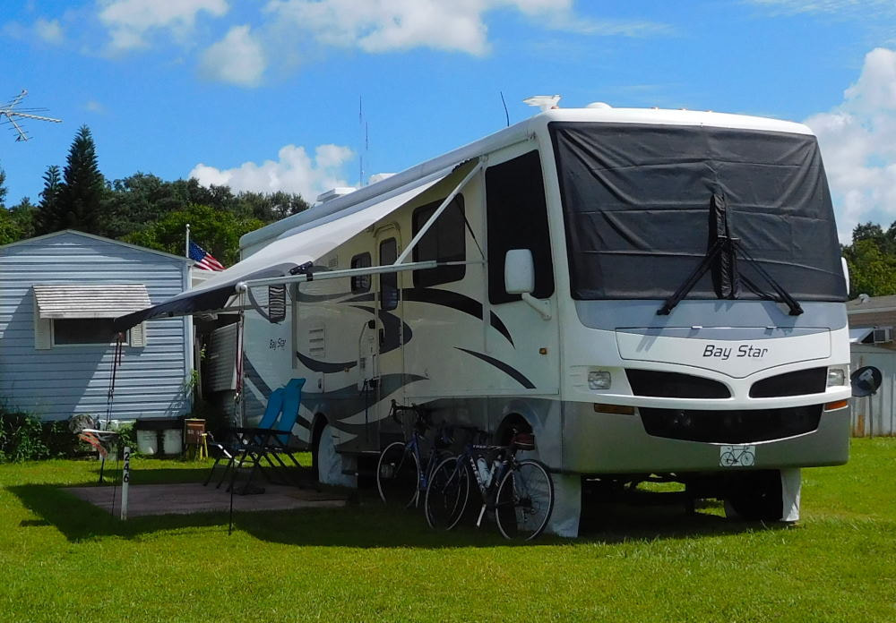
"Pearl" in Winter Garden, Florida
|
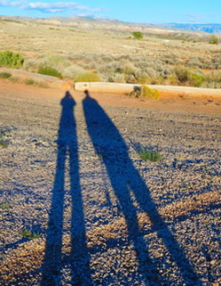
Long shadows in Wyoming
|
|
Since arriving in Portland, Oregon late Monday afternoon, we've been having an amazing, busy time and have been on the go almost every minute! I've already fallen way behind on blogging, and it will take a week of rainy days to get caught up completely. But before we even start blogging Portland, I wanted to share our photos from the absolutely stunning drive we had heading west from Walla Walla in eastern Washington State. We got some great travel tips from my friends Terese and Teri, so we took our time and enjoyed the beautiful sights along the way. The Columbia River Gorge is absolutely "GORGE-ous"! The first dramatic sights began right after we turned off WA Highway 12 onto Highway 730 near Wallula. All of a sudden we came over a hill and the Columbia River was right THERE, staring us in the face. We were greeted with amazing gorge views like these. And of course it was much more dramatic in three dimensions than flat photographs can begin to show. 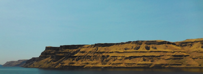
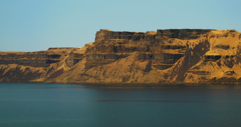
We crossed into Oregon soon after and would drive westward along the Columbia River for miles and miles, seeing dramatic cliffs, wind farms, and breathtaking views everywhere we looked. 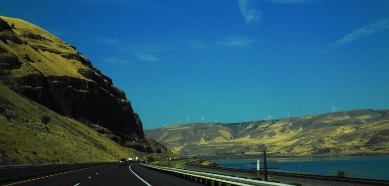
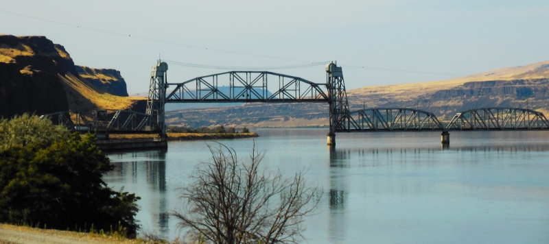
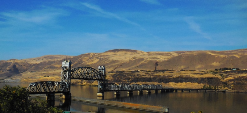
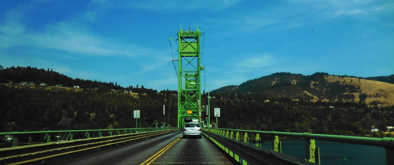
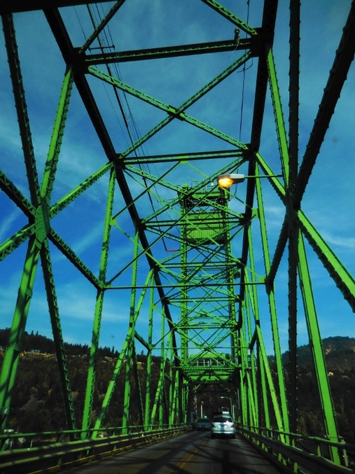
There were quite a few bridges across the river between Oregon and Washington, all unique in design. 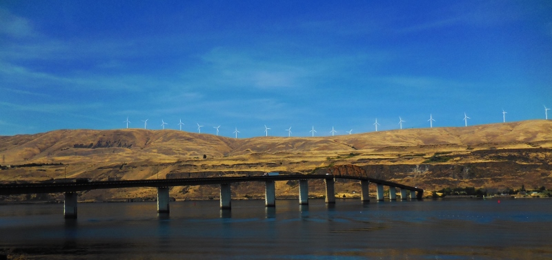
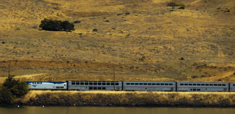
Amtrak train on WA State side of Columbia River
As Terese told us, rather abruptly the scenery would change from dry, brown desert-like landscapes to green, forested, and lush. She was absolutely right. It does happen suddenly and takes you by surprise. And even though the sky was a bit hazy as we headed further west, all of a sudden we caught a glimpse of Mount Hood in the distance, looking incredibly regal, as if it were standing guard over the valley below. Wow! 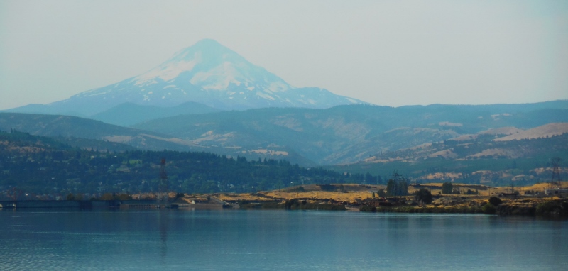
Mt. Hood
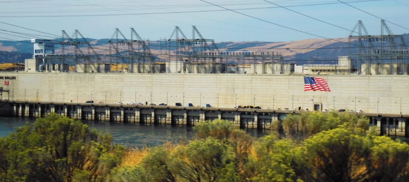
Dam at The Dalles, Washington
We paid $1 toll to cross over to Washington to see the views from a different angle on this pretty green bridge. You can see how many evergreens grace the river banks now. Washington is called "the Evergreen State" for good reason! 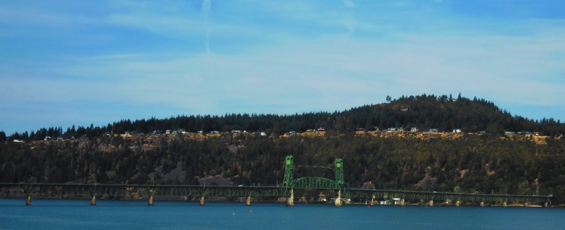
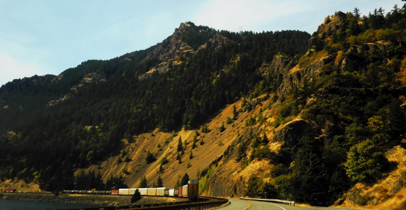
Washington landscape and freight train
The sun wasn't right to get any good photos of the Oregon side, so a bit over 20 miles farther west we paid another $1 to cross over this bridge back to Oregon. 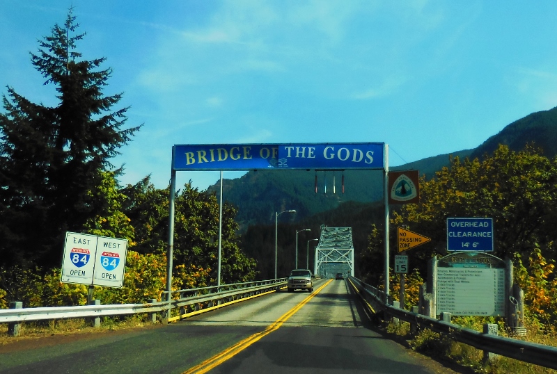
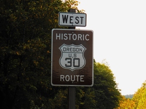
Soon thereafter, we chose to get off the interstate and take the winding, scenic old highway 30 past a group of waterfalls in this area. Both Teri and Terese had highly recommended checking them out.
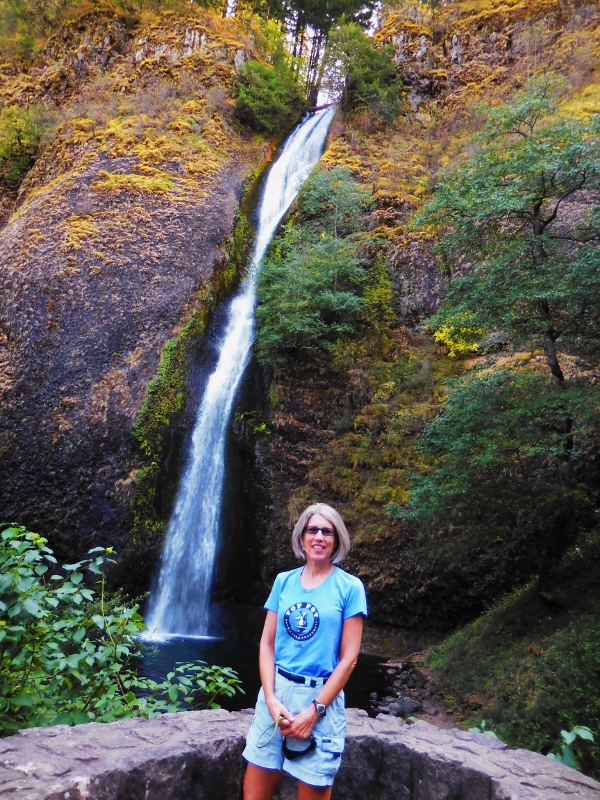
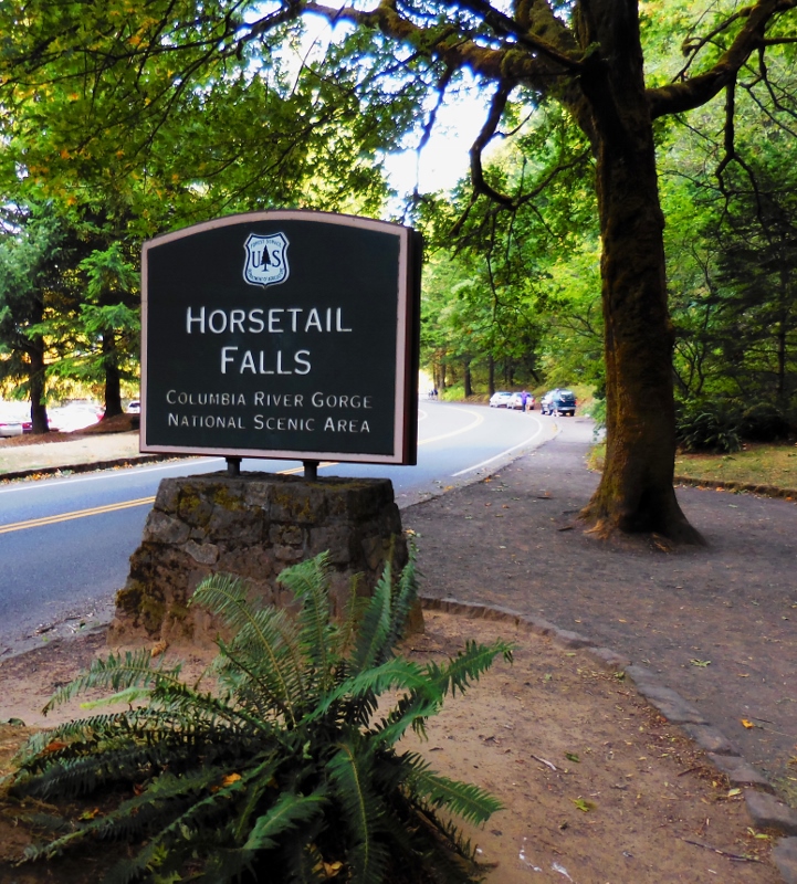
Horsetail Falls
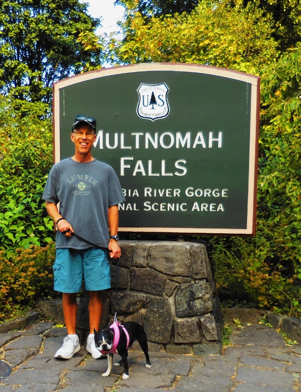
Next on the agenda was the tallest waterfall in the state of Oregon, Multnomah.
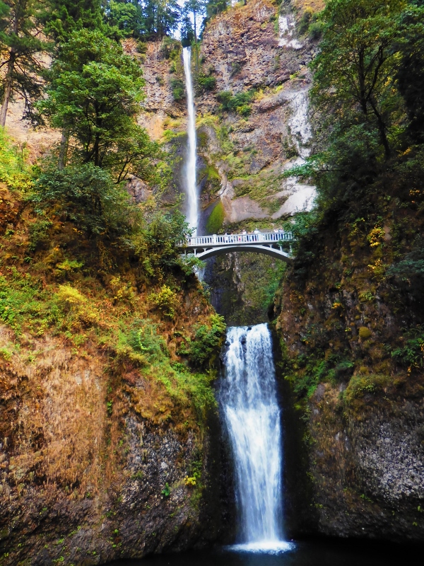
Multnomah Falls -- of course we hiked up to the bridge!
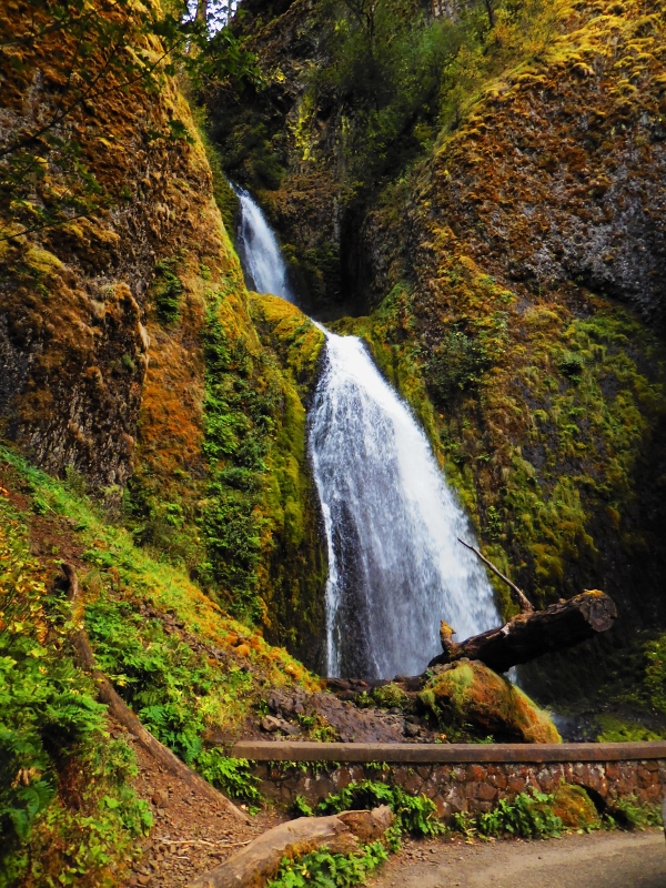
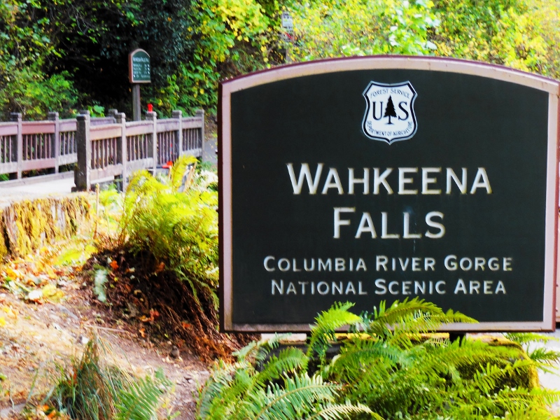
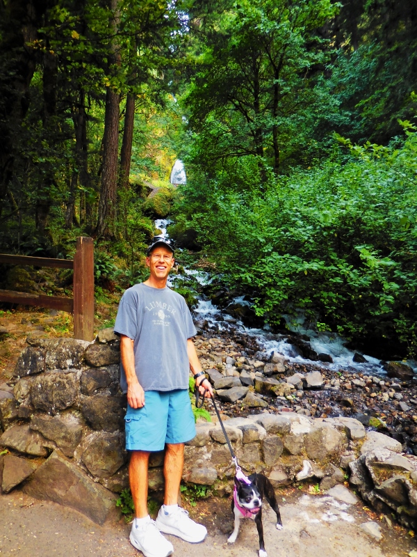
Wahkeena Falls
We made one final quick photo stop at a viewpoint at the pinnacle of the windy climb up Highway 30. Here's the building at the pinnacle. 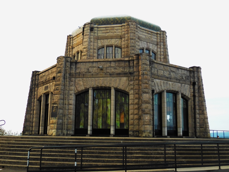
And the view from above, which was stunning. Contrast this with the rocky view when we first encountered the Columbia River Gorge earlier in the day, and you can really see the difference in landscape features. It was refreshing to be back in an area with so many trees after the more arid eastern Washington landscape we'd been living in for a couple of months (although my hair is not a fan of the humidity!) 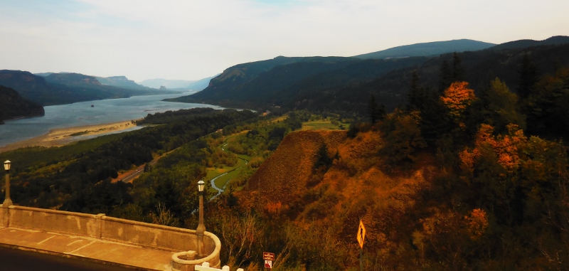
Zooming in... 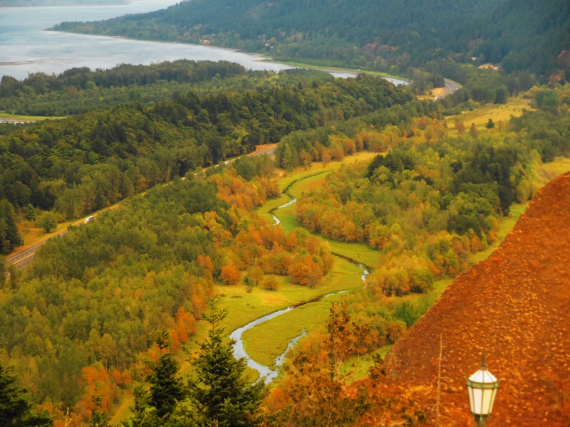
Beautiful fall color beginning in the river valley below
When we got into the Portland Metro area shortly after taking this final photo, we had to deal with tons of commuter traffic and the serenity we felt on this beautiful drive quickly fell away. But there were still plenty of good times to come, so stay tuned!
2 Comments
We've been seeing an advertising crawl on TV for Granny's Tamales ever since arriving in Walla Walla at the beginning of July. Looking them up online, I discovered that it is a family-owned business that originally started in Corpus Christi, Texas (where we spent the month of January!) using their grandmother's recipe. The business expanded to Walla Walla when another sibling decided to start making the tamales here. We noticed that they had a booth at the Downtown Farmer's Market on Saturday mornings and finally, on our last Saturday in town, decided it was high time we give them a try. We had chosen several flavors we wanted to try before we even got there. So at the booth, we were a bit taken aback to learn that you have to buy a dozen of the same flavor as that is how they are sold and packaged. It keeps them warm bundled together that way and is certainly simpler for the staff. At $12 a dozen and having only one night to eat them all, we weren't going to be able to taste a variety of different flavors, like we hoped. We finally settled on the chicken jalepeno cream cheese and purchased a dozen to take home. They told us that was their most popular flavor. 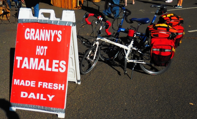
Our Bike Friday folding bikes at the farmer's market
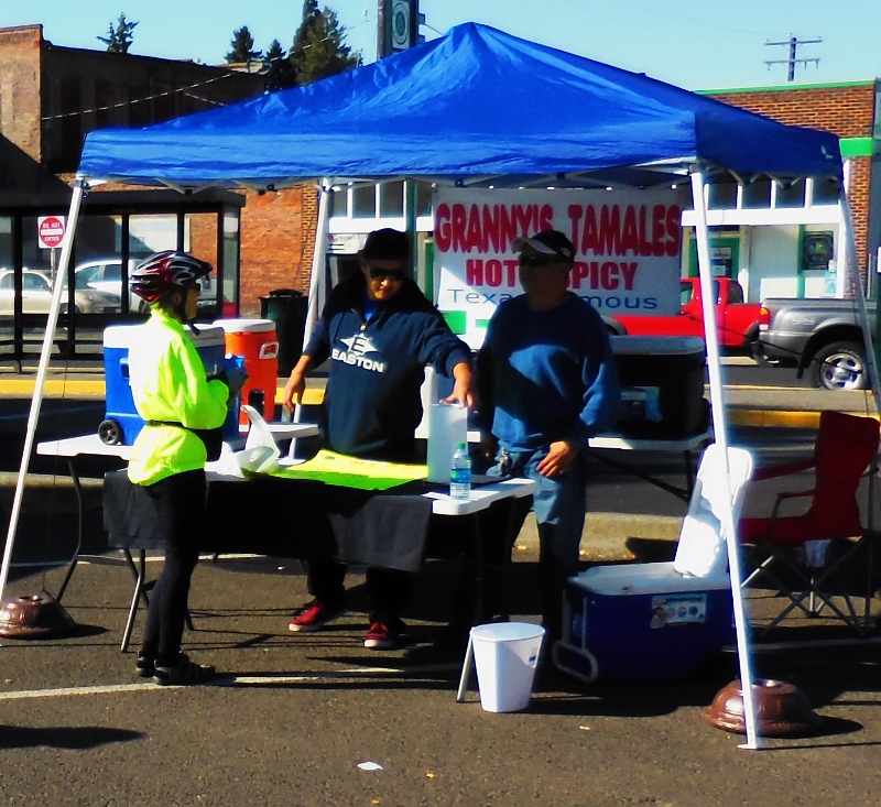
I'm trying to make a difficult decision on filling choice
I popped them into the fridge when we got back "home", and at dinner time, simply heated them in the microwave in their husks. These are not large tamales, so a dozen was the perfect number for a dinner for the two of us: I ate five, and Barry ate seven. I made baby kale with Walla Walla onions and cherry tomatoes as a side dish. 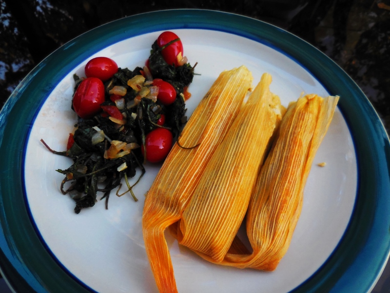
So how did they taste? Yummy! There wasn't a lot of noticeable chicken, but the filling was spicy and good. Accompanied with chips, guac, and a Corona with lime, this was the perfect late-summer meal out on the deck. 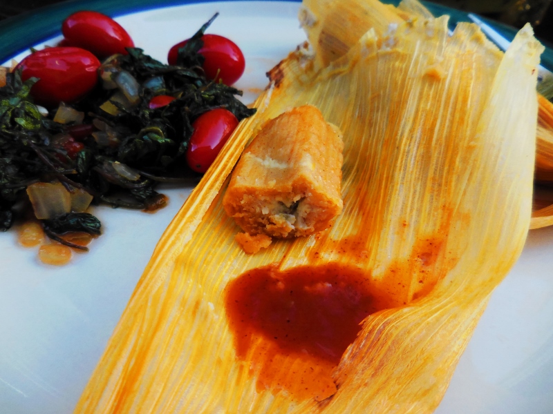
Yum!
We're glad we finally tried Granny's Tamales. They were a great way to finish up our summer here in Walla Walla!
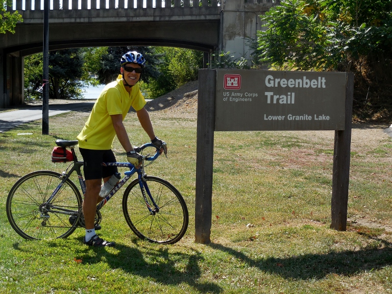
I didn't get the significance of the names of the two adjoining cities of Clarkston, Washington and Lewiston, Idaho at first. I finally put two and two together when I saw an information board indicating that we were cycling trails very close to the Lewis and Clark Trail...d'oh! Now I get it. Some of us are a little slower than others! We took a day trip here from Walla Walla to ride the Greenbelt Trail in Clarkston and the Levee Parkway Trail in Lewiston. These two paved trails are connected by two bridges across the Snake River, so you can park in one place and ride on both trails for several hours, if you like. And yes, we liked! 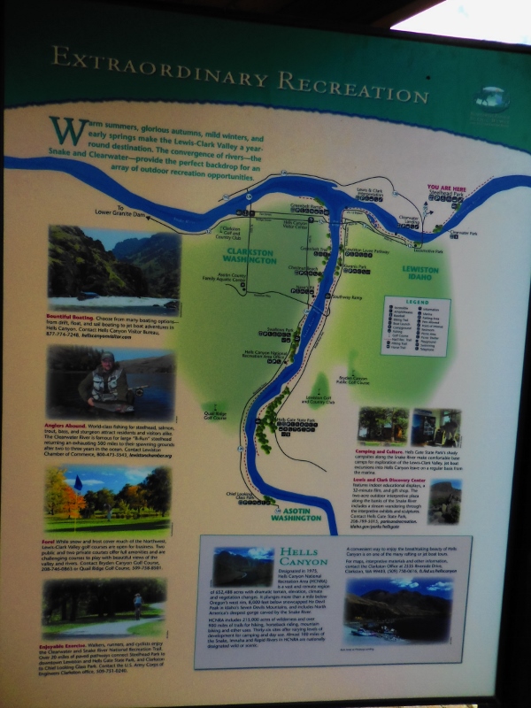
Map of the area rivers, trails, parks, and other sights
We parked at Granite Lake Park in Clarkston and started our ride on the Washington side, riding out and back on the Greenbelt Trail along the Snake River first. 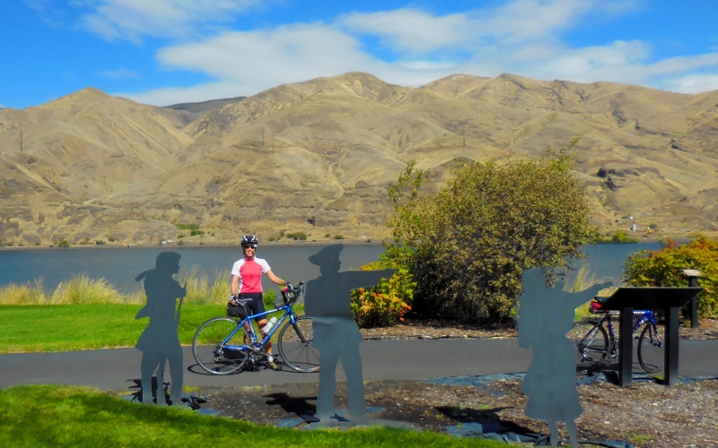
Starting out at Granite Lake Park by Lewis & Clark metal sculptures
This unique house right beside the road overlooking the Snake River caught my eye. I'd love to see the interior! 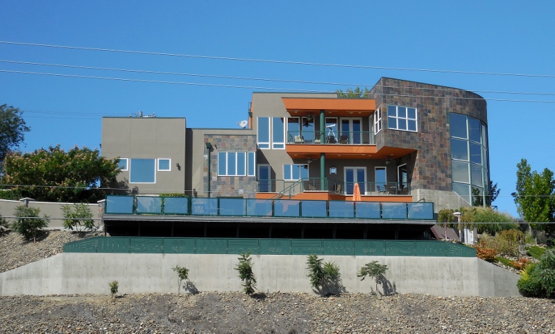
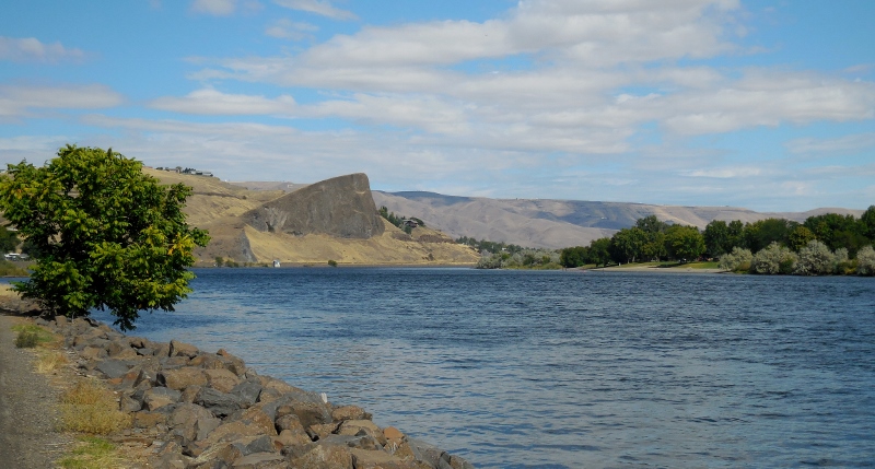
Snake River
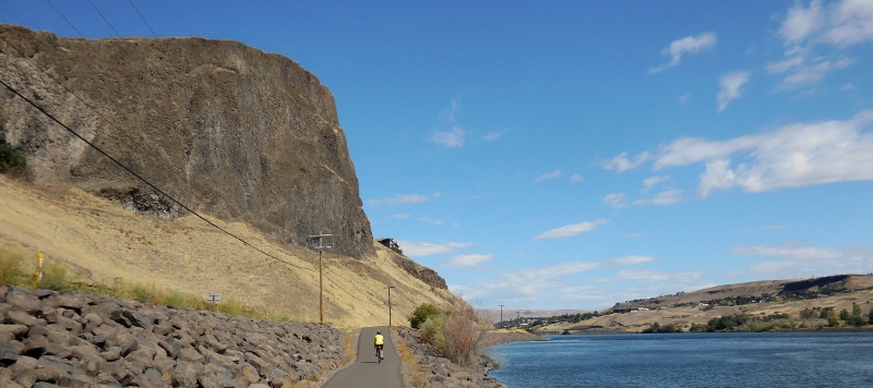
Dramatic rock cliffs along the Greenbelt Trail
The Greenbelt Trail is only seven miles one way, so after riding from the north to south endpoints and most of the way back, we crossed over the Snake River on one of the bridges to Idaho and the Lewiston Levee Trail. 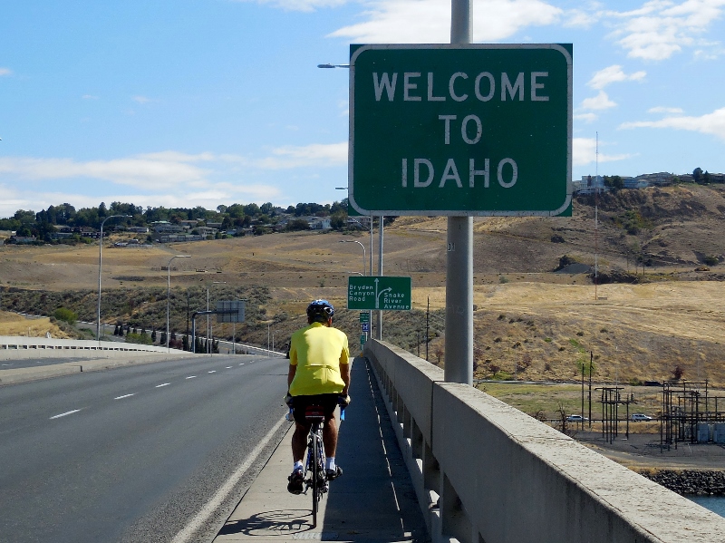
The Lewiston Levee Parkway is approximately 11 miles in length. We started at around the mid-way point of the trail after getting off the bridge and headed south. 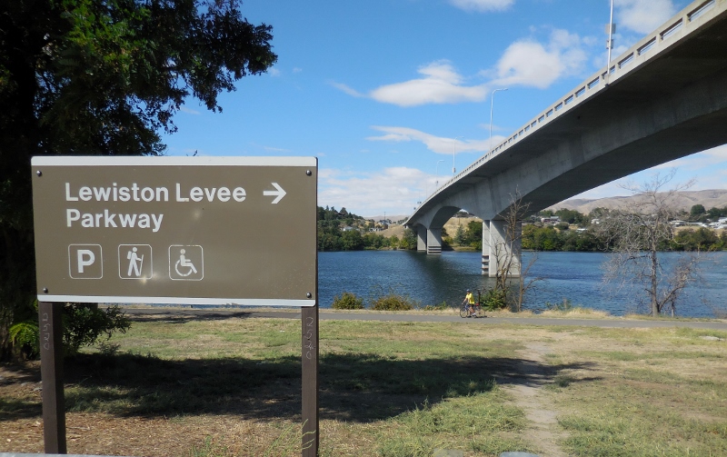
Looking across the Snake River, the Clarkston Greenbelt trail is right on the other side, where we just rode. 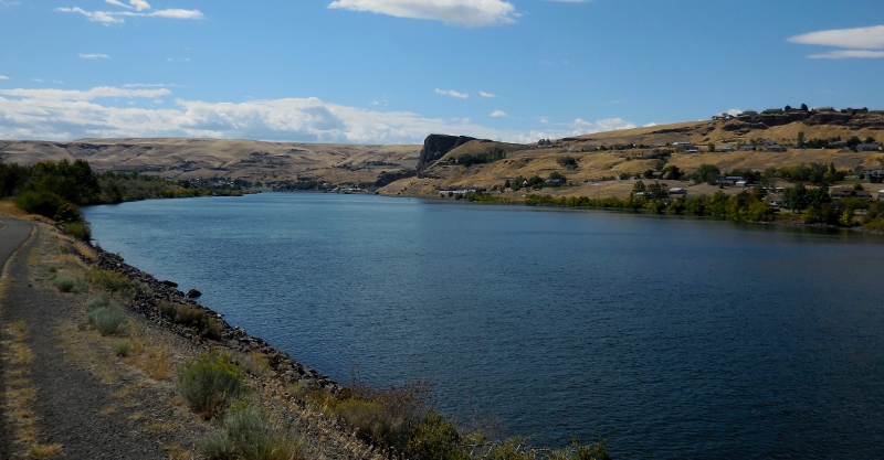
At least on this Wednesday, the Clarkston side was busier than the Lewiston side, probably because the Greenbelt trail passes through numerous parks in just a few miles, with plenty of parking all along. The Lewiston Levee Parkway is a bit more isolated at its south end. The southern terminus of the trail is in the Hell's Gate State Park, which was also very quiet. I'm sure it's busier on weekends as there's a marina and boat ramp in addition to camping. 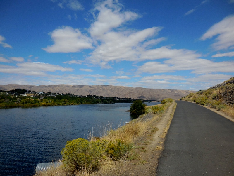
We had this part of the trail to ourselves
Here's a funny sign at the camp store at the state park. 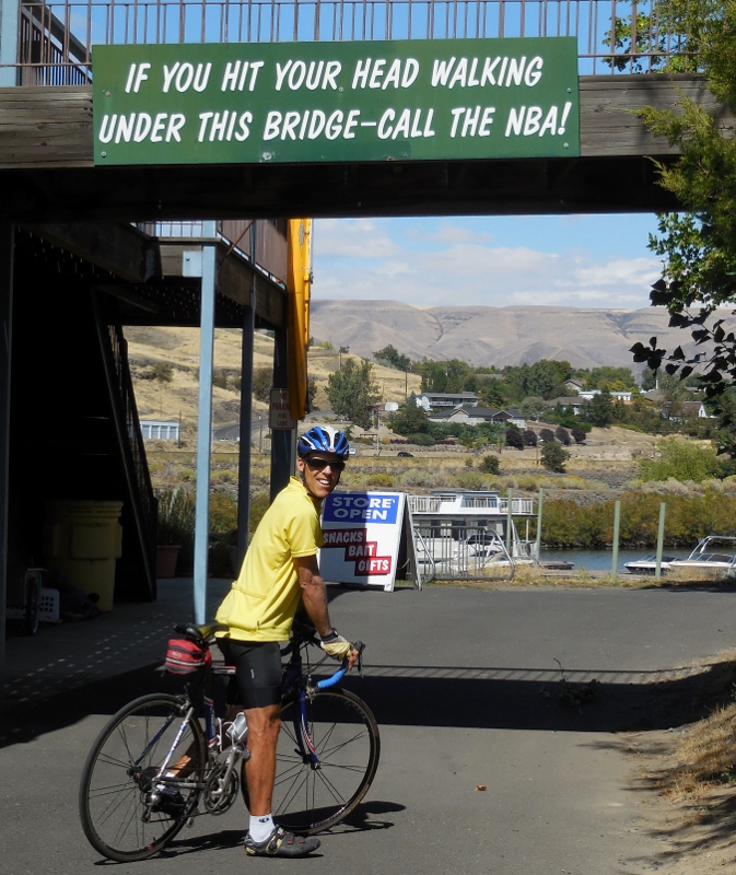
We noticed some Puncturevine in the park. Here's what a goathead looks like. Evil, evil weed; this has given us many flats in the past year riding in the west. Thankfully none on this day, however. 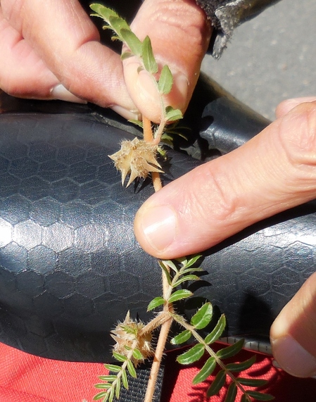
After turning around and heading north on the trail, we made our way past a park with a nice pond with ducks. I think this is a female mallard (top) with an immature male Mallard (bottom). 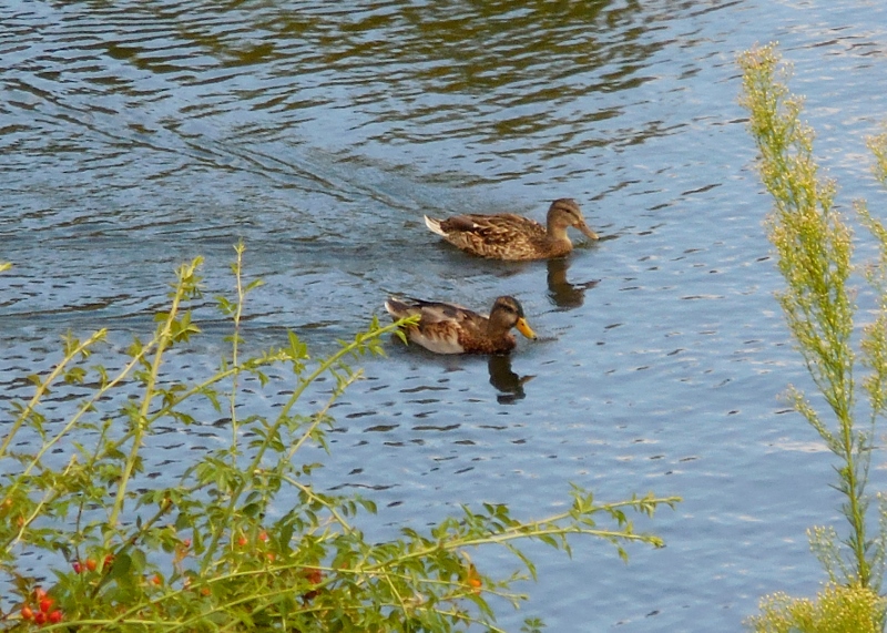
Here's the second and northernmost bridge over the Snake River. The "blue bridge" is very pretty, I think. Of course, I am always partial to Carolina blue! 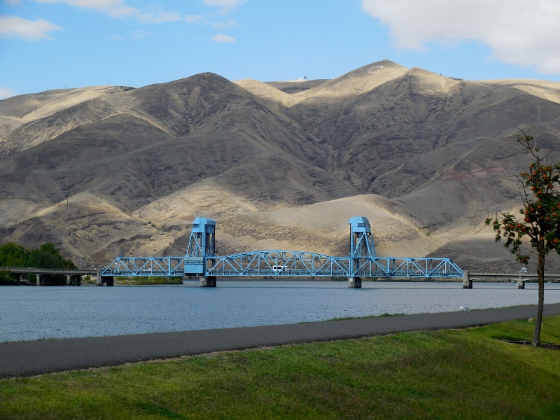
Blue Bridge
There's also this wonderful "wave" sculpture made of canoes near the trail. So imaginative! 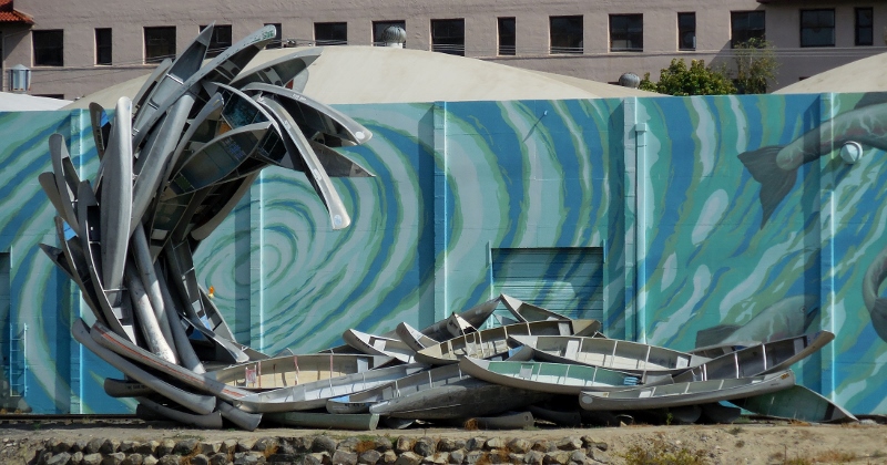
We would cross the blue bridge later, but for now, we continued north, soon rounding the eastward bend to the Clearwater River. 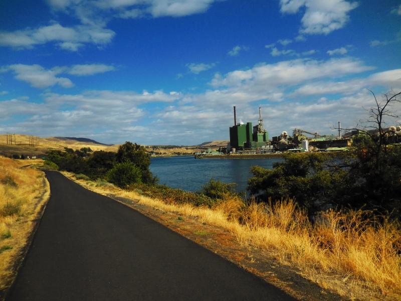
Levee trail along the Clearwater River
While most of the surface of both trails is well maintained, as we continued heading east onto the lesser-used part of the Levee trail, it was apparent that this portion was not a city priority! 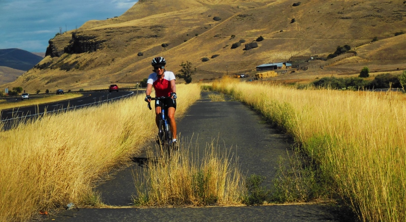
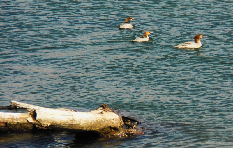
Common Mergansers on the Clearwater River
It was a very breezy day, and the northwest wind picked up as the day went on. We encountered the worst of it pedaling back towards the west after reaching the end of the Levee trail. No wonder it had been so easy heading east! When we turned westward, the wind hit us like a wall, and pedaling was tough. Photos don't really show it, but I promise that there were whitecaps in the river, indicating a pretty good blow. 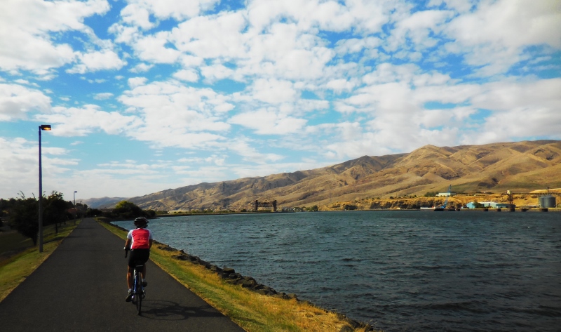
There's a very cool pedestrian visible from this part of the Levee trail. It's kind of hard to see in the photo, but there are colorful images of fish and a long snake decorating the bridge. It's not as fancy as the snake bridge in Tucson, but still fun. 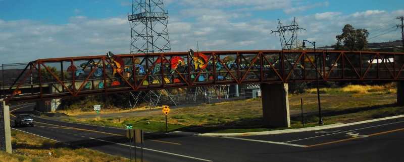
Soon we were back at the blue bridge and about to cross back over from Idaho into Washington. 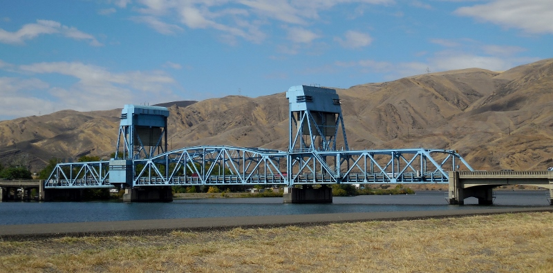
Bye-bye, Idaho! That's the last we'll see of you this year.... 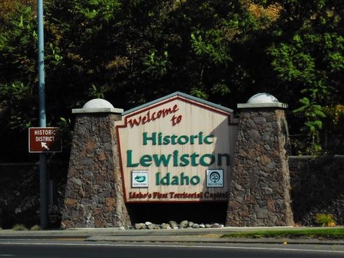
Back in Washington! 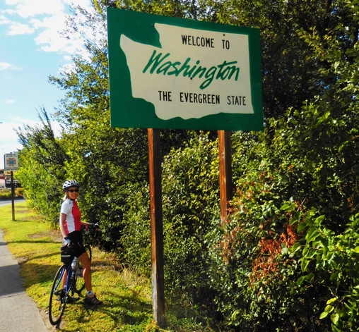
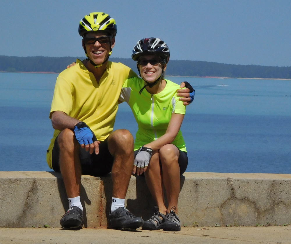
And here we are again, several hours later. 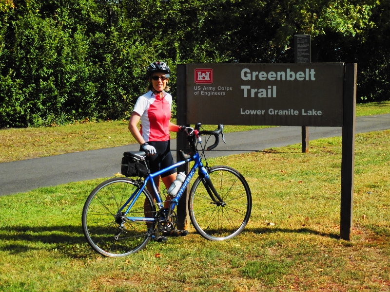
We had a fun ride and nice day for it, only a bit too much wind. Still, the dramatic scenery and change of pace from the roads around Walla Walla that have become all too familiar after over two months here, were welcome.
The mileage riding out and back on both trails is around 37, but you can obviously do just one trail or a portion of each if you don't want that many miles. If you go: There's water available in the parks along the trail, so one water bottle is plenty, as you can refill. But take plenty of snacks; there's really no casual places to grab a bite along the trail, which was too bad -- we were hoping for something more than the energy bars we brought. Of course, you can pedal or drive into either of the cities after your ride for food. We were anxious to get back to let Paisley out so didn't do that. We did buy gas over in Idaho, where it's a bit cheaper than in Washington! |
Emily & BarryWe're a long-married, early-retired couple who are currently traveling as nomads with no fixed home base. After years of living in North Carolina (Emily's home state), we spent 18 months living oceanfront on Ambergris Caye, Belize, a year road-tripping the US in a Honda CR-V, a year in Playa del Carmen, Mexico, and are now roaming North America in our 32' motorhome, Pearl, following warm weather whenever possible. 
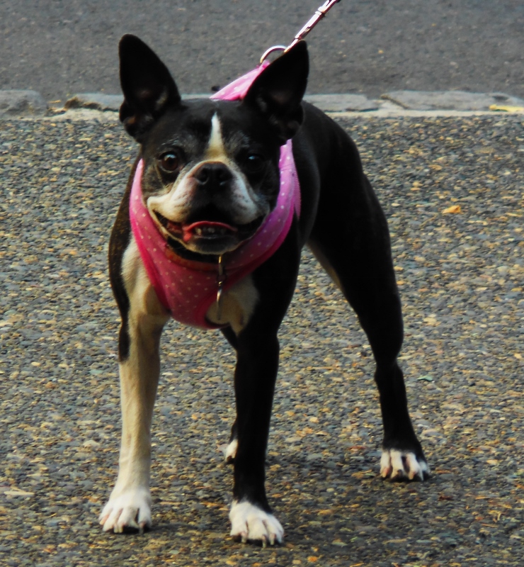
Paisley, May 2016
States visited (pre-RV)
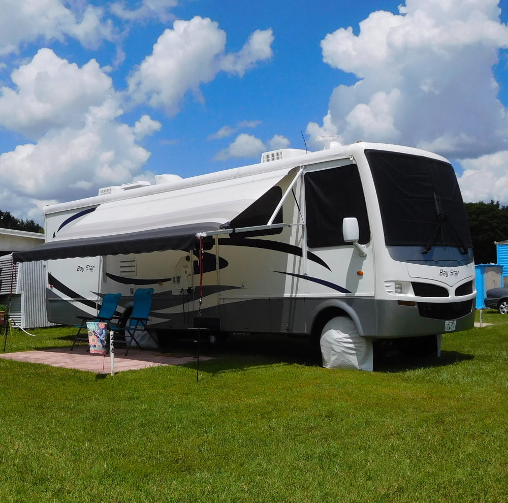
Pearl, a 2007 Newmar Bay Star
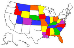
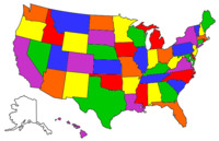
States visited in "Pearl"
Archives
July 2019
Favorite Travel Blogs |
 RSS Feed
