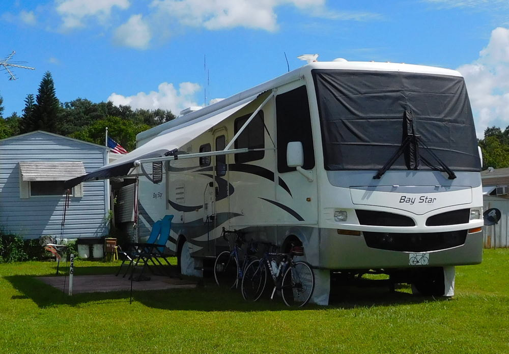
"Pearl" in Winter Garden, Florida
|
Long shadows in Wyoming
|
|
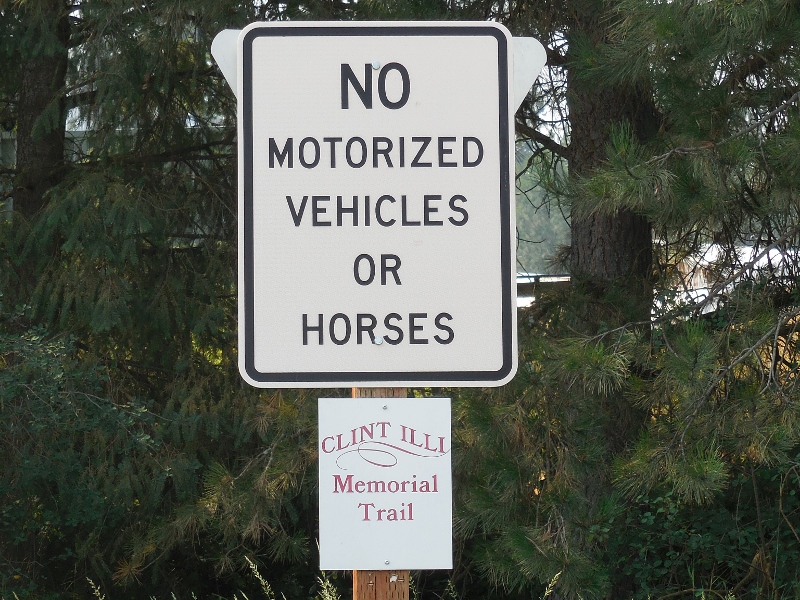
I didn't get the significance of the names of the two adjoining cities of Clarkston, Washington and Lewiston, Idaho at first. I finally put two and two together when I saw an information board indicating that we were cycling trails very close to the Lewis and Clark Trail...d'oh! Now I get it. Some of us are a little slower than others! We took a day trip here from Walla Walla to ride the Greenbelt Trail in Clarkston and the Levee Parkway Trail in Lewiston. These two paved trails are connected by two bridges across the Snake River, so you can park in one place and ride on both trails for several hours, if you like. And yes, we liked! 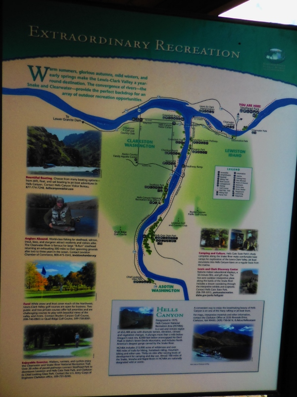
Map of the area rivers, trails, parks, and other sights
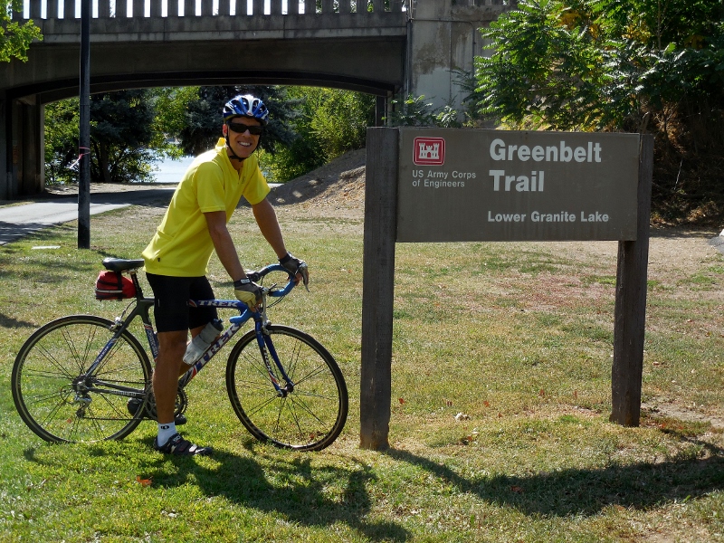
We parked at Granite Lake Park in Clarkston and started our ride on the Washington side, riding out and back on the Greenbelt Trail along the Snake River first. 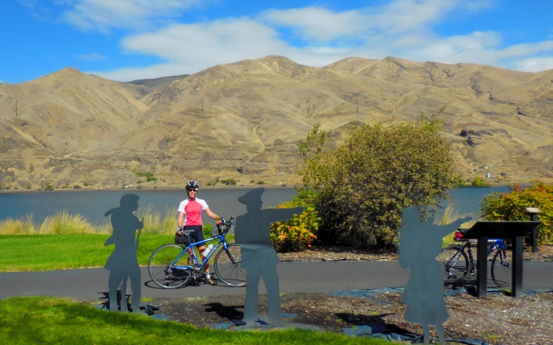
Starting out at Granite Lake Park by Lewis & Clark metal sculptures
This unique house right beside the road overlooking the Snake River caught my eye. I'd love to see the interior! 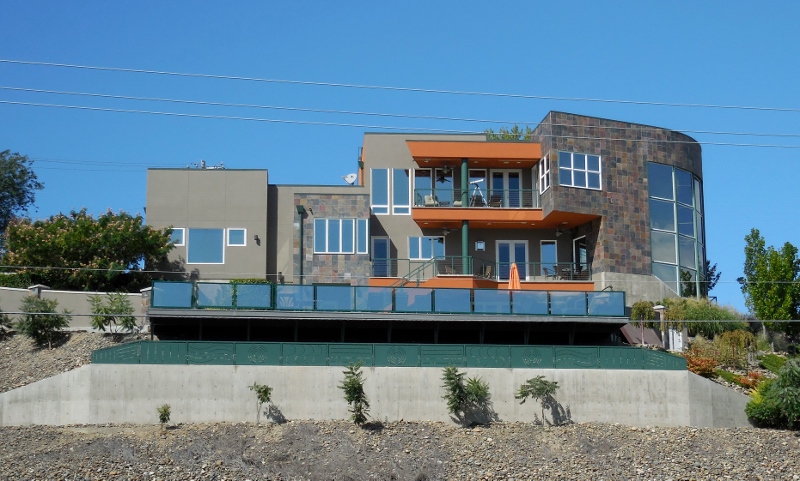
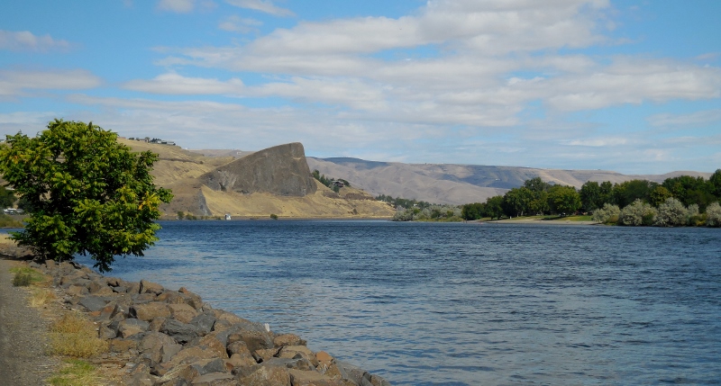
Snake River
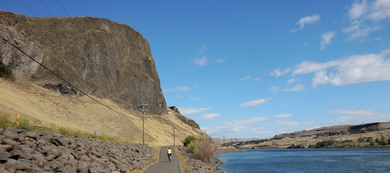
Dramatic rock cliffs along the Greenbelt Trail
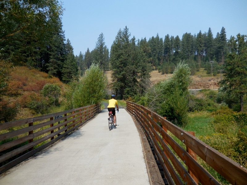
The Greenbelt Trail is only seven miles one way, so after riding from the north to south endpoints and most of the way back, we crossed over the Snake River on one of the bridges to Idaho and the Lewiston Levee Trail. 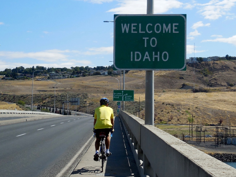
The Lewiston Levee Parkway is approximately 11 miles in length. We started at around the mid-way point of the trail after getting off the bridge and headed south. 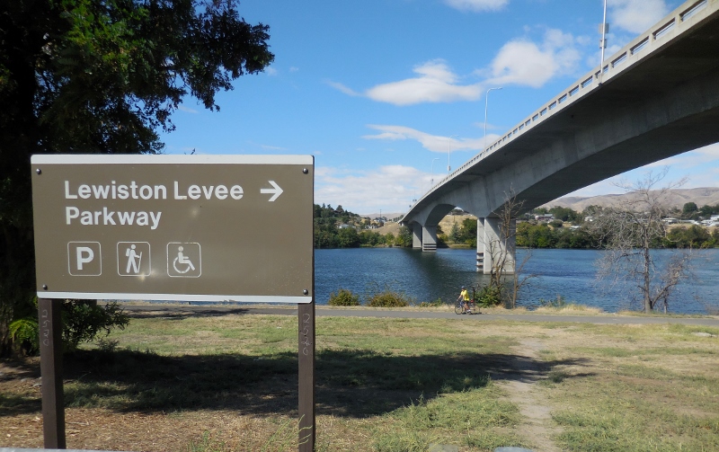
Looking across the Snake River, the Clarkston Greenbelt trail is right on the other side, where we just rode. 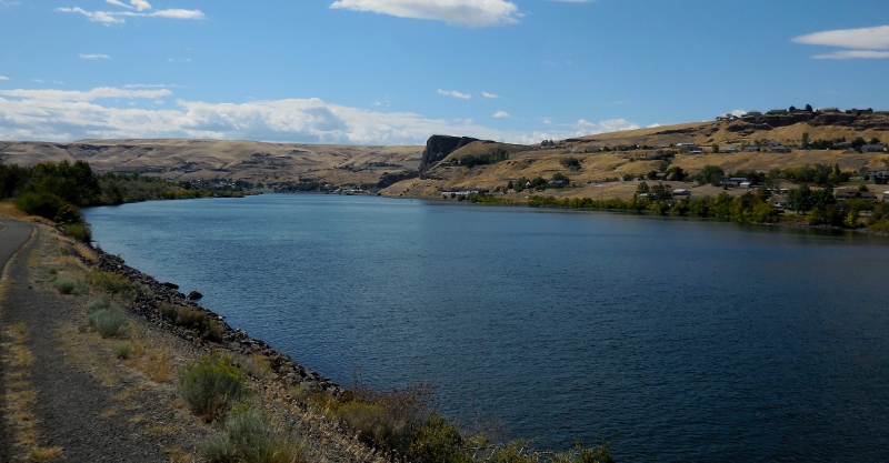
At least on this Wednesday, the Clarkston side was busier than the Lewiston side, probably because the Greenbelt trail passes through numerous parks in just a few miles, with plenty of parking all along. The Lewiston Levee Parkway is a bit more isolated at its south end. The southern terminus of the trail is in the Hell's Gate State Park, which was also very quiet. I'm sure it's busier on weekends as there's a marina and boat ramp in addition to camping. 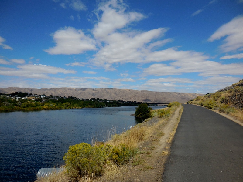
We had this part of the trail to ourselves
Here's a funny sign at the camp store at the state park. 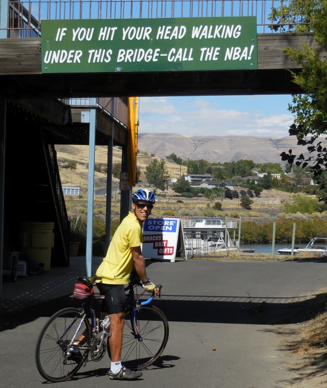
We noticed some Puncturevine in the park. Here's what a goathead looks like. Evil, evil weed; this has given us many flats in the past year riding in the west. Thankfully none on this day, however. 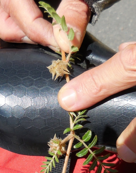
After turning around and heading north on the trail, we made our way past a park with a nice pond with ducks. I think this is a female mallard (top) with an immature male Mallard (bottom). 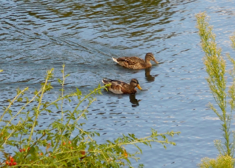
Here's the second and northernmost bridge over the Snake River. The "blue bridge" is very pretty, I think. Of course, I am always partial to Carolina blue! 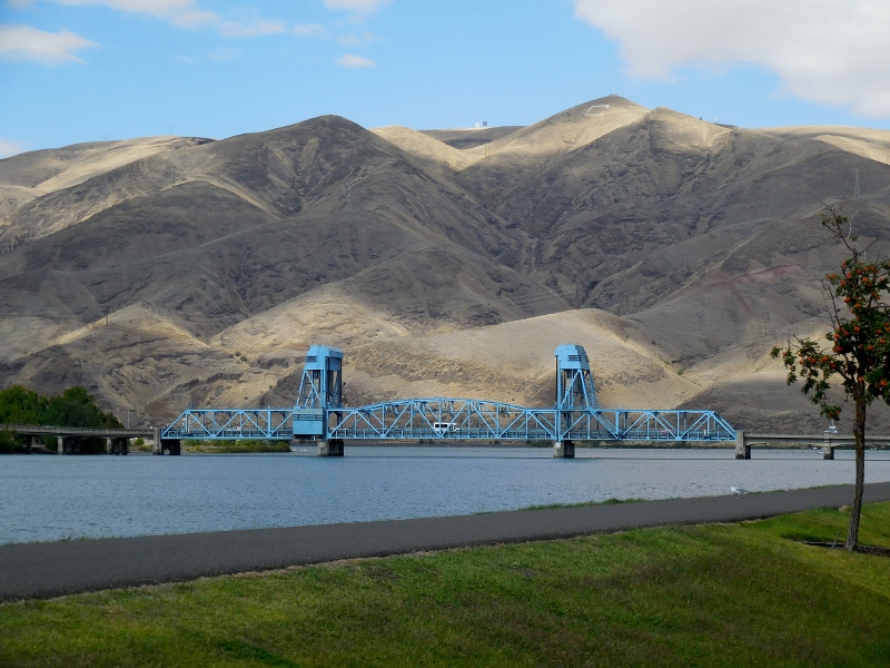
Blue Bridge
There's also this wonderful "wave" sculpture made of canoes near the trail. So imaginative! 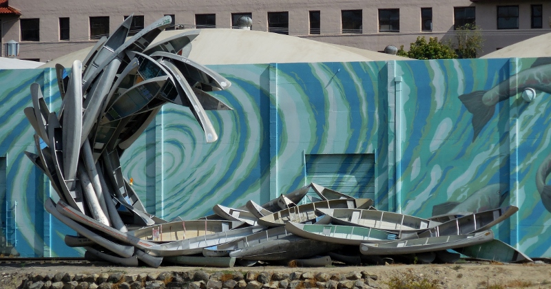
We would cross the blue bridge later, but for now, we continued north, soon rounding the eastward bend to the Clearwater River. 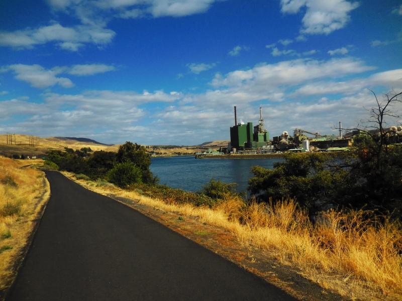
Levee trail along the Clearwater River
While most of the surface of both trails is well maintained, as we continued heading east onto the lesser-used part of the Levee trail, it was apparent that this portion was not a city priority! 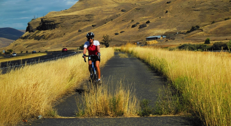
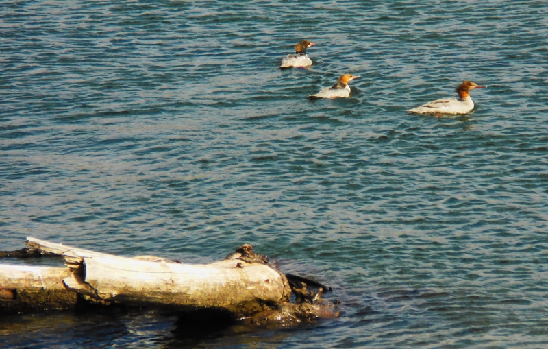
Common Mergansers on the Clearwater River
It was a very breezy day, and the northwest wind picked up as the day went on. We encountered the worst of it pedaling back towards the west after reaching the end of the Levee trail. No wonder it had been so easy heading east! When we turned westward, the wind hit us like a wall, and pedaling was tough. Photos don't really show it, but I promise that there were whitecaps in the river, indicating a pretty good blow. 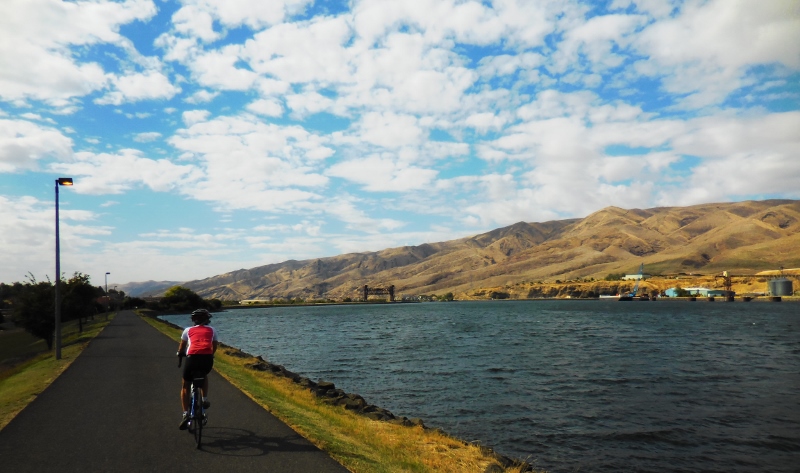
There's a very cool pedestrian visible from this part of the Levee trail. It's kind of hard to see in the photo, but there are colorful images of fish and a long snake decorating the bridge. It's not as fancy as the snake bridge in Tucson, but still fun. 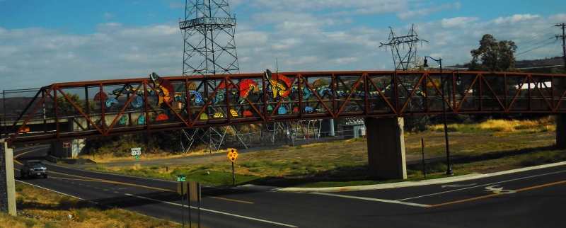
Soon we were back at the blue bridge and about to cross back over from Idaho into Washington. 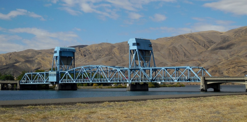
Bye-bye, Idaho! That's the last we'll see of you this year.... 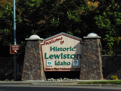
Back in Washington! 
And here we are again, several hours later. 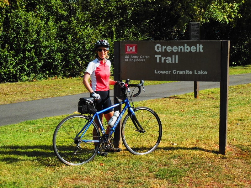
We had a fun ride and nice day for it, only a bit too much wind. Still, the dramatic scenery and change of pace from the roads around Walla Walla that have become all too familiar after over two months here, were welcome.
The mileage riding out and back on both trails is around 37, but you can obviously do just one trail or a portion of each if you don't want that many miles. If you go: There's water available in the parks along the trail, so one water bottle is plenty, as you can refill. But take plenty of snacks; there's really no casual places to grab a bite along the trail, which was too bad -- we were hoping for something more than the energy bars we brought. Of course, you can pedal or drive into either of the cities after your ride for food. We were anxious to get back to let Paisley out so didn't do that. We did buy gas over in Idaho, where it's a bit cheaper than in Washington!
3 Comments
Contiguous to the Paradise Path and Latah Trails we documented in Part 1 of this post lies the Bill Chipman Palouse Trail. This rail-trail runs west from Moscow, Idaho, where we stayed, mostly downhill to Pullman, Washington, home of Washington State University. Another 10' wide, paved, and well-maintained trail, it was a joy to ride. Despite running close to the highway, we really didn't notice traffic noise, just the rustling of the wind in the field crops. And once in the city of Pullman, the Chipman Trail connects to other trails that loop around town. Here is the entrance to the trail in Moscow, close to our hotel (La Quinta -- a great place to stay for those wanting to ride the area trails). 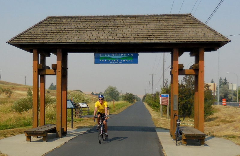
At the trailhead, there's an informational sign providing a trail map and telling more about the trail's namesake, Bill Chipman. I was saddened to read in the first link above that Mr. Chipman died in a tragic car accident, same as my father. The area citizens gave the trail his name to honor his memory. 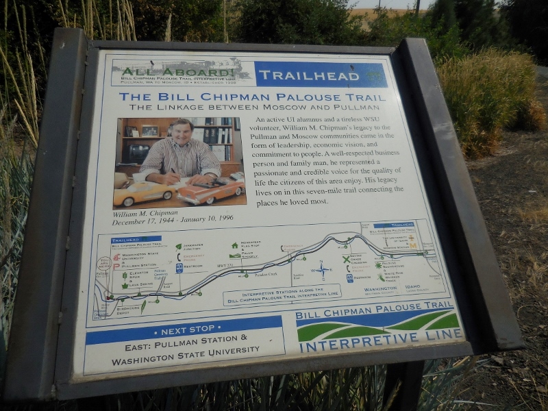
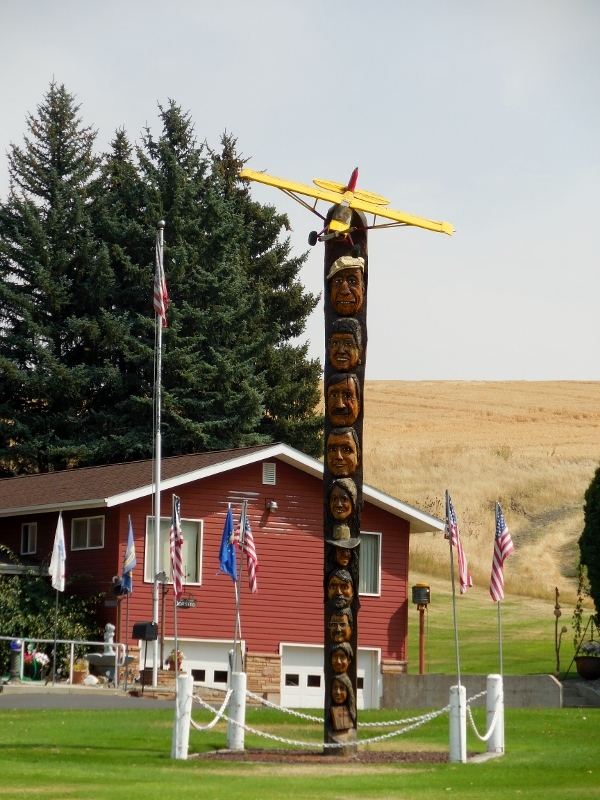
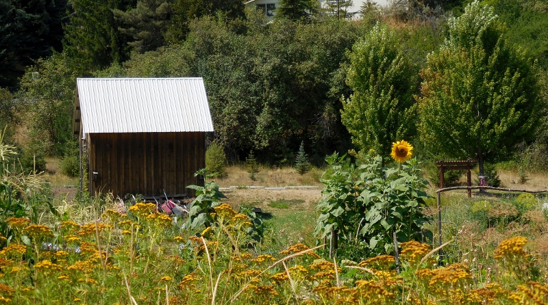
One of the interesting sites along the Chipman trail just outside of Pullman is the unique Jorstad's homestead. I am sure they are used to having cyclists stop and take photos, just like we did. You just have to see it for yourself. 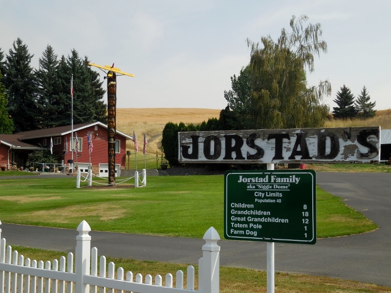
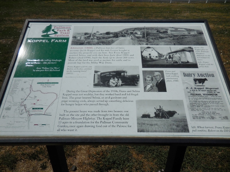
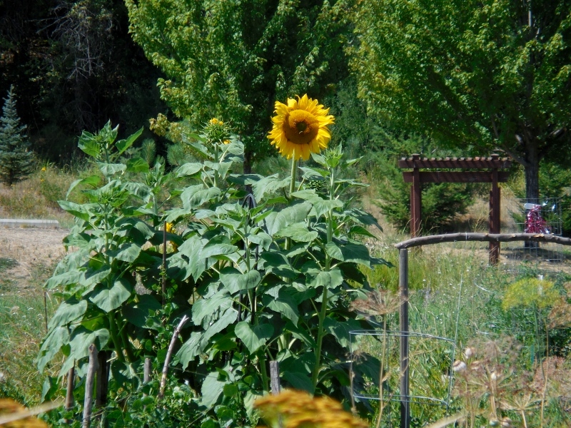
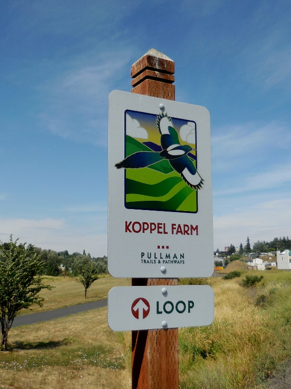
Upon arriving in Pullman, we were delighted to see that we could continue riding various trails looping around the city. College towns are generally among the most bike-friendly, and Pullman was no exception. We especially enjoyed checking out the community garden at historic Koppel Farm. Just look at this cute hand-painted sign! 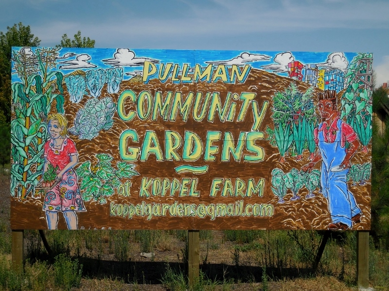
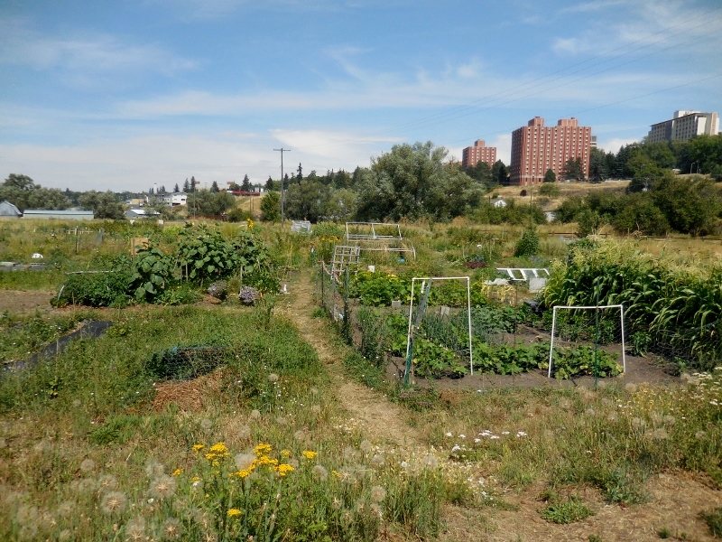
Some garden plots are a weedy mess this late in the summer, but others are still looking good!
Here's how the homestead is preserved today. Charming! 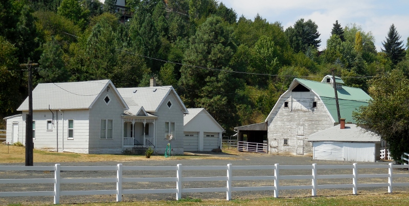
Pedaling onto the Downtown Riverwalk, we checked out the old historic "Pufferbelly" train depot. 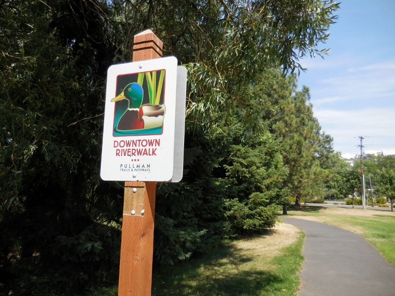
I love how all the Pullman trail signs are decorated with different colorful images
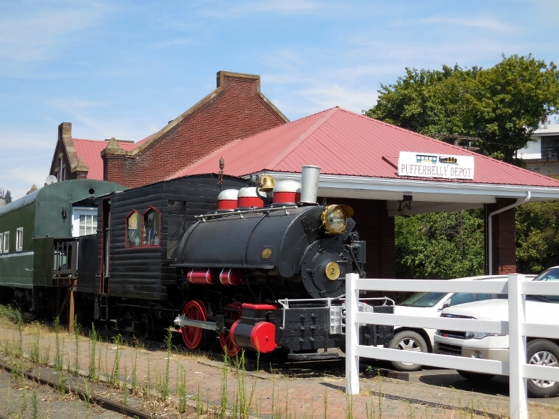
Pufferbelly Depot
Then we continued riding through town on the Grand Avenue Greenway. 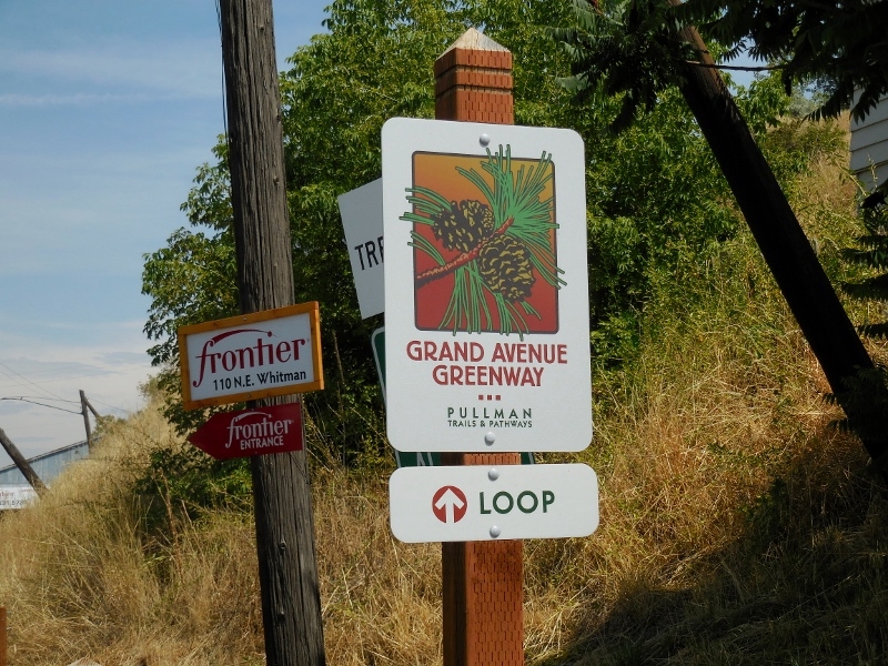
By the time we reached the end of The Grand Avenue Greenway, we were getting hungry, so turned back towards downtown and looked for a spot to get a bite to eat. There is yet another continuation of the loop trail that we didn't take, Terre View, which connects to the Arbor Link trail and finally back to the Chipman trail. (See a full Pullman loop trail map here.) 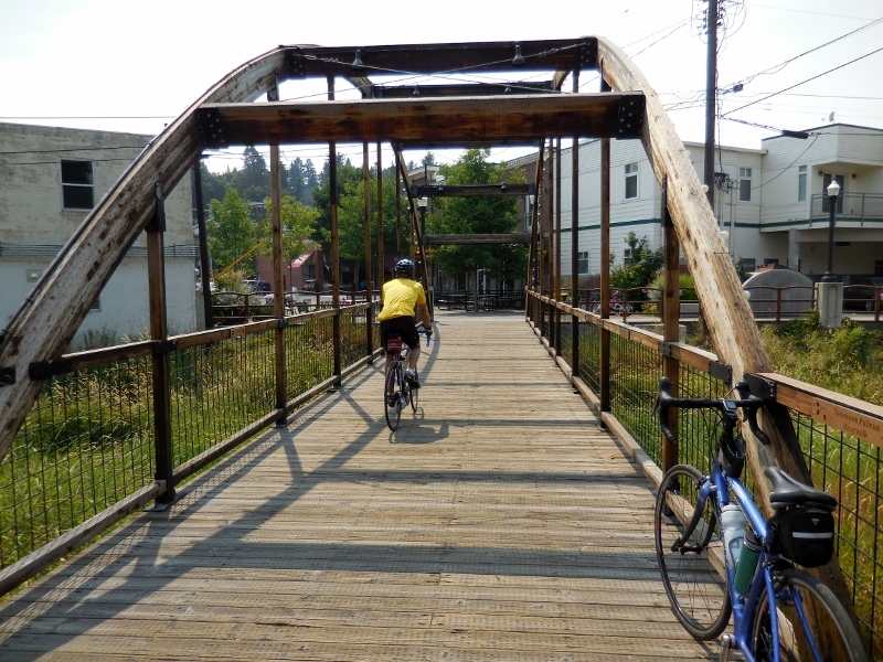
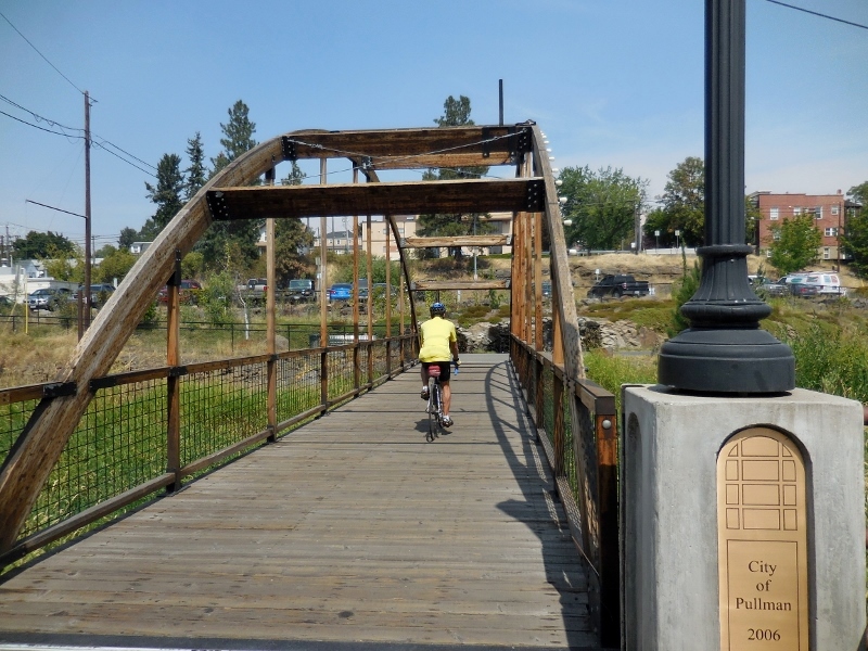
Barry crossing the river into downtown Pullman
Conveniently located right over the bridge, we found this great little taco place, Taco Del Mar. This would certainly do, especially since there was an outside seating area where we could keep our bikes with us. 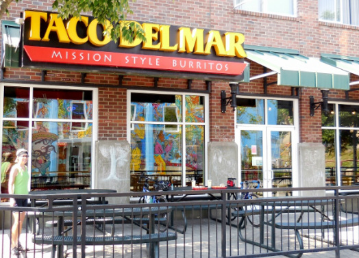
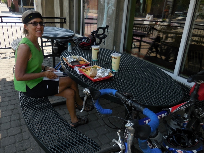
My Baja fish tacos were delicious! 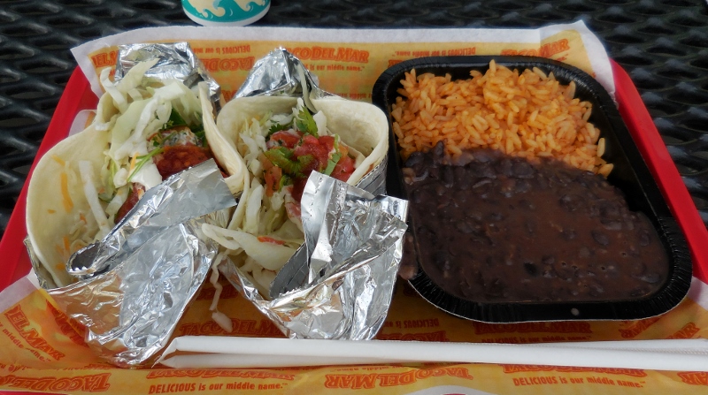
And Barry had no problem scarfing down this huge chicken and bean burrito (along with some of my beans and rice!) 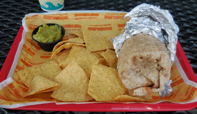
We had a perfect view of this fantastic mural on the side of a coffee shop across the way. 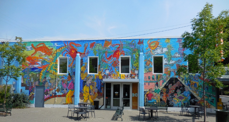
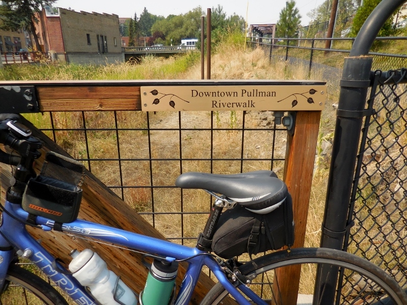
Once we'd gorged ourselves on delicious Mex food, it was time to head back uphill towards Moscow, after a couple more shots of the Riverwalk area. 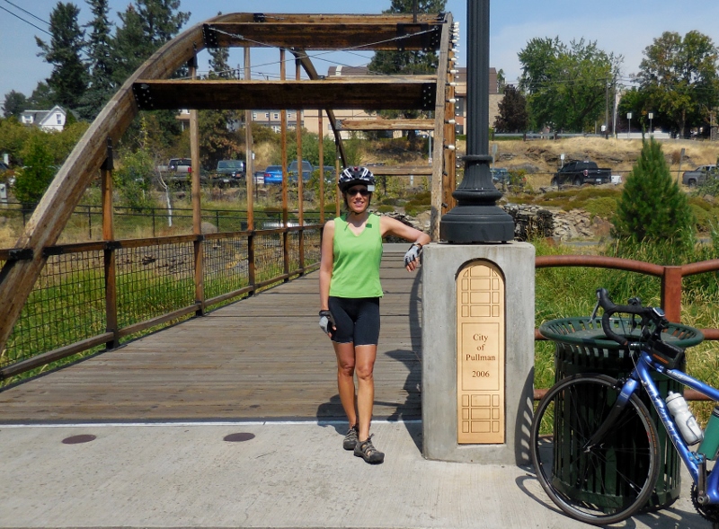
But that's not all the fun we had in Pullman! We had dinner in a very interesting spot, but I'll save that for another post.
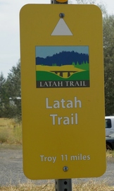
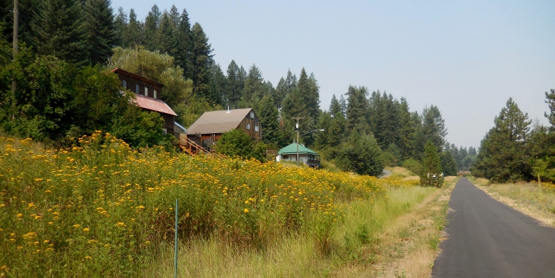
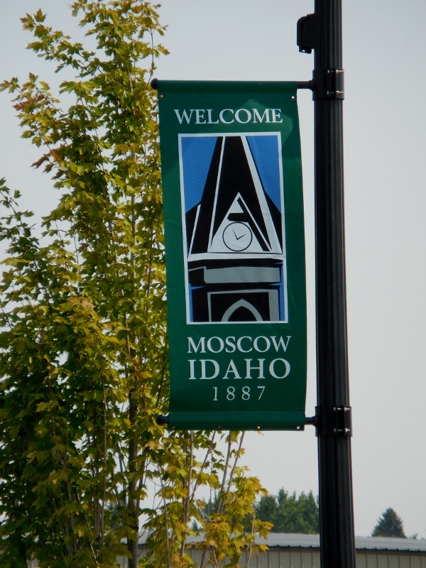
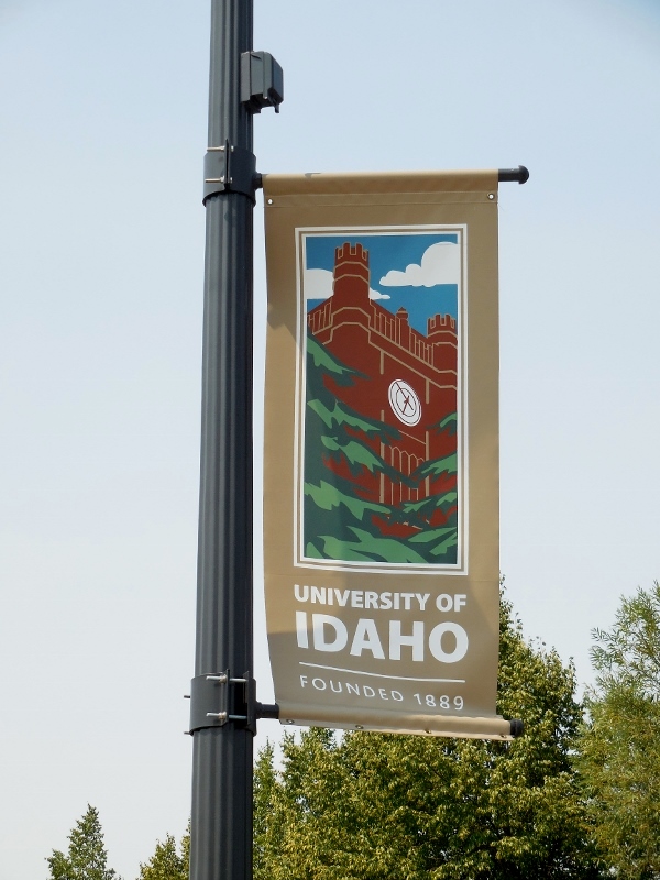
Side trip to Moscow, ID (Part 1): Cycling from Moscow to Troy on the Paradise Path and Latah Trail8/17/2014 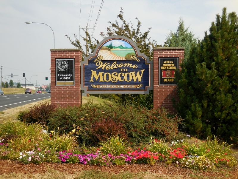 Who knew there was a Moscow in Idaho? We didn't! This past week we took a side trip from Walla Walla up to Moscow, Idaho, just over state line. There are several interconnected bike trails in the area that we'd read about and wanted to ride, and we thought it would be fun to check out a different area for a few days. It was! We had two full days in the area and ended up riding the trails both days. Our hotel had great access, just half a block or so, and we could ride in either direction -- east towards Troy or west to Pullman, WA. We ended up riding from Moscow to Troy, back to Moscow, west to Pullman, then back to Moscow, both days since it was so convenient and easy to get to the trails without having to drive our bikes anywhere. In Part 1 we'll show the trails we rode from Moscow east to Troy, and in Part 2, we'll cover Moscow to Pullman. Here's a map showing the area. The portion of the trail covered in this post is highlighted in blue. 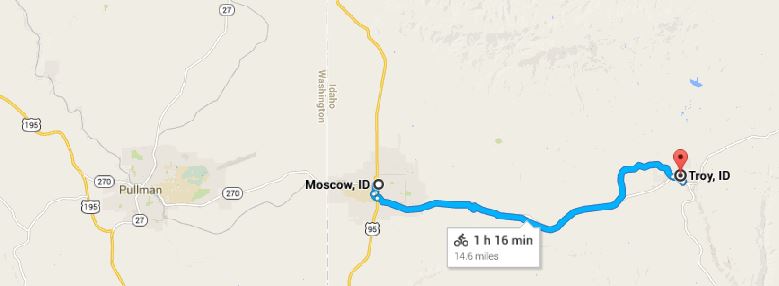 Moscow, ID to Troy, ID and back Heading east, we first rode through the cute college town of Moscow and the edge of the University of Idaho. A two-mile connector trail, the Paradise Path, provides the connection through town between the Bill Chipman-Palouse Trail that runs west to Pullman and the Latah Trail, which runs east to Troy. 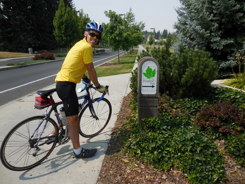 Barry on the Paradise Path in Moscow, ID 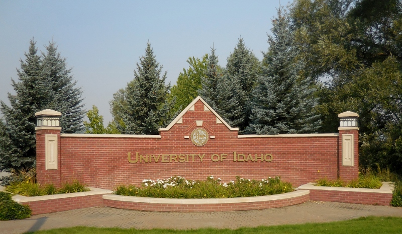
 Unfortunately, we didn't take any photos of downtown Moscow as we were there only briefly in the morning, and the light was not great. But it is a charming downtown with bike lanes, and I wish we'd had more time to check it out on foot. Leaving the Paradise Path, we started pedaling on the Latah Trail towards Troy. This paved rail trail is 10' wide, smooth, and beautifully maintained, with restroom facilities, benches, and interpretive signage along the way. And the scenery is splendid! On the Latah Trail Foundation's website, you can see trail maps and read much more about the trail's history. Below is an example of one of the interpretive signs along the trail. 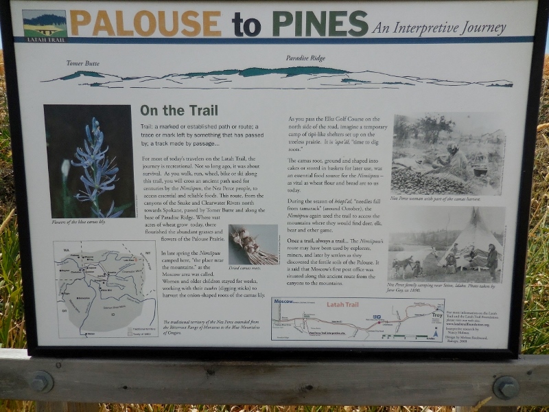 On our first morning of riding, there was a heavy cover of smoke that had blown in overnight hanging over the Palouse Hills, almost completely obscuring them from the trail. Fortunately, it cleared out as we rode, and conditions improved as the morning went on. 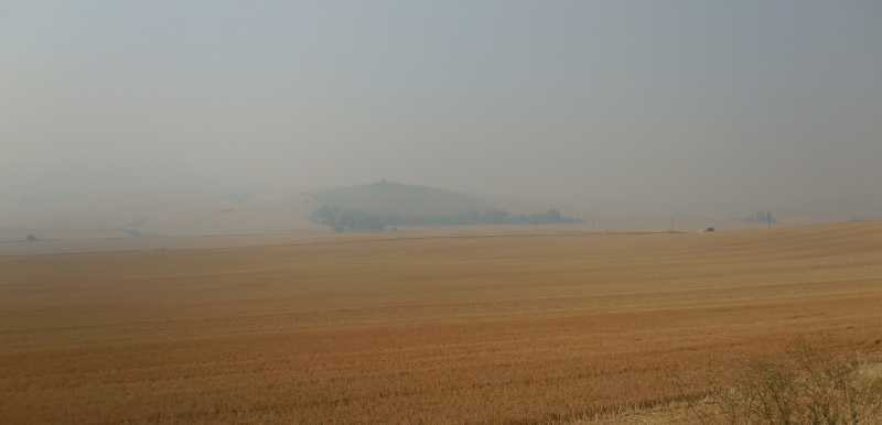 "Smoke on the mountains..." 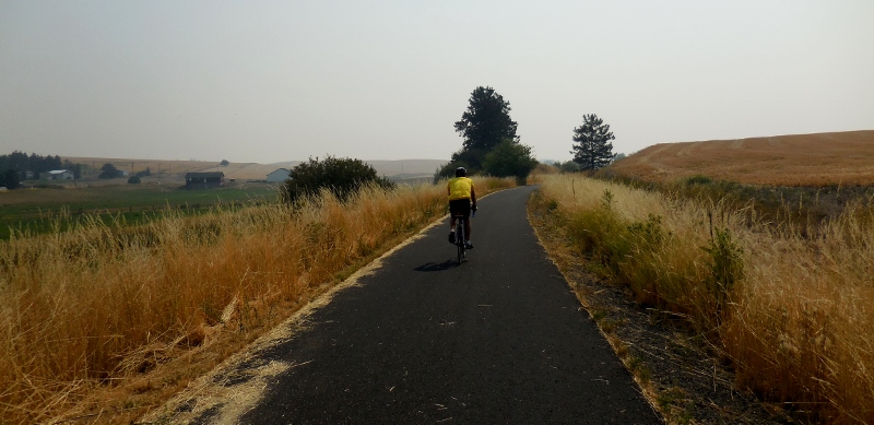 On a weekday, you'll have the the trail mostly to yourself 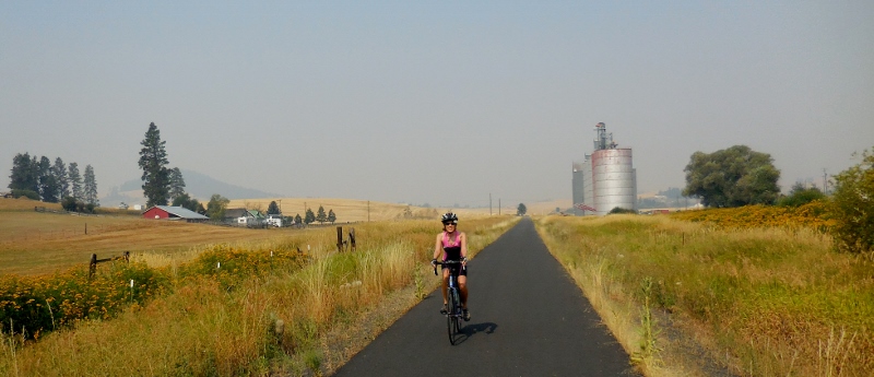 The rural area just outside Moscow is primarily wheat fields, but as we approached the small town of Troy, the trailside environment rather abruptly changed to a shady evergreen forest. It smelled as pretty as it looked -- like Christmas trees! I really enjoyed riding through this green area, taking deep breaths of the sweet air, and listening to all the birds twittering away in the trees. 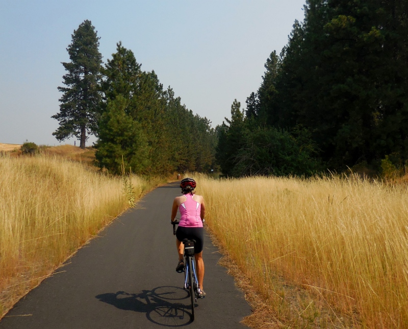 Transition from fields to forest The 2676' summit of the trail is in the forest just a couple of miles west of Troy, but never fear, the elevations of Moscow and Troy are 2583' and 2400' respectively, so there's not a lot of strenuous climbing on the trail, just a few rollers. 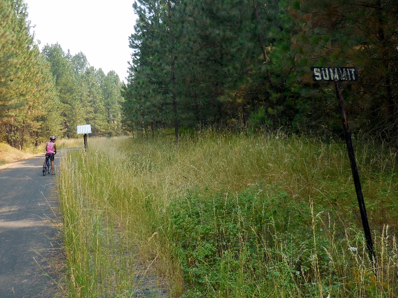 After a nice downhill run through the forest, taking in the wonderful pine aroma and cool shade, we arrived at a small city park in Troy (with restroom facilities) and grabbed a photo by the Troy sign. (Note: I'm not sure why the elevation here says 2500'; other sources I read said 2400'. Must depend on where in town they are measuring from.) 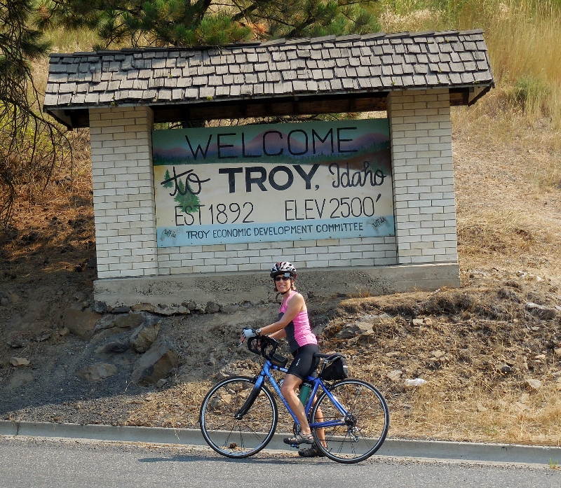 We noticed a short extension to the trail across the road and continued along.
 After riding the extension out and back, we re-joined the Latah Trail at mile 0, now heading west. 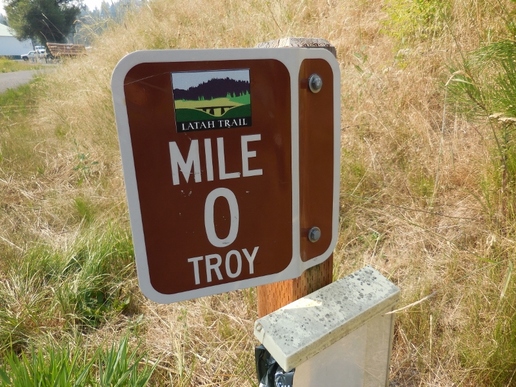 We rode back through the piney woods... 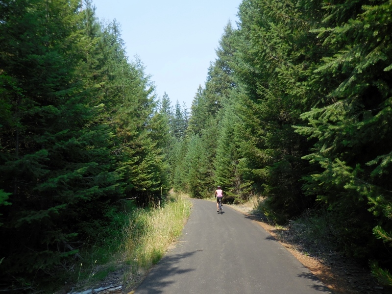 ...and transitioned to the pretty fields... 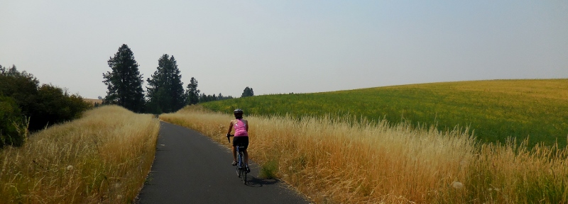 I had to stop and snap a photo of a quail family on the trail -- just one of several family groups we saw in the two riding days. 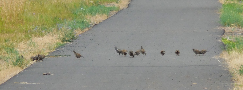 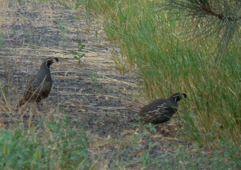 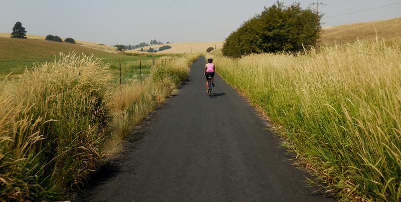  Definitely looks different from North Carolina!  Friendly faces along the trail Once the smoke cleared out, the views of the Palouse Hills were much better, wouldn't you agree? 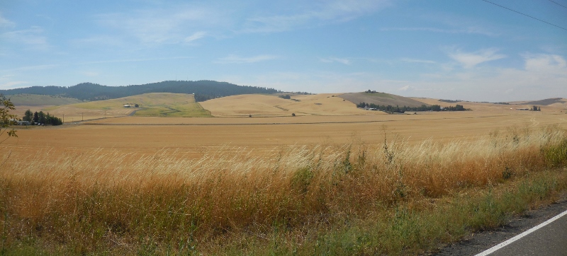 Soon we were leaving the Latah Trail behind and returning to the Paradise Path in Moscow. 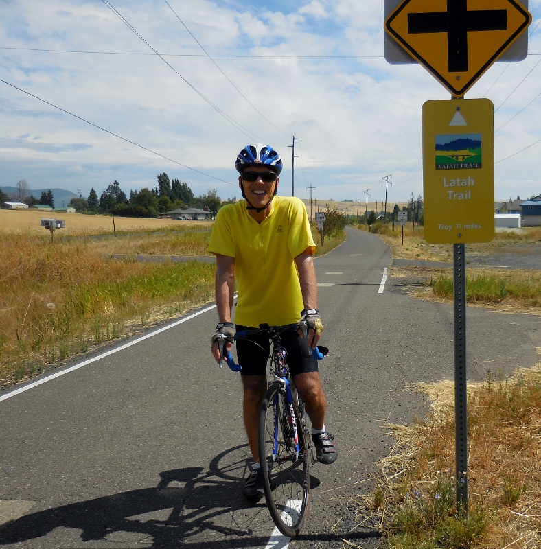 We pedaled through a nice park, where we took a short snack break. The light sprinkles of numerous weeping willows cooled us down as we rolled through -- the afternoon had turned into a hot one. 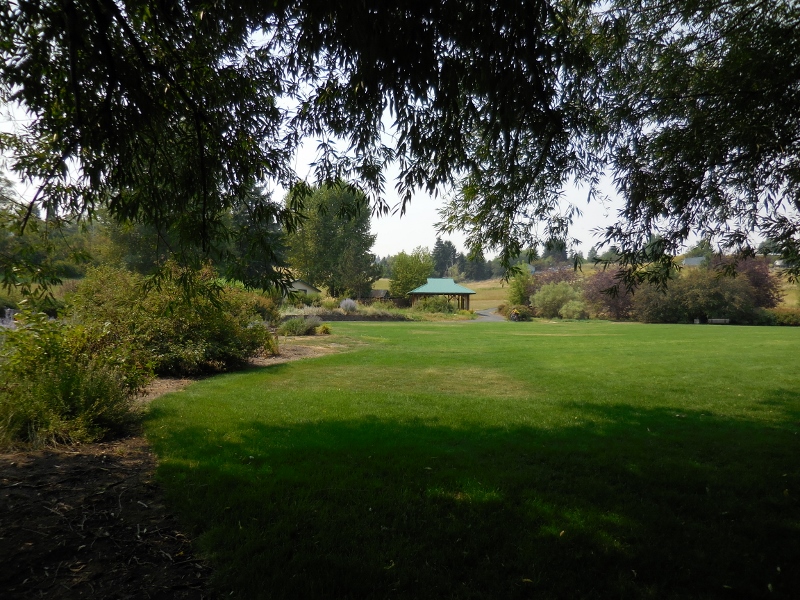 In Part 2, we'll take you along on the Bill Chipman Palouse Trail to Pullman, Washington, so stayed tuned!  |
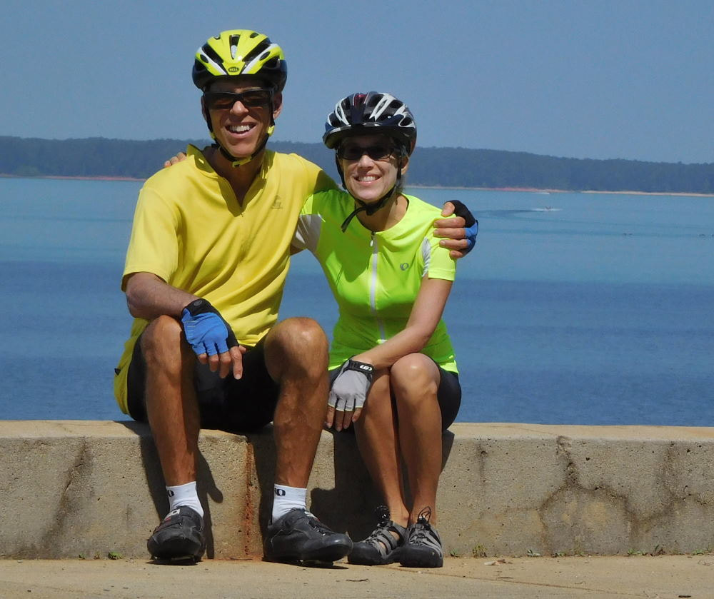
Emily & BarryWe're a long-married, early-retired couple who are currently traveling as nomads with no fixed home base. After years of living in North Carolina (Emily's home state), we spent 18 months living oceanfront on Ambergris Caye, Belize, a year road-tripping the US in a Honda CR-V, a year in Playa del Carmen, Mexico, and are now roaming North America in our 32' motorhome, Pearl, following warm weather whenever possible. 
Paisley, May 2016
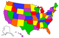
States visited (pre-RV)
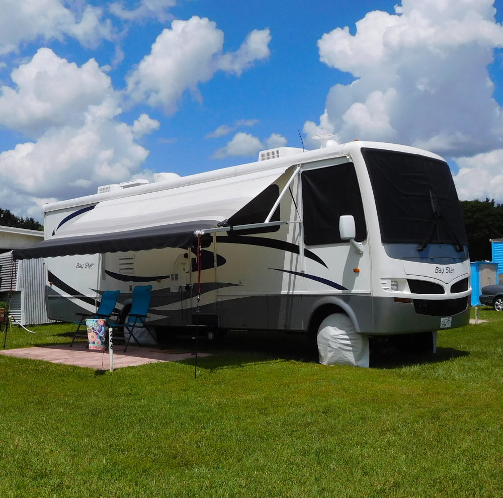
Pearl, a 2007 Newmar Bay Star
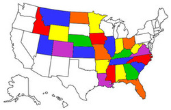
States visited in "Pearl"
Archives
July 2019
Favorite Travel Blogs |
 RSS Feed
