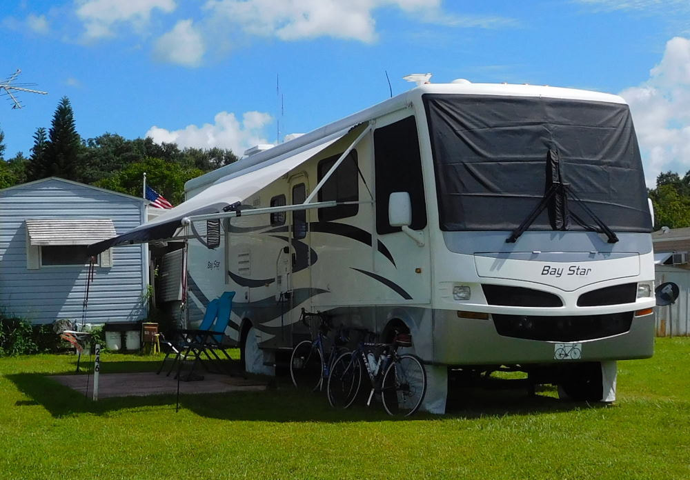
"Pearl" in Winter Garden, Florida
|
Long shadows in Wyoming
|
|
I didn't get the significance of the names of the two adjoining cities of Clarkston, Washington and Lewiston, Idaho at first. I finally put two and two together when I saw an information board indicating that we were cycling trails very close to the Lewis and Clark Trail...d'oh! Now I get it. Some of us are a little slower than others! We took a day trip here from Walla Walla to ride the Greenbelt Trail in Clarkston and the Levee Parkway Trail in Lewiston. These two paved trails are connected by two bridges across the Snake River, so you can park in one place and ride on both trails for several hours, if you like. And yes, we liked! 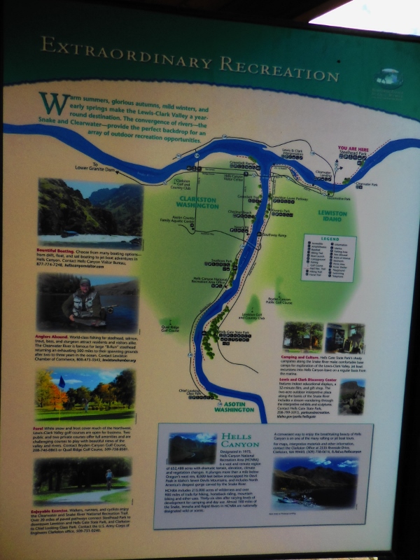
Map of the area rivers, trails, parks, and other sights
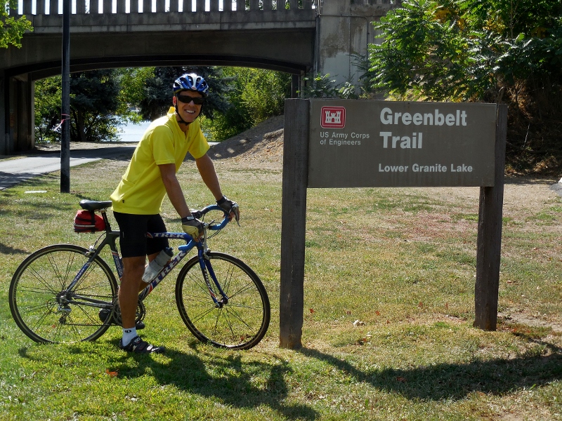
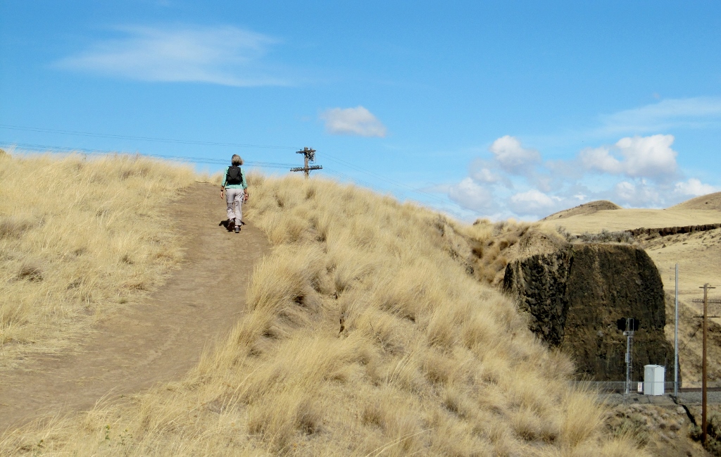
We parked at Granite Lake Park in Clarkston and started our ride on the Washington side, riding out and back on the Greenbelt Trail along the Snake River first. 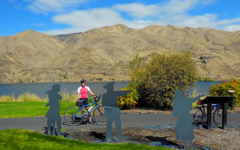
Starting out at Granite Lake Park by Lewis & Clark metal sculptures
This unique house right beside the road overlooking the Snake River caught my eye. I'd love to see the interior! 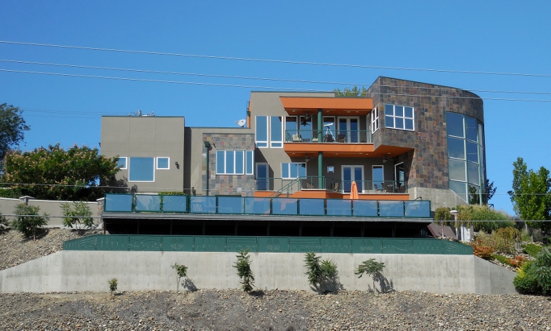
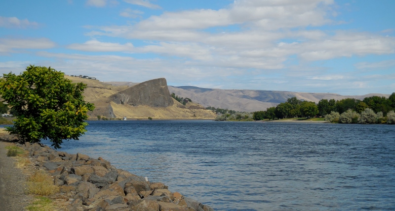
Snake River
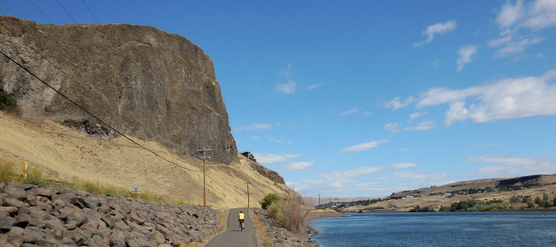
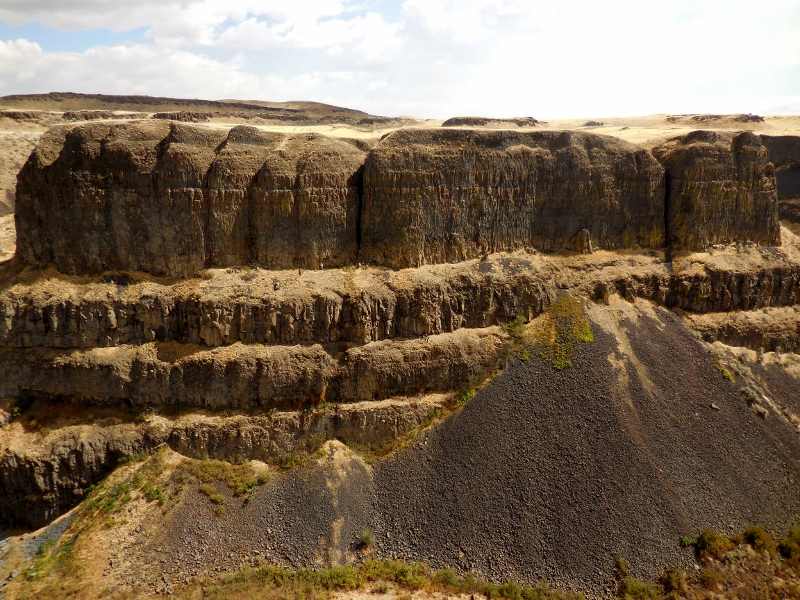
Dramatic rock cliffs along the Greenbelt Trail
The Greenbelt Trail is only seven miles one way, so after riding from the north to south endpoints and most of the way back, we crossed over the Snake River on one of the bridges to Idaho and the Lewiston Levee Trail. 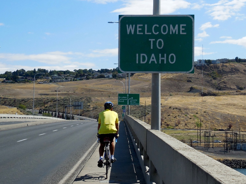
The Lewiston Levee Parkway is approximately 11 miles in length. We started at around the mid-way point of the trail after getting off the bridge and headed south. 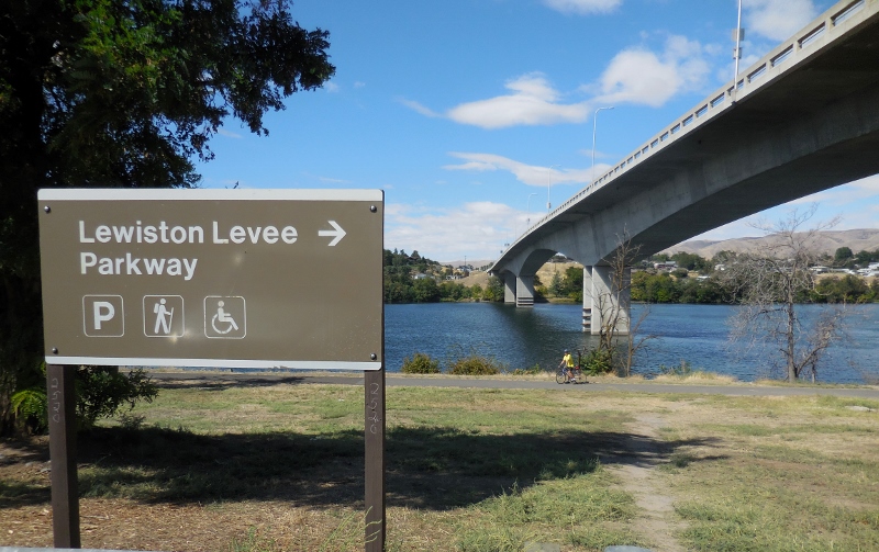
Looking across the Snake River, the Clarkston Greenbelt trail is right on the other side, where we just rode. 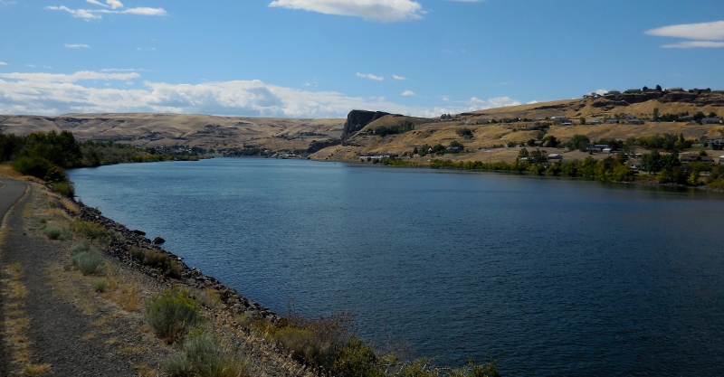
At least on this Wednesday, the Clarkston side was busier than the Lewiston side, probably because the Greenbelt trail passes through numerous parks in just a few miles, with plenty of parking all along. The Lewiston Levee Parkway is a bit more isolated at its south end. The southern terminus of the trail is in the Hell's Gate State Park, which was also very quiet. I'm sure it's busier on weekends as there's a marina and boat ramp in addition to camping. 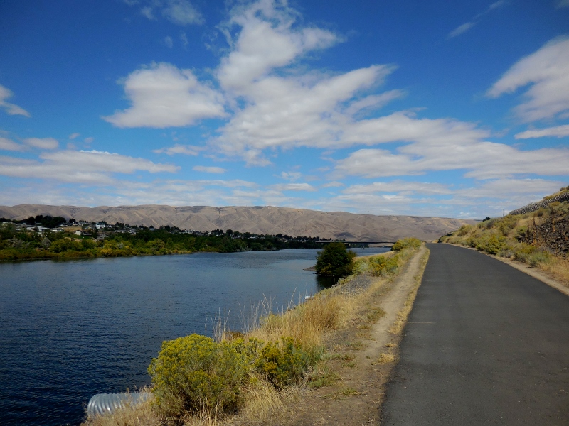
We had this part of the trail to ourselves
Here's a funny sign at the camp store at the state park. 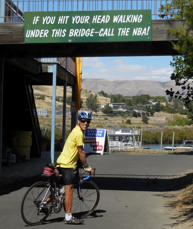
We noticed some Puncturevine in the park. Here's what a goathead looks like. Evil, evil weed; this has given us many flats in the past year riding in the west. Thankfully none on this day, however. 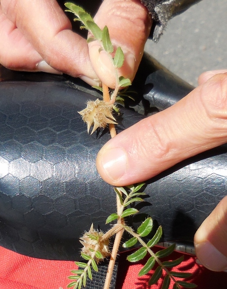
After turning around and heading north on the trail, we made our way past a park with a nice pond with ducks. I think this is a female mallard (top) with an immature male Mallard (bottom). 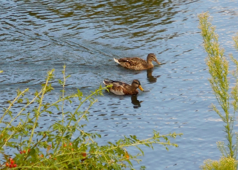
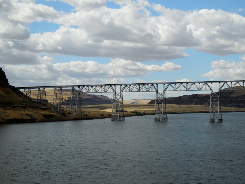
Here's the second and northernmost bridge over the Snake River. The "blue bridge" is very pretty, I think. Of course, I am always partial to Carolina blue! 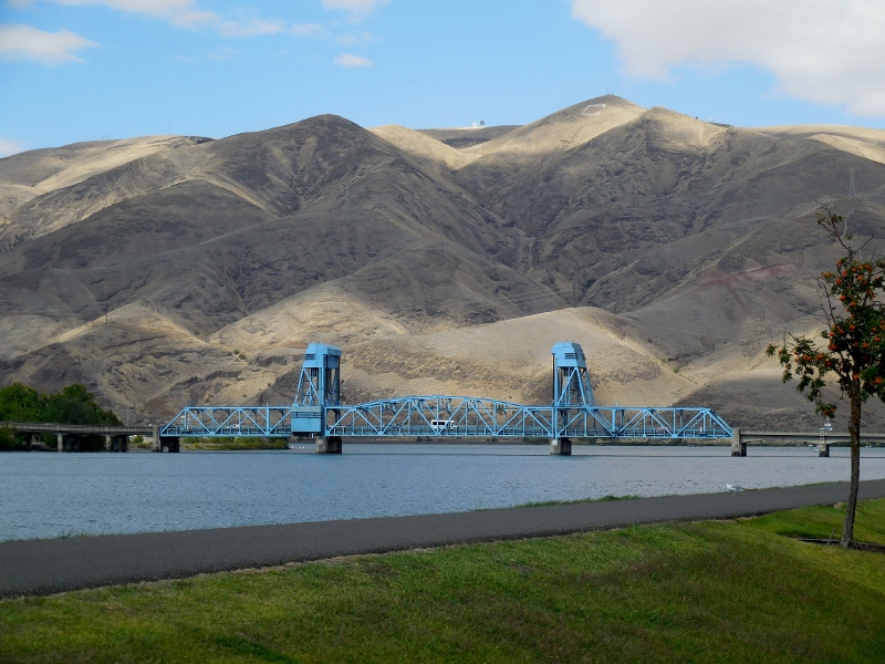
Blue Bridge
There's also this wonderful "wave" sculpture made of canoes near the trail. So imaginative! 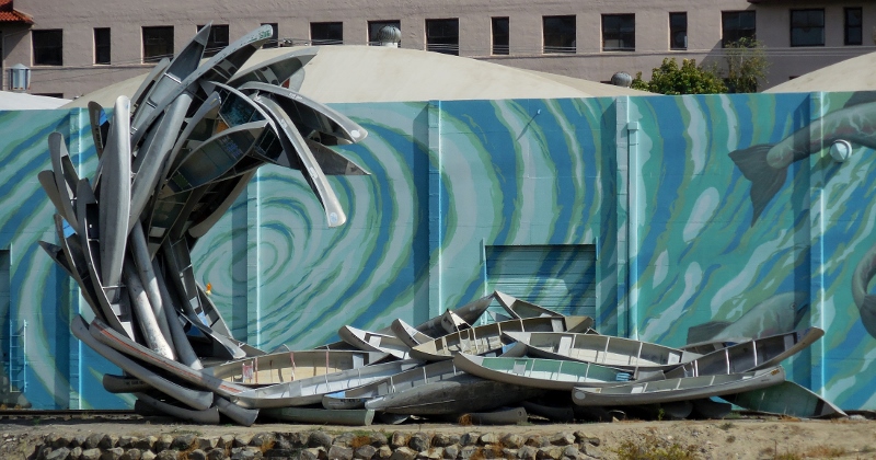
We would cross the blue bridge later, but for now, we continued north, soon rounding the eastward bend to the Clearwater River. 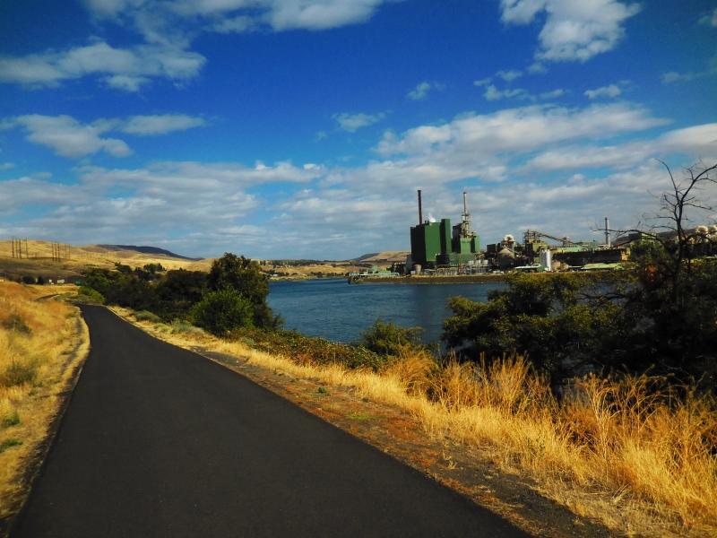
Levee trail along the Clearwater River
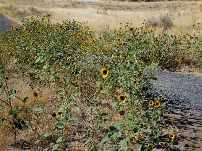
While most of the surface of both trails is well maintained, as we continued heading east onto the lesser-used part of the Levee trail, it was apparent that this portion was not a city priority! 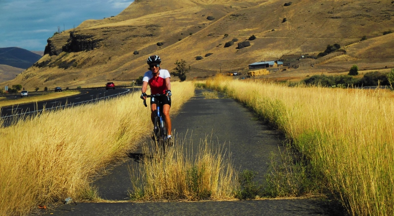
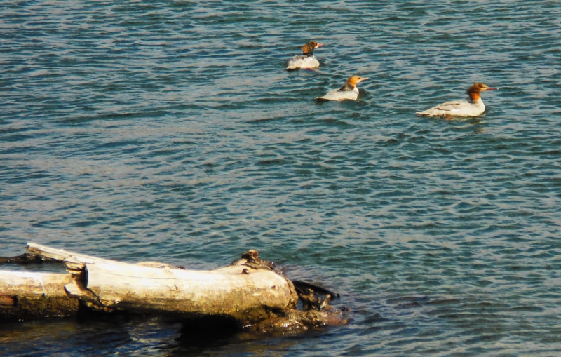
Common Mergansers on the Clearwater River
It was a very breezy day, and the northwest wind picked up as the day went on. We encountered the worst of it pedaling back towards the west after reaching the end of the Levee trail. No wonder it had been so easy heading east! When we turned westward, the wind hit us like a wall, and pedaling was tough. Photos don't really show it, but I promise that there were whitecaps in the river, indicating a pretty good blow. 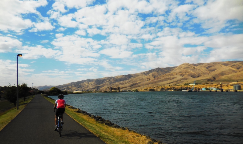
There's a very cool pedestrian visible from this part of the Levee trail. It's kind of hard to see in the photo, but there are colorful images of fish and a long snake decorating the bridge. It's not as fancy as the snake bridge in Tucson, but still fun. 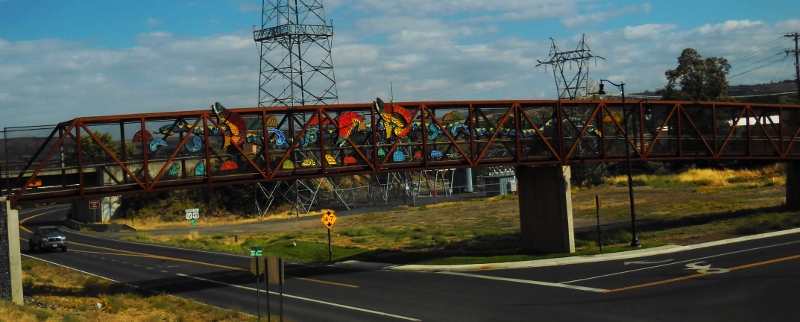
Soon we were back at the blue bridge and about to cross back over from Idaho into Washington. 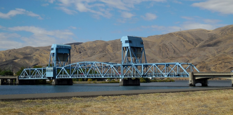
Bye-bye, Idaho! That's the last we'll see of you this year.... 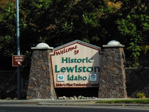
Back in Washington! 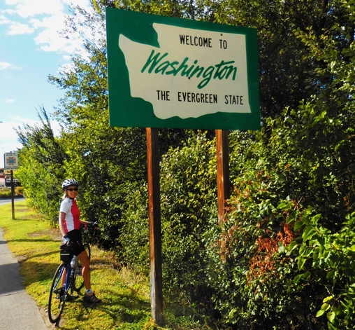
And here we are again, several hours later. 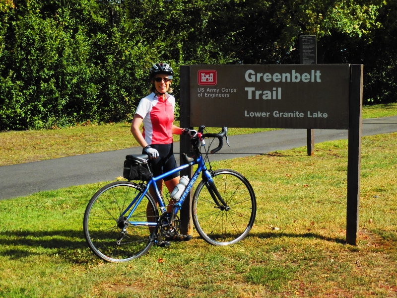
We had a fun ride and nice day for it, only a bit too much wind. Still, the dramatic scenery and change of pace from the roads around Walla Walla that have become all too familiar after over two months here, were welcome.
The mileage riding out and back on both trails is around 37, but you can obviously do just one trail or a portion of each if you don't want that many miles. If you go: There's water available in the parks along the trail, so one water bottle is plenty, as you can refill. But take plenty of snacks; there's really no casual places to grab a bite along the trail, which was too bad -- we were hoping for something more than the energy bars we brought. Of course, you can pedal or drive into either of the cities after your ride for food. We were anxious to get back to let Paisley out so didn't do that. We did buy gas over in Idaho, where it's a bit cheaper than in Washington!
3 Comments
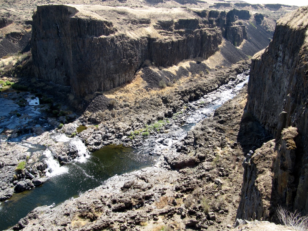
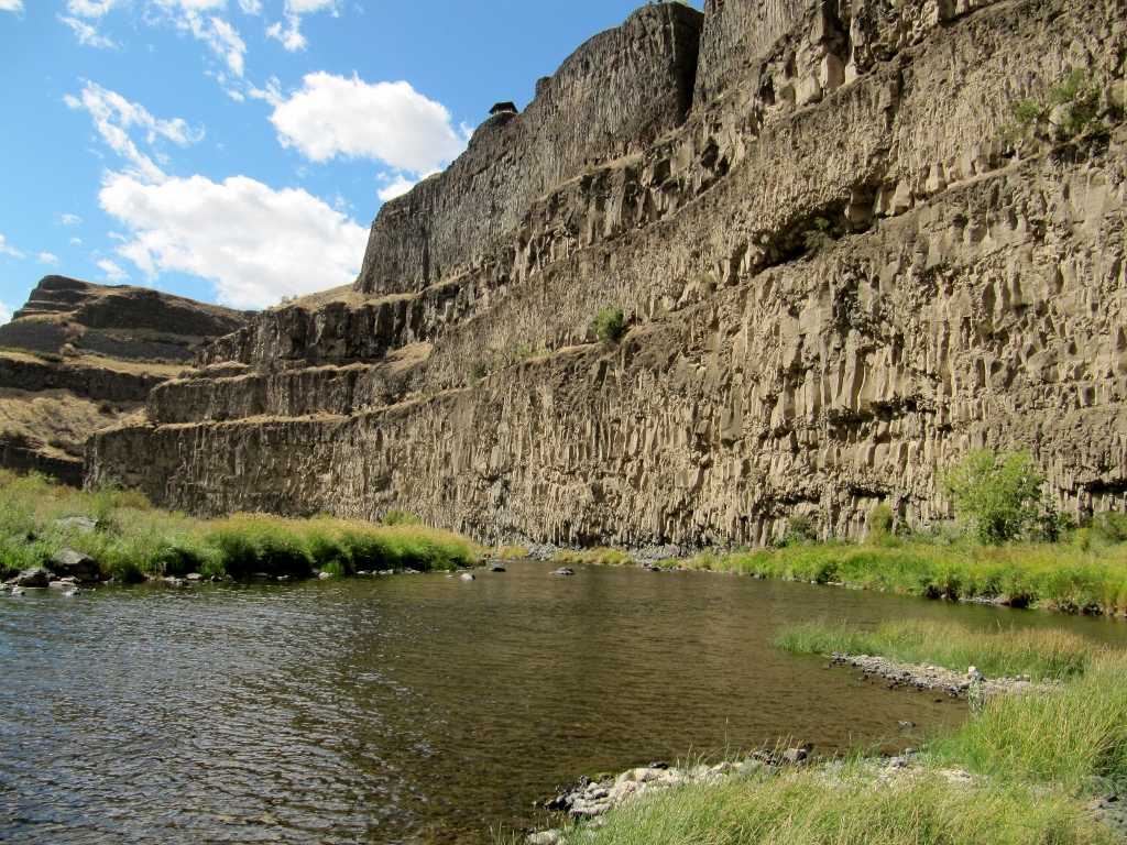
In Part 1, we visited beautiful Palouse Falls State Park, and Barry took a pretty amazing hike to get a closer look. After leaving the park in the afternoon and heading south, we were relieved to see all the smoke from the morning wildfire had cleared out, presenting us with perfectly clear views of the Snake River as we passed over for the second time of the day. It's really shockingly beautiful and so dramatic. 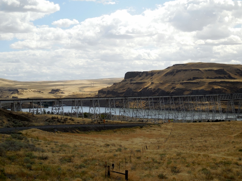
Snake River
Our drive back to Walla Walla took us through the charming small town of Dayton, WA with its beautifully restored historic downtown. We'd planned to stop for lunch, though this would be a late one: 3 pm by the time we actually ate. 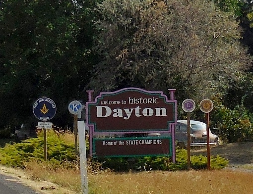
But first, we walked up and down Main Street, checking it out and researching the restaurant options. 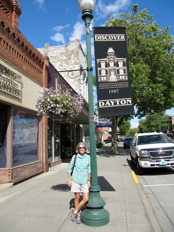
Here's the attractive Columbia County courthouse depicted in the Main Street flag above. 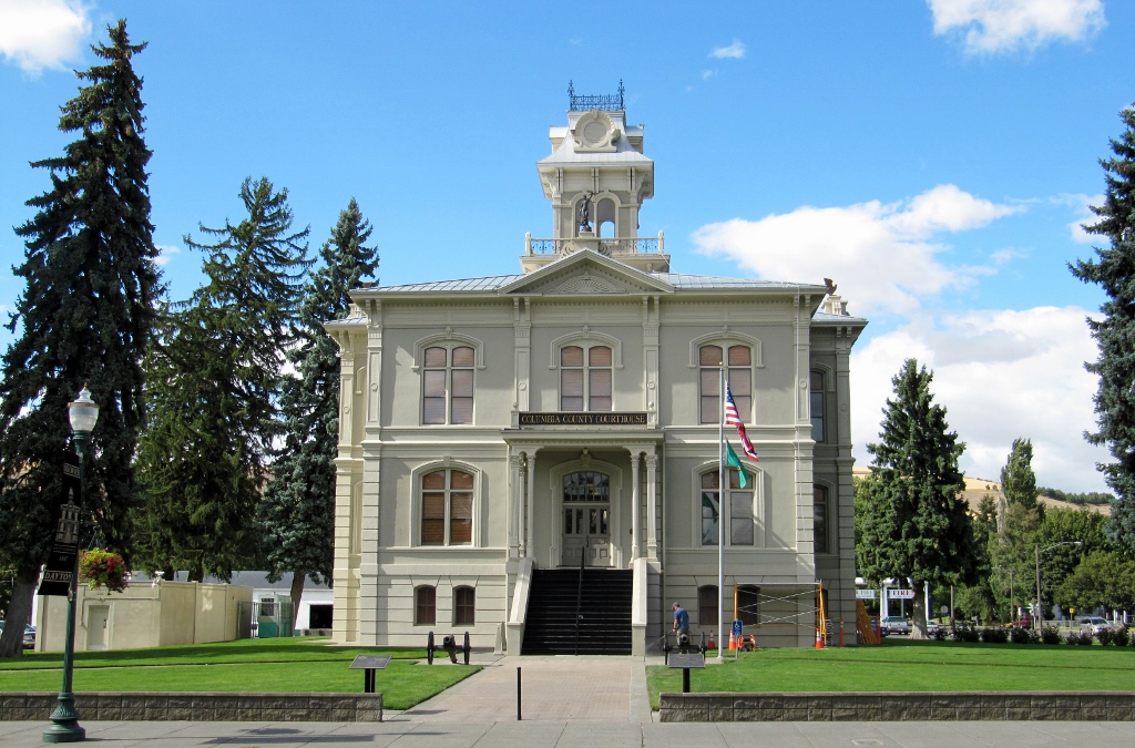
And a couple of nice murals. 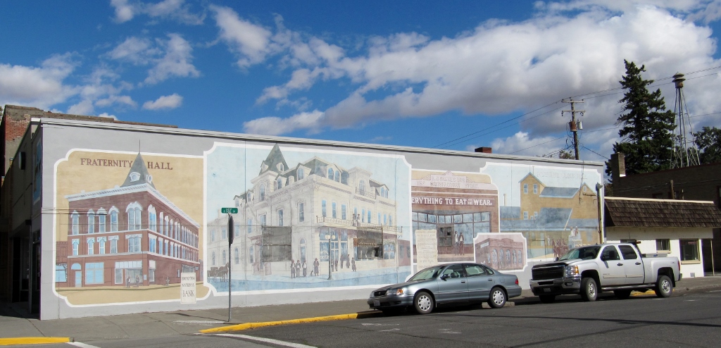
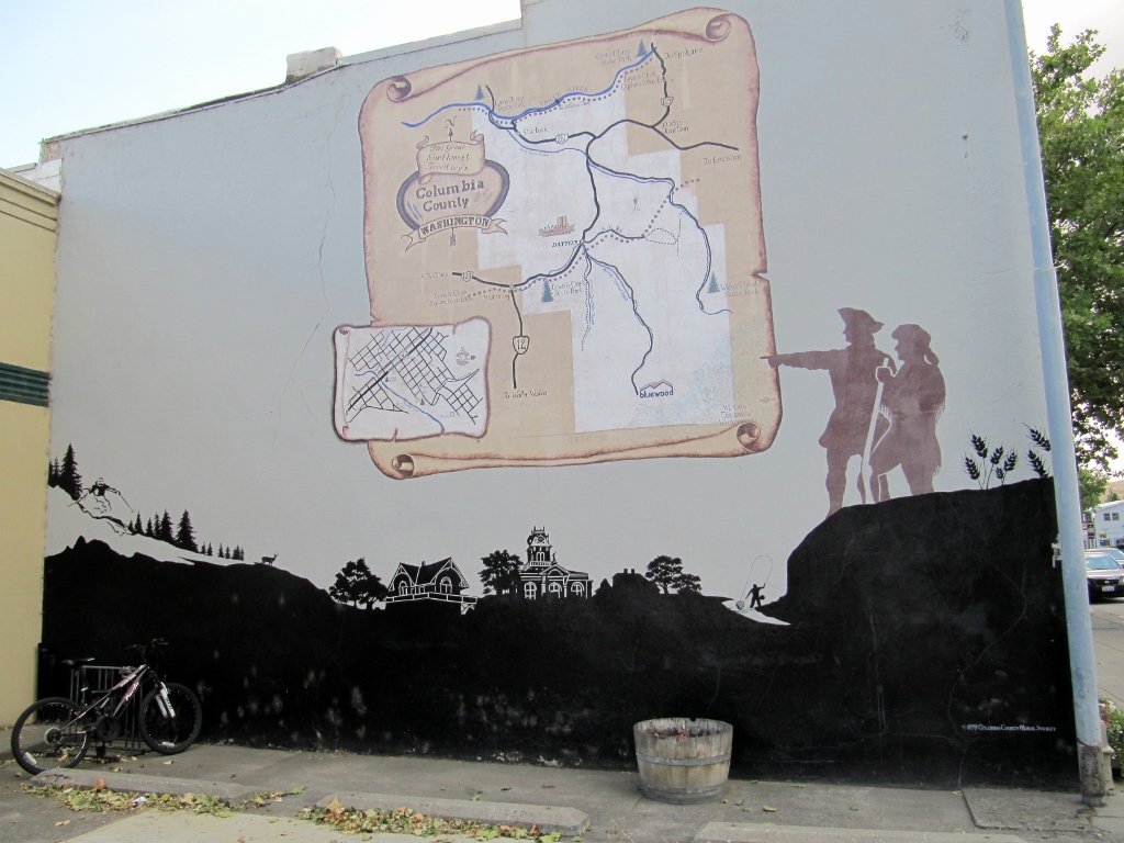
Dayton lies on the historic Lewis & Clark Trail
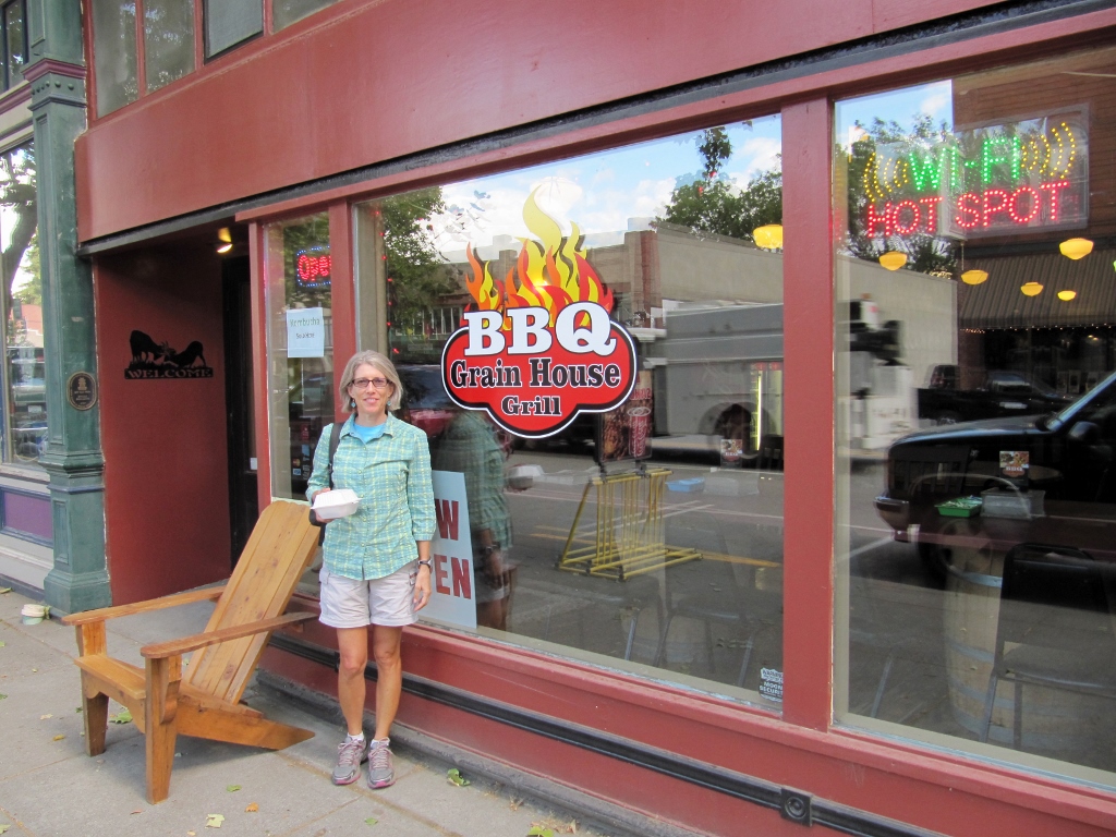
We decided to eat at the Grain House Grill, a barbeque place. We were really hungry by this time, and that sounded so good. I thought the name was a bit odd for a place that served so many carnivorous specialties, but realized that it must refer to the historic use of the building itself. It was charming inside, with exposed brick, lots of wood, and vintage-style lamp fixtures. 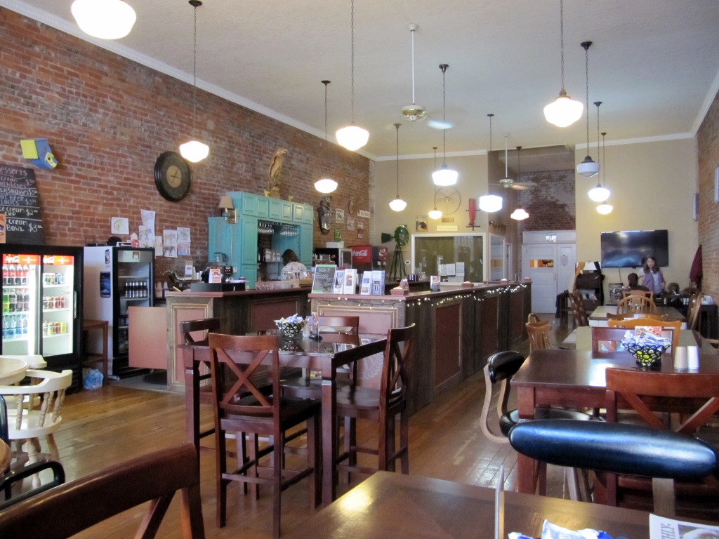
The pork BBQ was yummy, but we were surprised there was no extra sauce on the table -- very odd for a BBQ joint. And of course, no vinegar-based eastern North Carolina sauce would be in evidence here, even in the depths of the kitchen! But still, the pork was good as were the beans. Barry opted for a sandwich, while I went whole hog and ordered the platter. It was huge, so I took home a good portion of it for the next day's lunch. 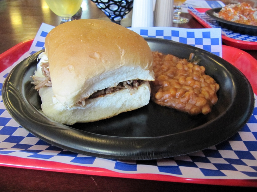
Barry's BBQ sandwich
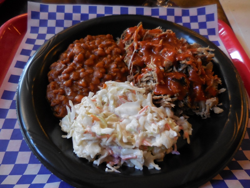
My huge BBQ platter
I think Barry ordered a "light" lunch because he'd previously spied this bakery up the street. So after lunch, we walked up there for dessert. 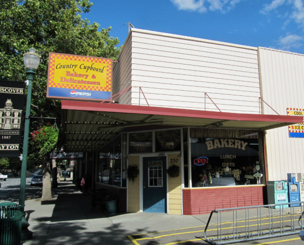
I was too full to eat another bite so ordered a couple of cookies to take back with me. 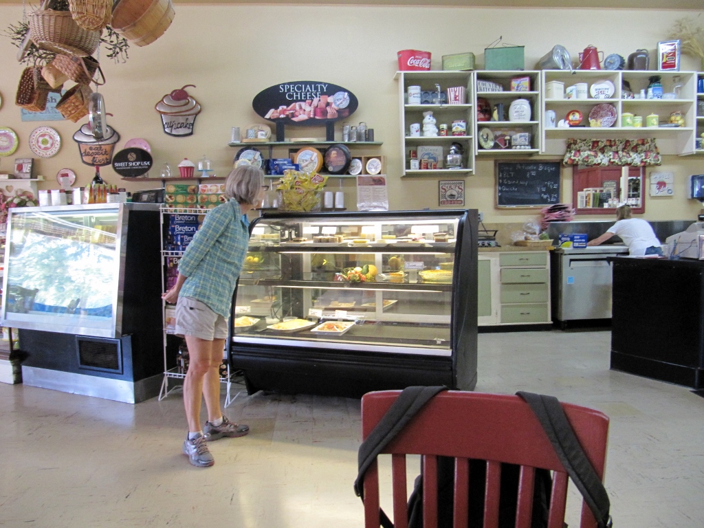
Lots of yummy looking choices
Barry, though, went for the chocolate mousse cake. After his hike, he totally deserved it! 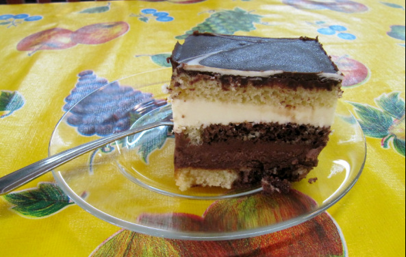
Time for another short road trip! This week on our day off from cycling we took a road trip north up to Palouse Falls State Park and spent a brief time in charming downtown Dayton on our way back. We were concerned on the way up when we saw this huge plume of smoke in the distance. 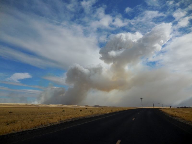
Where there's smoke, there's probably fire...
Not long after, we were smelling and driving through smoke and had very low visibility. We were afraid that we'd barely be able to see the falls, much less get any good photographs. Here was the hazy view greeting us at the Snake River bridge. Not good. 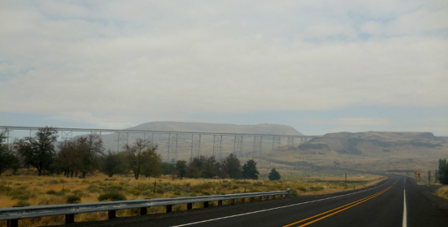
Luckily just a mile or two farther north we left all the smoke behind us. We did find out on the local news later that the smoke came from a rather large wildfire that broke out that morning. The fire fortunately occurred in a grassland with no population, but it did burn about 30 square miles before being contained. By the time we left the park in the afternoon, the smoke was gone. We arrived at the park in the late morning and were the only people there! That didn't last long, but it was nice for a short while anyway. 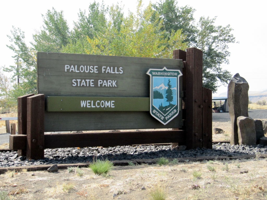
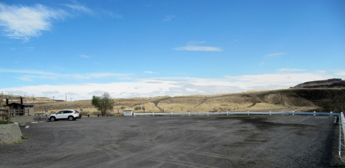
Our lone Honda CR-V
There's a $10 fee per car to park if you don't have a Washington State Discovery pass. We don't, so we paid up at the honor fee station. 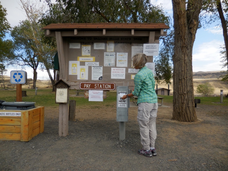
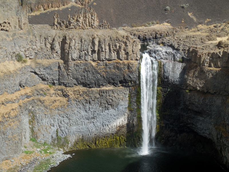
We didn't venture into the picnic and camping area, but there is a small area for primitive tent camping and one pit toilet. There are numerous picnic tables scattered around the park as well. Soon after arriving, we realized that the falls were very close at hand. We're used to parks where you have to hike a bit to see waterfalls hidden in the woods, so this was a bit different. We also quickly discovered that maybe the reason we were the first people at the park was because the light was not great for photographing the falls in the morning. Mid-afternoon looked to be the best time. So, it looked like we were in for a longer stay than I'd first anticipated if we hoped to get some decent shots. Shooting in this direction, the photos were a little washed out at this time of day. No worries -- they get better, but I figured I better give you an early preview of the 200' falls. After all, that is the main attraction here! 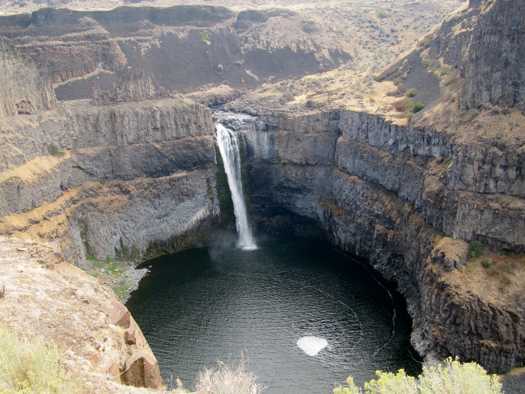
Palouse Falls in the morning
This information board explained how the dramatic landscape here was carved by huge floods at the end of the last Ice Age. 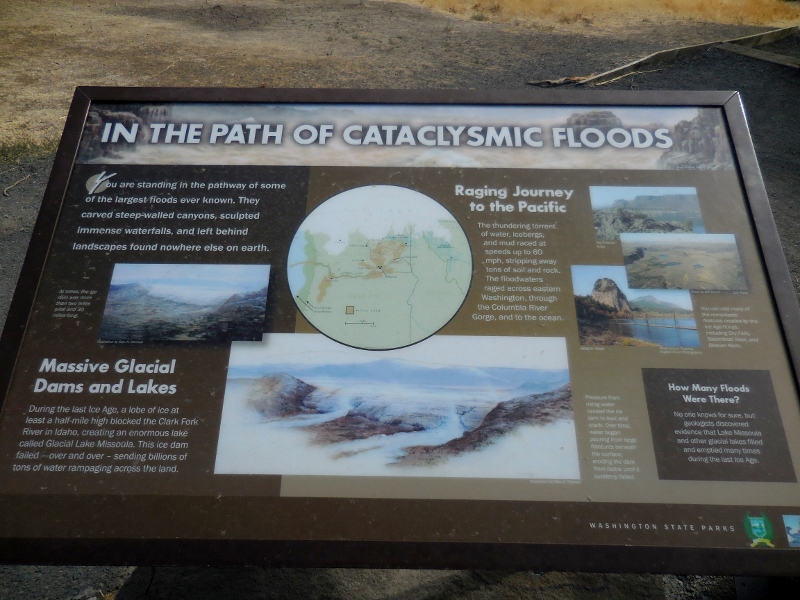
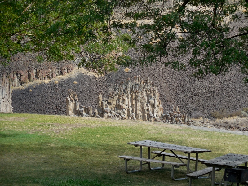
We hiked around on some of the shorter trails near the falls. My only complaint about this park is that none of the trails were marked or rated. It's always nice to know how long and how difficult a trail is. In addition to wider trails that were obviously "park trails" (even though unmarked), we could see where other, narrow trails criss-crossed down into the canyon and closer to the falls. We weren't sure if they were legitimate park trails or just "rogue" trails that determined folks had blazed. We still don't know for sure. The views and sights were pretty anywhere you looked, though. 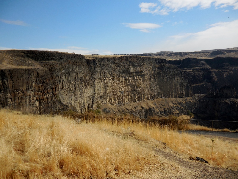
This photo turned out nice even though the the falls were still partially shaded. 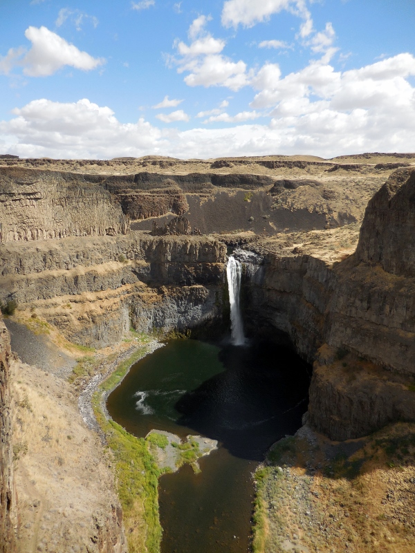
Barry, never one to content himself with a short walk around a park, decided to investigate a trail we found at the west end of the park trail. This is one of those trails we weren't sure was "official" or "rogue" as there were no markings, but we could see that it descended rather sharply down talus into the canyon and appeared to eventually wind around to the falls. Our hiking poles were in the car, and he'd worn his hiking boots, so of course he couldn't resist giving it a try. I decided to pass and take photos from above; after all, this was supposed to be our "rest" day! Here he is, starting down the trail. You'll have to look closely to see his tiny figure in the upper right of this photo. And the all-talus (loose rock) trail dropping steeply down in front of him. Yes, he's an adventurer! 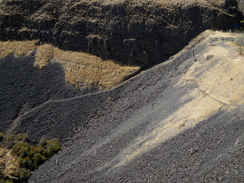
It actually worked out well that I stayed up top so I could take photos of his efforts. I'd brought my binoculars in case of interesting birds (which I didn't see), but turned out they were great for Barry sightings as well. I ended up getting plenty of exercise as I walked back and forth, back and forth looking for him on the trail and taking photos, up and down a hill over and over. My shins were sore the next day! Here's more of his hike as seen from above. Zooming in... 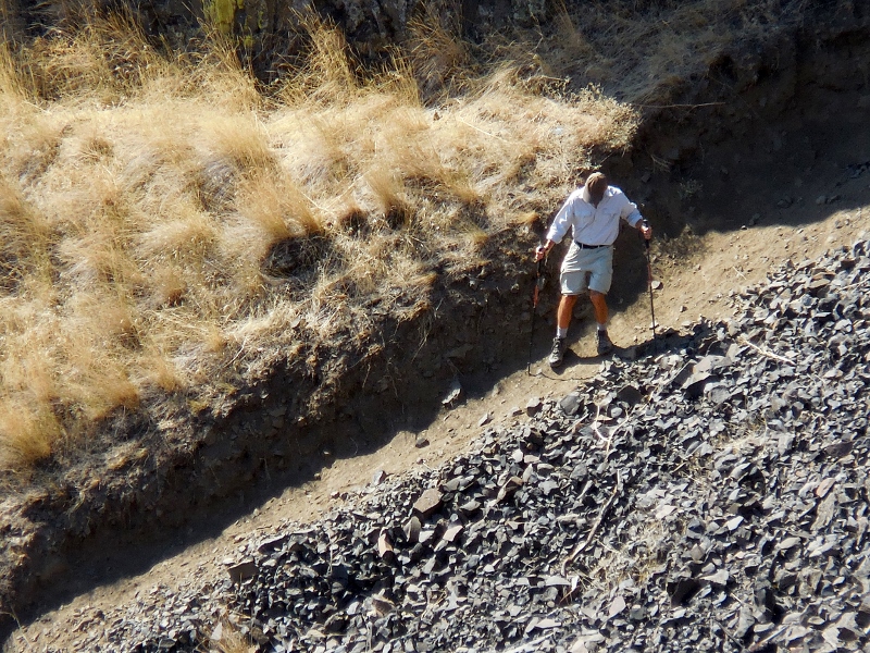
And back out a bit... 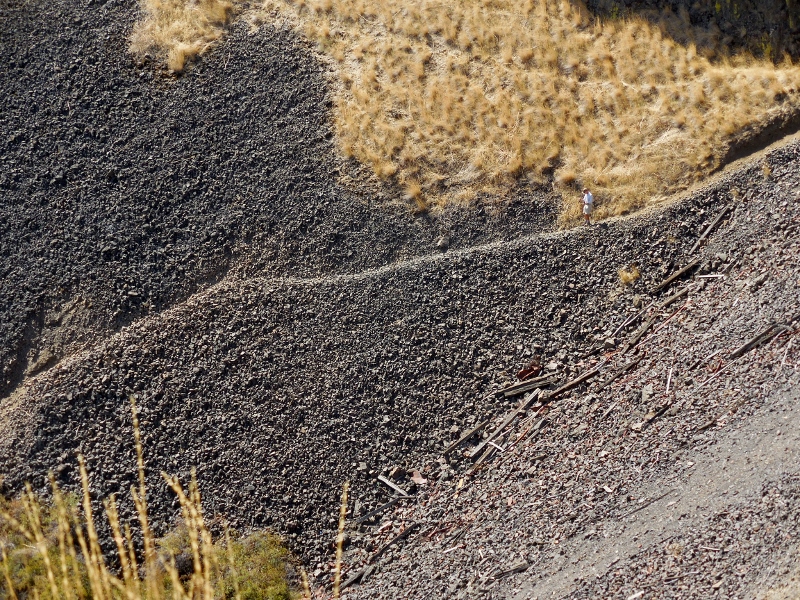
Now's he made it down the rock and onto a flat, grassy area. He's right in the center of this photo. 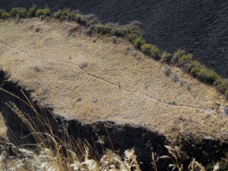
He made it to the foliage down by the river! Can you see him among the greenery? 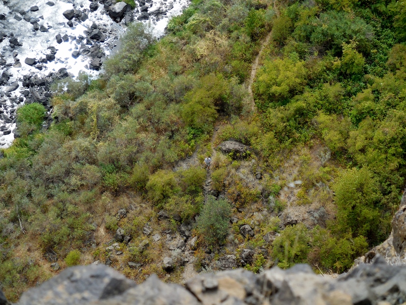
And finally to the little island near the falls! 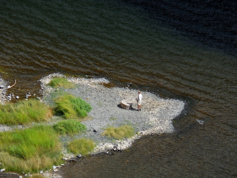
Looking at the big picture; can you see where Barry is on the little island? Impressive, right?! 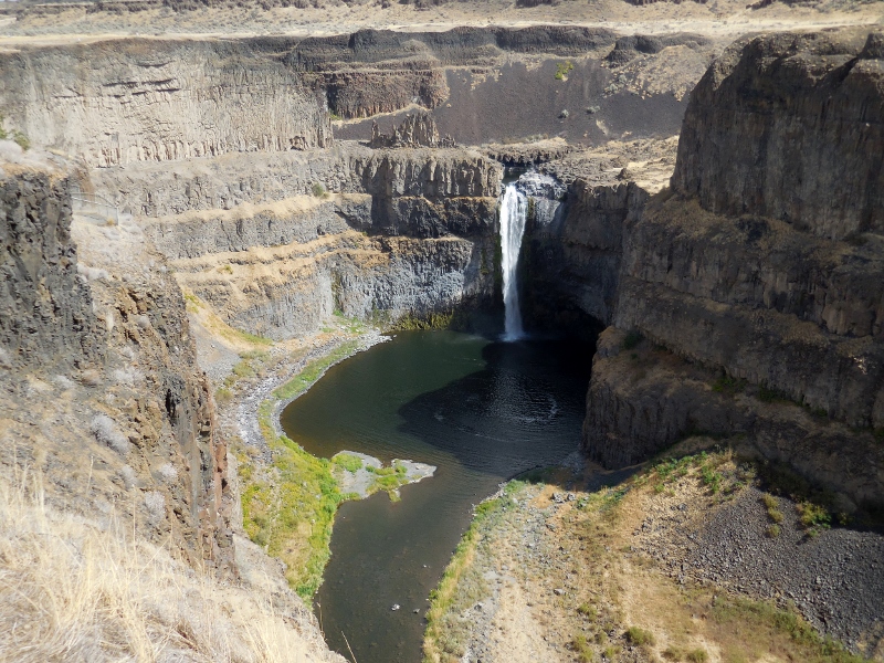
Here are a few shots he took while on the trail. 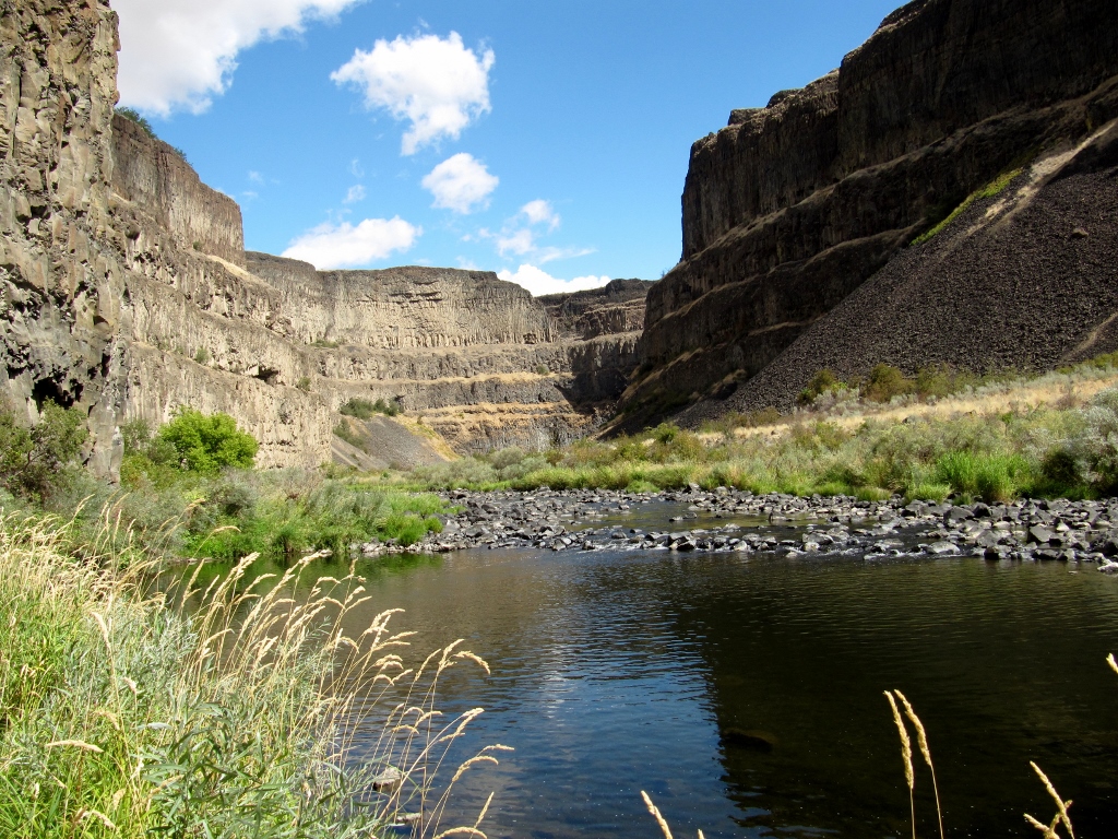
Uhhhh....don't think this trail gets a lot of use! 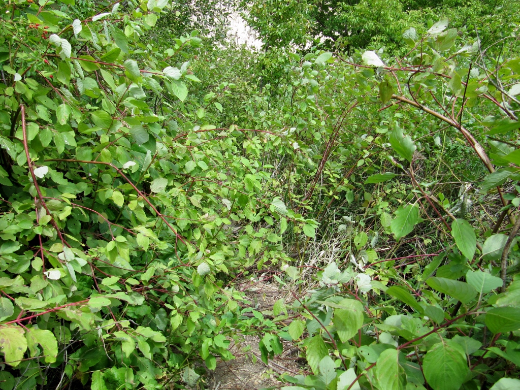
This looks like some pretty tough hiking conditions. One slip and you're in the drink! 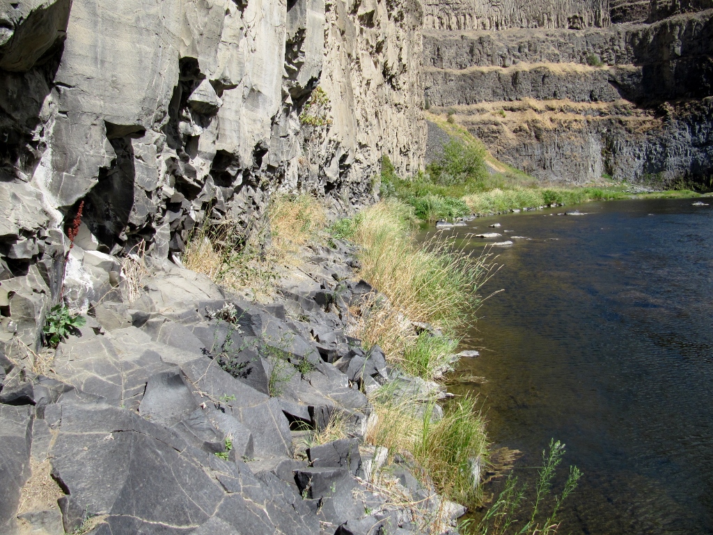
Peek-a-boo waterfall view! 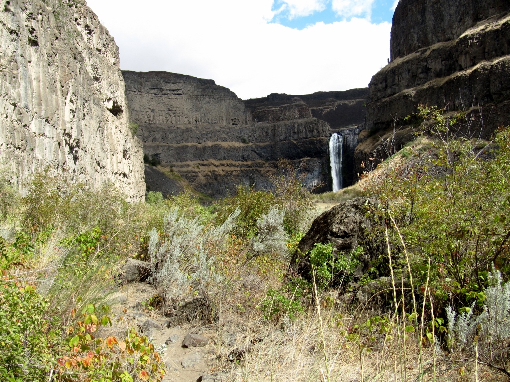
And he's there! 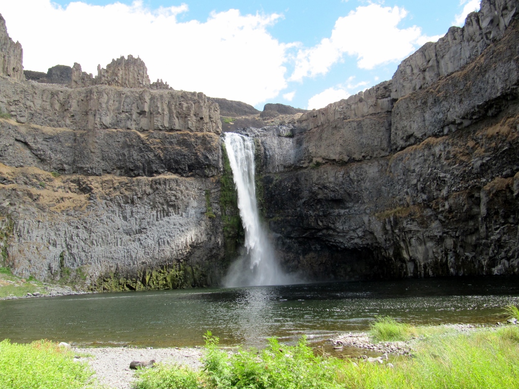
He was able to walk a bit further for a good view of the side of the falls. 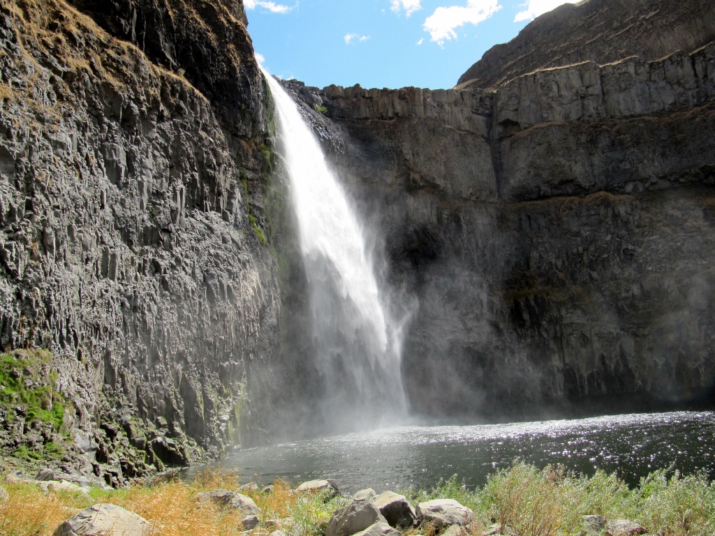
Trail conditions were awfully rough. This was not a long hike, but it took him a fairly long time because of the need to walk so carefully. Fortunately, he did great, with no injuries. 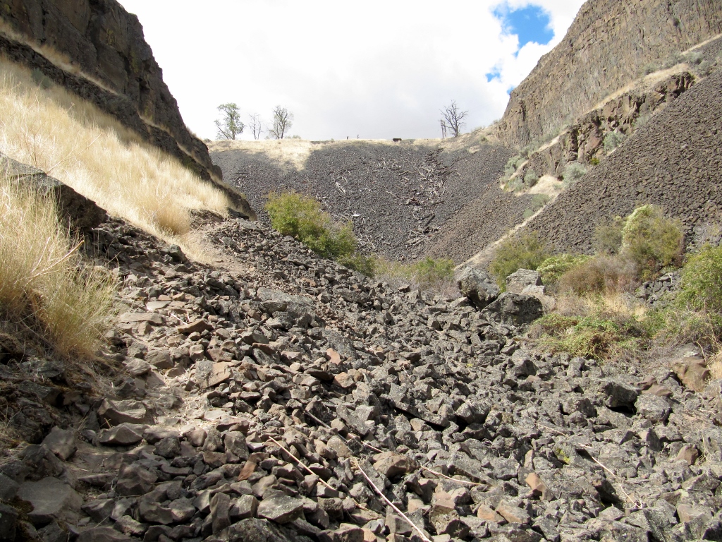
Not very comfy underfoot, I'm sure
Back to my photos, the sky was getting very dark towards the east, but it never rained where we were. Check out the start of fall color up here! 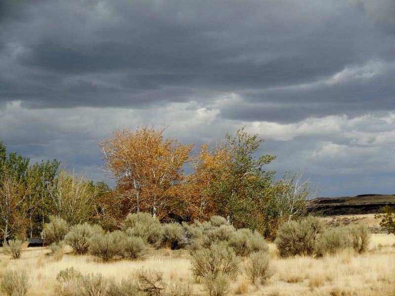
Barry's on his way up -- once again a tiny figure in the middle of the photo. 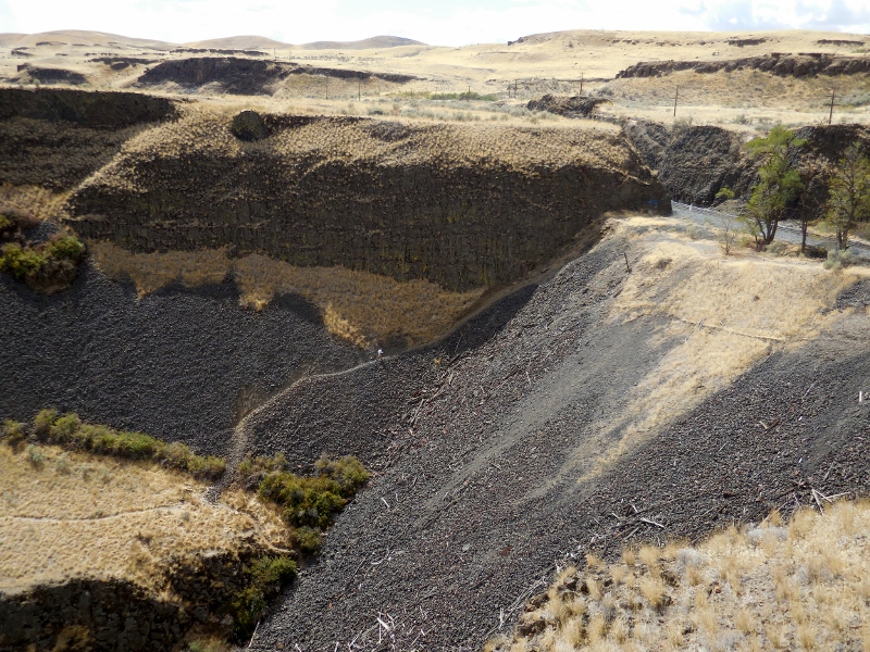
A freight train rumbled by at the top of the trail while he was climbing. 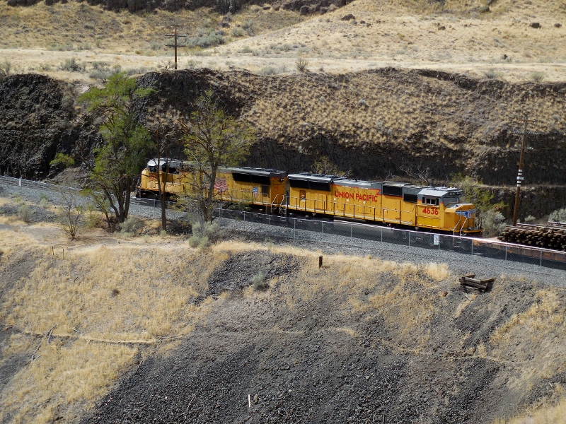
And he made it! 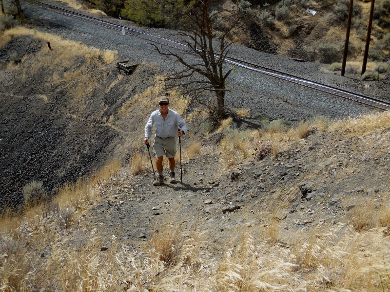
Once he was up, the light was better for a few more photos, so we snapped away before leaving the park. 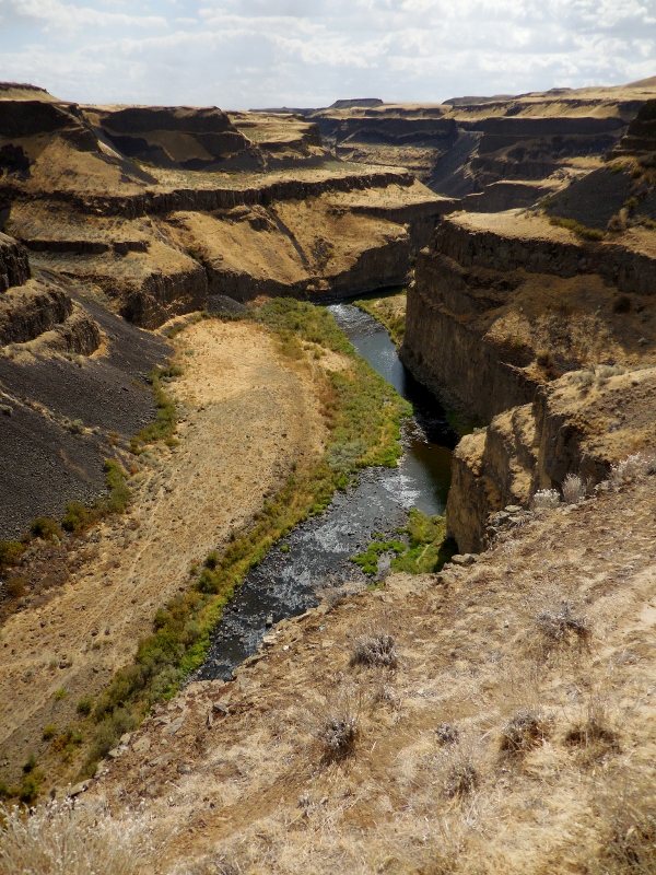
This formation to the left of the falls is aptly named "Castle Rock". Reminds me of the castle at Disneyworld! 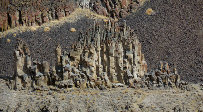
Castle Rock
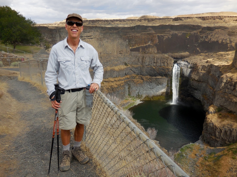
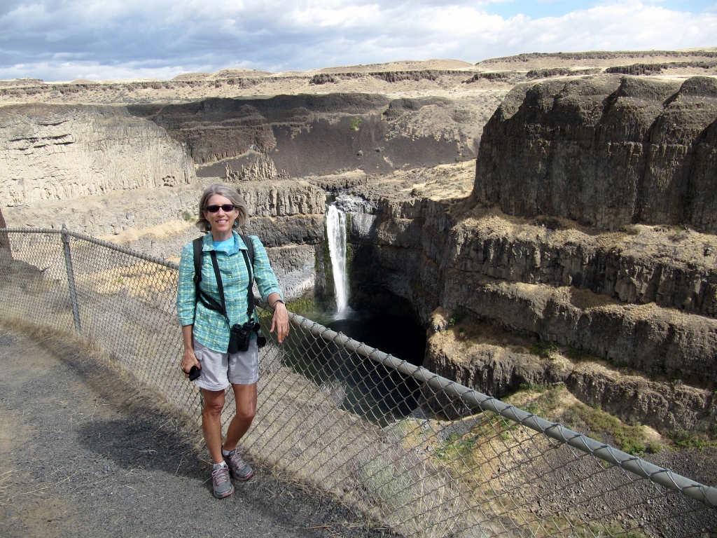
The intrepid hiker!
Nice view of Castle Rock beyond a picnic area
A final long view with afternoon sun... 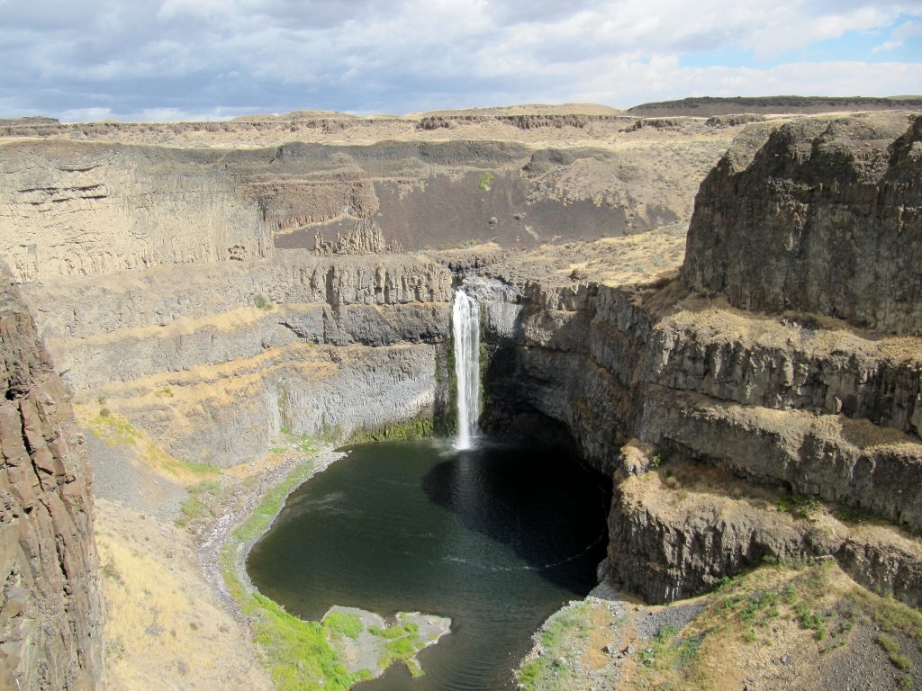
Stay tuned for Part 2 as we head down to Dayton for a look around!
|
Emily & BarryWe're a long-married, early-retired couple who are currently traveling as nomads with no fixed home base. After years of living in North Carolina (Emily's home state), we spent 18 months living oceanfront on Ambergris Caye, Belize, a year road-tripping the US in a Honda CR-V, a year in Playa del Carmen, Mexico, and are now roaming North America in our 32' motorhome, Pearl, following warm weather whenever possible. 
Paisley, May 2016
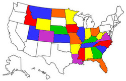
States visited (pre-RV)
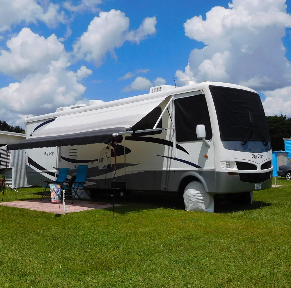
Pearl, a 2007 Newmar Bay Star
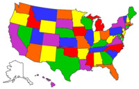
States visited in "Pearl"
Archives
July 2019
Favorite Travel Blogs |
 RSS Feed
