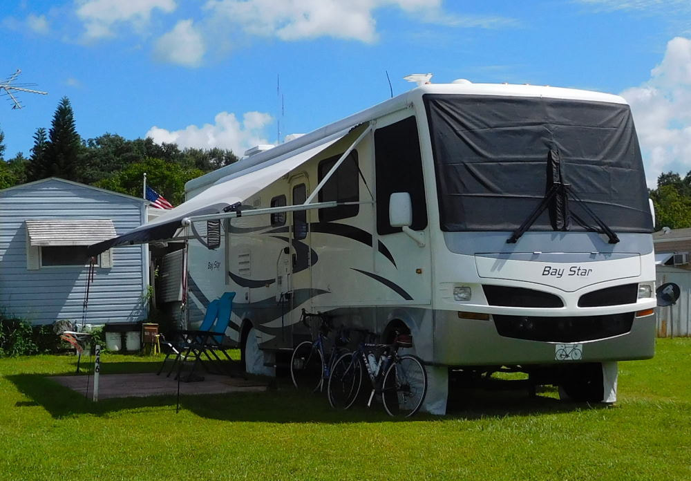
"Pearl" in Winter Garden, Florida
|
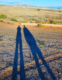
Long shadows in Wyoming
|
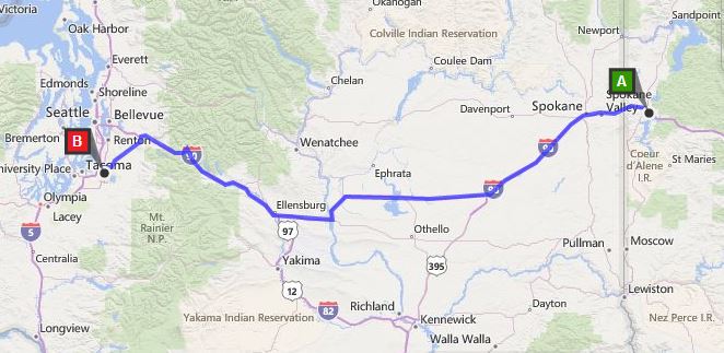
Coeur d'Alene, Idaho to Pacific, Washington
After a beautiful drive through Washington State from Coeur d'Alene, Idaho, we settled into a hotel in the small Seattle suburb of Pacific, south of the main metro area, for three days and four nights. We chose this place because we found reasonably priced, pet friendly lodging, and Barry discovered that we could ride our bikes into the city via several different paved bike paths. It was more rural than urban, and we were able to avoid most of the city traffic by not having to drive into Seattle proper. On our first full day in the area, it rained off and on all day long. Between showers, we got out for a walk to a grocery store in Auburn, the city next door, but did not do any riding. Our second full day also started out a little iffy -- chilly, cloudy, and damp. But we decided to pull on our layers (while cursing having to wear all these clothes at the end of June!) and take our chances. And it turned out to be a good decision as the day got nicer and nicer as it went on. We started out by riding north on the Interurban Trail, which we picked up just steps outside our hotel. 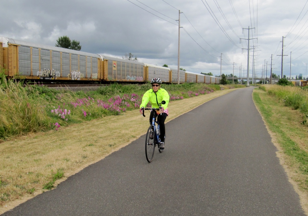
The day started out with cool temps and cloudy skies...
We went through parts of Auburn, Tukwila, and Kent on our way north. 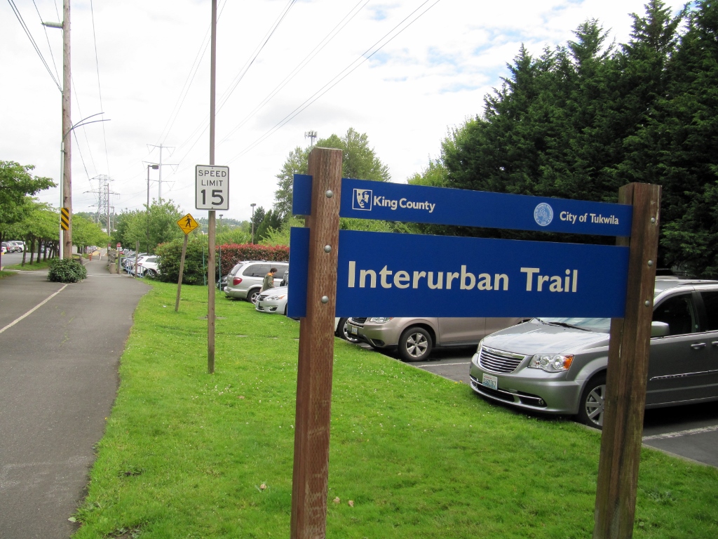
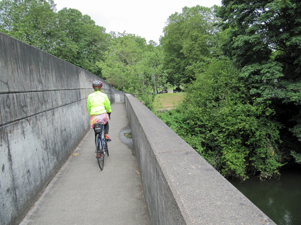
Continuing on, we turned onto the Green River Trail in Kent. This trail runs alongside the Green River, providing scenic views. 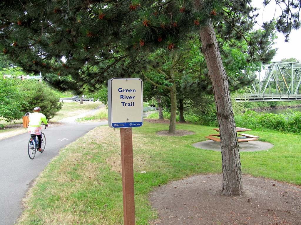
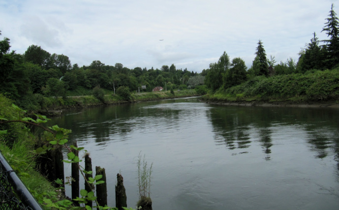
Green River
Finally we caught our first glimpse of downtown Seattle! Neither of us had ever been there before; in fact, this was our first time in Washington State, so we were excited. 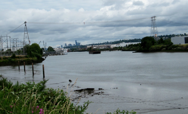
Seattle in the distance
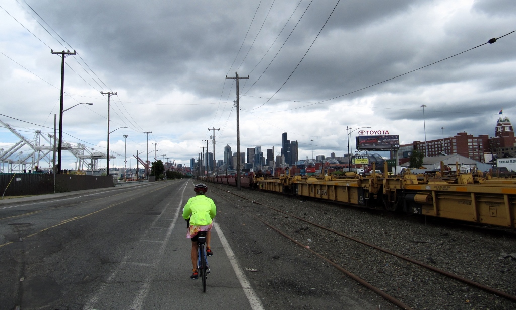
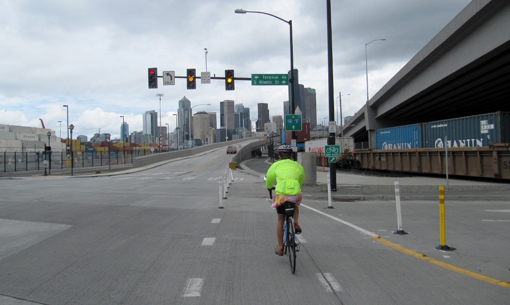
We had to ride through some kinda beat-up neighborhood roads while on our next trail, Duwamish. This was the first time we encountered any actual hills on our ride. 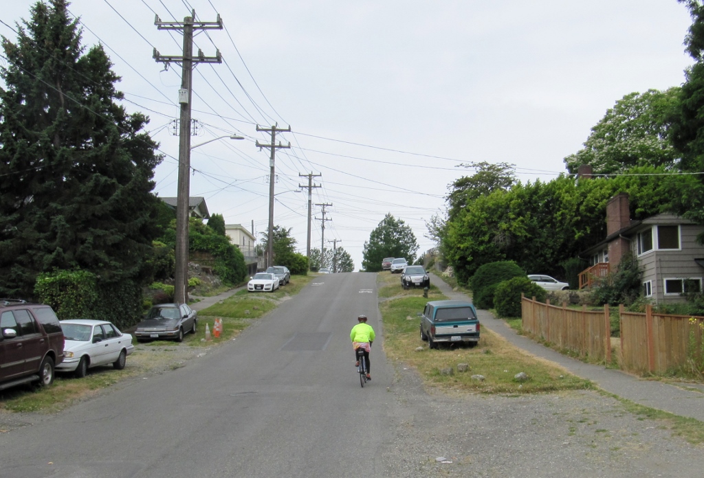
Now we knew we were getting close! 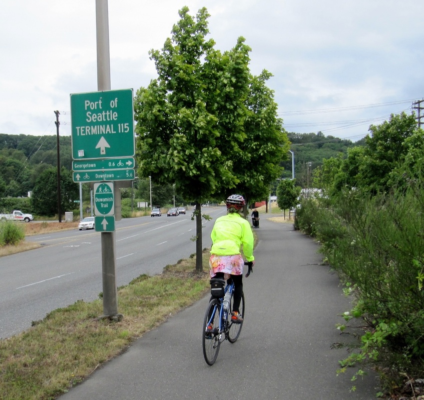
The Space Needle was hiding...for some reason I expected it to be taller than it is!
Slightly less than three miles from downtown, we turned onto the West Seattle Bridge Trail. We were going to get to go over a big bridge -- wheeee! 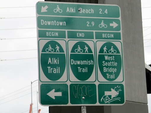
Great signs for peds and cyclists
But first, we had to stop and wait -- the bridge we were crossing was a drawbridge, and a boat was coming through. Cool! 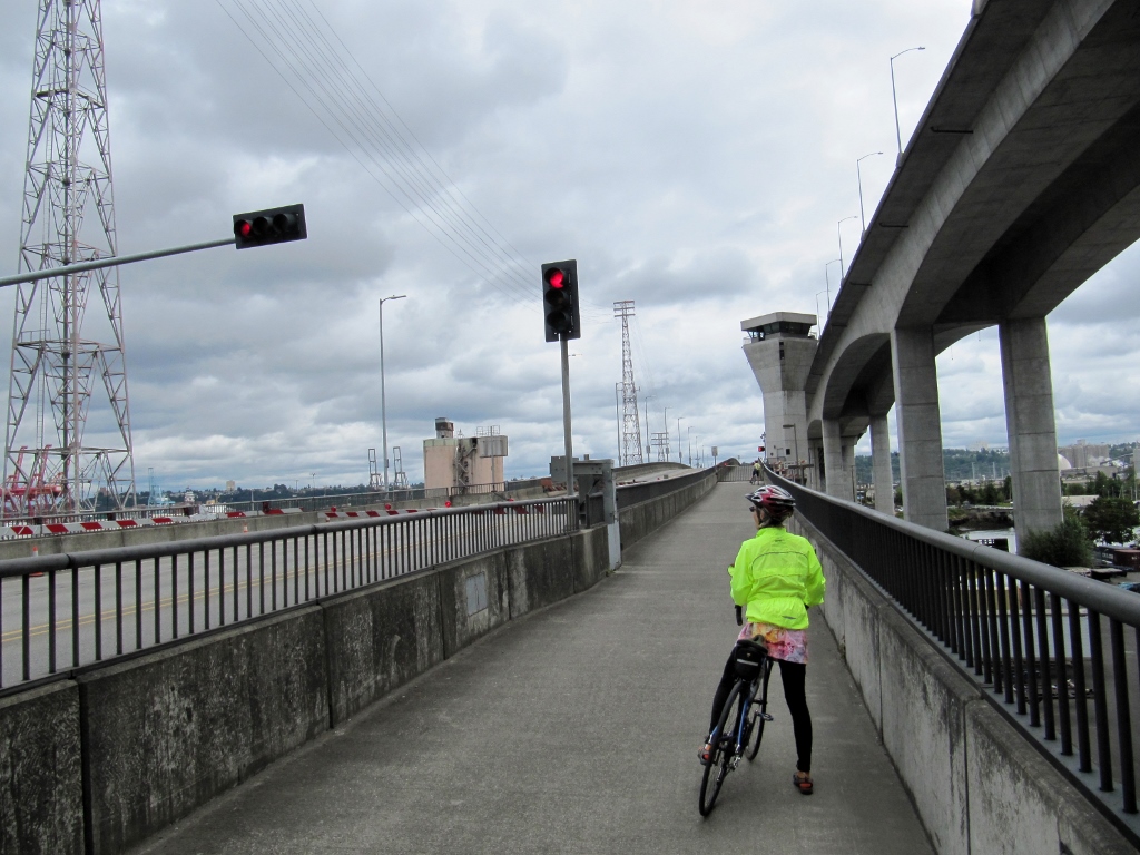
At least we finally got a good look at the Space Needle -- we had plenty of time to look while the bridge tender let the boat through and we waited to cross. 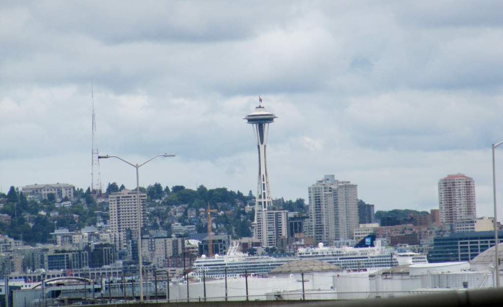
There she is!
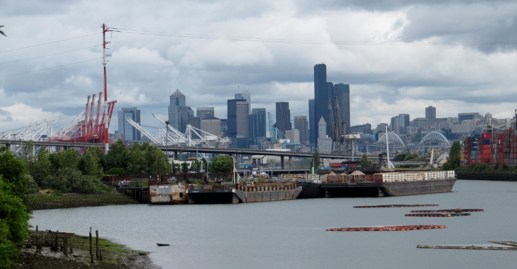
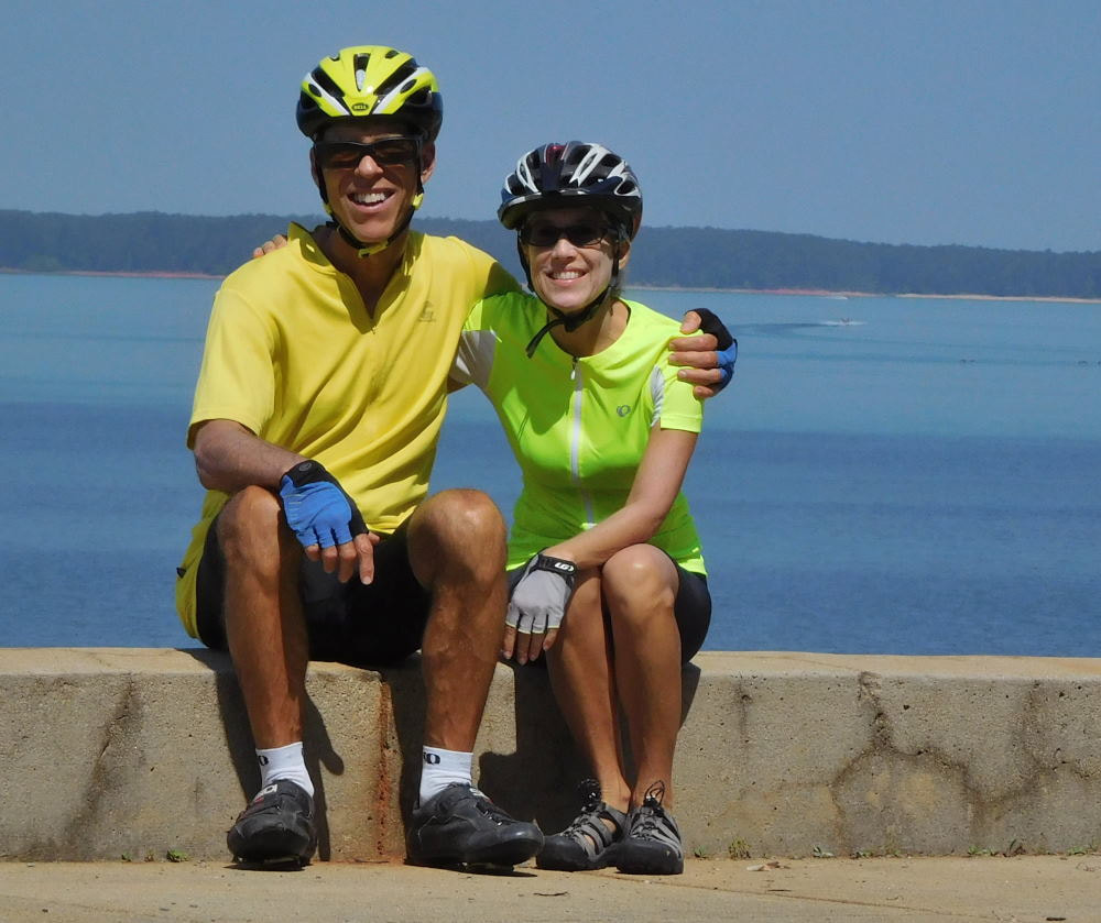
Once safely across the bridge, we set up the camera's self-timer for a photo of the two of us in front of the industrial port of Seattle. Notice the leg warmers have come off now as we were starting to warm up a bit. 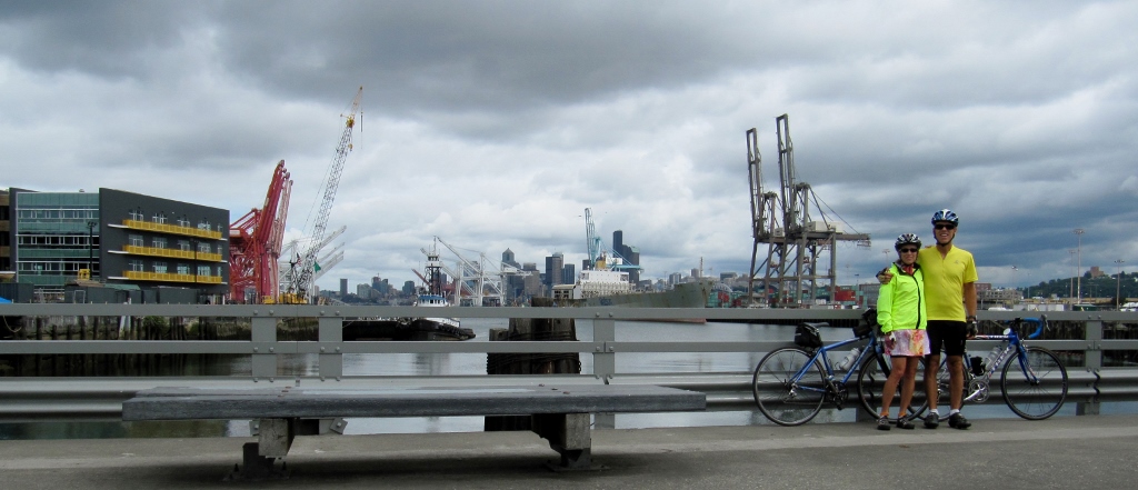
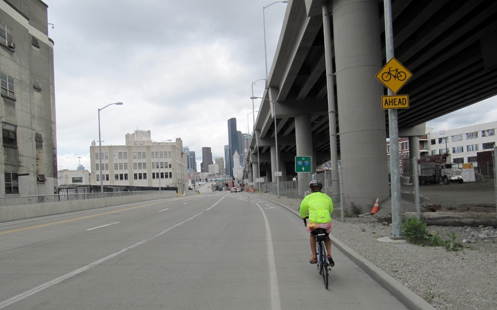
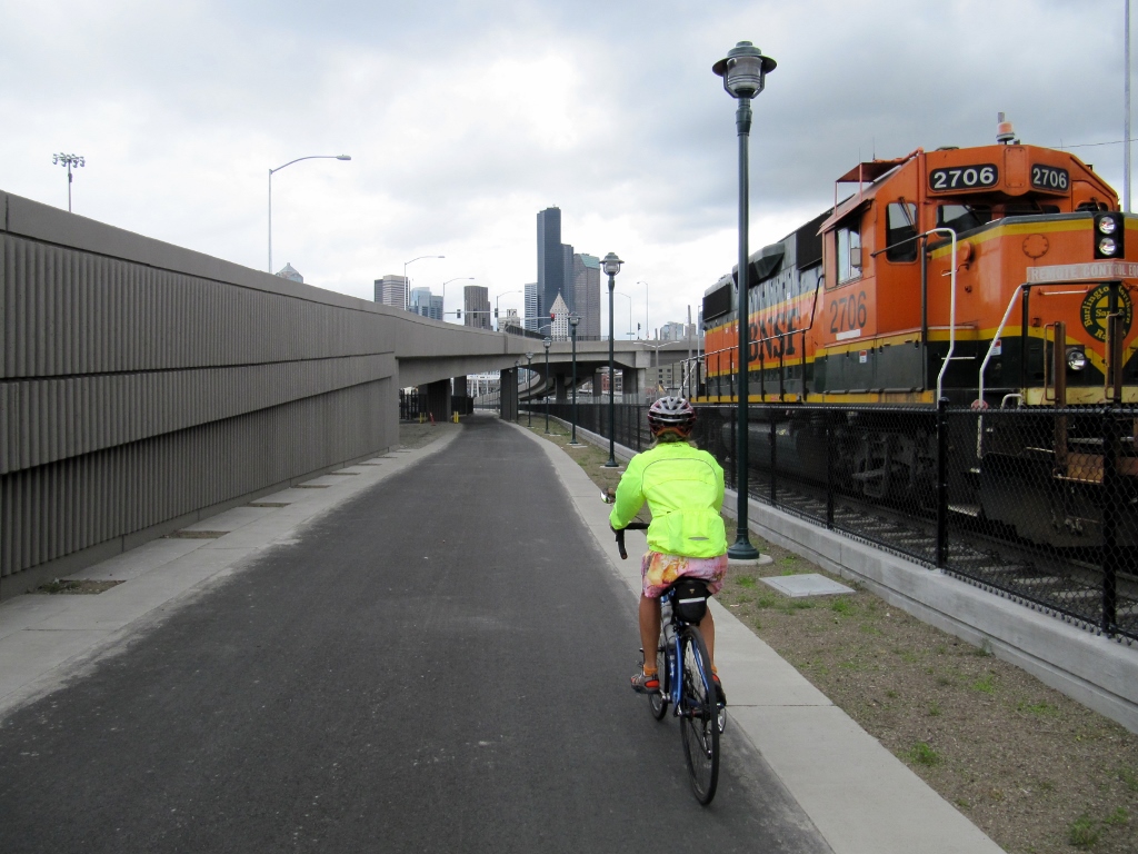
We still had a ways to go to get into downtown proper. Fortunately, Seattle's excellent cycling infrastructure with bike lanes and good signage made this pretty easy, although there were areas of construction that were a little hairy to get through. 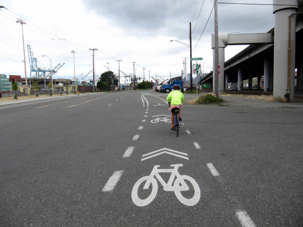
The flag on the top of this building was the first sign that this wouldn't be just a typical Sunday in Seattle! 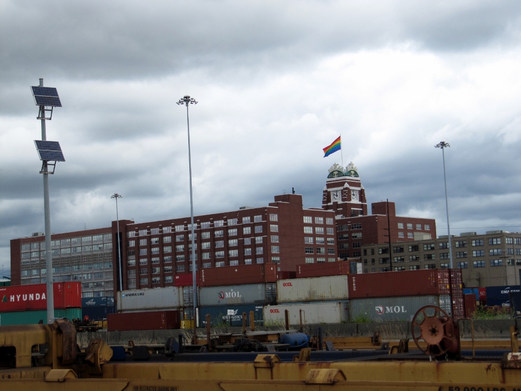
And we're here! The ride into town was around 30 miles. Stay tuned for Part 2 to see what we saw in the city. It was an incredibly day! 
0 Comments
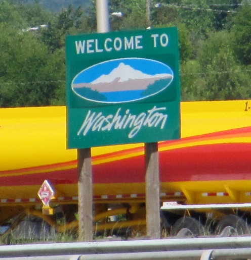
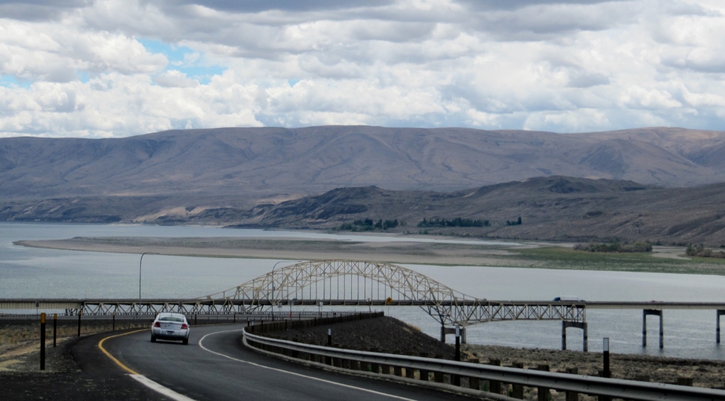
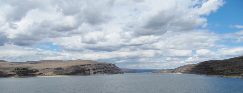
Entering Washington State by car this time (first time was on our bicycles!)
As we were traveling west from Coeur d'Alene, Idaho to the Seattle area on I-90, we saw the most stunning scenery as we approached and crossed the Columbia River near George, Washington (love the name of that town!) I found out from Wikipedia that the bridge we crossed is the Vantage Bridge and that this section of river is called Wanapum Lake. It is the reservoir formed by Wanapum Dam. Who knew? All I know is that it was simply gorgeous. It's not often you get to see things like this when traveling on an interstate highway! I think the dramatic clouds on this mostly overcast day actually added to the beauty of nature. 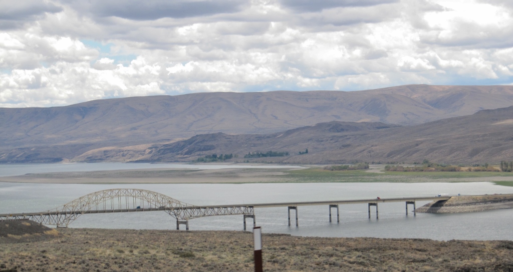
Next stop Seattle!
We had another full day in Coeur d'Alene ahead of us, but the day after our long ride on the Centennial Trail in Idaho and Washington State (Part 1 and Part 2 of that ride), we knew we needed a shorter, more relaxing ride. Pedaling east to Lake Coeur d'Alene on the Centennial Trail's eastern terminus filled the bill perfectly as it would be under 30 miles round trip. Unfortunately, we didn't have as pretty a day as the sunny day before; it was overcast and even a bit on the cool side with the occasional light sprinkle, but not bad enough to keep us indoors. 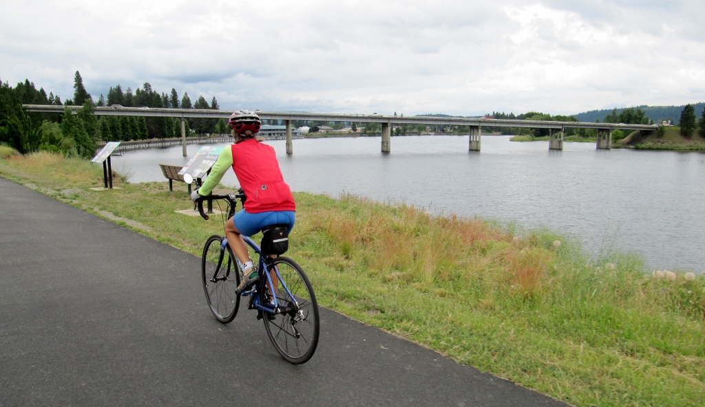
A wee bit gloomy and cool...
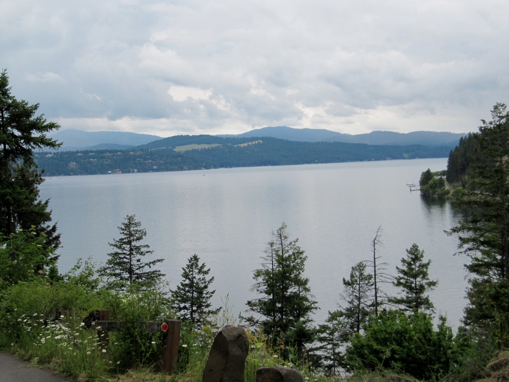
When we were driving into Coeur d'Alene from the east, I was amazed at the size of the lake, so I looked up some specs. The lake covers nearly 32,000 acres, is 27 miles long (though I found another source that said 23 miles), and ranges from one to three miles wide. It's also very deep: 197' at the deepest point. Wowza! Of course we only saw a small portion of this huge lake. 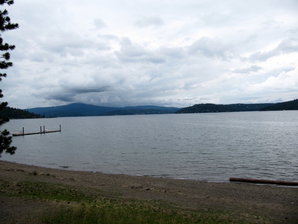
Lake Coeur d'Alene
Here's a map showing the Centennial Trail (in red) running along the northern portion of the lake (full-size PDF file here). I-90 is shown in orange. 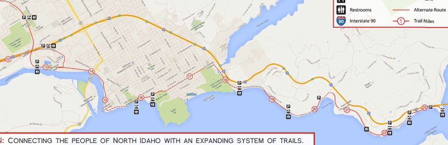
Starting out from our hotel and riding a couple of miles to access the trail near mile marker 13, we headed east and soon saw bustling downtown Coeur d'Alene up ahead. Since our hotel was a bit west of downtown, this was the first time we'd seen it. The pictures we took on this cloudy day just don't do it justice. 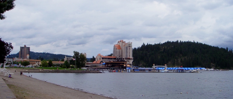
Downtown Coeur d'Alene waterfront
We had no idea that the city was gearing up for the annual Coeur d'Alene full Ironman over the coming weekend. Even though it was only Thursday, they were already getting the staging area in the park ready with tents and barriers. Some athletes had already arrived and were picking up their packets as well. We were really glad we weren't coming through here any later in the week as it would have been a zoo. 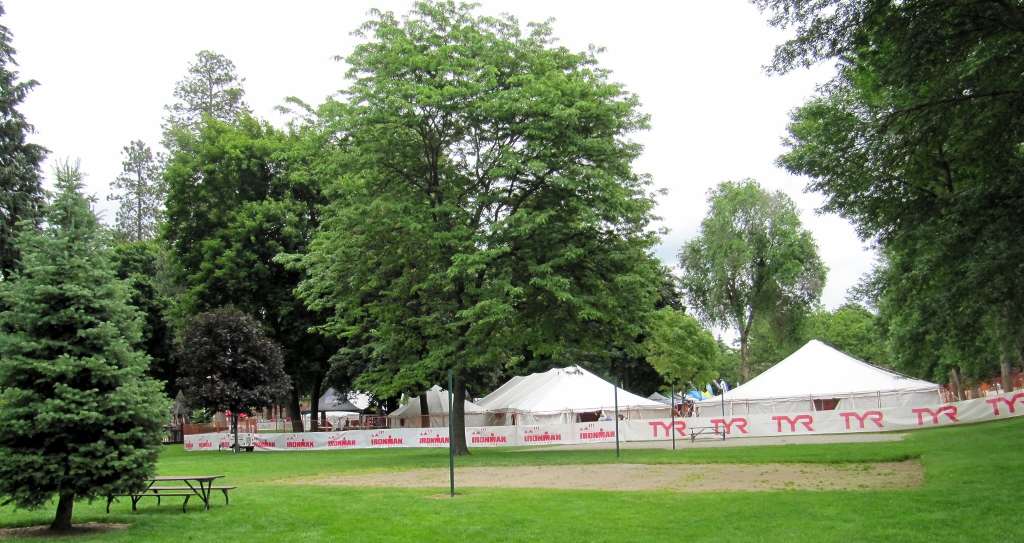
We got a little lost getting through downtown as the trail detours onto the road and the markings were not the best, as on the western part of the trail the day before. Finally we saw a marker and continued east out of town, enjoying more views of the lovely lake. 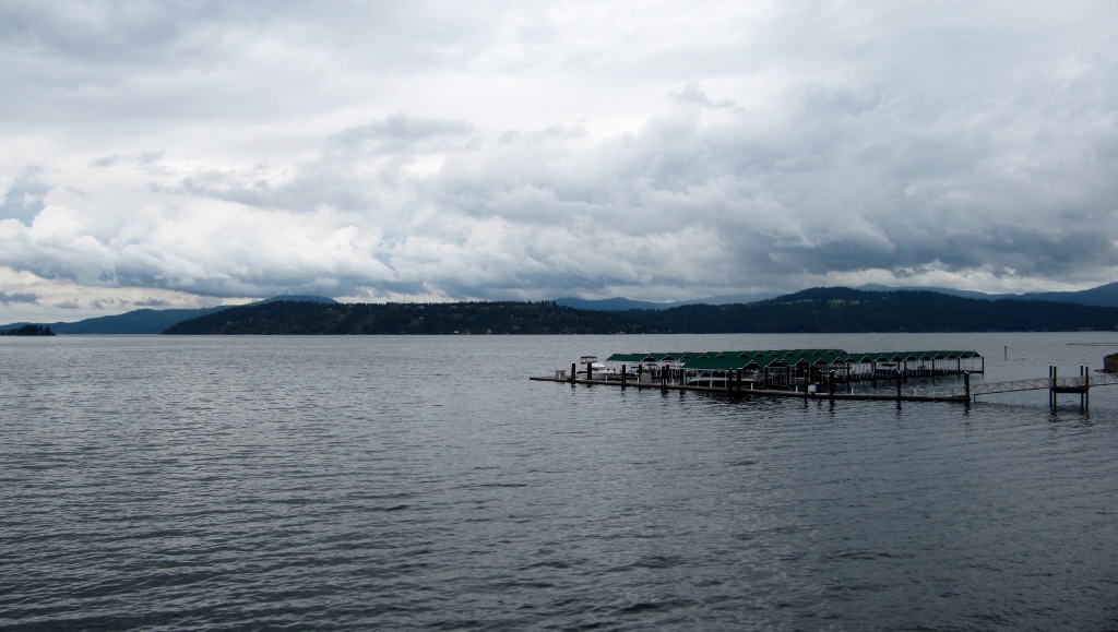
I-90 runs far above the lake on this impressive bridge, which we drove on on our way to Coeur d'Alene. You can see the trail in the lower left side of the photo. 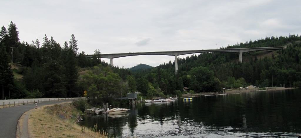
We rode to mile marker 23 at Higgens Point, where there's a boat access. I guess this is the official end of the trail, but there is a short paved spur up a fairly steep hill to a beautiful picnic/park area up high, so we continued on the short distance to check it out and take a quick snack break. Somehow we didn't take photos of the pretty area up there; a shame. Turning around and heading back, we saw more riders on both trail and road by this time. Some were recreational cyclists like us, but some were clearly Ironman competitors scouting out the bike route, part of which would run on lakeside road. Despite being along the lake, there are a couple of decent hills, so all of us got a workout! 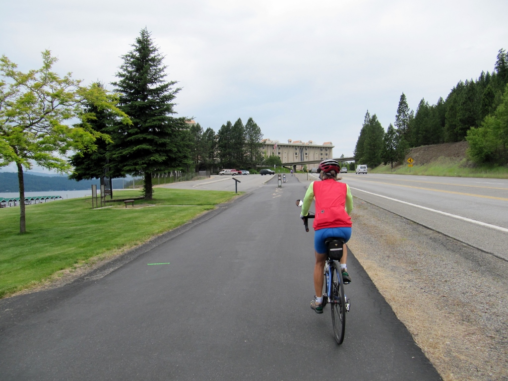
Heading back towards the city
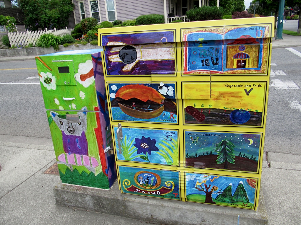
Colorful painted utility boxes
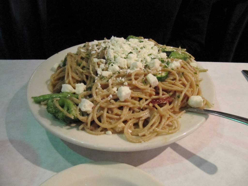
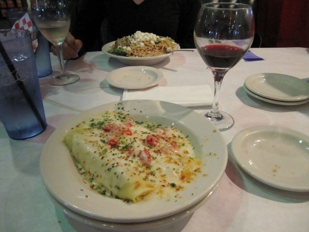
Unfortunately, things took a bad turn when we returned through downtown. I dropped and killed my ancient but very dependable digital camera on a concrete sidewalk in the park, and then I took a fall on my bike after pushing a crosswalk button on a slanted sidewalk and losing my balance. Owie! The camera was really a mercy killing, as my brother Adam so aptly put it. It had been having issues with blurriness in certain lighting conditions due to a scratched-up lens, so I had been needing to replace it anyway. As for me, I banged up my ribs on the left side when I hit the pavement hard, scratched up my right calf on the chainring, and hurt the palm of my left hand. It took a couple of weeks to heal up, especially the ribcage pain, so I expect I bruised a couple of ribs pretty good. We ended the day with a nice dinner at a good Italian place right across the street from our hotel called Tomato Street. My vegetable pasta entree was so huge I even had enough to put in the cooler for the next day! Barry's manicotti was a much more reasonable size, and he managed to finish it off.
We had a coupon for a free dessert from our hotel, so we chose to split the deliciously decadent Oreo Fried Ice Cream. Slurp! 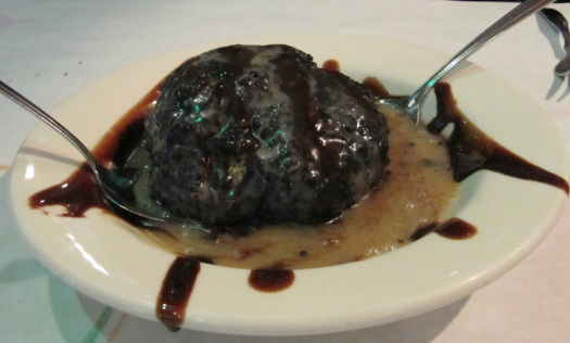
Stay tuned -- our next stop is Washington State!
|
Emily & BarryWe're a long-married, early-retired couple who are currently traveling as nomads with no fixed home base. After years of living in North Carolina (Emily's home state), we spent 18 months living oceanfront on Ambergris Caye, Belize, a year road-tripping the US in a Honda CR-V, a year in Playa del Carmen, Mexico, and are now roaming North America in our 32' motorhome, Pearl, following warm weather whenever possible. 
Paisley, May 2016
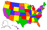
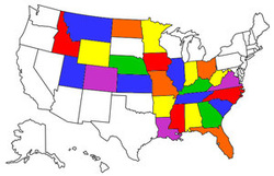
States visited (pre-RV)
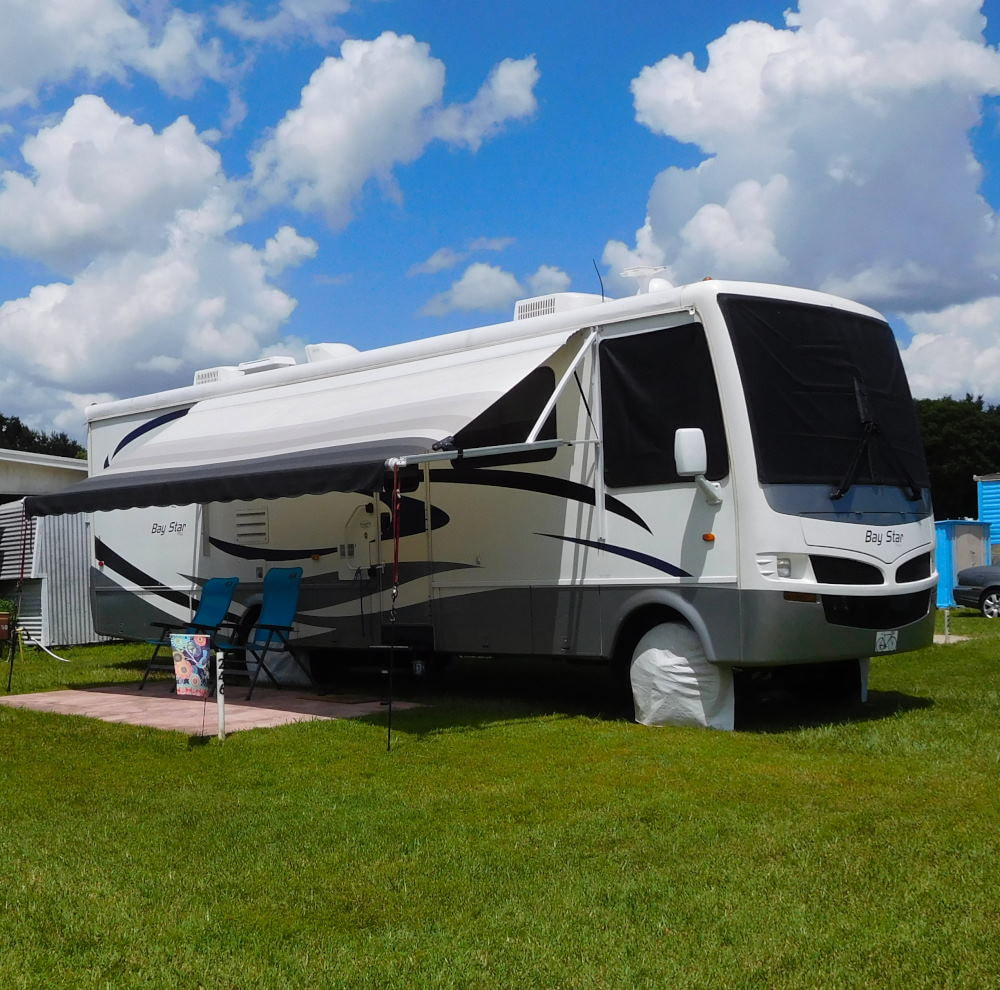
Pearl, a 2007 Newmar Bay Star
States visited in "Pearl"
Archives
July 2019
Favorite Travel Blogs |
 RSS Feed
